Blizzard in the Great Plains
Top Stories
14 Mar 2019 10:10 AM
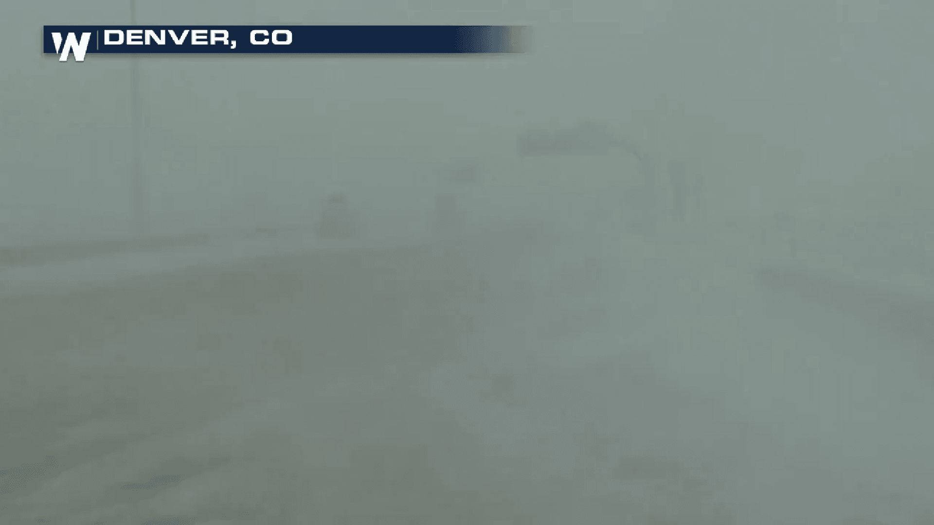
[Blizzard conditions Wednesday in Denver]
A powerful March storm has been bringing whipping wind and heavy snow from the Front Range to the Upper Midwest. This dynamic late winter storm will also bring the potential for flooding and severe thunderstorms a bit further to the south and east.
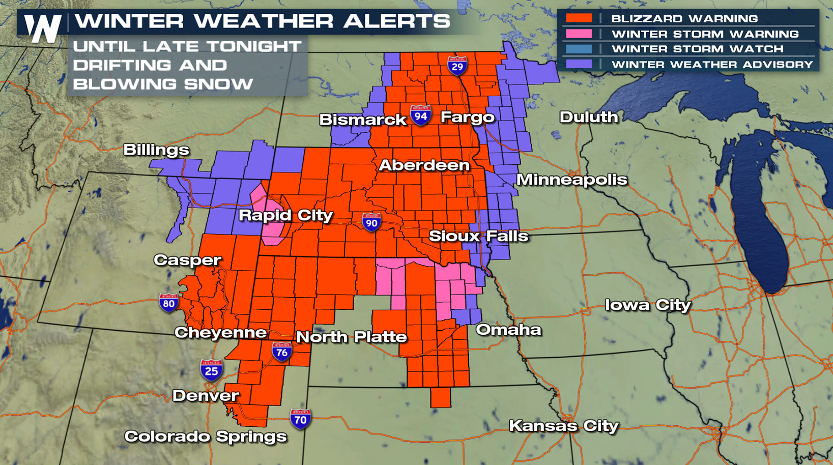
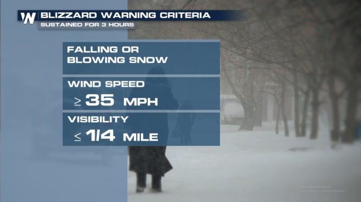
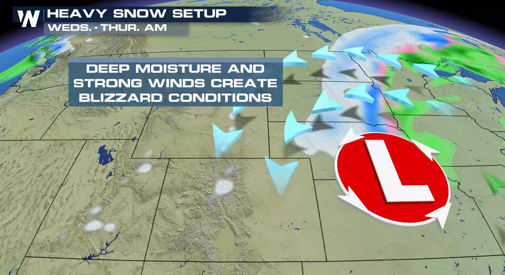 The National Weather Service has continued Blizzard Warnings across seven states. Wind gusts above 50 mph will produce significant blowing and drifting snow. White out conditions are likely in the Blizzard Warning areas.
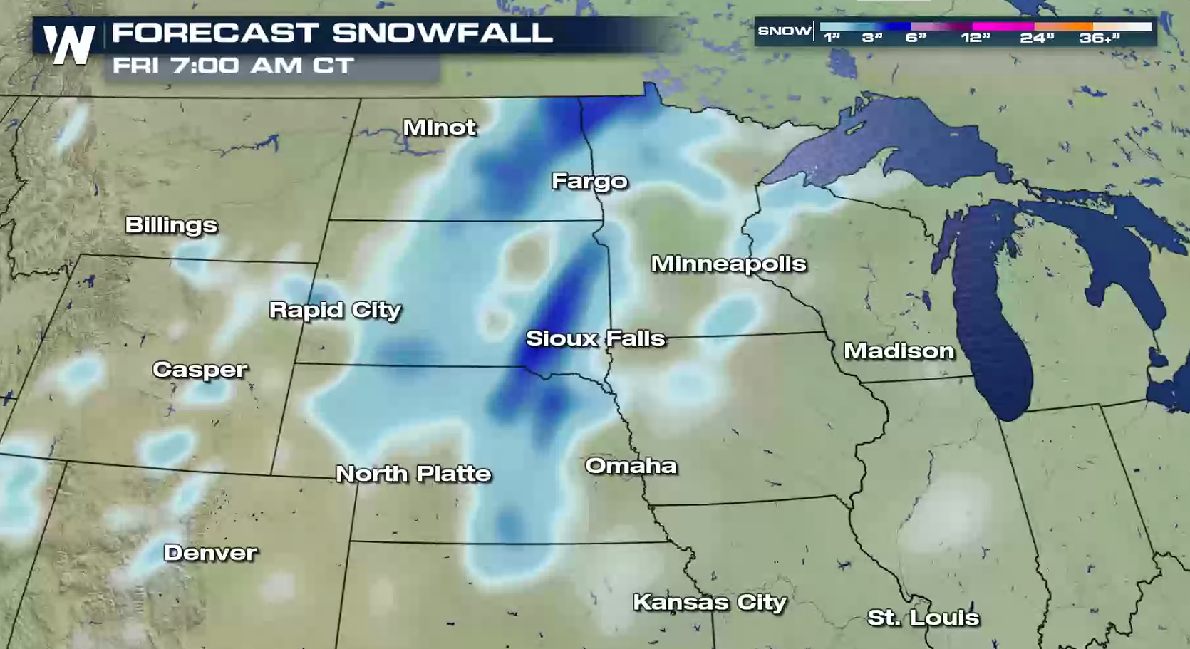 Snow totals will range from just a few inches to over one foot. Strong north and northeasterly winds will be sustained between 30 and 40 miles per hour at the height of this storm. Damaging wind gusts will reach 50+ miles per hour. This will reduce visibility to near zero at times and will likely halt traffic in many areas. Power outages will also be a concern.
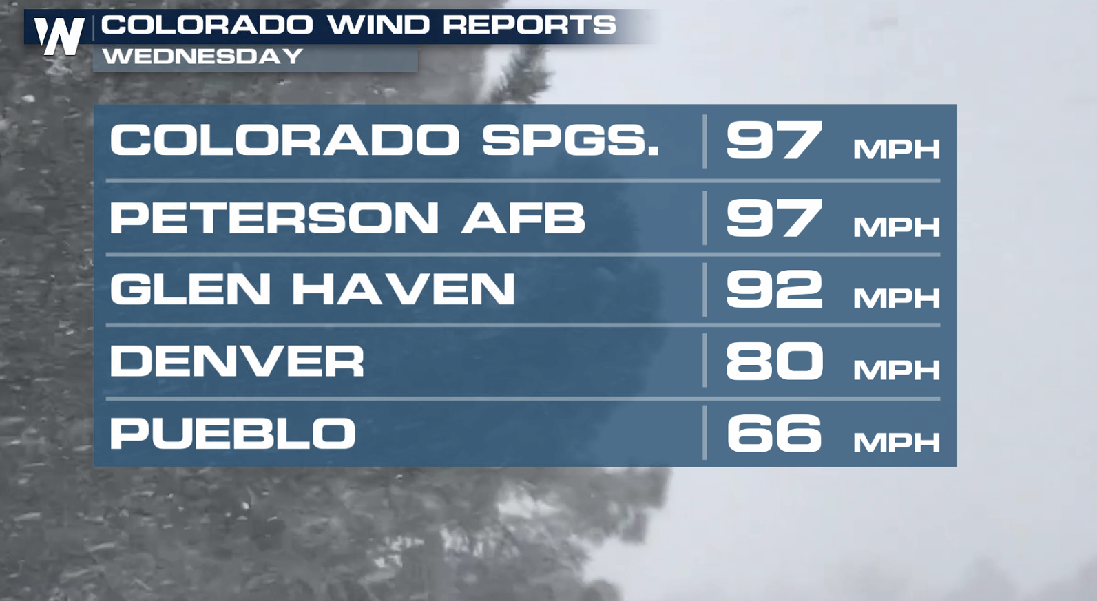
 In Colorado on Wednesday, winds were clocked to nearly 100 mph! Blizzard conditions were experienced in many areas in the Rockies and throughout the Front Range.
https://twitter.com/WeatherNation/status/1106117766468329472
In Colorado on Wednesday, winds were clocked to nearly 100 mph! Blizzard conditions were experienced in many areas in the Rockies and throughout the Front Range.
https://twitter.com/WeatherNation/status/1106117766468329472
 https://twitter.com/WeatherNation/status/1106159183861174272
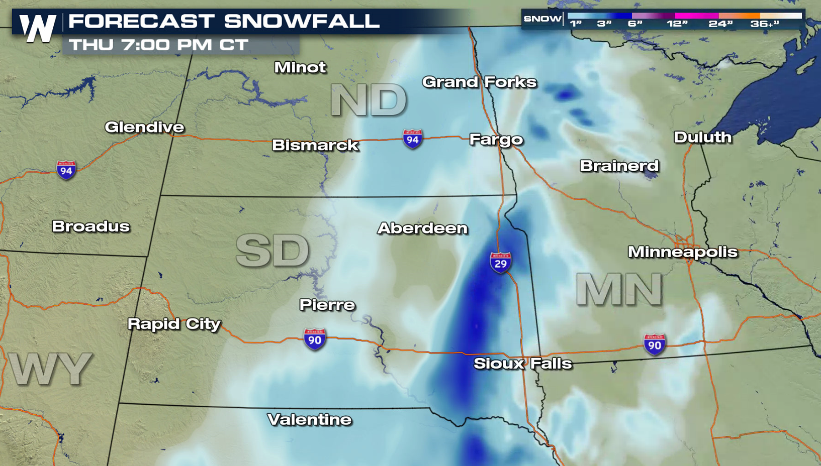
Blizzard conditions are now affecting the Dakotas. Wicked wind and heavy bursts of snow will produce whiteout conditions today (Thursday). Interstate corridors such as I-90, I-94, and I-29 will deal with nearly impossible travel with road closures.
https://twitter.com/WeatherNation/status/1106159183861174272
Blizzard conditions are now affecting the Dakotas. Wicked wind and heavy bursts of snow will produce whiteout conditions today (Thursday). Interstate corridors such as I-90, I-94, and I-29 will deal with nearly impossible travel with road closures.
 As is the case with any dynamic storm system, any minor change in the forecast track or strength will impact your local forecast. That's why it's important to follow WeatherNation on Facebook, Twitter, and Instagram for the latest breaking weather news and updates. Click HERE to find your local forecast.
- Meteorologist Joe Astolfi
As is the case with any dynamic storm system, any minor change in the forecast track or strength will impact your local forecast. That's why it's important to follow WeatherNation on Facebook, Twitter, and Instagram for the latest breaking weather news and updates. Click HERE to find your local forecast.
- Meteorologist Joe Astolfi
The National Weather Service has continued Blizzard Warnings across seven states. Wind gusts above 50 mph will produce significant blowing and drifting snow. White out conditions are likely in the Blizzard Warning areas.
Snow totals will range from just a few inches to over one foot. Strong north and northeasterly winds will be sustained between 30 and 40 miles per hour at the height of this storm. Damaging wind gusts will reach 50+ miles per hour. This will reduce visibility to near zero at times and will likely halt traffic in many areas. Power outages will also be a concern.
In Colorado on Wednesday, winds were clocked to nearly 100 mph! Blizzard conditions were experienced in many areas in the Rockies and throughout the Front Range.
https://twitter.com/WeatherNation/status/1106117766468329472
https://twitter.com/WeatherNation/status/1106159183861174272
Blizzard conditions are now affecting the Dakotas. Wicked wind and heavy bursts of snow will produce whiteout conditions today (Thursday). Interstate corridors such as I-90, I-94, and I-29 will deal with nearly impossible travel with road closures.
As is the case with any dynamic storm system, any minor change in the forecast track or strength will impact your local forecast. That's why it's important to follow WeatherNation on Facebook, Twitter, and Instagram for the latest breaking weather news and updates. Click HERE to find your local forecast.
- Meteorologist Joe AstolfiAll Weather News
More


More Storms for the East Sunday and Monday
A low-pressure system crashing through the Mi
2 Aug 2026 2:20 AM

After Reaching Category 5, Genevieve Weakens in the Pacific
PacificGenevieve formed on last Friday south
2 Aug 2026 1:30 AM

Flooding, Severe Storms Target the Midwest Again
After an active week of storms across the nor
1 Aug 2026 1:40 AM

Flooding Risk Increases as Heavy Rain Targets the Tri-State Area
Tuesday, heavy rainfall moved across the Nort
30 Jul 2026 12:25 AM

Severe Weather: Energy From the Midwest Now in the Southeast
UPPER MIDWEST - Through Monday, dangerous tor
29 Jul 2026 10:30 PM