Heat Bakes the West, Some Relief Coming

WEST - A persistent ridge of high pressure continues to keep the temperatures hot in the Southwest U.S. Denver, CO hit 97° on Wednesday with Grand Junction in the western part of the state hitting 102°! This is roughly 15-20 degrees above average! The heat continues today in the Four Corners but will start to wane for the immediate West Coast through the weekend. Still, widespread heat alerts are in effect through the weekend for the southern Four Corners and through Thursday for many others in California.
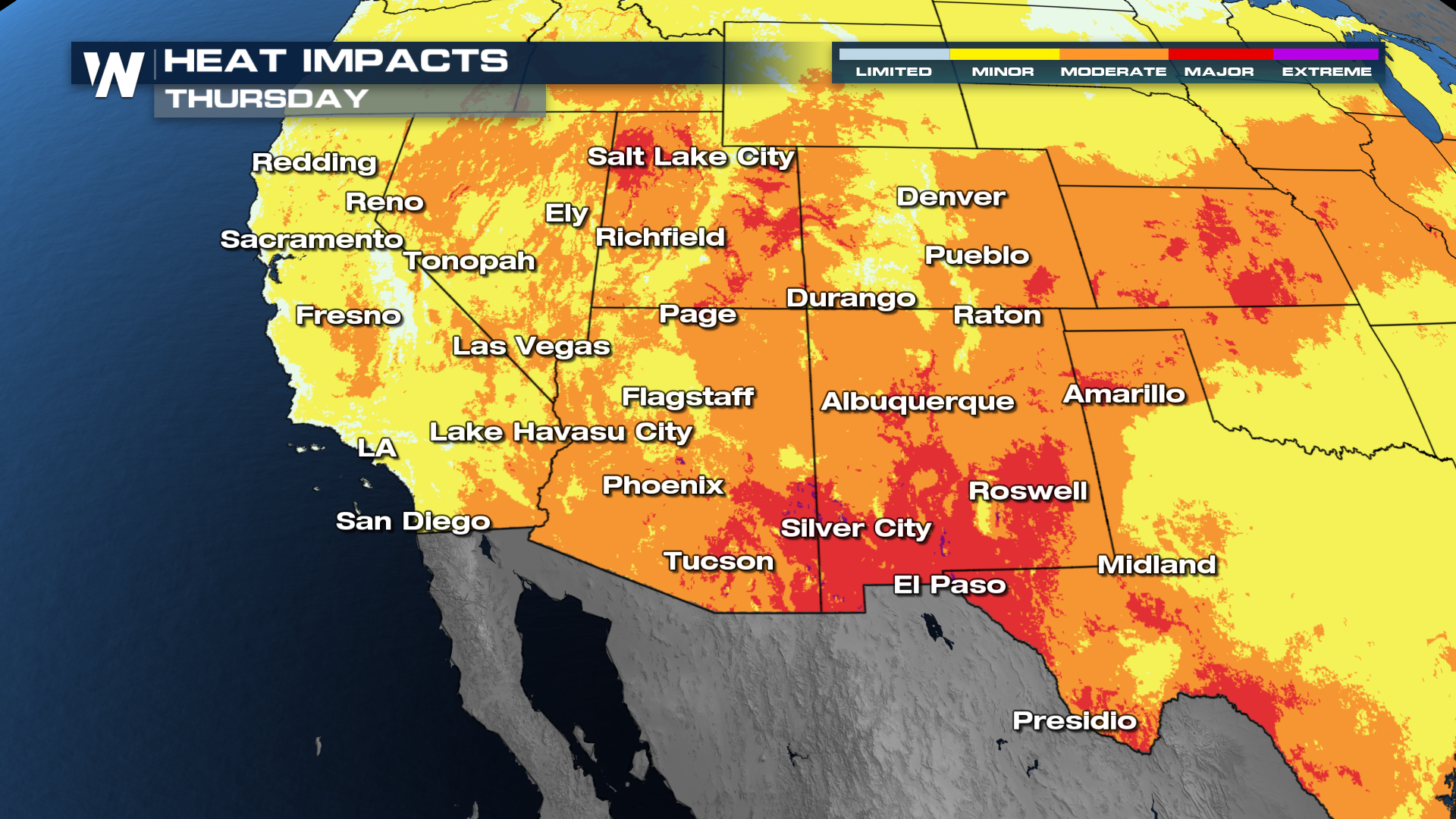
 The "HeatRisk" map shows many spots across the southwest under "major" and isolated areas of "extreme" heat danger on Thursday. Although these are not quite as hot as last week, it will still be dangerous for those working outside, so please practice heat safety if you have to be outdoors by drinking lots of water and spending time in the shade. The "HeatRisk" tool by NOAA considers how much above average temperatures are and the time of year to create the "risk" and aims to give a different way to view heat impacts.
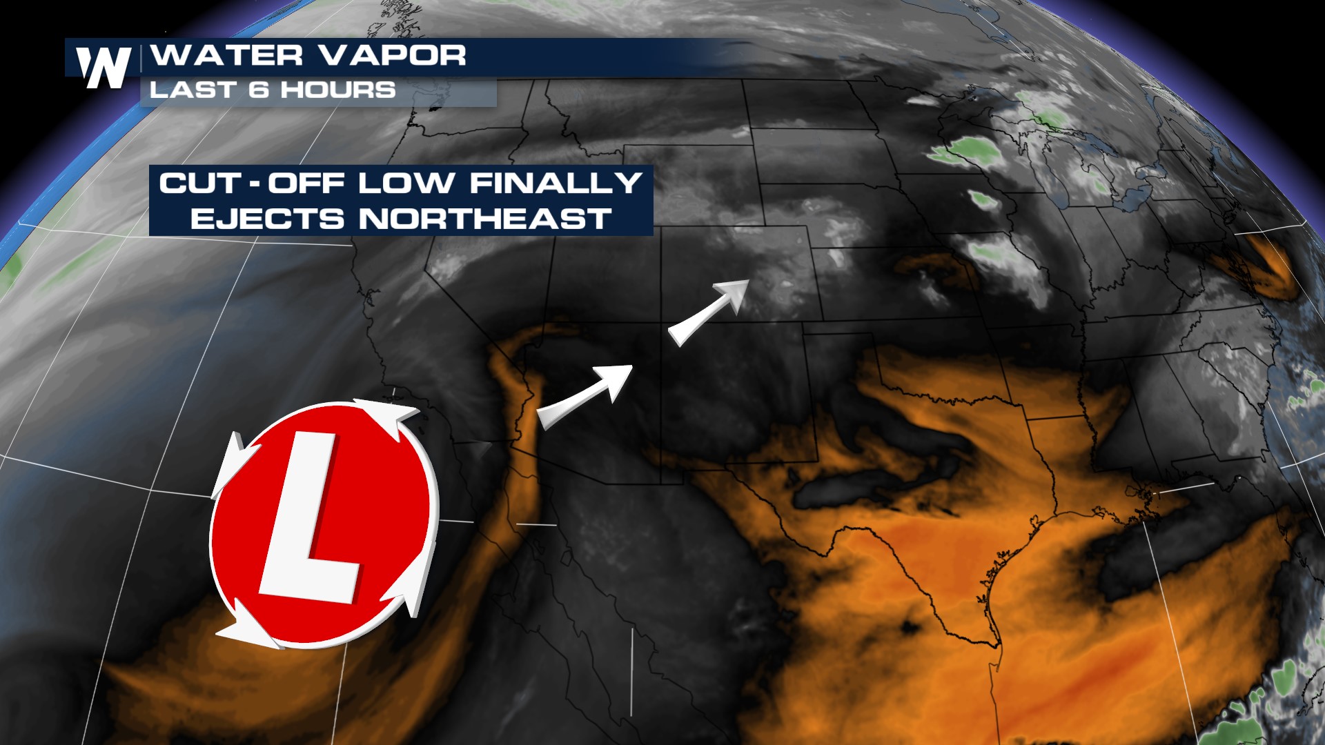
 Some cooler temperatures are coming, and mostly we will see an increase in cloud cover and the storm potential as an area of low pressure sitting off the Southwest Coast starts to get absorbed back into the main Jet Stream. As it does so, it wraps both Pacific and Gulf moisture into it, drawing that moisture up over the Four Corners. This is a monsoon setup, and monsoon season starts June 15th!
 Monsoon refers only to the direction of the wind, not to rain showers, although the wind direction typically results in showers. We will see more thunderstorms develop off the high terrain of the Four Corners on Thursday and Friday with rainfall totals isolated up to 1". This may not sound like a lot for other parts of the country but this amount of rainfall can do damage to dry southwest soils!


