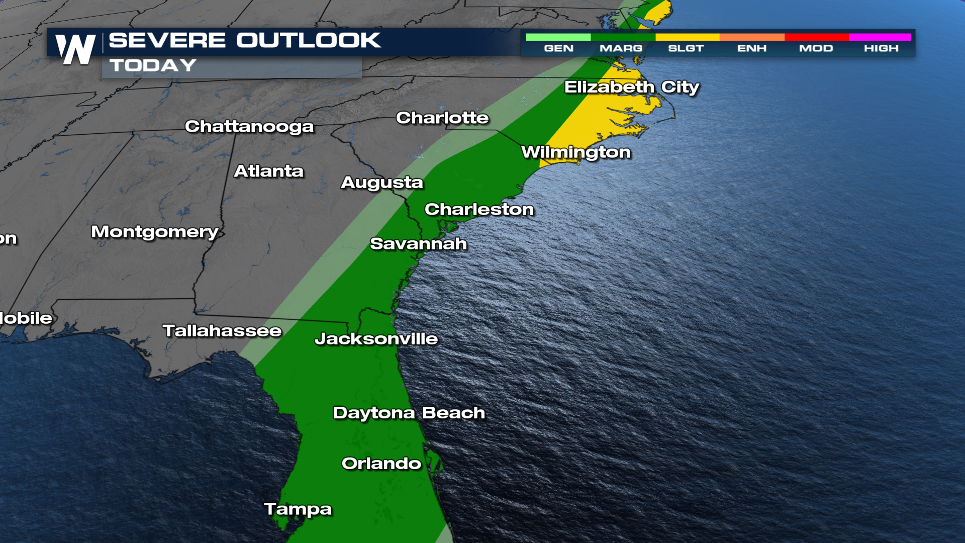
Severe & Flood Threat For The Southeast

Heavy rain continues to the South and Southeast this week. A slow-moving cold front will combine with Gulf moisture, bringing heavy rain and flooding concerns. Rainfall got over 4.50" in Alabama on Tuesday. Heavy rain continues again for Wednesday, but it is just one element with these storms, as a severe threat will be there into the evening. Right now, the Storm Prediction Center has issue a slight risk for the North Carolina. However, a marginal risk stretches down into the state of Florida.
 Heavy rain and severe thunderstorms will follow the frontal boundary through Wednesday. Rainfall amounts of up to 5 inches will be possible for the heavier totals.
As this system moves east we can see strong to severe storms on Wednesday. Cities like Tallahassee, Wilmington, and Charleston have the potential for damaging winds and tornadoes. The best timing for the strong storms will be in the afternoon.
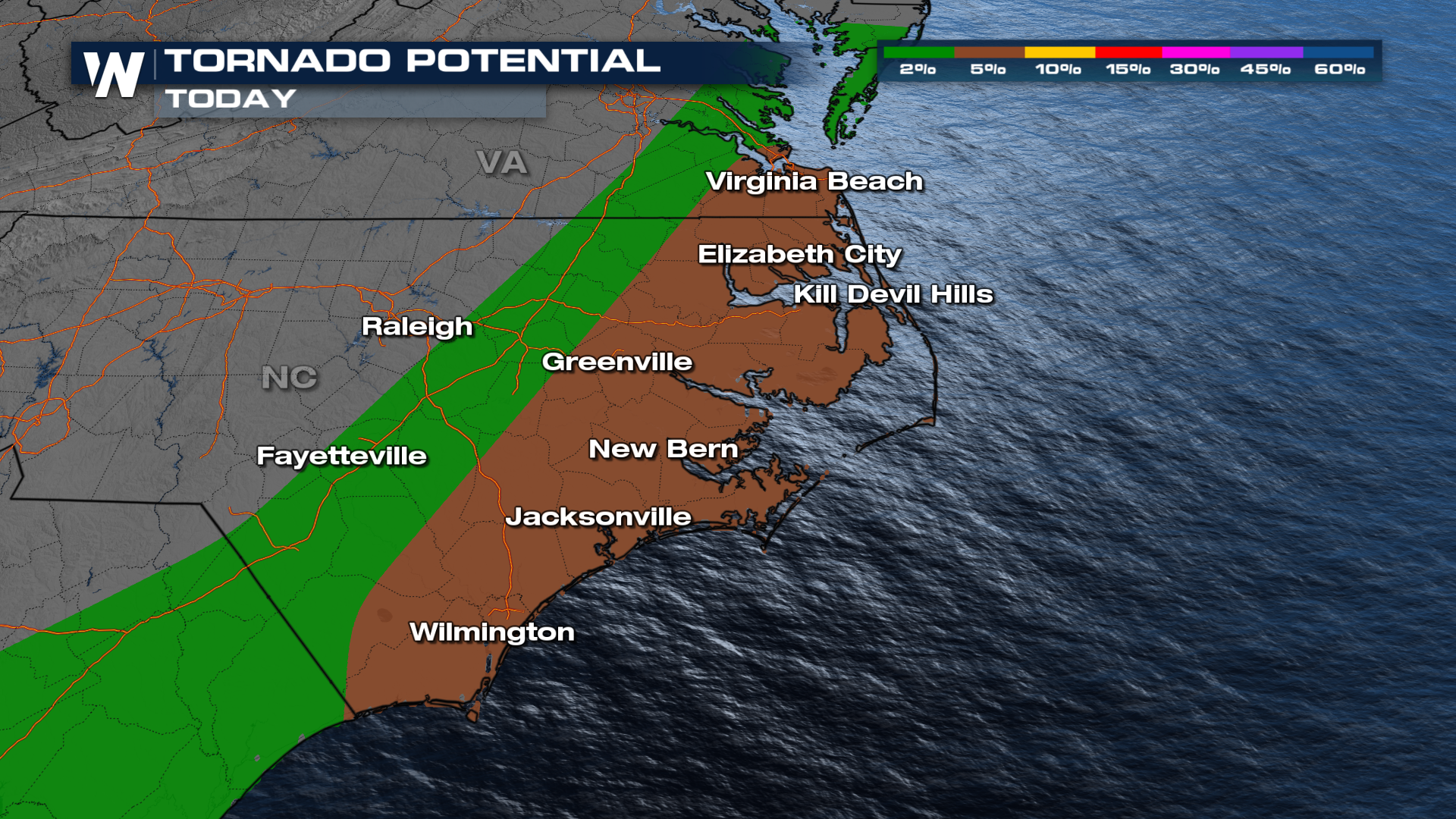 As the front moves eastward, the severe threat follows it, largely lining up in the Carolinas. Stay tuned to the forecast for any additional changes. Catch your East Regional Forecasts at :10 past the hour or your Central Regional Forecast at :30 past the hour, every hour.


