Hurricane Laura: Three Years Later
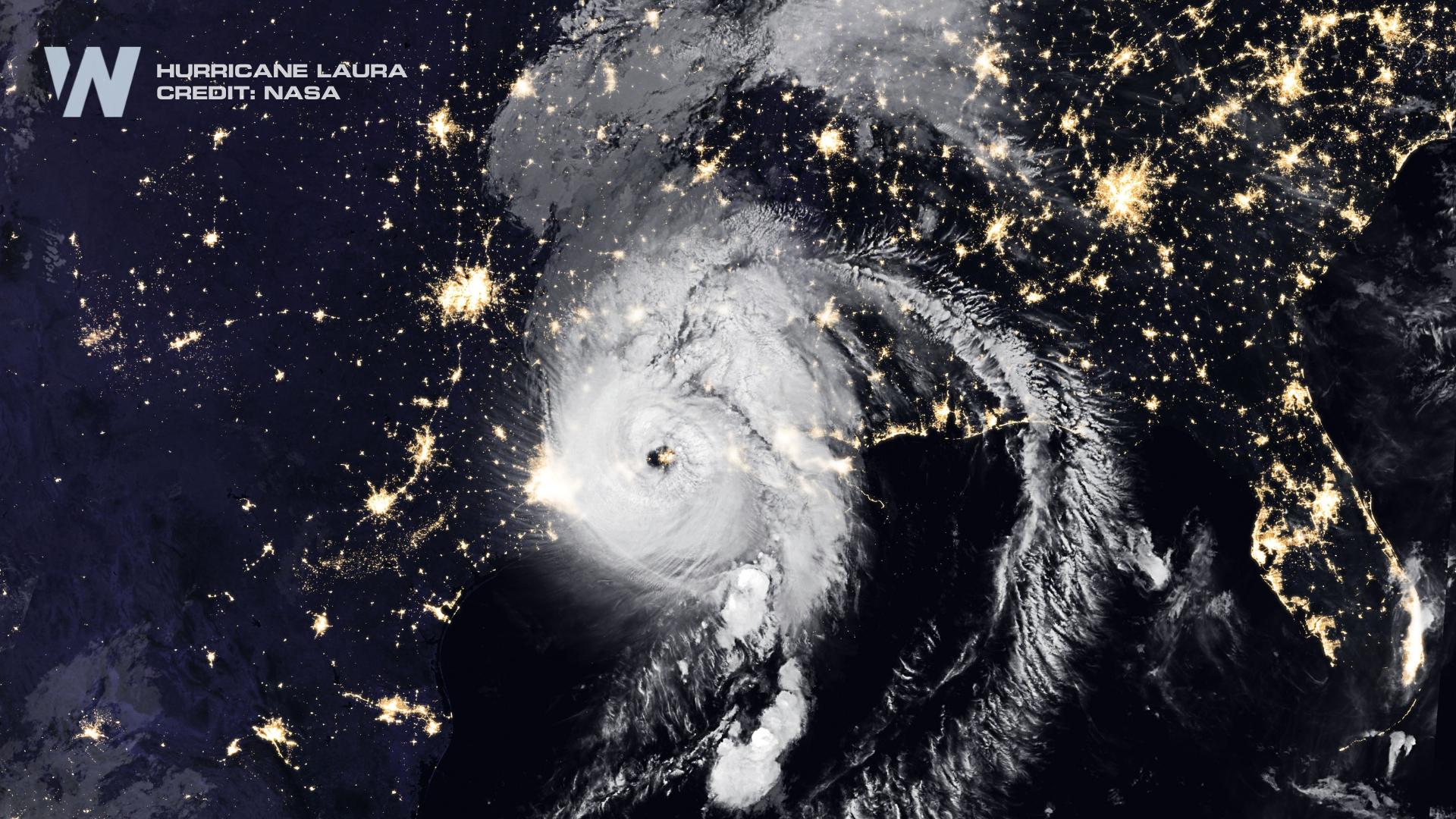
Three years ago today Major Hurricane Laura made landfall along the Louisiana coastline near Cameron, LA early on the morning of August 27th, 2020. It came ashore as a CAT 4 with sustained winds of 150mph!
Laura began as a wave off Africa about 9 days before it struck Louisiana, becoming the earliest named “L” storm on record. Laura moved into the Caribbean and making landfall in Hispaniola and Cuba before getting into the Gulf of Mexico.
In the Gulf, Laura quickly intensified into a CAT 4 reaching peak strength on the evening of August 26th. At the time, it was the strongest hurricane on record to hit Southwest Louisiana in modern history (it was tied the following year by Ida).
Just ahead of Laura’s landfall, the storm surge was forecast to be “unsurvivable”. In Cameron, LA numerous structures saw storm surge over 13’, and even a measurement of 17.1’ storm surge in Creole, LA.
Winds and storm surge were the most impactful parts of Laura through Louisiana with significant damage in Cameron and Calcasieu parishes. Many wind observing stations were destroyed in the hurricane but not before measuring wind gusts in the range of 100-130 mph.
Laura was a relatively quick moving storm, with the center in northern Louisiana by midday on the 27th. Still, heavy rain on the order of 5-11" caused issues for parts of coastal Louisiana.
Sadly, Hurricane Laura claimed the lives of 47 people in the U.S., Haiti and the D.R.. Indirectly, 34 people died in cleanup activity following the storm.
Laura was just the start of an active year for Louisiana though. In just 1 year coastal Louisiana was struck 4 times by 4 MAJOR hurricanes: Laura, Delta, Zeta and Ida. Proving that just because you got hit once, doesn’t mean you won’t get hit again.


