Lake Effect Snow Winds Down Friday

Winter weather alerts remain in effect off of the Great Lakes as another round of lake-effect snow continues. Cold air and strong W to NW flow behind a cold front are helping to spur this round of snow. These conditions will gradually back off on Friday while rain and a wintry mix return to the region around another low-pressure system to end the weekend.
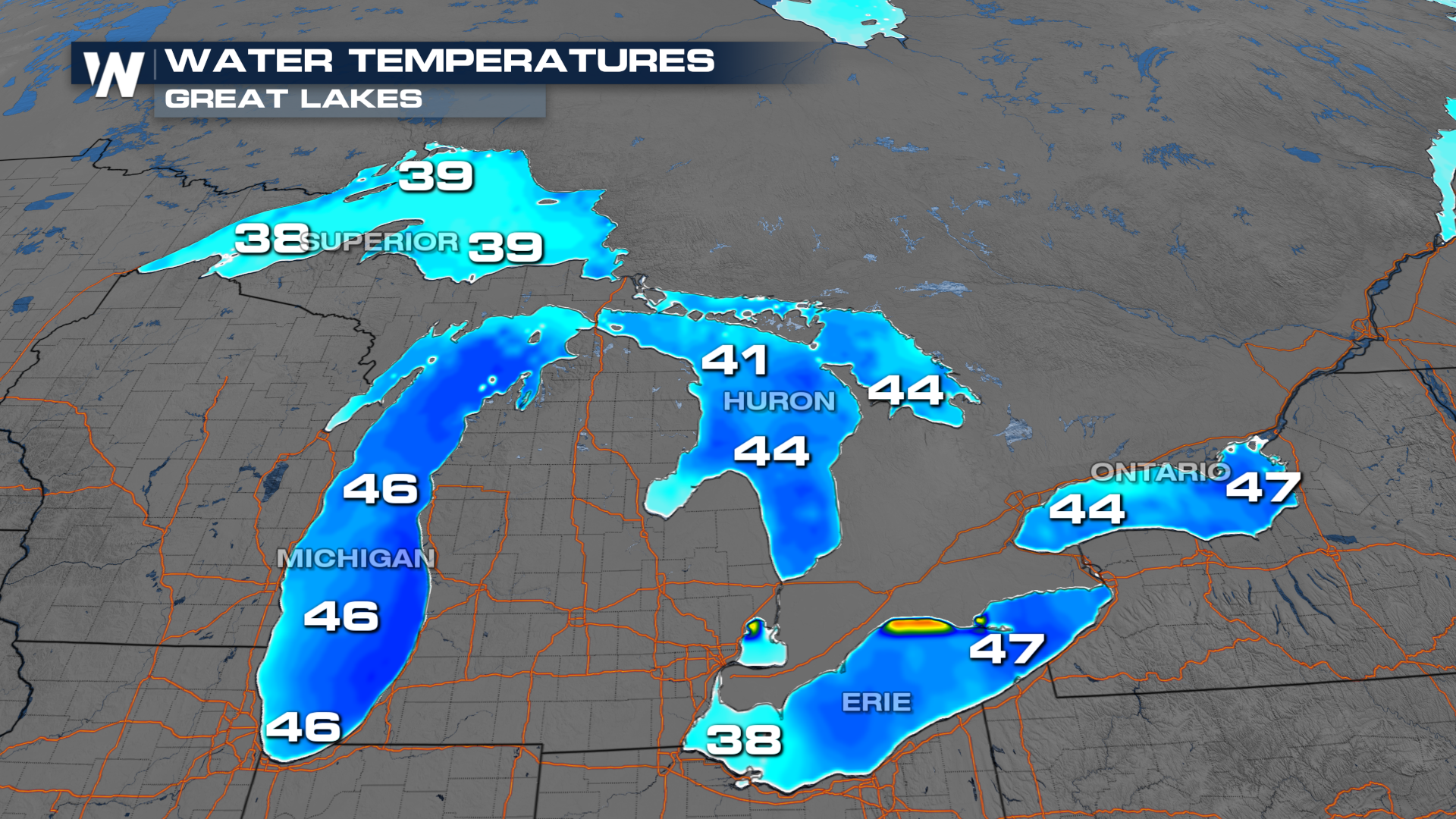
Lake effect snow happens when relatively colder air moves over the unfrozen water of lakes. The colder air picks up moisture from the lakes, making it less dense and causing it to rise. Clouds and precipitation begin to form and efficiently start producing snow. Because the Great Lakes still have water temperatures in the 40s, any lake effect events will be prolific producers (as we have seen this season).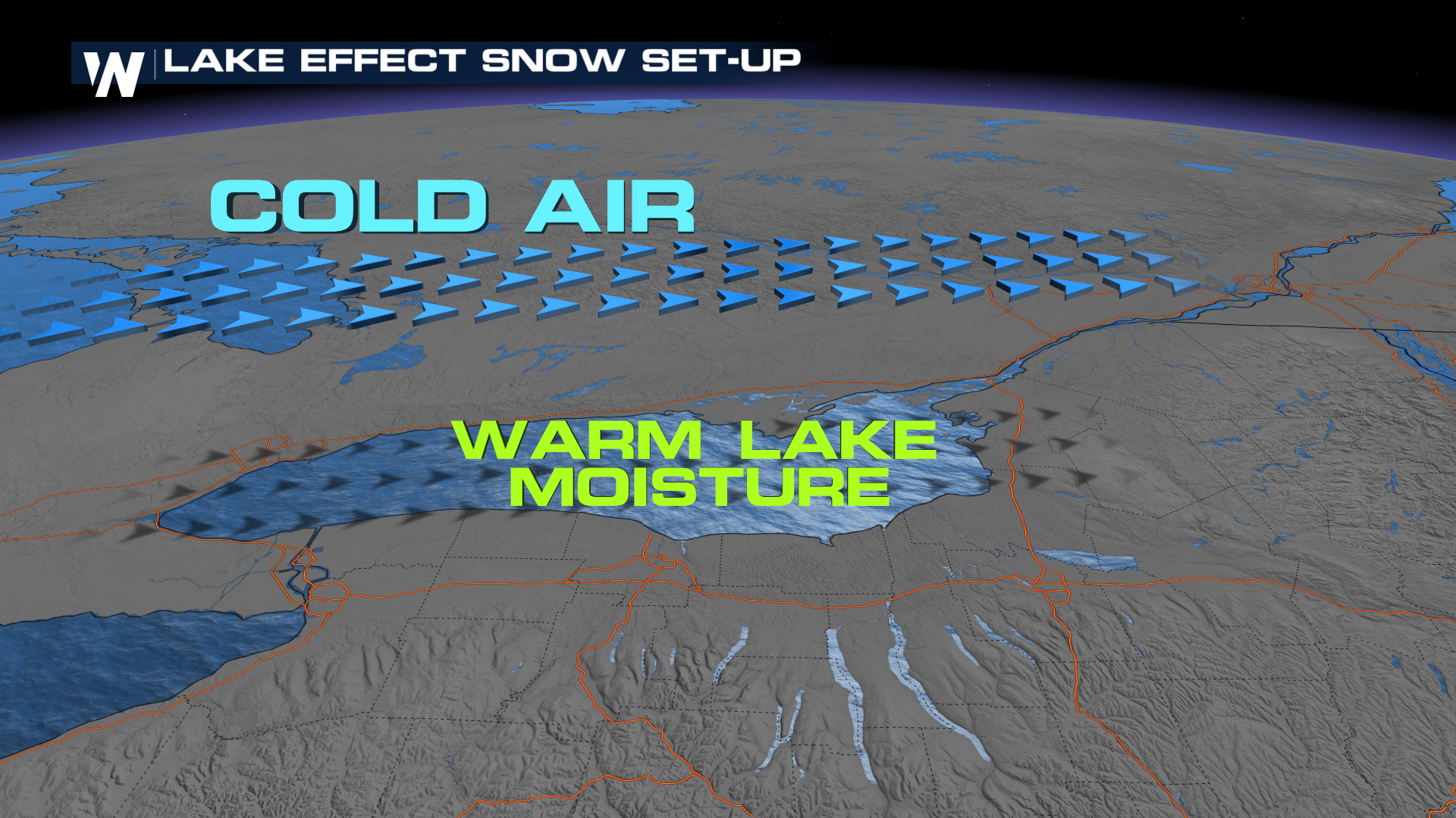
 Snowfall rates will begin to lessen quickly Friday morning near Lake Erie, but it will take longer around Lake Ontario. Friday's lake effect should be more manageable for most areas before it ends overnight into Saturday.
Potential Snowfall Totals and Impacts
Light snow is expected on Friday, except for area east of Lake Ontario where another 6-10 inches are possible by midnight.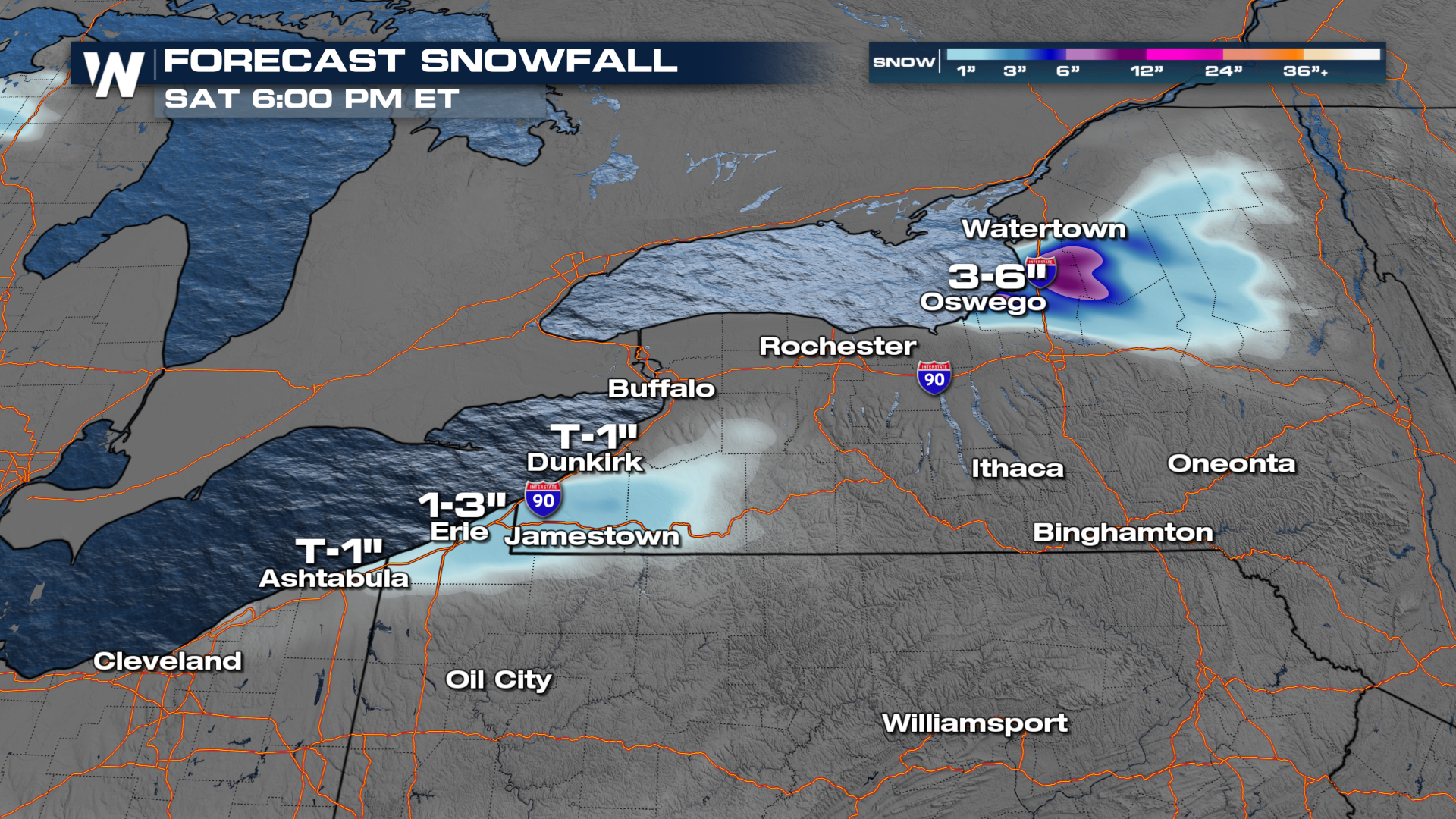 Tune into Weather Nation for more details.


