Major Winter Storm Barrels Toward the Northeast
Special Stories
19 Jan 2019 7:10 PM
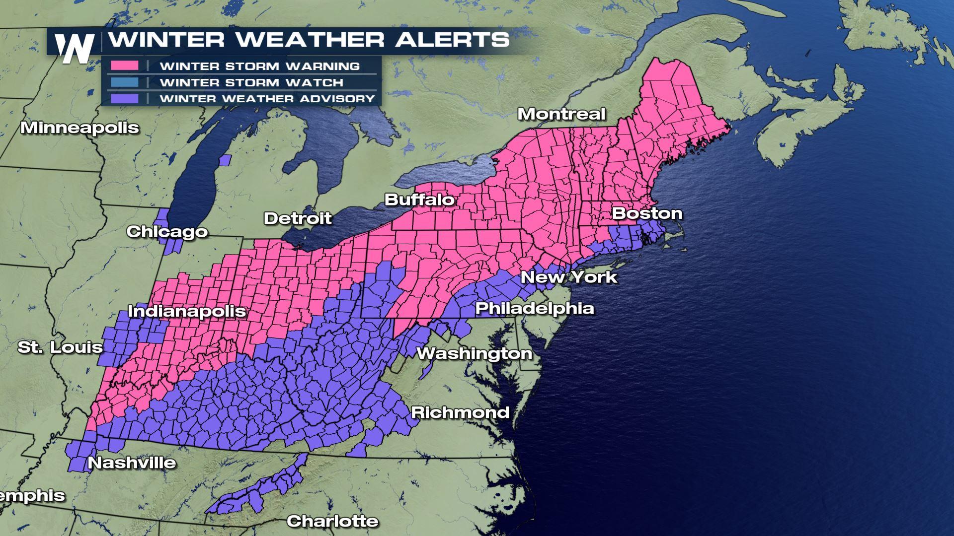
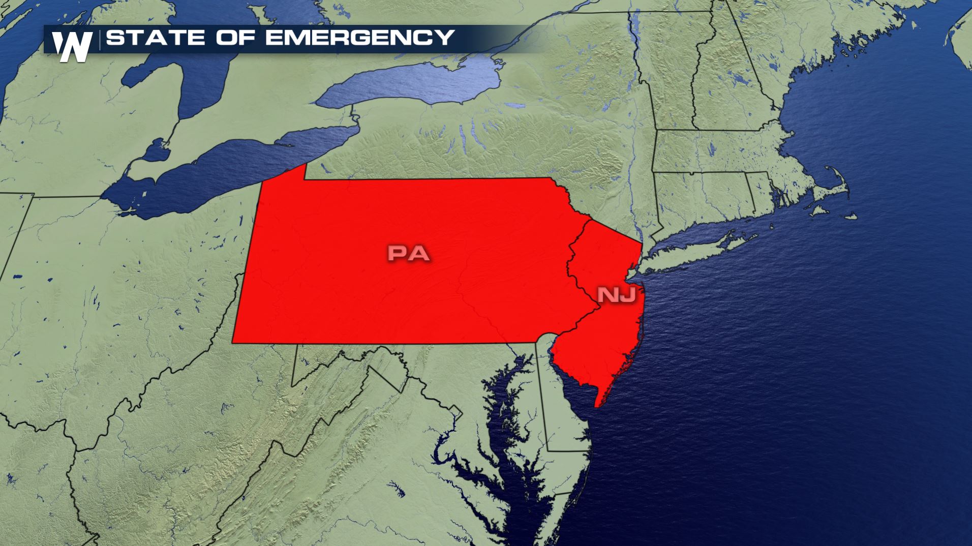
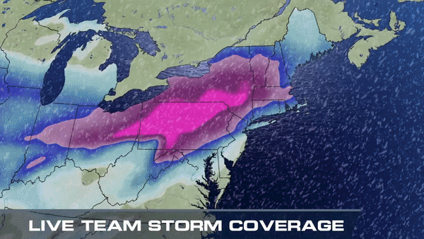
A major winter storm continues to press through the eastern U.S., bringing the threat for snow, ice, and severe storms. Several areas from New York to Maine could end up with more than a foot of snow, and for others an icy wintry mix. Winter weather alerts have been issued for over 20 states extending from the Upper Midwest to New England. A state of emergency remains in effect for Pennsylvania and New Jersey ahead of the storm.
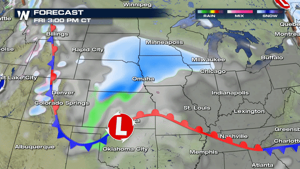
 The storm has already dropped 6 to 12" of snow across the Midwest and Lower Great Lakes Friday to Saturday. The low pressure responsible continues to move east, and will intensify off the northeast coastline, creating a powerful nor'easter with heavy snow expected for much of interior Northeast.
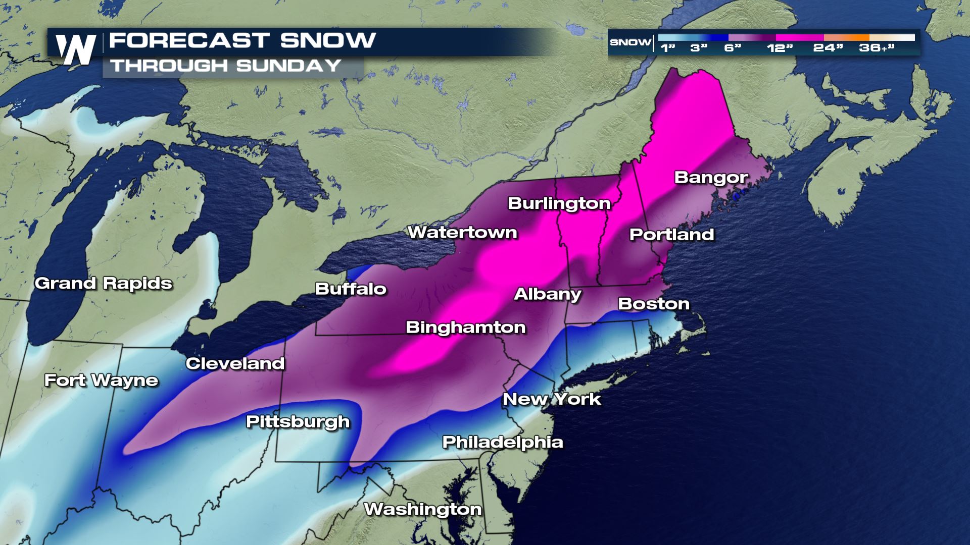
 The heaviest snow totals will likely fall in the interior northeast with as much as 12"-24" of snow expected from Pennsylvania to Maine.
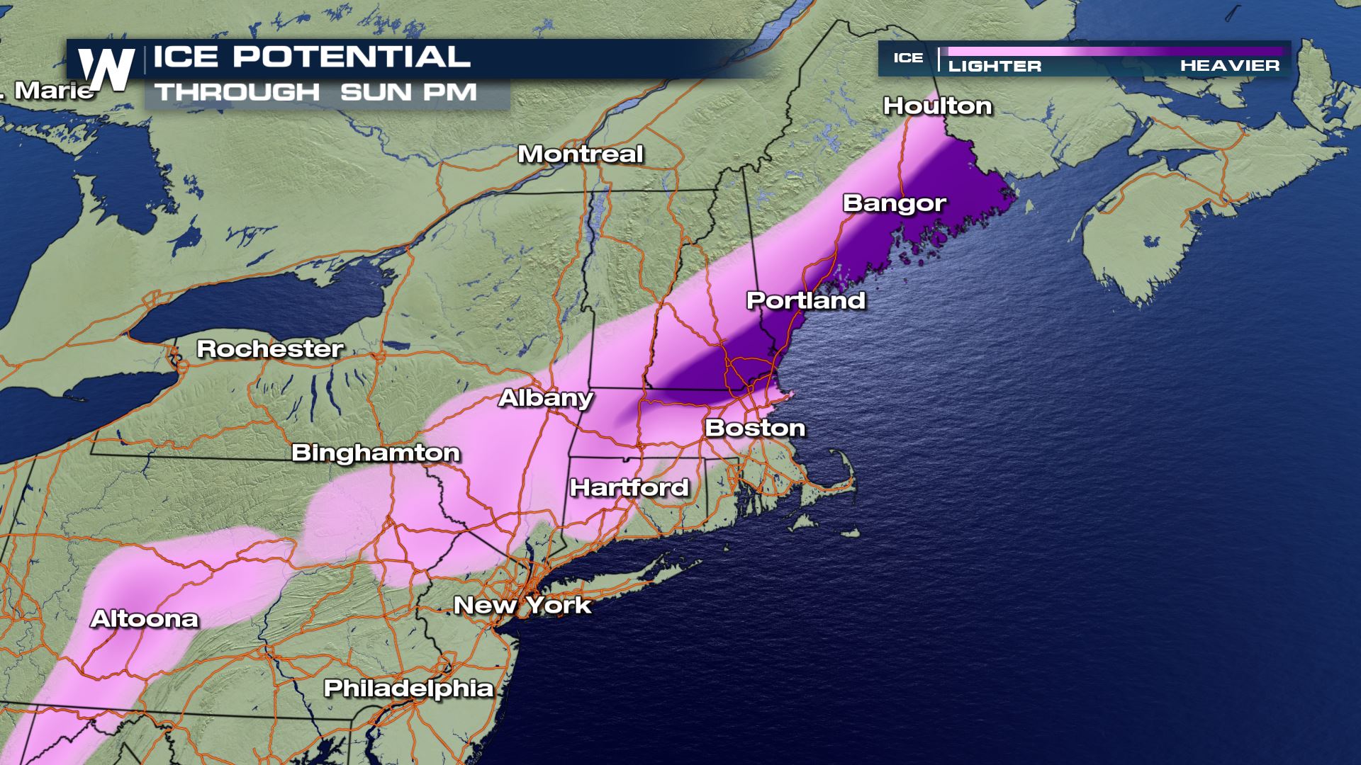
 Ice potential is also a growing concern for the northeast. With temperatures hovering near 32 degrees, many areas will see all types of precipitation. Freezing rain potentially in the northeast could lead to scattered power outages and extremely hazardous travel through the weekend.
 Be sure to check back with WeatherNation on-air and online for the latest updates on the winter storm all weekend long.
The storm has already dropped 6 to 12" of snow across the Midwest and Lower Great Lakes Friday to Saturday. The low pressure responsible continues to move east, and will intensify off the northeast coastline, creating a powerful nor'easter with heavy snow expected for much of interior Northeast.
The heaviest snow totals will likely fall in the interior northeast with as much as 12"-24" of snow expected from Pennsylvania to Maine.
Ice potential is also a growing concern for the northeast. With temperatures hovering near 32 degrees, many areas will see all types of precipitation. Freezing rain potentially in the northeast could lead to scattered power outages and extremely hazardous travel through the weekend.
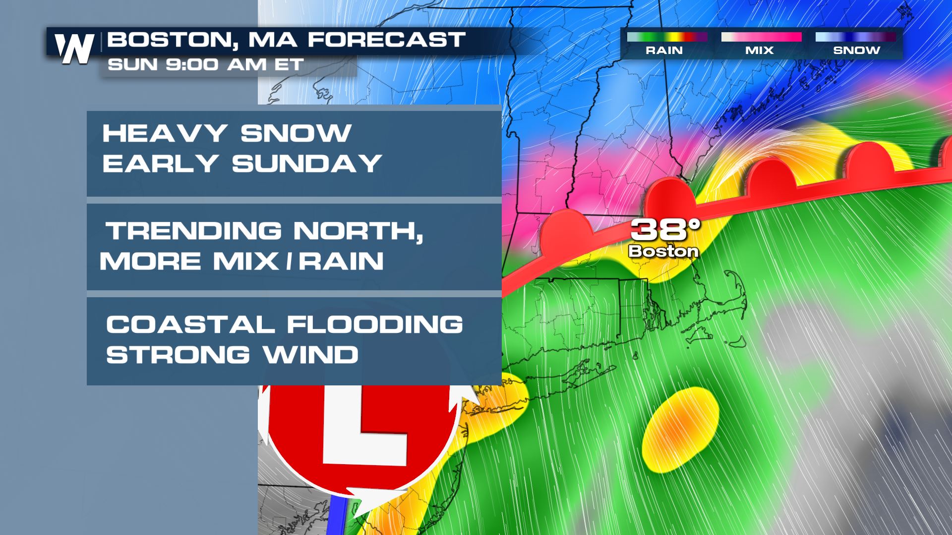
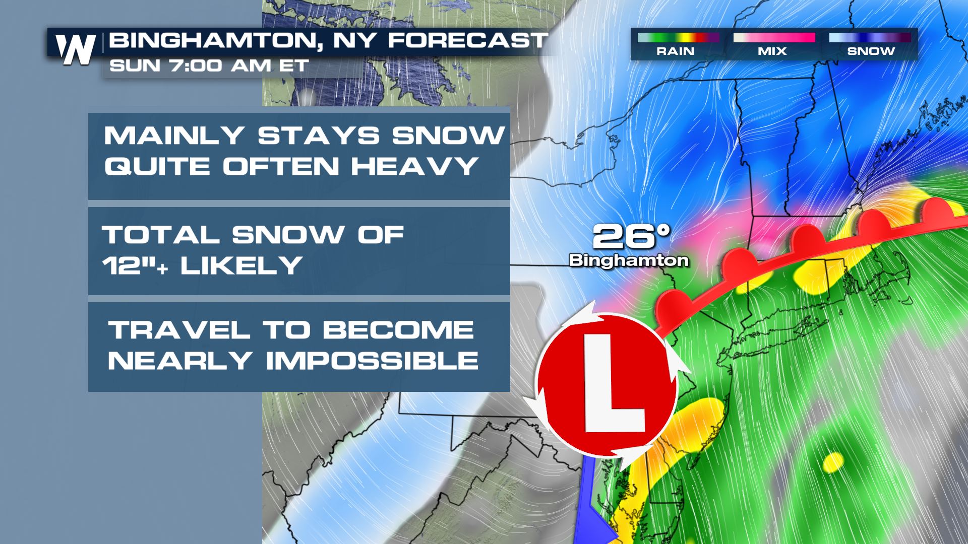
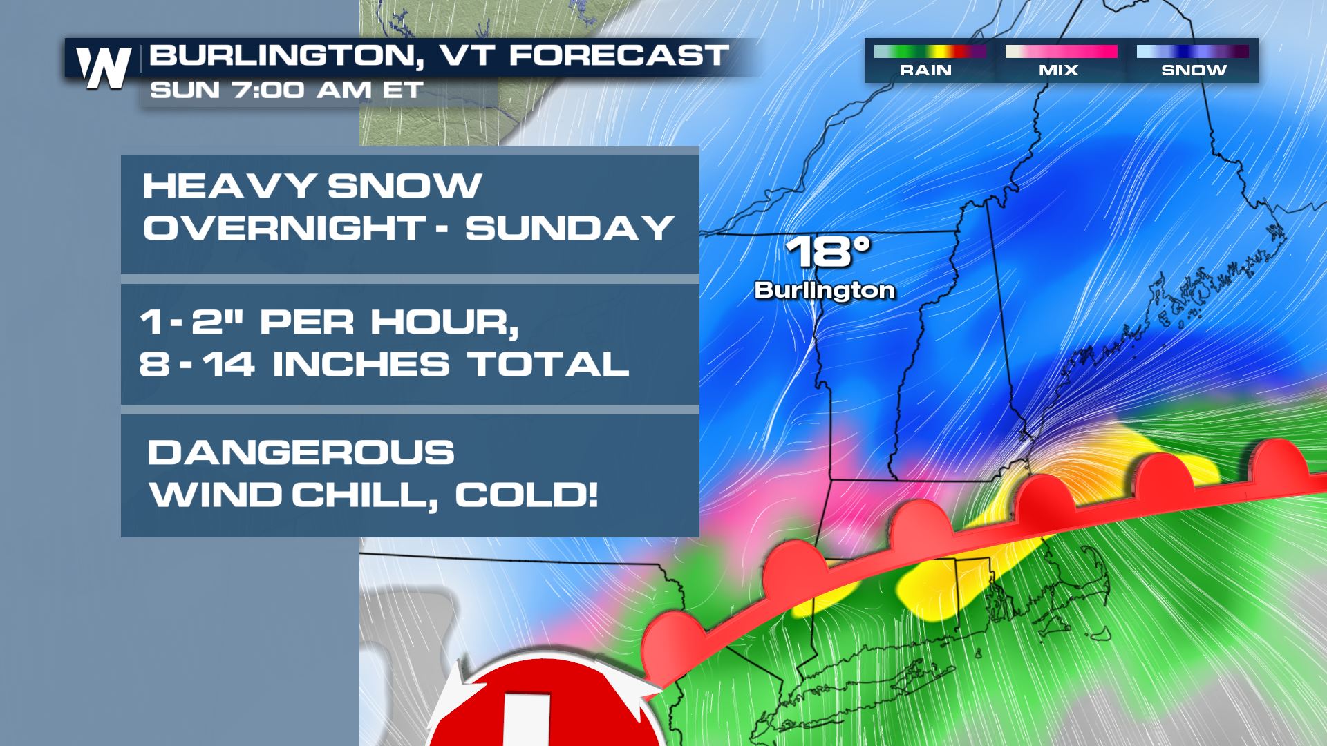
CITY-BY-CITY
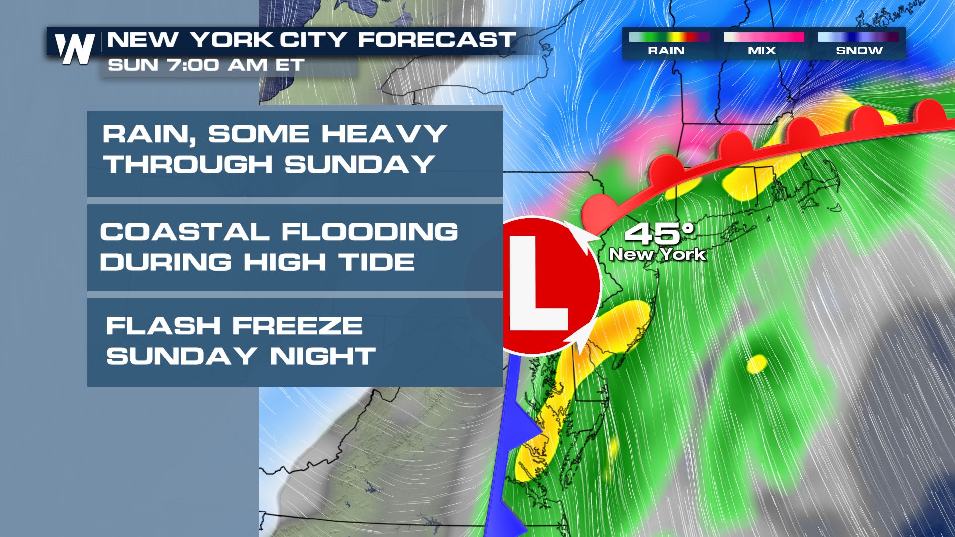
Here's a look at what to expect in some of the major Northeast cities:NEW YORK CITY
BOSTON
BINGHAMTON, NY
BURLINGTON
Be sure to check back with WeatherNation on-air and online for the latest updates on the winter storm all weekend long.
All Weather News
More

Flooding Risk Increases as Heavy Rain Targets the Tri-State Area
TRI-STATE AREA - Along with the threat of sev
29 Jul 2026 2:00 AM

Tropics: Fausto Heads towards Hawaii; Genevieve a Major Hurricane
PacificTropical Storm Fausto continues to tra
29 Jul 2026 1:35 AM


Southeast Flood Risk Lingers Near Stalled Front
A stalled boundary over the Southeast will ke
25 Jul 2026 10:55 AM

Another Round of Storms Targets the Northeast
Tuesday brought severe weather again across p
23 Jul 2026 1:15 AM