Flooding Concern Continues in the Southwest

Flash flooding will continue to be possible in the southwestern United States over the next couple of days. Be sure to check your property's flood zone and have a plan to seek higher ground if necessary. NEVER drive through flood waters if you cannot easily see the water's depth or the road below it. Multiple water rescues have been needed over the past few days. Remember, you're not only risking your life but the lives of the first responders if you drive into flooded roads.
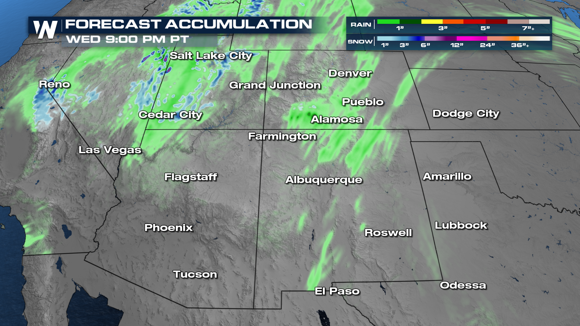
The remnant moisture from the two most recent tropical systems in the Eastern Pacific, Priscilla and Raymond, led to heavy showers and thunderstorms over a wide range of terrain throughout the weekend. And now a trough out west and a ridge out east are helping to funnel moisture into New Mexico and Colorado.
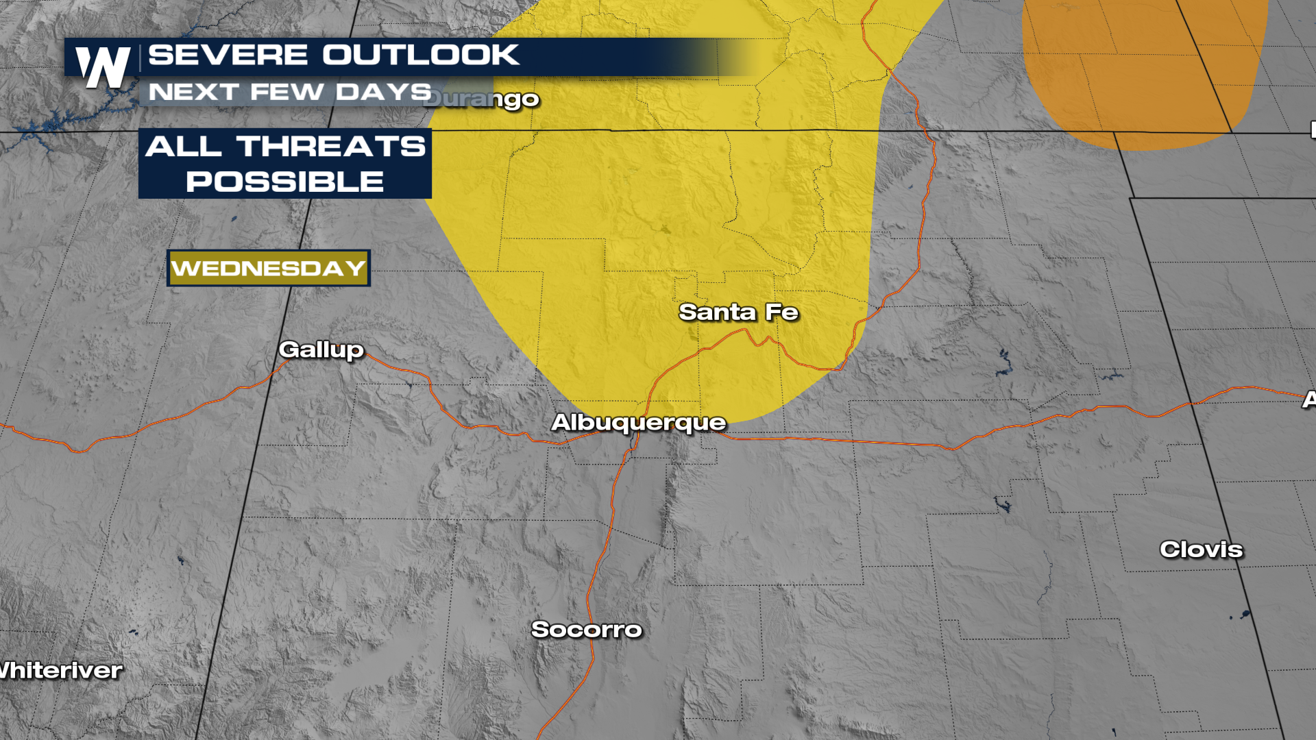
In addition to the flood threat, severe storms are possible through Wednesday as the trough moving through the northern Rockies increases wind shear farther south. Damaging wind gusts have been a problem already this week, with places like Tempe clocking 71 mph winds from a microburst.
We have seen heavy rain and flooding with these storms, and that threat will continue over the next few days.
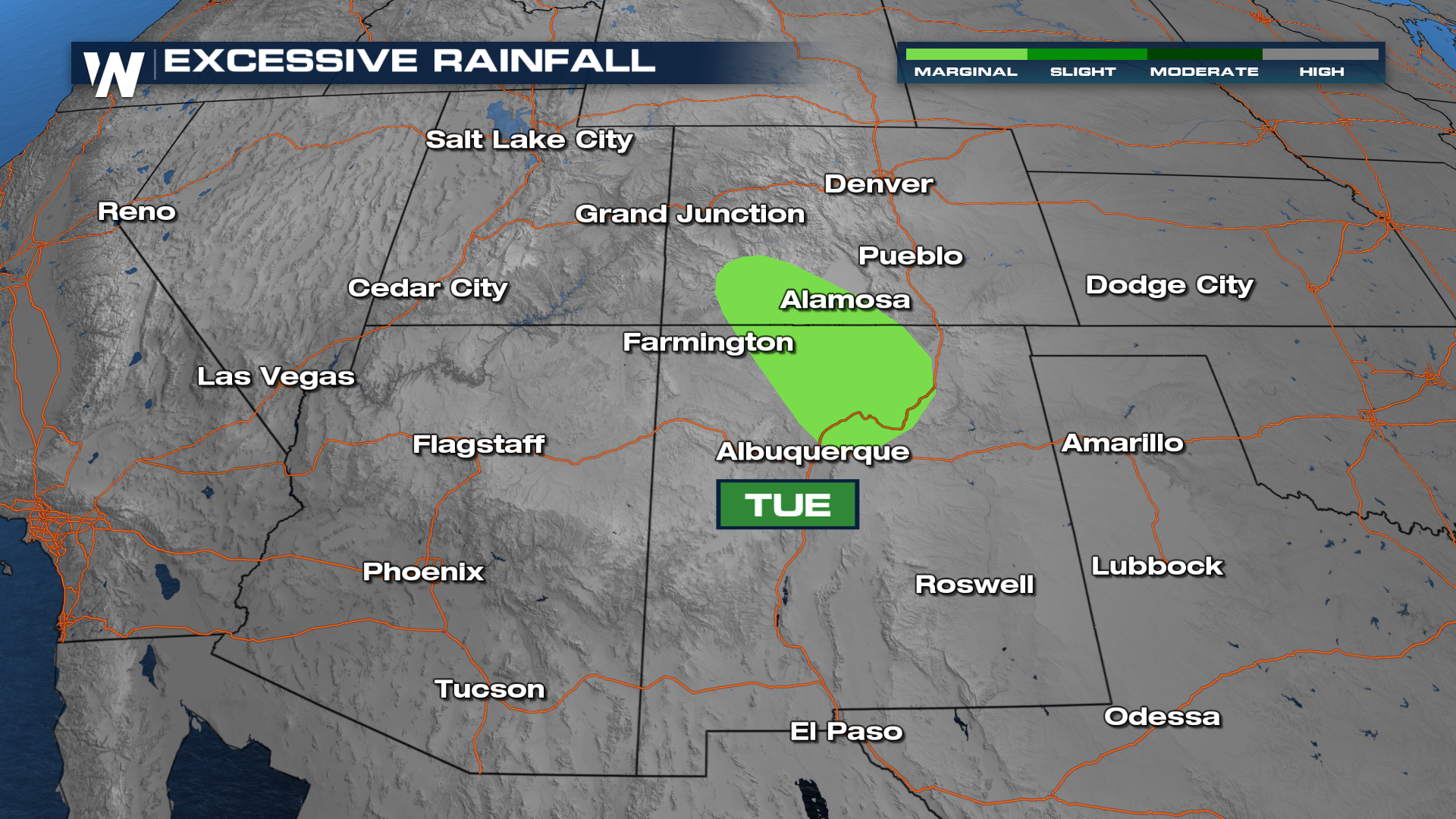
This surge of moisture across the southwest brings forth the chance for excessive rainfall in places like Alamosa, CO all the way down to Santa Fe, NM.
As a result, multiple flood warnings have been issued for several spots near Durango, CO. Some of these areas are near rivers and streams, which in some cases like near Rio Grande, have already seen roughly 8" of rain since the past weekend. This causes these areas to be more prone to flooding once more rain is in the forecast.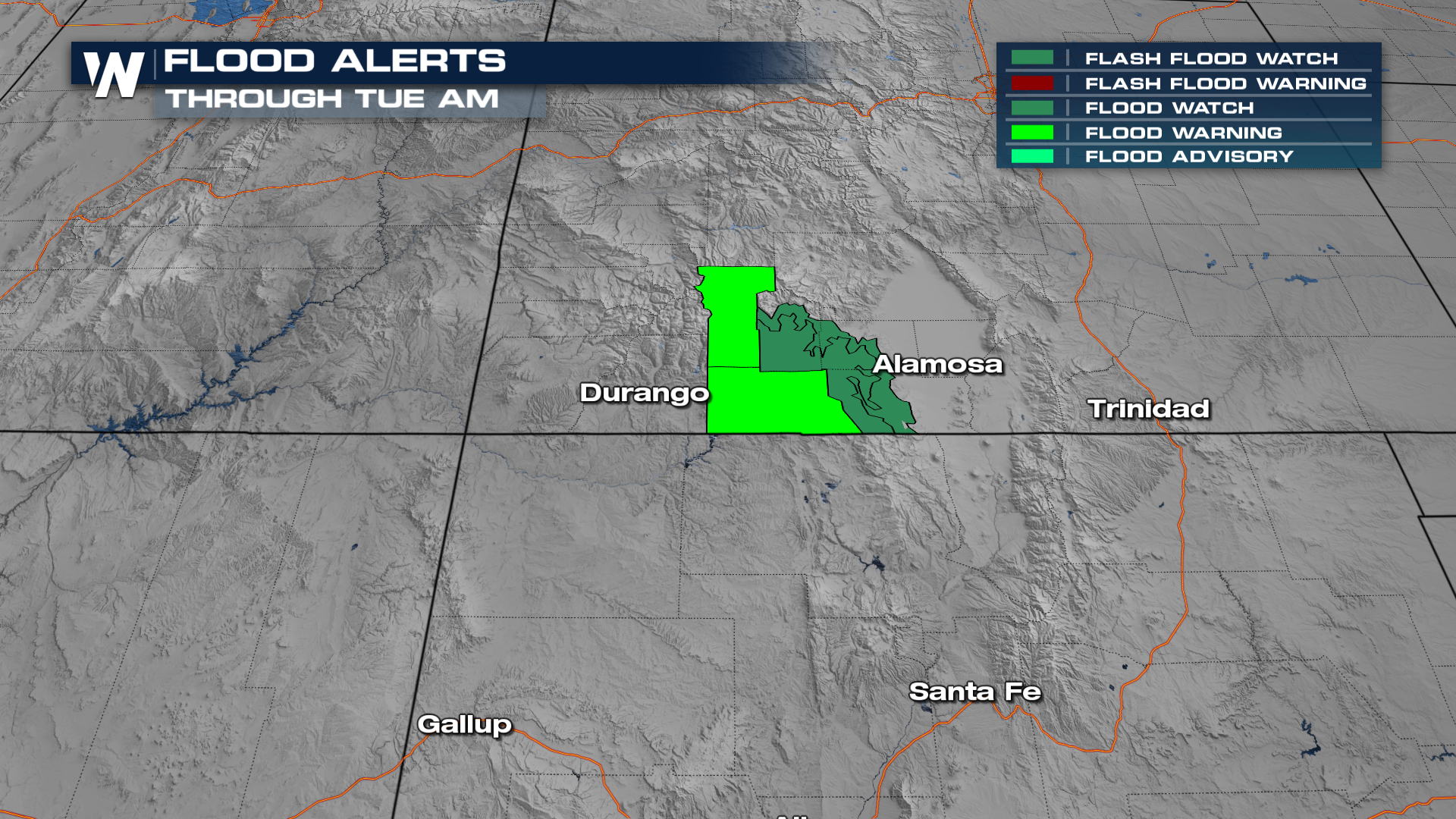
We'll be detailing this more live on WeatherNation. For a more immediate update on your southwest regional forecast, be sure to tune in at:50!


