Overnight Storms Target the Great Plains
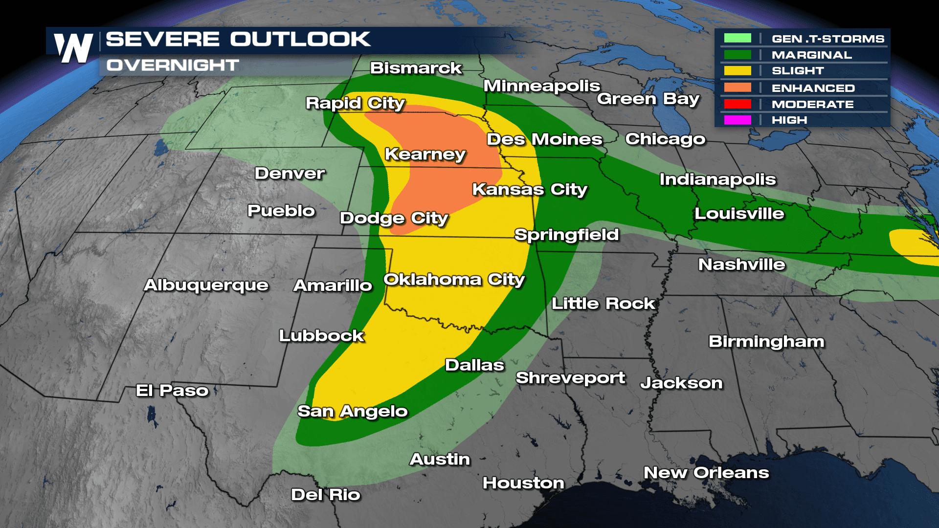
The Storm Prediction Center has maintained an enhanced risk (level 3 out of 5) of severe storms through the overnight hours across Nebraska, Kansas, and southern South Dakota. A slight risk (level 2 out of 5) extends from South Dakota through Texas. Severe weather threats include several tornadoes, very large hail, and damaging winds. Storms continue into Tuesday and Wednesday as the area of low pressure responsible for the storms moves east.
Related article: Looking Ahead: Severe Weather Tuesday Through Wednesday
Scattered thunderstorms are expected to continue developing overnight across the Great Plains. A dryline working through the western Plains will be responsible for overnight convection across these areas encouraging upscale growth through the overnight timeframe.
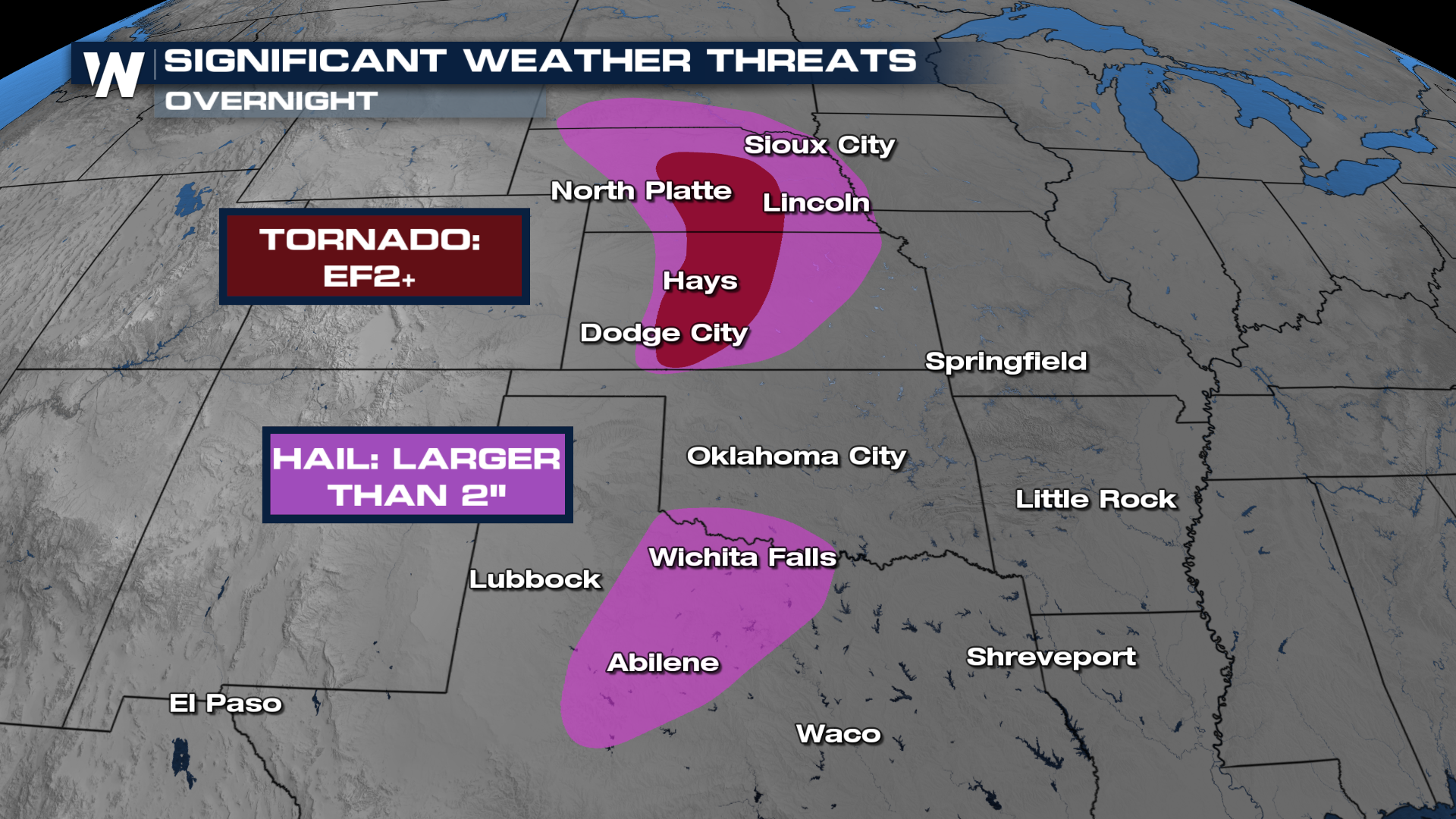
Highlighted below, there's a significant hail threat overnight from portions of southern South Dakota, reaching through Nebraska and into central Kansas. And there's a separate bullseye from the Red River Valley and through Abilene, TX. This means there's a possibility of seeing hailstones 2" in diameter or larger. A few isolated tornadoes can spin up with the first few isolated supercells, some of which have the potential to be EF-2 or greater for the areas in brown.
 Be prepared for another multi-day severe weather event and stay with WeatherNation for all your weather needs.


