Weekend Forecast: Severe Weather for the Plains
The severe weather threat continues through the end of this week and into the weekend with multiple days of severe weather chances for the Plains and Midwest. An incoming area of low pressure in the upper levels of the atmosphere will combine with energy and moisture at the surface to develop storms through Saturday this week. Not only will we see the severe threat but also the flood risk, for more on that, click here.
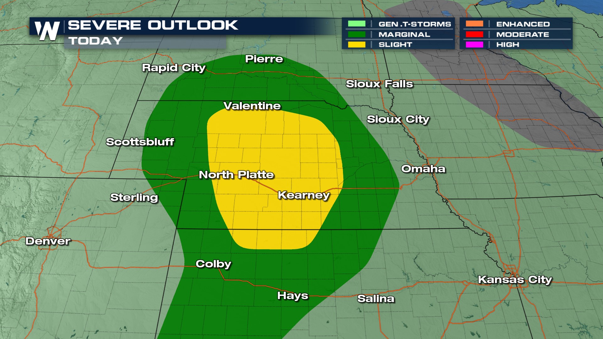
Our severe weather risk stretches from southern South Dakota into Nebraska and western Kansas as well as Colorado. Though low-end, all modes of severe weather are possible along with heavy rainfall.
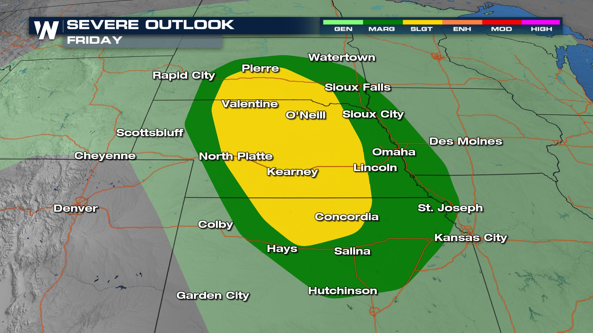
 Friday's risk is elevated across central South Dakota, Nebraska, and Kansas. All types of severe weather (including tornadoes) will be possible so make sure you have severe alerts and are checking back on the forecast leading up to this event.
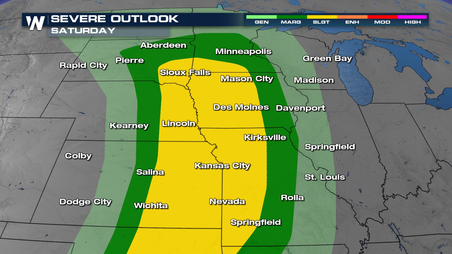
 Saturday's risk continues to move slightly south and east, covering areas of the I-29 corridor from Minneapolis all the way south towards Kansas City and the southern Plains. Prepare ahead for the weekend and have indoor alternatives for the weekend!
