MUST SEE: "Pyrocumulonimbus" Cloud Friday in Texas
Special Stories
11 May 2018 10:45 PM
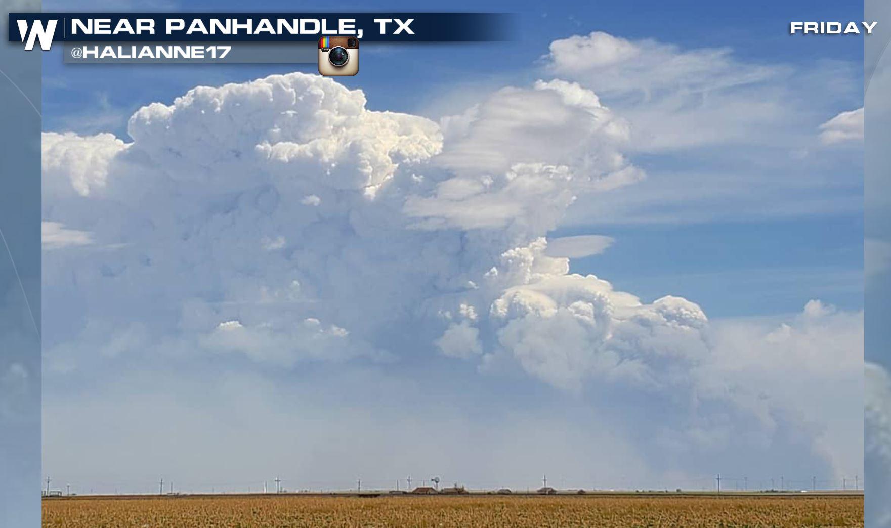
A rare "pyrocumulonimbus" cloud formed in northern Texas Friday and the thunderstorm then proceeded ending up being severe and even dropping hail! All of this happening from an ongoing wildfire!
 Courtesy Instagram user Halianne17
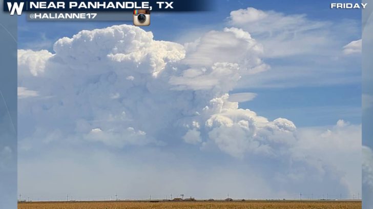
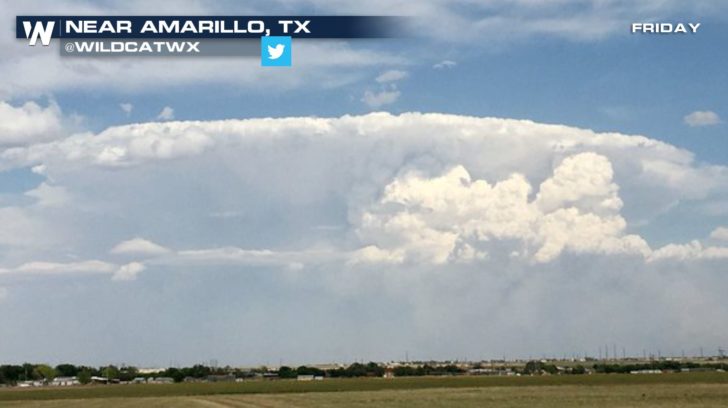 Courtesy Twitter user Wildcatwx
The Mallard Fire had burned about 35,000 acres Friday east of Amarillo, Texas. Then, an approaching front called a 'dry line' approached and helped boost temperatures close to 100 degrees while bringing in 40 mile per hour wind gusts! At the same time, conditions became favorable for this cloud to form from off the wildfire!
Wondering how it forms? Here's an explanation:
https://twitter.com/SteveGlazier/status/995160058479624192
This type of cloud is referred to as a "cumulus flammagenitus."
Here's the definition from the World Meteorological Organization:
Courtesy Twitter user Wildcatwx
The Mallard Fire had burned about 35,000 acres Friday east of Amarillo, Texas. Then, an approaching front called a 'dry line' approached and helped boost temperatures close to 100 degrees while bringing in 40 mile per hour wind gusts! At the same time, conditions became favorable for this cloud to form from off the wildfire!
Wondering how it forms? Here's an explanation:
https://twitter.com/SteveGlazier/status/995160058479624192
This type of cloud is referred to as a "cumulus flammagenitus."
Here's the definition from the World Meteorological Organization:
Courtesy Instagram user Halianne17
Courtesy Twitter user Wildcatwx
The Mallard Fire had burned about 35,000 acres Friday east of Amarillo, Texas. Then, an approaching front called a 'dry line' approached and helped boost temperatures close to 100 degrees while bringing in 40 mile per hour wind gusts! At the same time, conditions became favorable for this cloud to form from off the wildfire!
Wondering how it forms? Here's an explanation:
https://twitter.com/SteveGlazier/status/995160058479624192
This type of cloud is referred to as a "cumulus flammagenitus."
Here's the definition from the World Meteorological Organization:
"Clouds may develop as a consequence of convection initiated by heat from forest fires, wildfires or volcanic eruption activity. Clouds that are clearly observed to have originated as a consequence of localized natural heat sources, such as forest fires, wildfires or volcanic activity and which, at least in part, consist of water drops, will be given the name relevant to the genus followed, if appropriate, by the species, variety and any supplementary features, and finally by the special cloud name “flammagenitus.”
Courtesy the WMO: https://cloudatlas.wmo.int/flammagenitus.html You could really visually see this from space on Friday. Check it out! https://twitter.com/WeatherNation/status/995083103642120193 Have questions about the weather? Drop us a note on social media! For WeatherNation, Meteorologist Steve GlazierAll Weather News
More
More Storms for the East Through Monday
A low-pressure system that moved through the
3 Aug 2026 1:50 AM

Wildfire Outbreak in the Pacific Northwest
SPOKANE, WA - On Saturday, August 1st, the Ol
2 Aug 2026 10:35 PM


After Reaching Category 5, Genevieve Weakens in the Pacific
PacificGenevieve formed on last Friday south
2 Aug 2026 6:25 PM

Flooding, Severe Storms Target the Midwest Again
After an active week of storms across the nor
1 Aug 2026 1:40 AM

Flooding Risk Increases as Heavy Rain Targets the Tri-State Area
Tuesday, heavy rainfall moved across the Nort
30 Jul 2026 12:25 AM

Severe Weather: Energy From the Midwest Now in the Southeast
UPPER MIDWEST - Through Monday, dangerous tor
29 Jul 2026 10:30 PM