Severe Weather Threat Returns to the Midwest

The weather continues to remain quite active across parts of the Upper Midwest and Great Lakes. Following severe weather on Wednesday and Thursday, the next round of severe storms will move in tonight and throughout the weekend for the Dakotas and Upper Midwest.
Outlooks
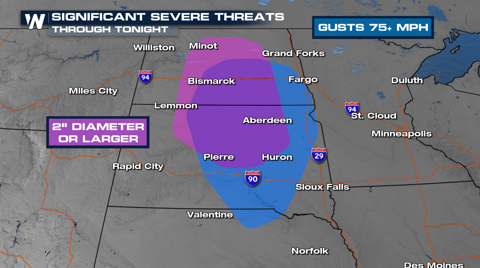
Tonight, there is an ENHANCED RISK of severe weather across North Dakota with the biggest threats being destructive winds and large hail. Tornado threat is possible so have a few ways to receive severe weather alerts late tonight!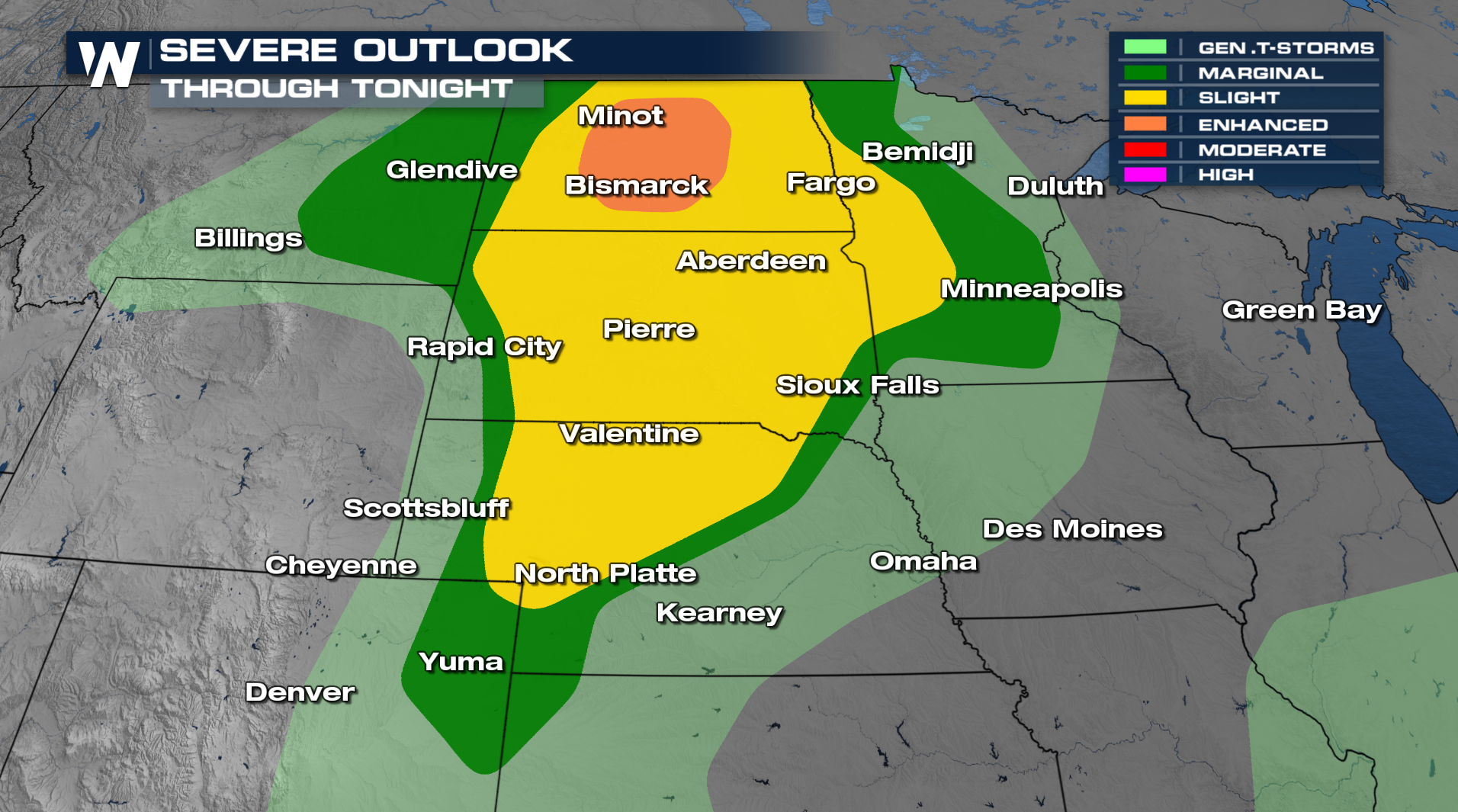
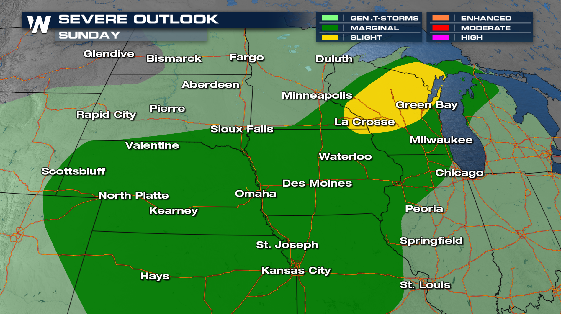
For the rest of the weekend, storms will continue to push eastward across the rest of the Upper Midwest and Great Lakes states.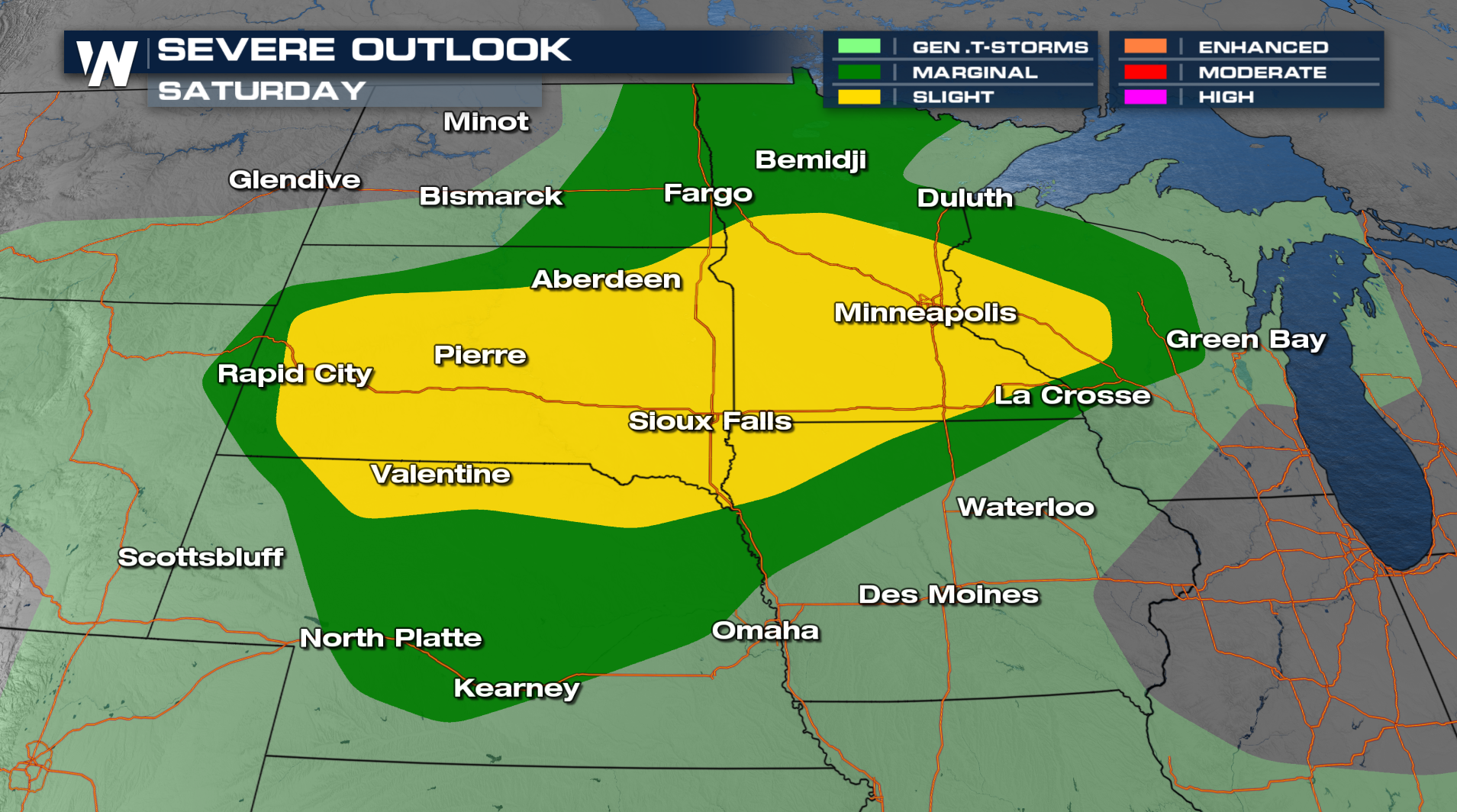
FORECAST
Tonight individual storms will congeal into a couple of storm clusters moving throughout the Interstate 90, 94 and 29 corridors. By Saturday morning, a few severe storms will be possible in Minnesota. As the cold front moves eastward, it will be the trigger mechanism for additional thunderstorm development Saturday afternoon! Some heavy rain will be possible too.


