Blizzard - Nor'easter Takes Aim at the Atlantic Coast

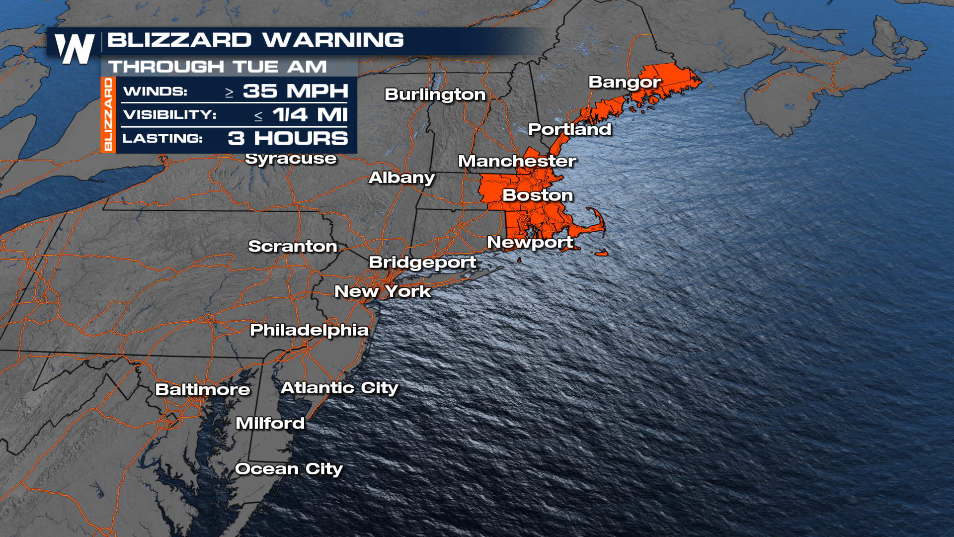
NORTHEAST - A strengthening Nor’easter churned up the Atlantic and slammed into the Northeast, delivering heavy snow, hurricane-force wind gusts, and pounding surf along the coastline. Communities from Pennsylvania to Maine faced dangerous travel and rapidly changing conditions as the storm intensified offshore. Blizzard warnings and winter alerts remain in place through tonight and into early tomorrow morning across the northeastern United States.
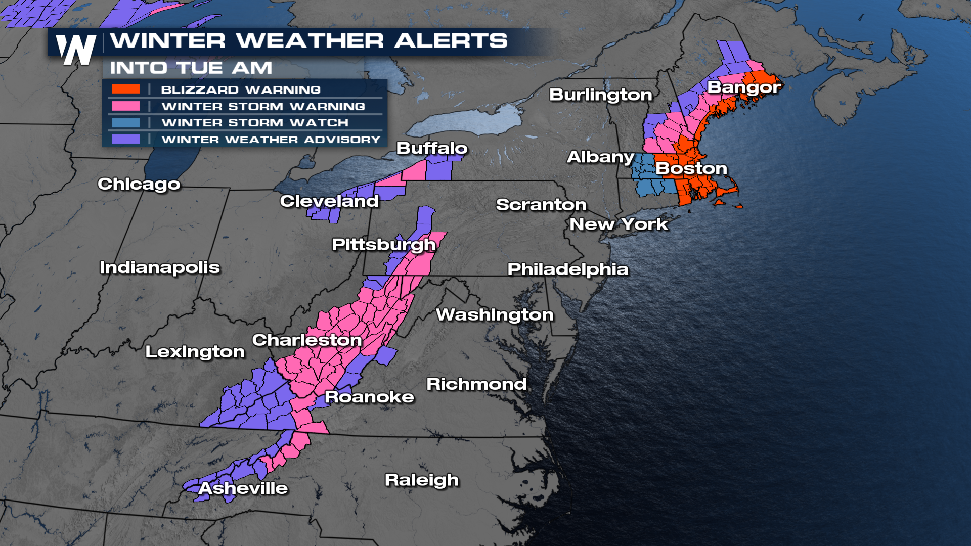
As a reminder, blizzard warnings are issued for low visibility due to blowing snow. The wind is the biggest factor in a blizzard, which makes travel difficult if not impossible. This is the first blizzard warning issued by the NWS in New York City since January of 2022.
The forecast for additional snowfall totals could still exceed another 6-12", and has already exceeded a foot for portions of New Jersey. The Winter Storm Severity Index (WSSI) for the weight of snow across these locations hits EXTREME. 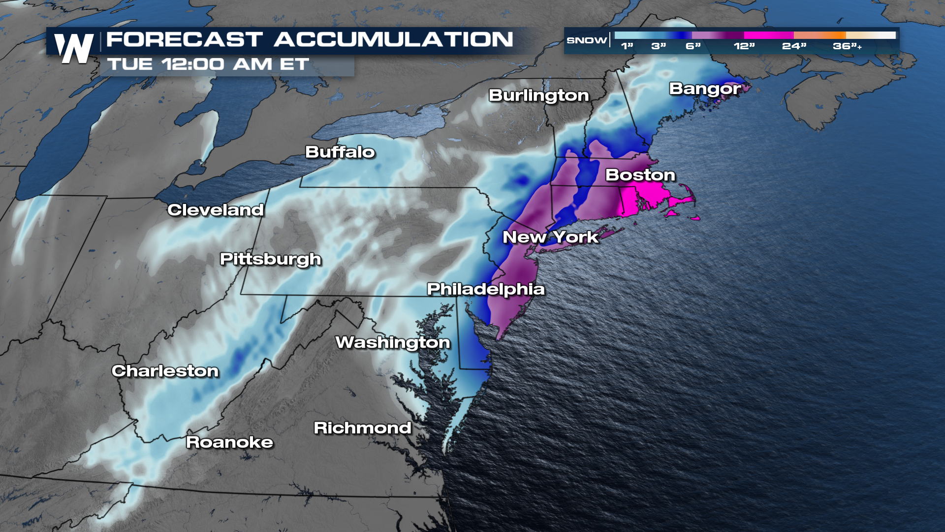
Timing
Heavy snow and strong winds will continue with this low-pressure system through tonight and into early tomorrow morning. Areas still being impacted include southern New England, New York, and New Jersey metro areas.
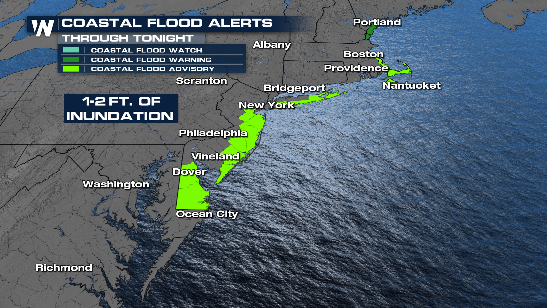
Strong winds continue as the low-pressure system deepens. Remember, the bigger the pressure difference, the stronger the winds. The persistent strong winds will lead to large swells developing with waves 8-12 feet, possibly higher, for many Northeast beaches through Tuesday. Coastal Flood Alerts are in place through tonight.
 We'll be updating this story frequently on air and online, so be sure to check back for updates.


