Rounds of Rain & Snow Returns to California

There is a threat for heavy rain and heavy snow for California this week.
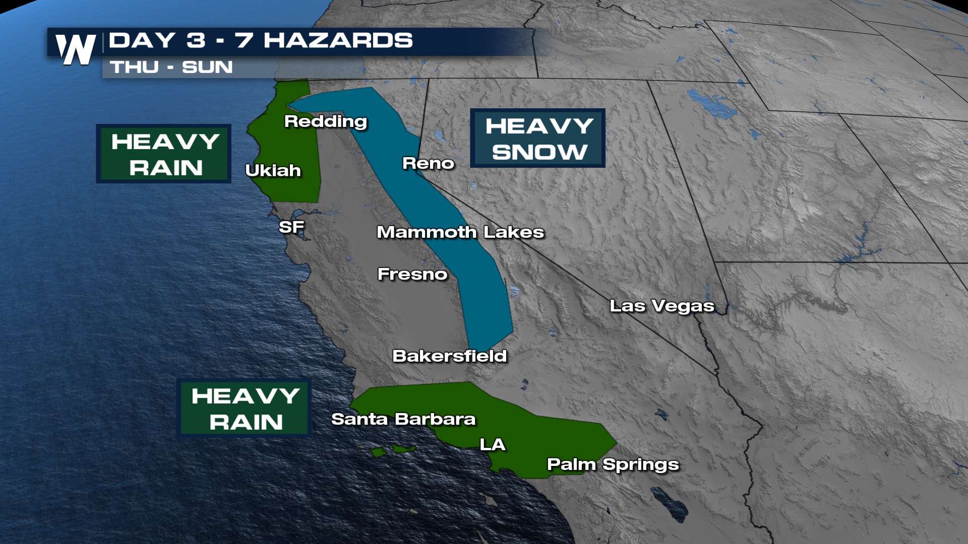 Models indicate over a foot of snow for the higher elevations of the Sierra Nevada Mountains with several inches of rainfall possible for Southern California. Just one week ago, Southern California saw major flooding. These areas will be more susceptible for additional flooding with the recently saturated soils.
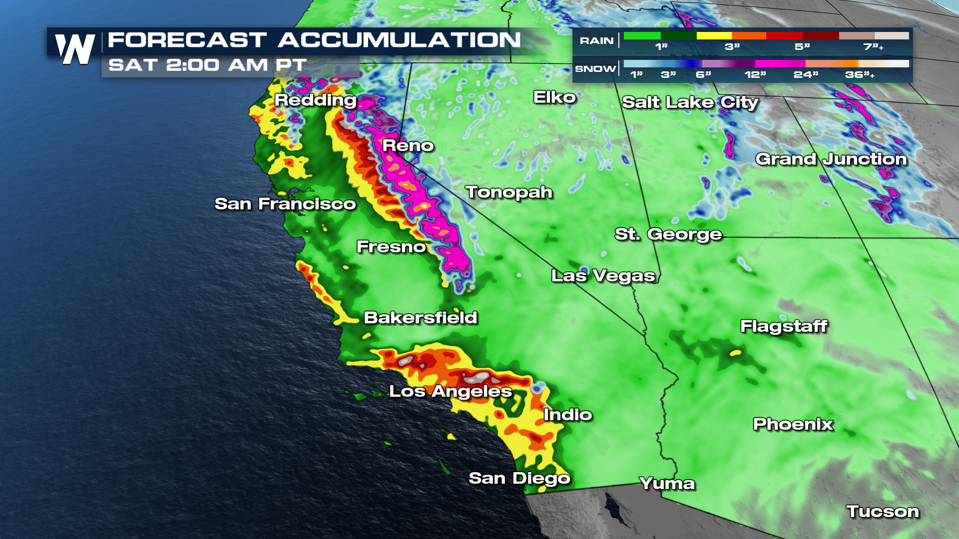
Burn scar areas and communities should be on alert for this heavy rainfall on the way. The Weather Prediction Center (WPC) has isolated to scattered threats for flooding already in place for Southern California, with isolated flooding possible in Northern California. 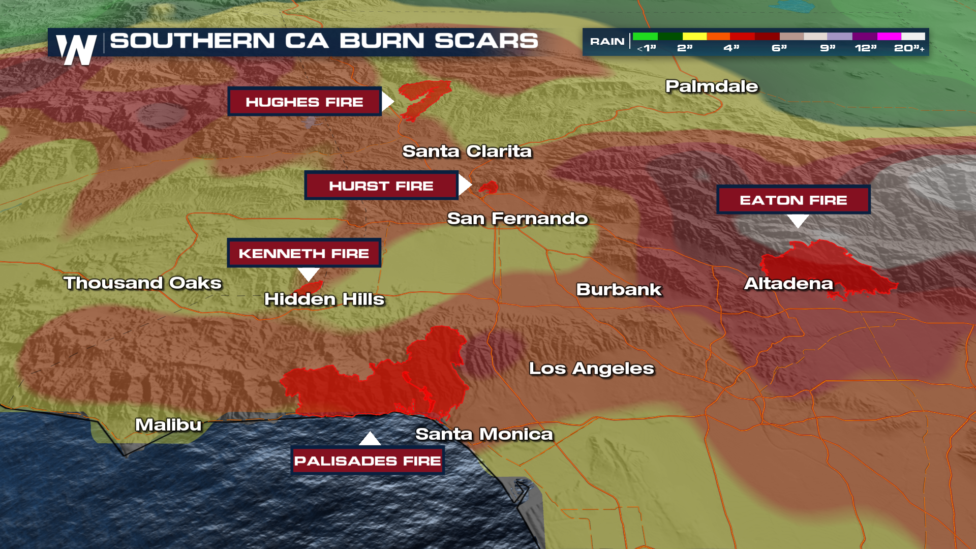 Below is the latest on the timeline of rainfall moving into the region. Rain looks widespread for New Year's Eve morning with several rounds through New Year's Day soaking Southern California. By Friday, another round of moisture already starts to sweep through Northern California. This will also bring more snow to the Sierra Nevada Mountains into the weekend.
More details on your Western Regional Forecast can always be found :50 past the hour on WeatherNation.


