Progress Continues on SoCal Fires

Key Messages
The Hughes Fire, near Castaic Lake, started on Wednesday and quickly grew in LA County to 10k acres, but growth slowed Thursday and containment increased from 14 to 79%.
Wind direction shifted Friday afternoon, allowing for onshore flow to set up. This will finally help limit fire danger in the region.
Heavy rain arrives by Sunday in fire areas with flooding and debris flows (mudslides with fire debris) possible.
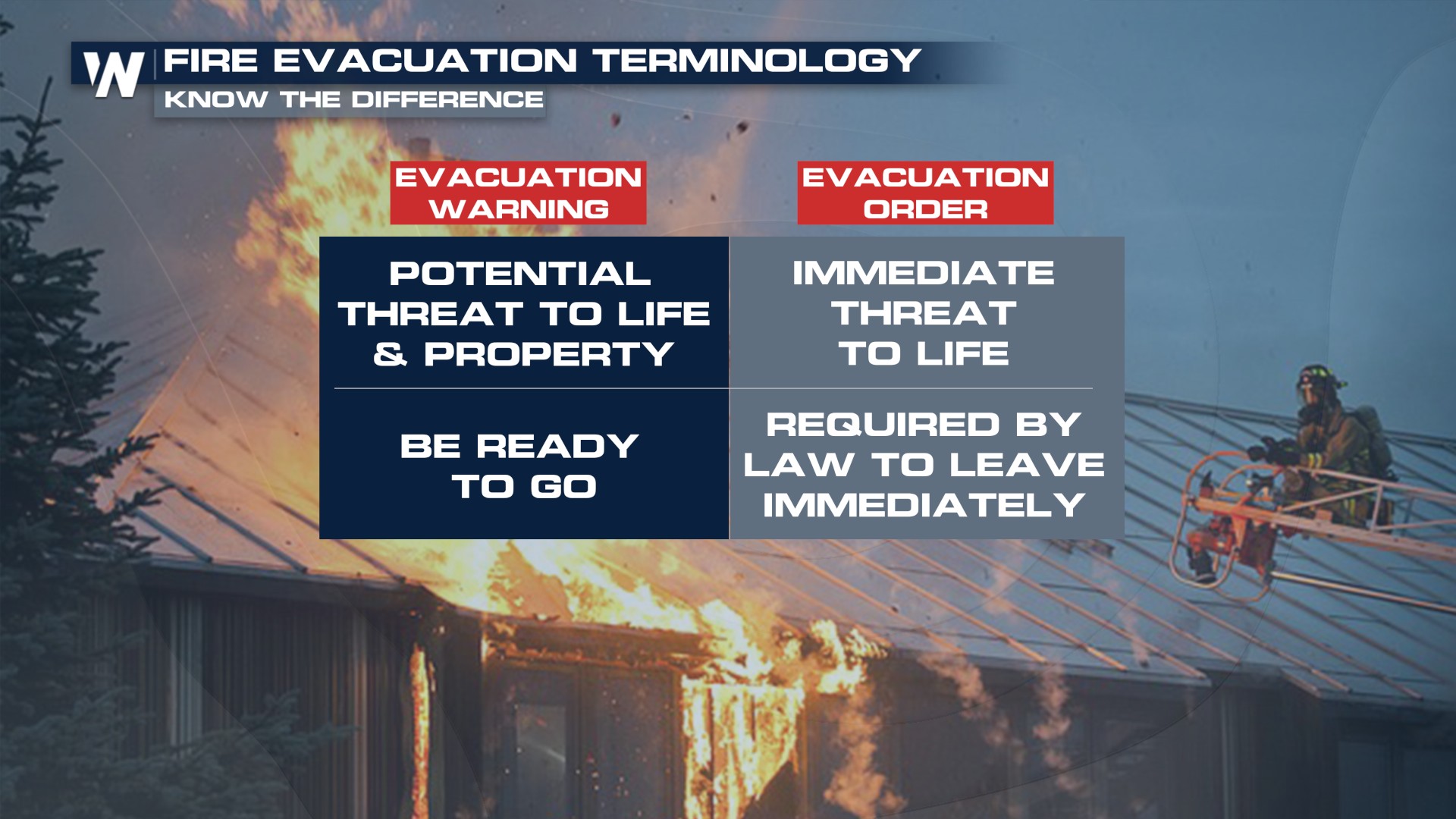
Have a plan in place and a go bag ready for quick evacuations!
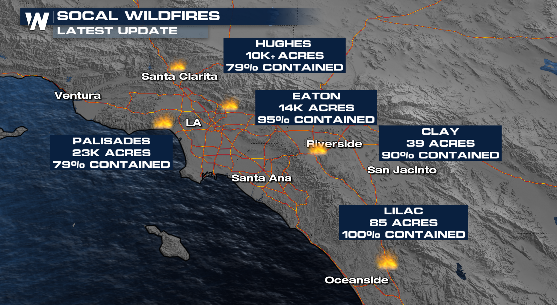 Containment continues to increase on all of the large fires in Southern California. Several other smaller fires have started in the region but are mostly under control or are growing minimally.
The attention now turns to onshore flow increasing humidity ahead of a digging trough this weekend. Cooler temperatures return this weekend, with rainfall expected by Sunday.
RELATED ARTICLE: Rain and Snow for SoCal, Fires Get Relief
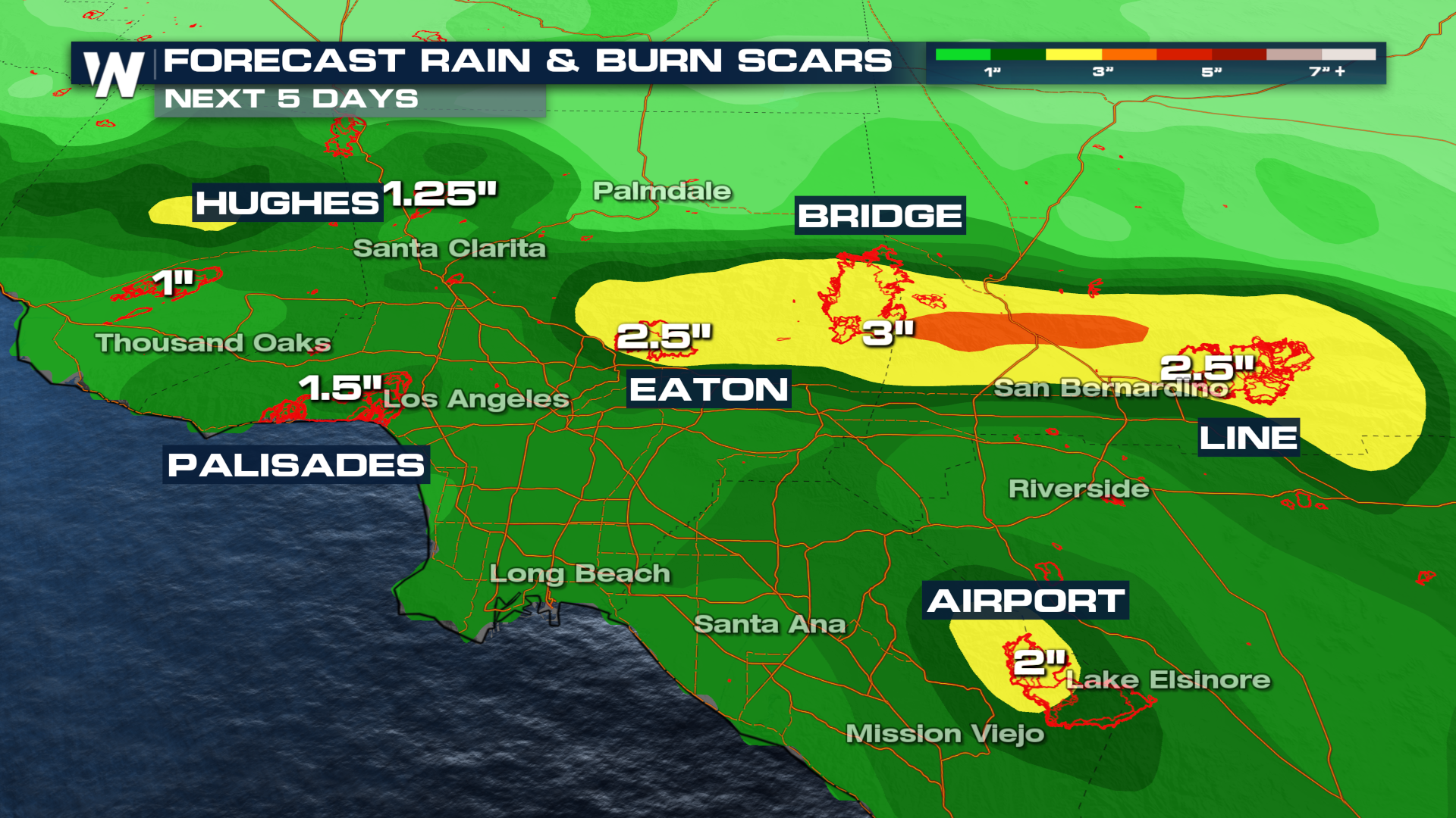 The precipitation will greatly aid firefighting efforts, but could also lead to mudslides, debris flows, and flash flooding. Sandbags are being made available to residents in burn scar areas with flash flooding possible. Most of the large burn areas from the late Summer through today are expected 1-3" of rain.
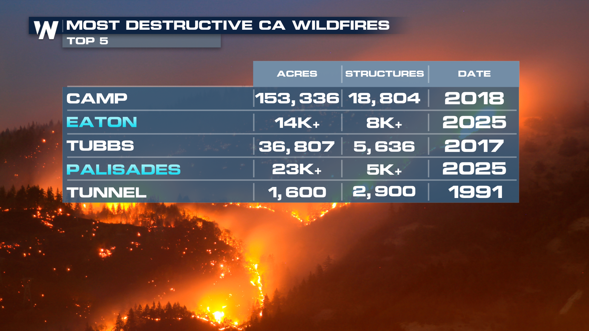 The Eaton and Palisades Fires rank in the top 4 most destructive fires in California history with over 15,000 structures burned.
 Tune in to your West Regional forecast at :50 past the hour, every hour on WeatherNation.


