Damaging Winds and Tornadoes Possible for the East Coast
Special Stories
19 Apr 2019 8:05 AM
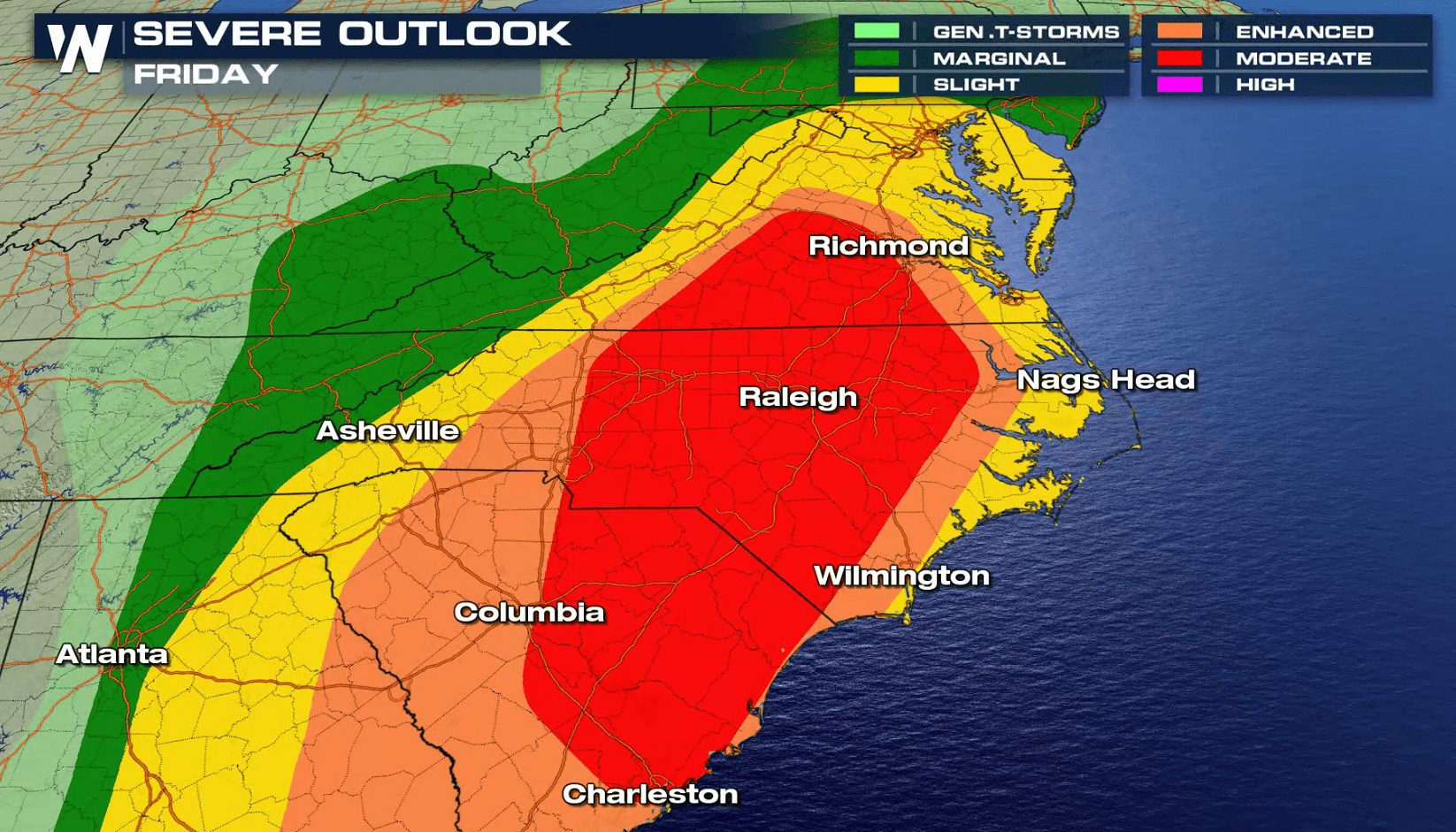
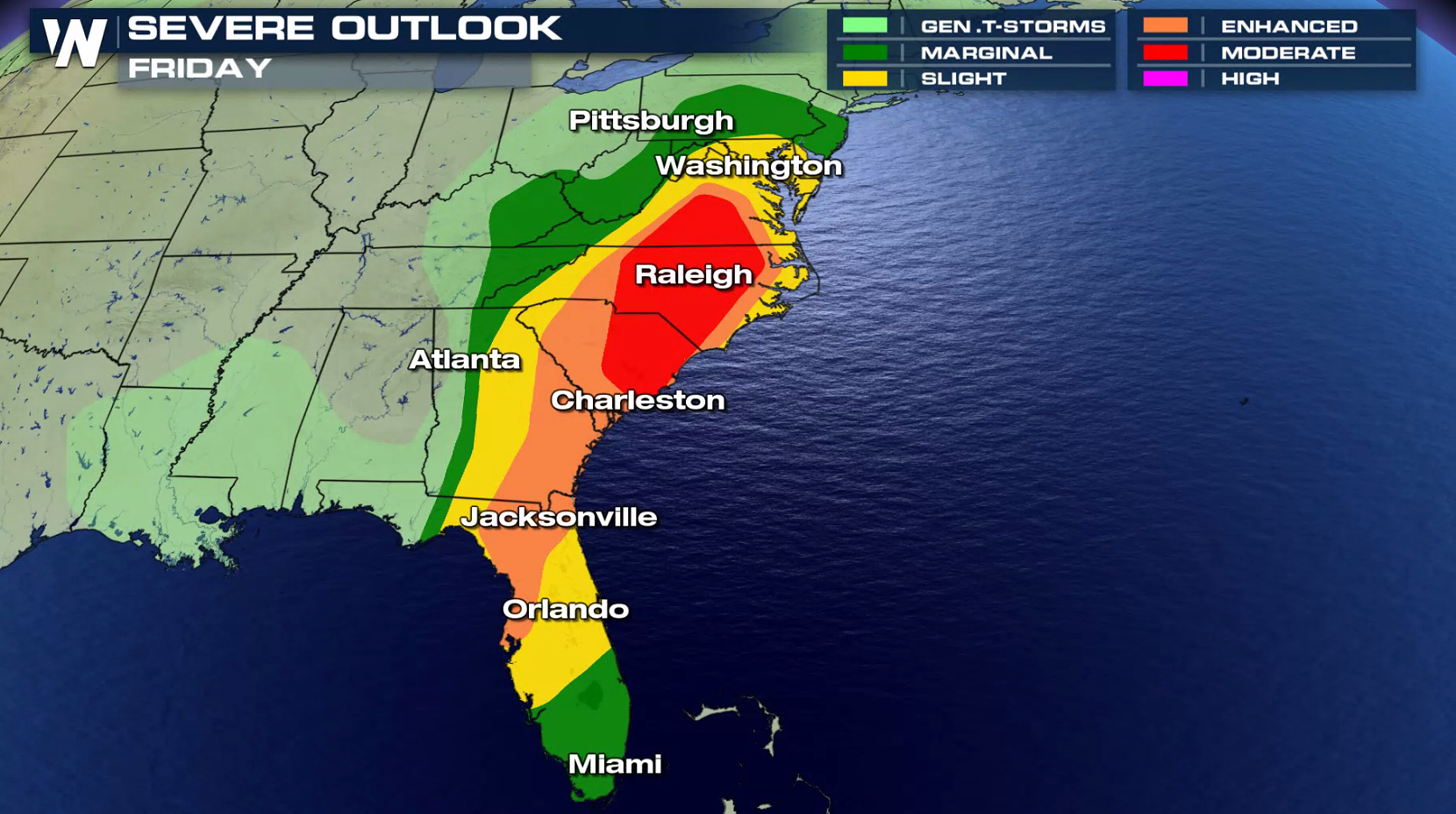
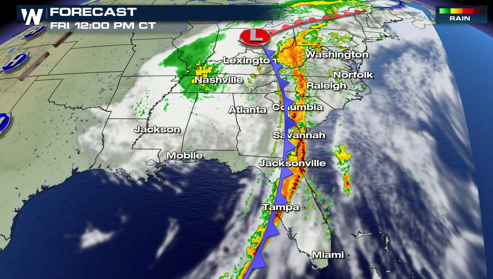
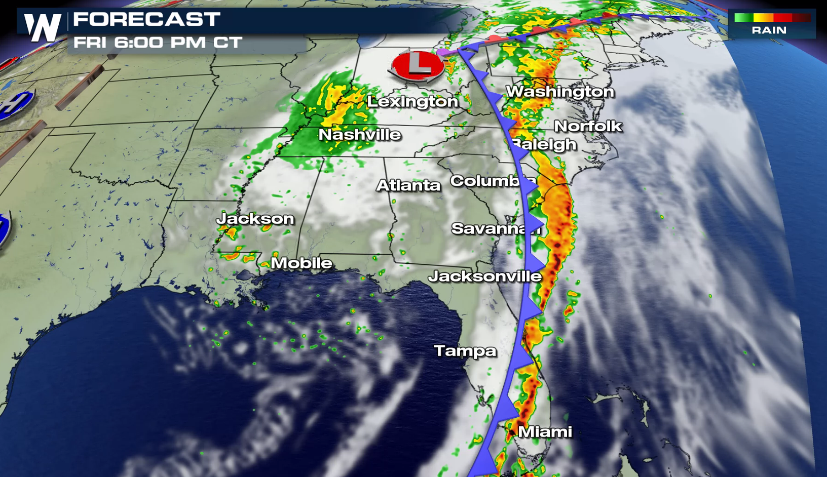
A strong storm system has been producing severe weather in the mid-section of the nation this week. It will continue to bring a widespread threat for severe weather for the East Coast states today (Friday). The threat for severe thunderstorms today extends from Chesapeake Bay to Lake Okeechobee. The risk is enhanced from Virginia to Georgia, with a moderate risk for severe weather from near Raleigh to Charleston.
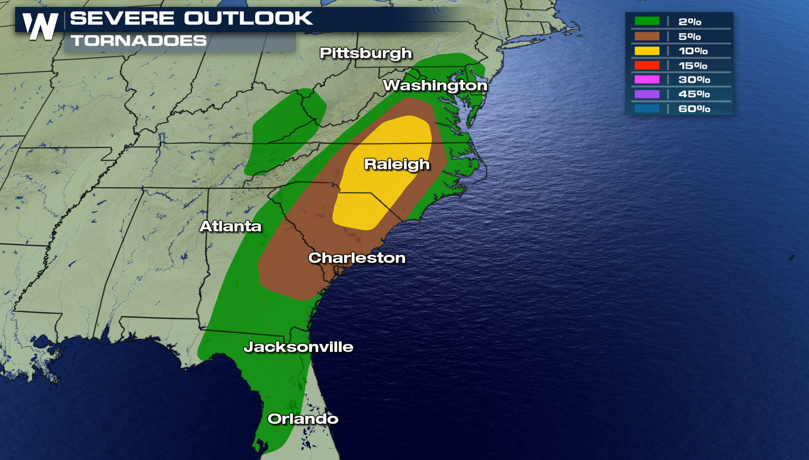
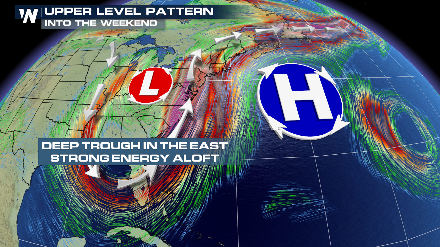
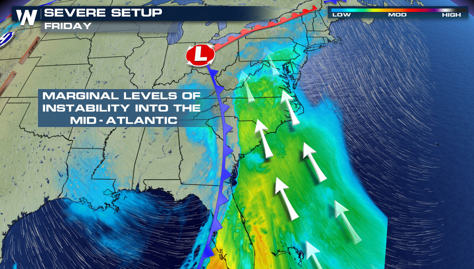
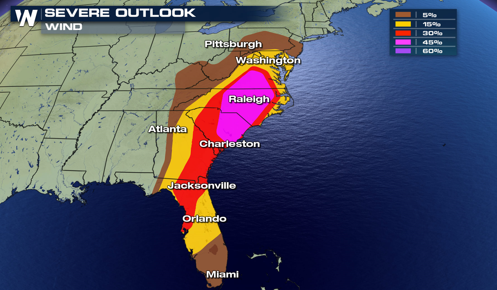 A potent Jet Stream will dig into the region, providing strong upper level support for severe storms. A southerly wind flow will push warmth and humidity into the region from the Gulf of Mexico and Atlantic Ocean. Increasing instability will help to create and sustain severe thunderstorm development, especially in the afternoon and evening. Wind shear will be present, with surface winds from the southeast and winds aloft turning to the southwest. This will support severe thunderstorms, including tornadoes.
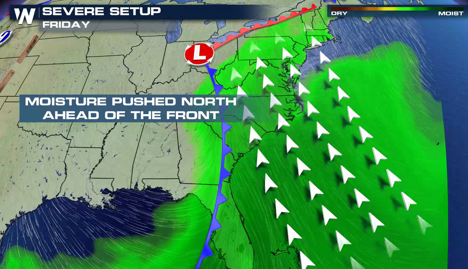
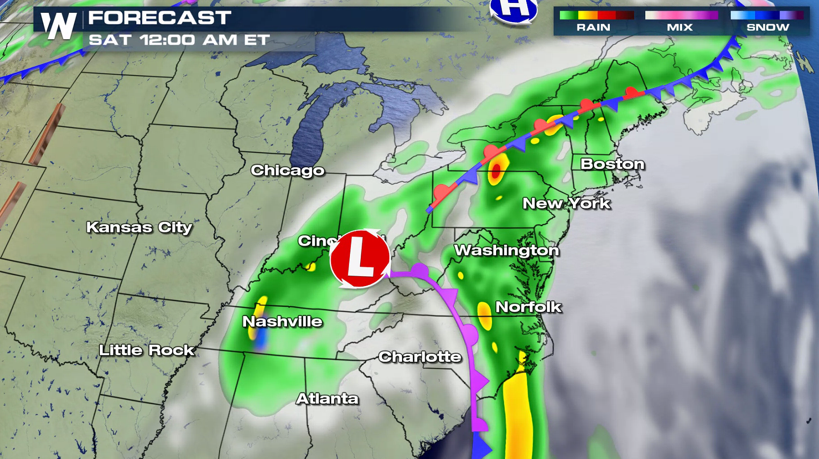
 The storm system will slowly move eastward, extending from the Mason-Dixon line to the Florida Straights by evening. Severe thunderstorms will be possible ahead of the front, especially in the afternoon to early evening. The biggest threat is damaging wind gusts ahead of the front, along with isolated tornadoes.
 Have a severe weather plan in place, in case you need to take shelter if threatening storms approach your area. Be sure to check back with WeatherNation on-air and online if you are in the severe weather risk areas.
For WeatherNation: Meteorologist Mace Michaels
Have a severe weather plan in place, in case you need to take shelter if threatening storms approach your area. Be sure to check back with WeatherNation on-air and online if you are in the severe weather risk areas.
For WeatherNation: Meteorologist Mace Michaels
A potent Jet Stream will dig into the region, providing strong upper level support for severe storms. A southerly wind flow will push warmth and humidity into the region from the Gulf of Mexico and Atlantic Ocean. Increasing instability will help to create and sustain severe thunderstorm development, especially in the afternoon and evening. Wind shear will be present, with surface winds from the southeast and winds aloft turning to the southwest. This will support severe thunderstorms, including tornadoes.
The storm system will slowly move eastward, extending from the Mason-Dixon line to the Florida Straights by evening. Severe thunderstorms will be possible ahead of the front, especially in the afternoon to early evening. The biggest threat is damaging wind gusts ahead of the front, along with isolated tornadoes.
Have a severe weather plan in place, in case you need to take shelter if threatening storms approach your area. Be sure to check back with WeatherNation on-air and online if you are in the severe weather risk areas.
For WeatherNation: Meteorologist Mace MichaelsAll Weather News
More
Wildfire Outbreak in the Pacific Northwest
Conditions have been incredibly dry out west.
2 Aug 2026 1:30 PM

After Reaching Category 5, Genevieve Weakens in the Pacific
PacificGenevieve formed on last Friday south
2 Aug 2026 1:25 PM

More Storms for the East Sunday and Monday
A low-pressure system crashing through the Mi
2 Aug 2026 1:25 PM


Flooding, Severe Storms Target the Midwest Again
After an active week of storms across the nor
1 Aug 2026 1:40 AM

Flooding Risk Increases as Heavy Rain Targets the Tri-State Area
Tuesday, heavy rainfall moved across the Nort
30 Jul 2026 12:25 AM

Severe Weather: Energy From the Midwest Now in the Southeast
UPPER MIDWEST - Through Monday, dangerous tor
29 Jul 2026 10:30 PM