Snow & Wind Headed for the Rockies

Top Stories
16 Nov 2023 5:20 PM
A bit of snow is headed to the Rockies Thursday and Friday with most of the moisture expected above 8k feet. This will be a quick moving system, which will produce more wind than rain or snow. Another storm system on the heels this weekend will keep the pattern active.
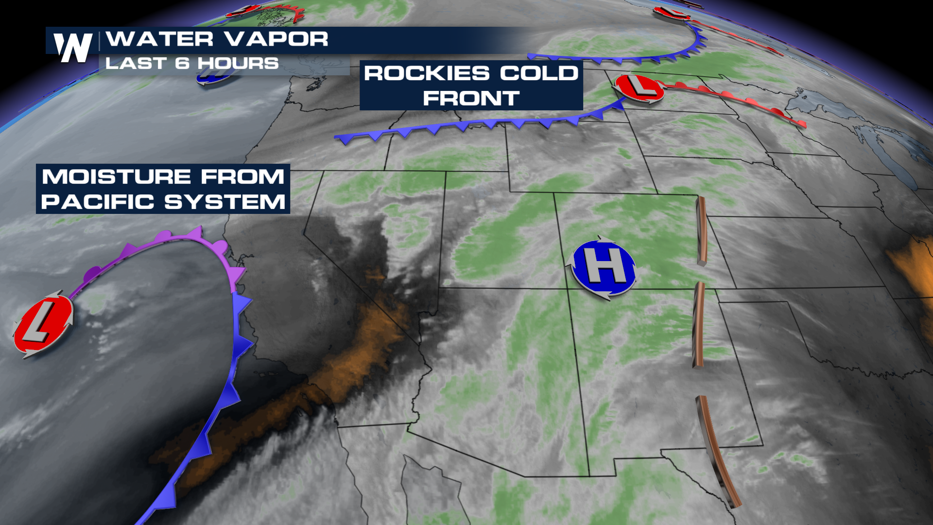 Our first cold front departs the area Thursday afternoon and evening before yet another front arrives in time for the weekend. We have the opportunity for rain and high elevation snowfall starting Saturday evening continuing through Thursday. Our heaviest accumulation will be for areas over 9k feet with 8"+ possible of snowfall.
All Weather News
More
Wildfire Outbreak in the Pacific Northwest
Conditions have been incredibly dry out west.
2 Aug 2026 1:30 PM

After Reaching Category 5, Genevieve Weakens in the Pacific
PacificGenevieve formed on last Friday south
2 Aug 2026 1:25 PM

More Storms for the East Sunday and Monday
A low-pressure system crashing through the Mi
2 Aug 2026 1:25 PM


Flooding, Severe Storms Target the Midwest Again
After an active week of storms across the nor
1 Aug 2026 1:40 AM

Flooding Risk Increases as Heavy Rain Targets the Tri-State Area
Tuesday, heavy rainfall moved across the Nort
30 Jul 2026 12:25 AM

Severe Weather: Energy From the Midwest Now in the Southeast
UPPER MIDWEST - Through Monday, dangerous tor
29 Jul 2026 10:30 PM