EF-2 Tornado Confirmed in Rome, NY - More Across Atlantic Seaboard
Tornado-warned storms drove through portions of New York State and Pennsylvania on Monday and Tuesday causing damage to homes in the area. Very large hail up to 3" in diameter was reported in cities like Victor, New York on Monday evening. Farmington, New York at one point was under a tornado warning (outside of Rochester). The storm that caused the damage in Rome, pictured below, was rated an EF-2 with estimated max winds up to 135 mph.
Through Tonight
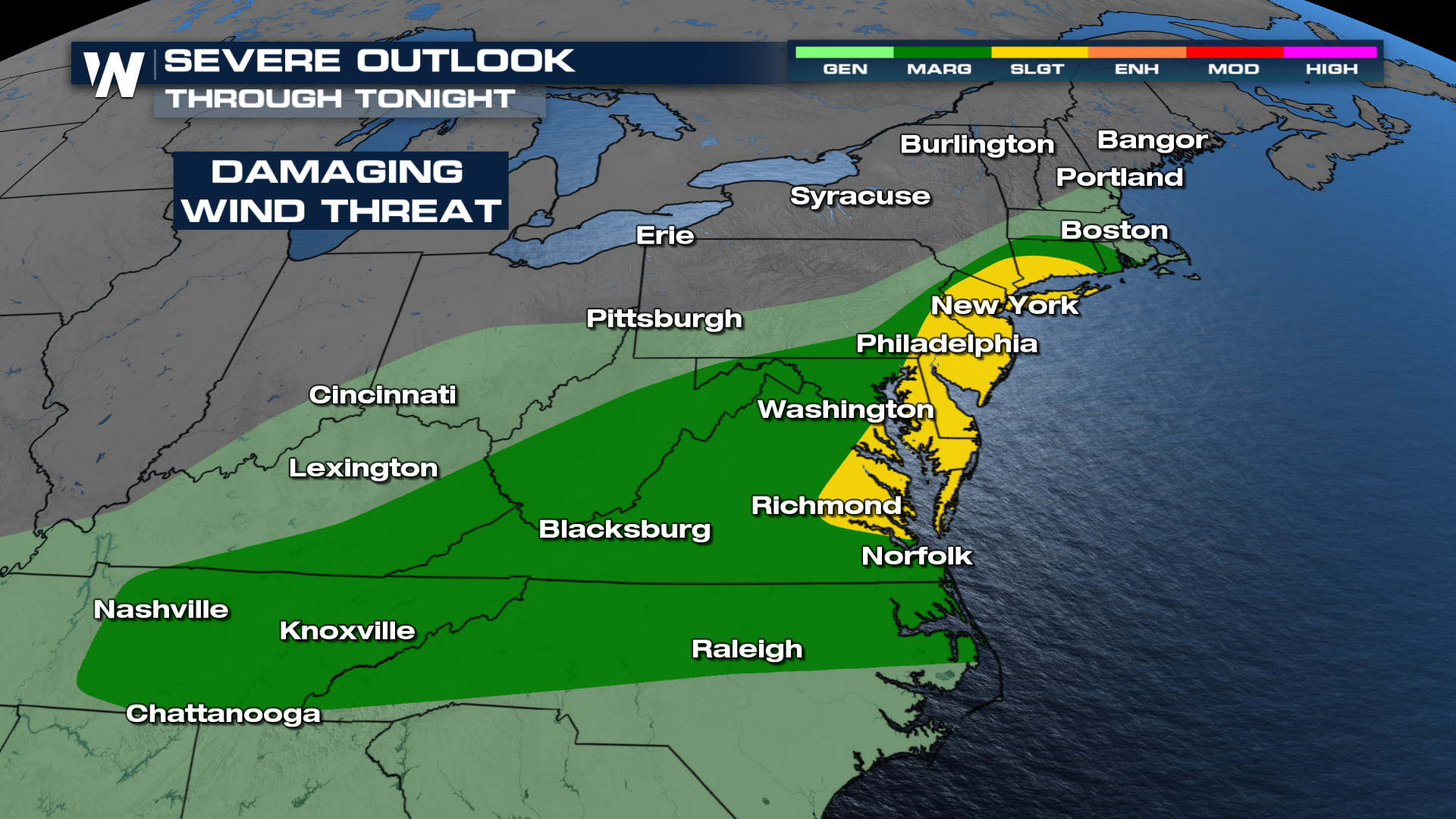
The Storm Prediction Center has issued a marginal and slight risk through tonight for portions of the east. Cities in the slight risk (level 2 out of 5) include New York and Philadelphia. Strong gusty winds will be the primary concern as a frontal boundary continues to move through this evening. Any storms that develop tonight will have the potential to be strong to severe. Storms will see a weakening trend through the overnight hours.

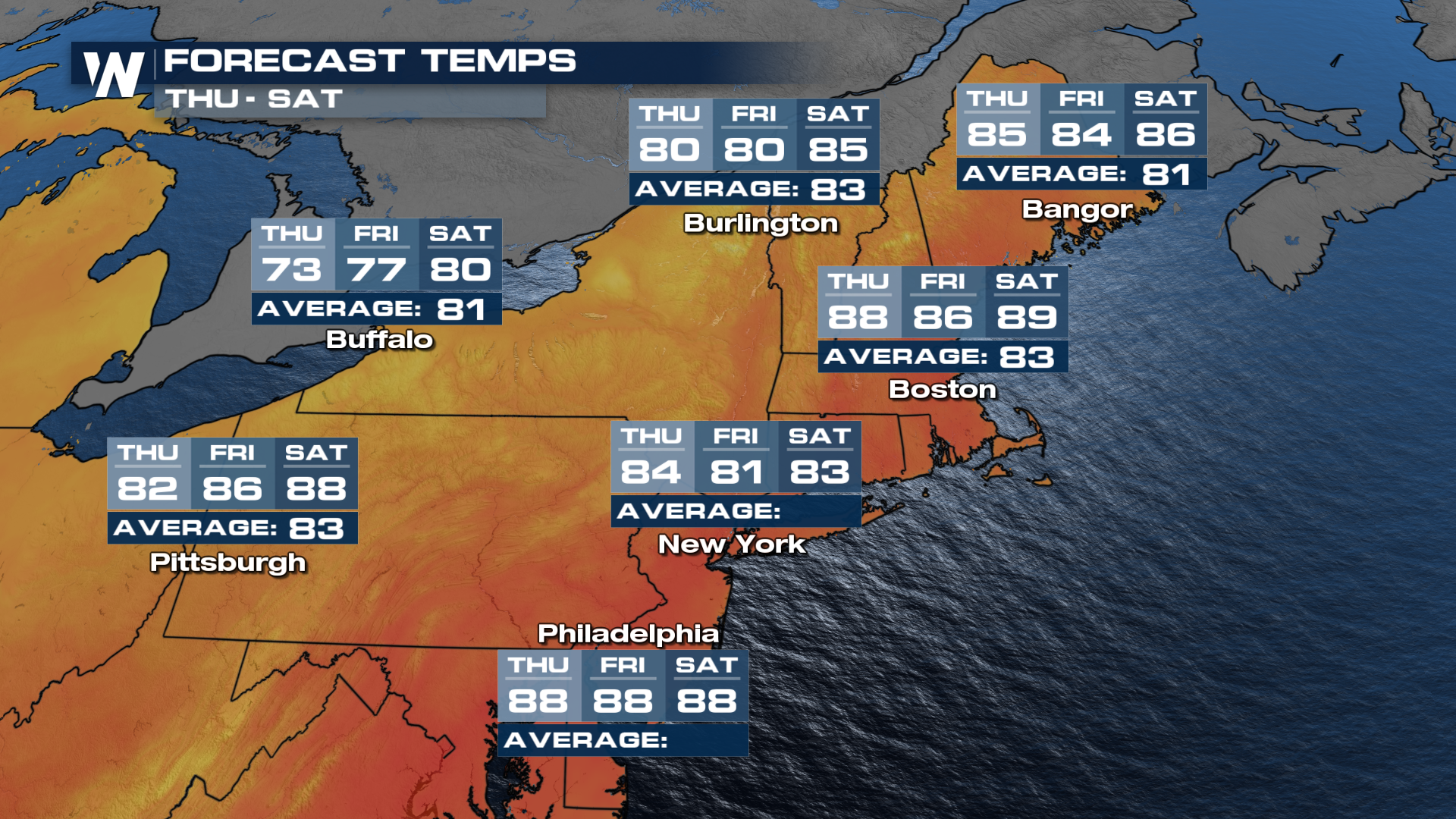
The stormy weather will subside on Thursday as drier and cooler air works its way into the region. It won't feel fall-like, but the record heat and high humidity will ease. Extremely hot temperatures and high humidity fueled Wednesday's storms, but the good news is the heat finally drops behind the cold front for Thursday and folks will see some relief. Buffalo, NY will be below average Thursday and Friday with temps in the 70s. New York City will see highs in the low 80s.
