Weekend System To Shake up Pattern Across the Country

A significant early-summer trough is expected to dig across the western half of the country through the weekend and into early next week. Much cooler temperatures across the Northwest, along with increasing severe weather chances across the Great Plains, are expected by Saturday.
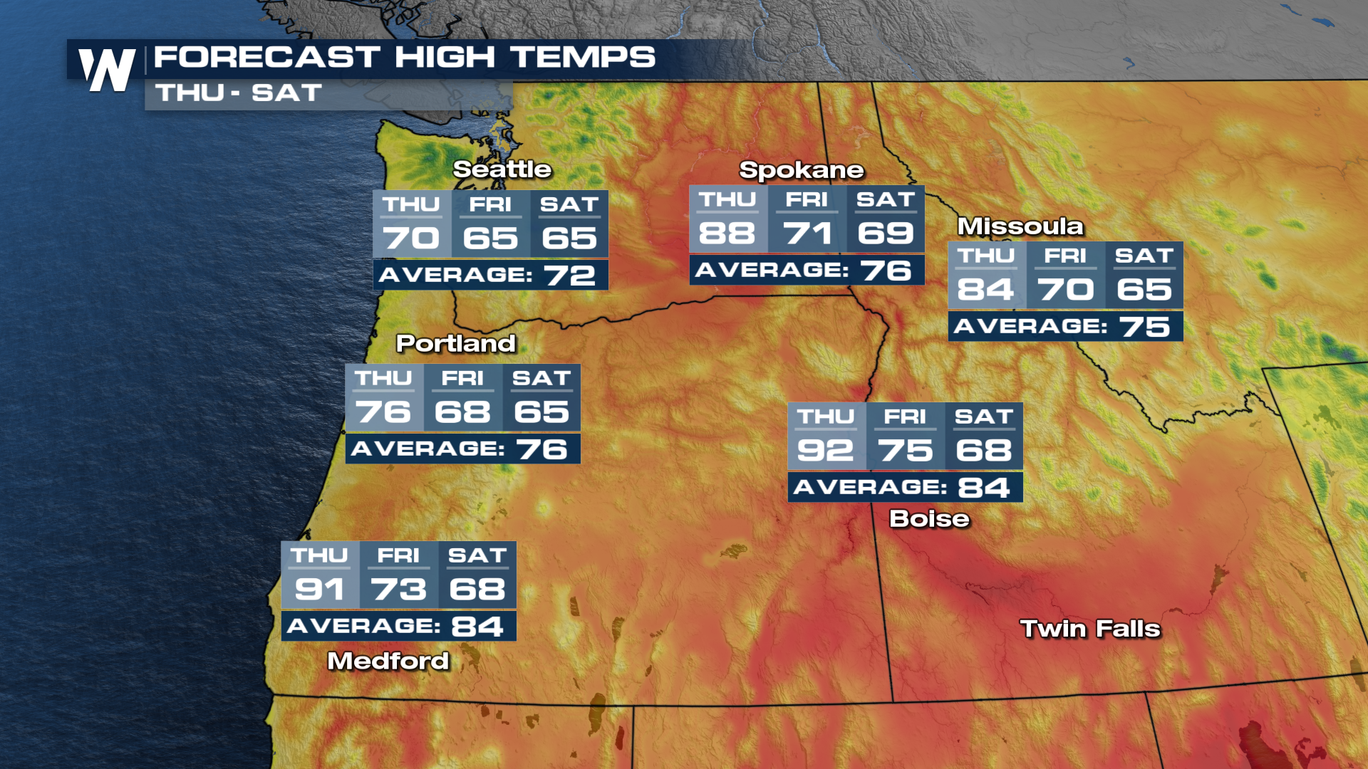
The Northwest will be the first to feel the impacts of the incoming system, as rain chances increase Thursday night and daytime highs dip to well below seasonal averages.
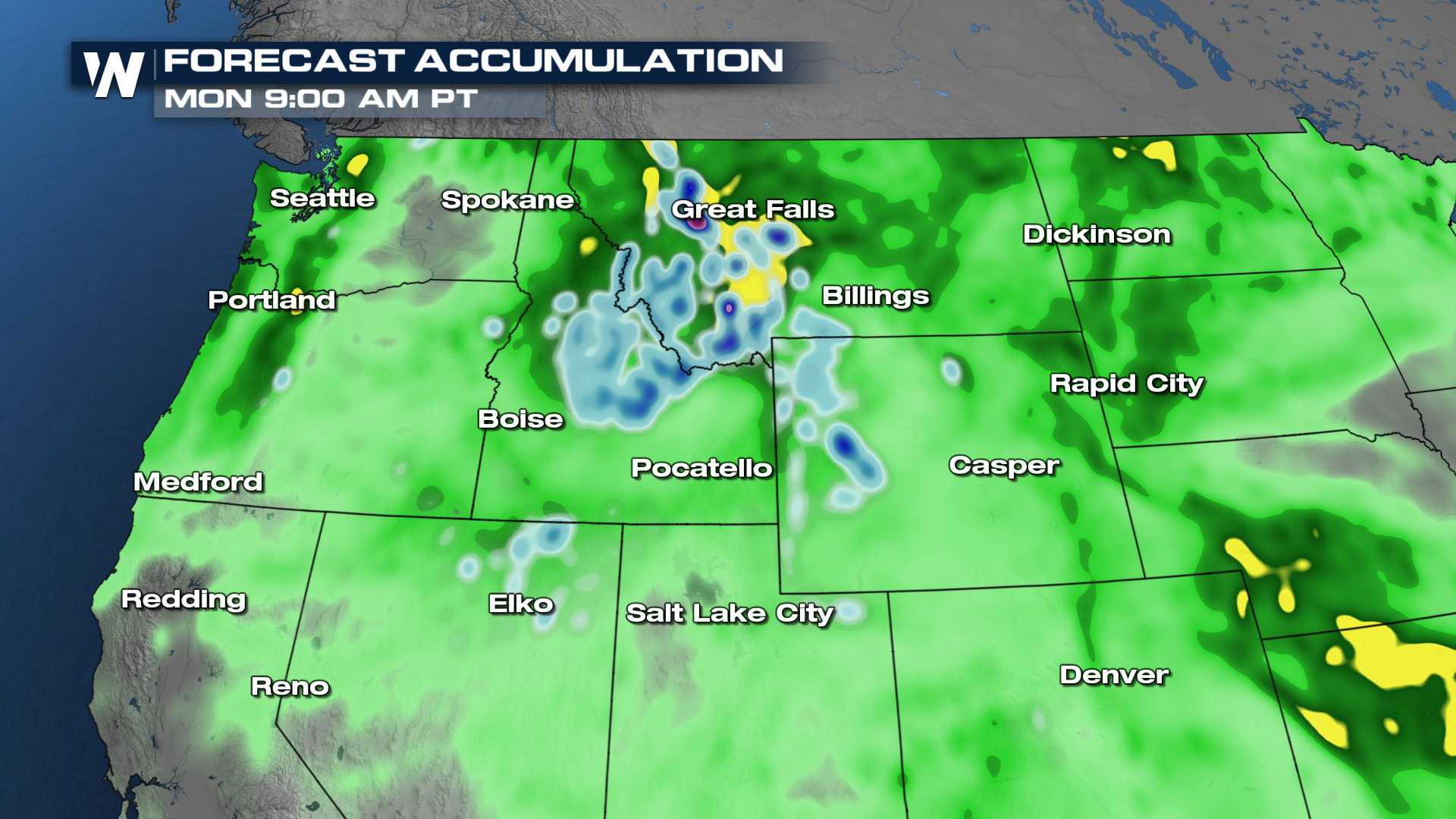
By the weekend, some locations will be feeling daytime highs that are 15°+ below-average. In fact, significant snow accumulation across the higher elevations is being hinted at by the models!
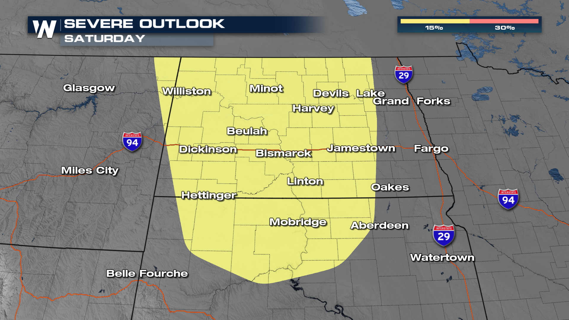
As stronger upper-level winds overspread heat and humidity building each afternoon across the Plains, severe weather will be likely several days in a row. As of now, portions of North Dakota have been highlighted for potential severe thunderstorms on Saturday.