Will It Ever End? Heat Wave Persists for Much of the South & Plains

A relentless ridge of high pressure has been tormenting much of the middle and eastern portions of the lower 48 for the past week. For the Labor Day Weekend, the ridge is finally moving, which will allow cooler air to spill across the Great Lakes, Northeast, and even portions of the Southeast. For areas back to the west and across the South, however, the ridge will not weaken or move much, letting the extreme heat ann humidity to persist.
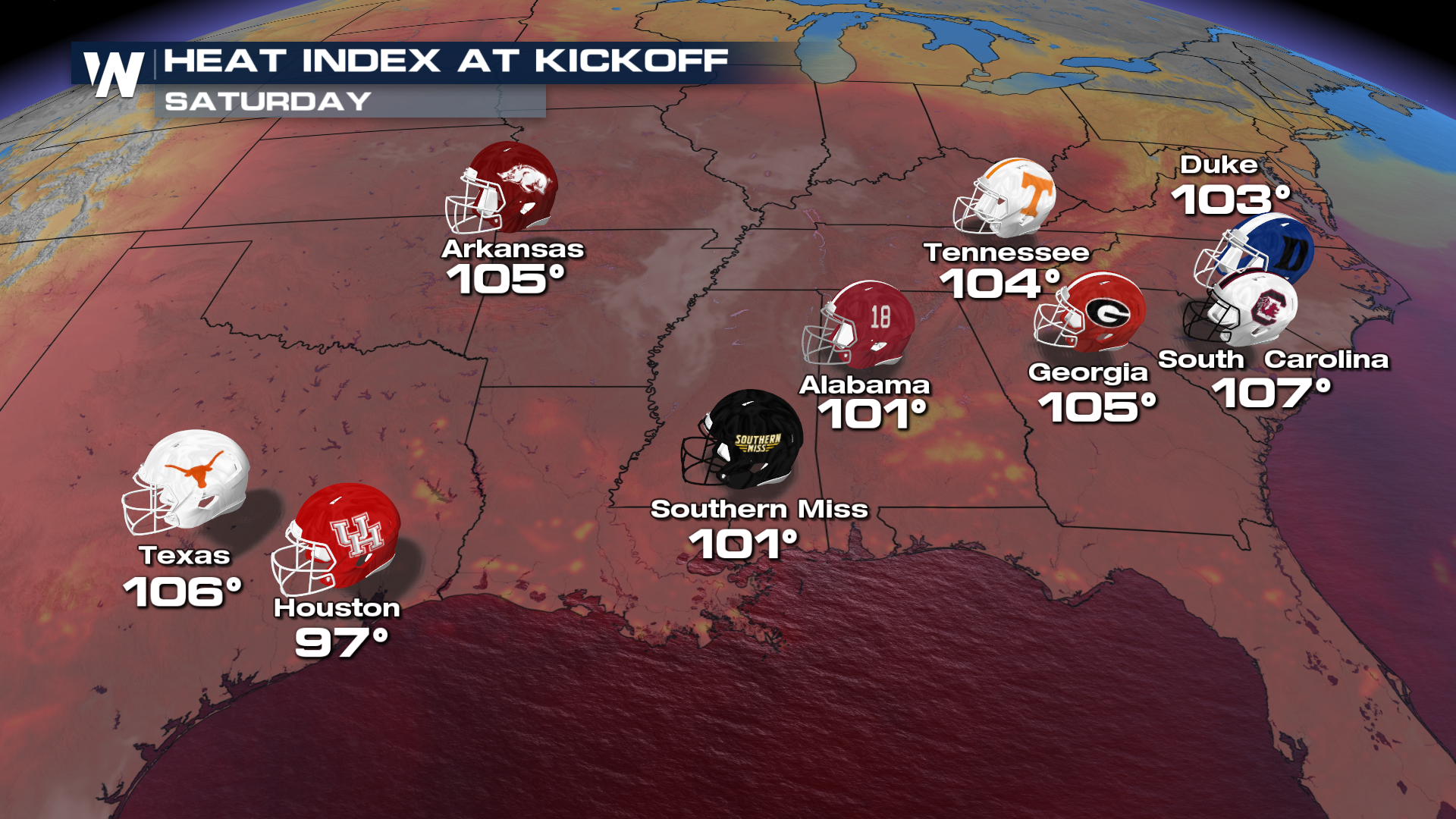
A lot of people will be outside for various activities over the holiday weekend, including to watch the first full week of college football. Heat index values will be dangerously high, which could lead to heat related illness if precautions aren't taken. Drink lots of water and take breaks from the heat!
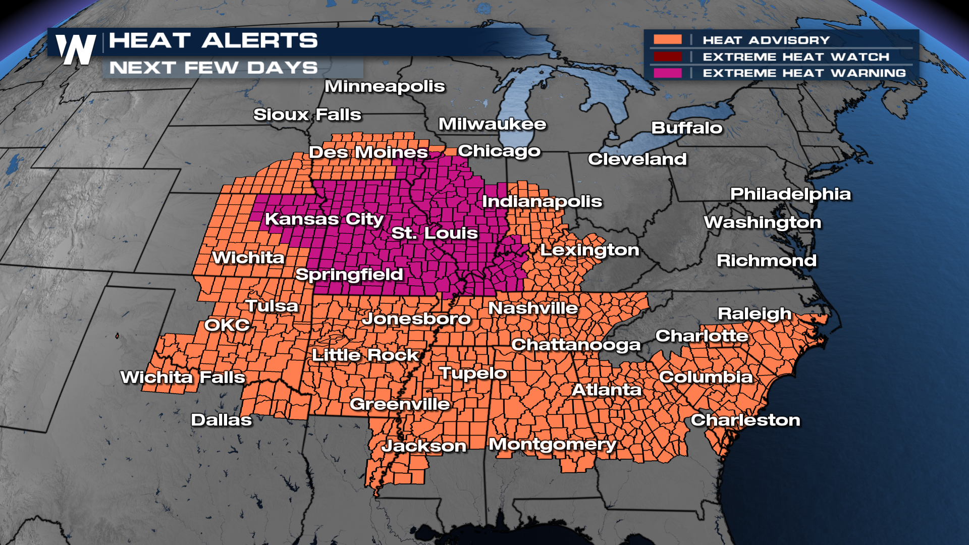
 Heat alerts remain in effect for over 70 million people in the East, South, and Midwest through the next several days. Alerts have been dropped farther east and will likely drop off farther south into the Carolinas through the end of the weekend.
 While highs drop for some, not everyone sees a huge cool down.
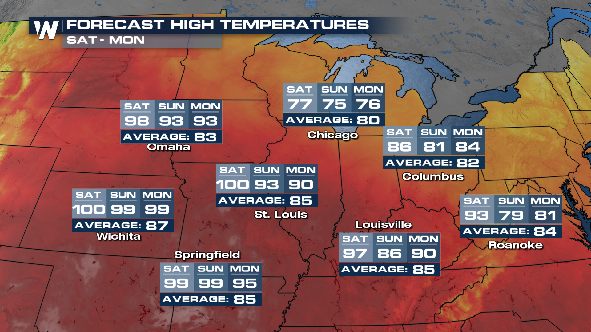
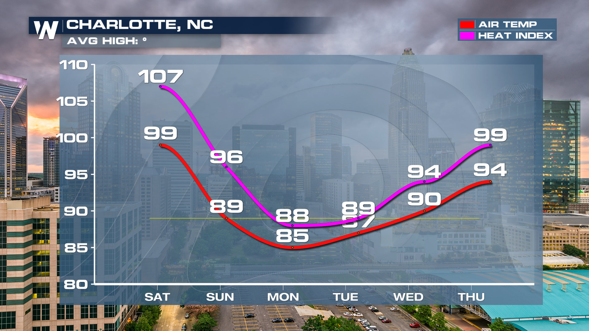
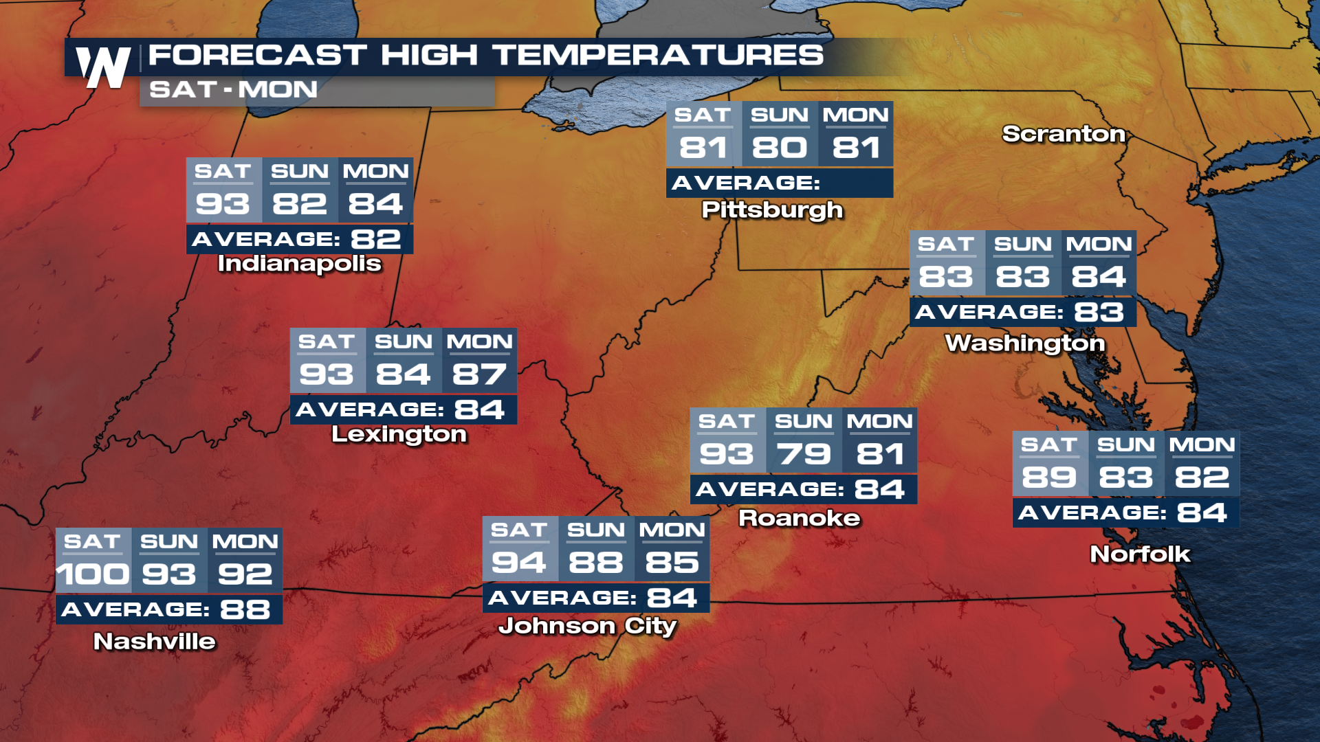 Folks in the Carolinas should get a nice break, even though it will be brief, before the heat surges again next week.
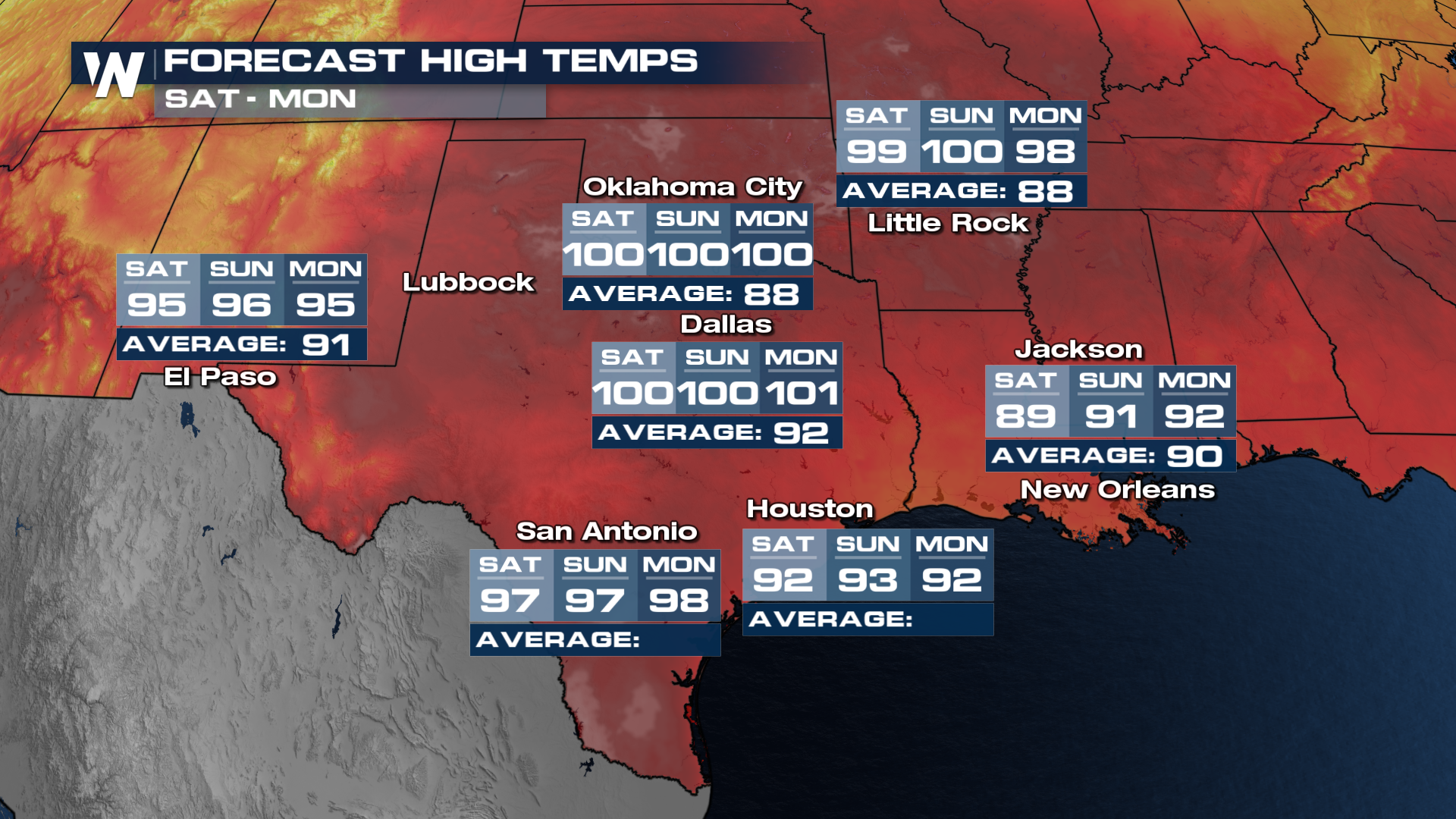
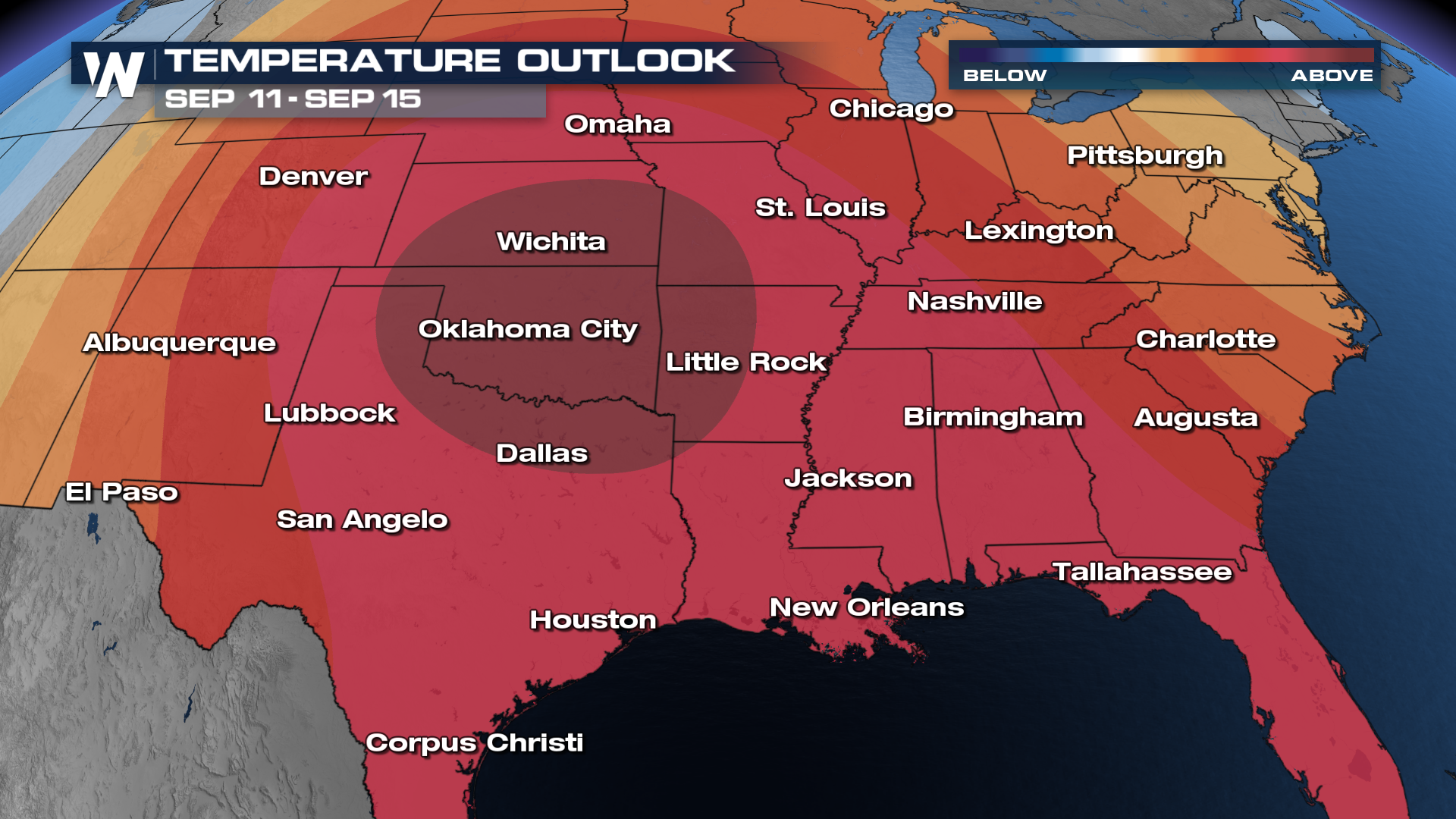
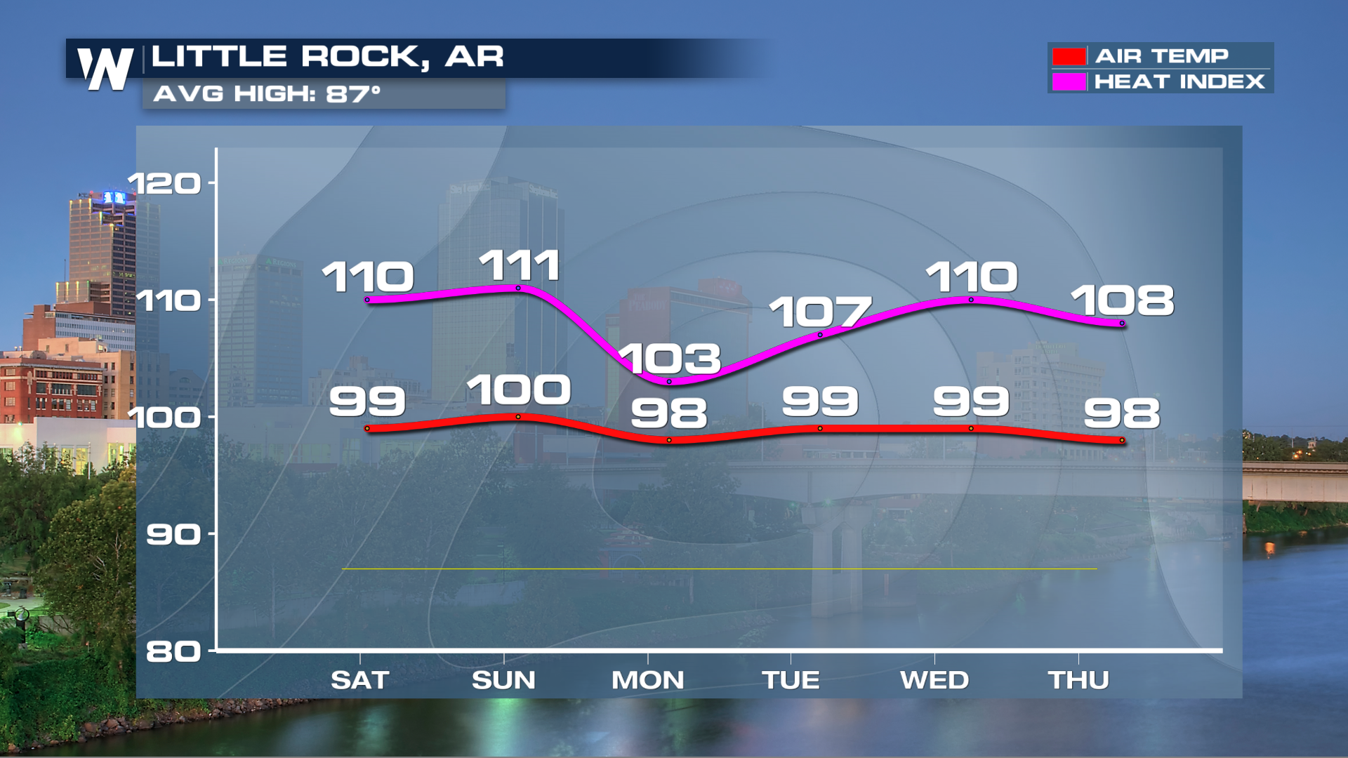 Unfortunately for the middle of the country, the middle of September likely wont bring any relief from the heat.