BREAKING: Tropical Depression 9 Forms in the Gulf

On Tuesday afternoon, Tropical Depression 9 formed off the Mexico coast in the southern Gulf. We expect this storm to continue to organize and strengthen as it makes its way north. By Thursday, it should reach hurricane status, making it the first one in the Atlantic this year; shattering previous satellite-era records for latest hurricane to form. As it moves north, the National Hurricane Center has its initial landfall forecast between New Orleans and Panama City Beach as a category two. Reminder, category two storms have winds between 96-110 mph. Heavy rain and flooding will be possible along the Gulf Coast states, regardless of the system's strength. For now, that is the biggest impact we're expecting.
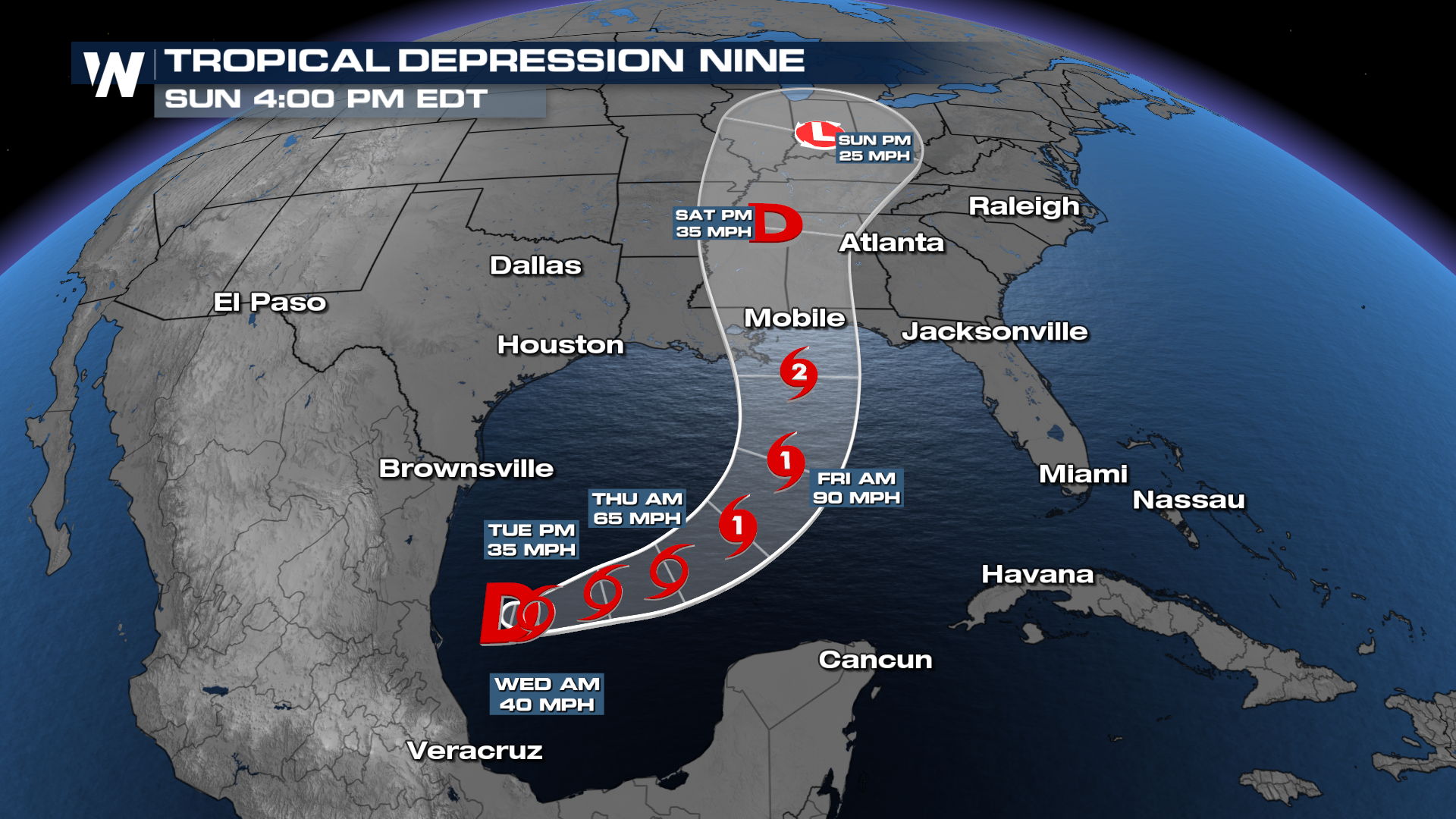
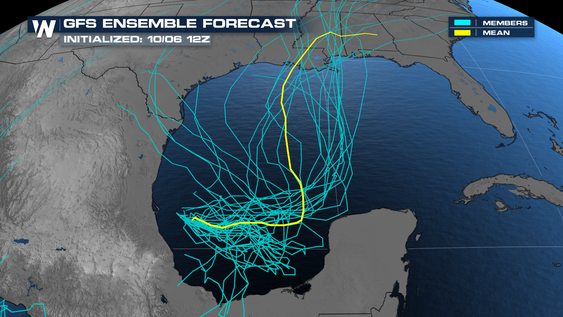
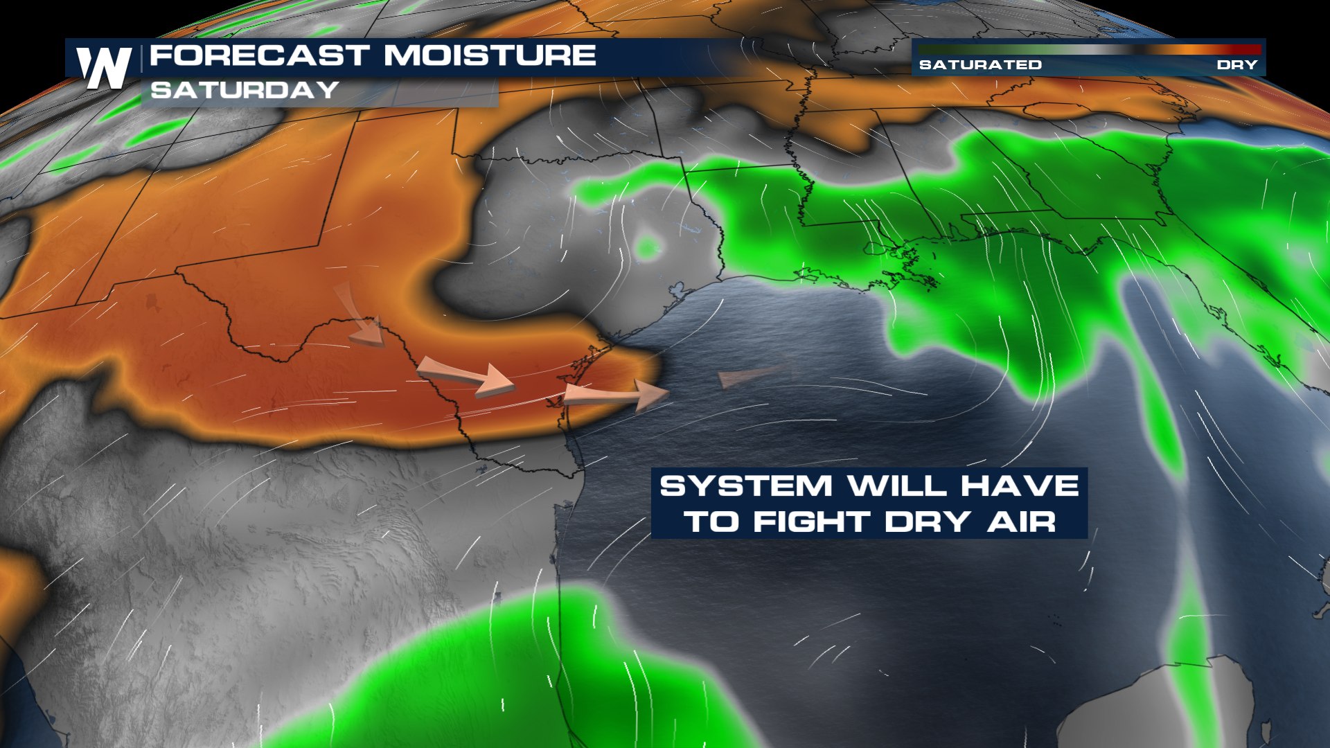
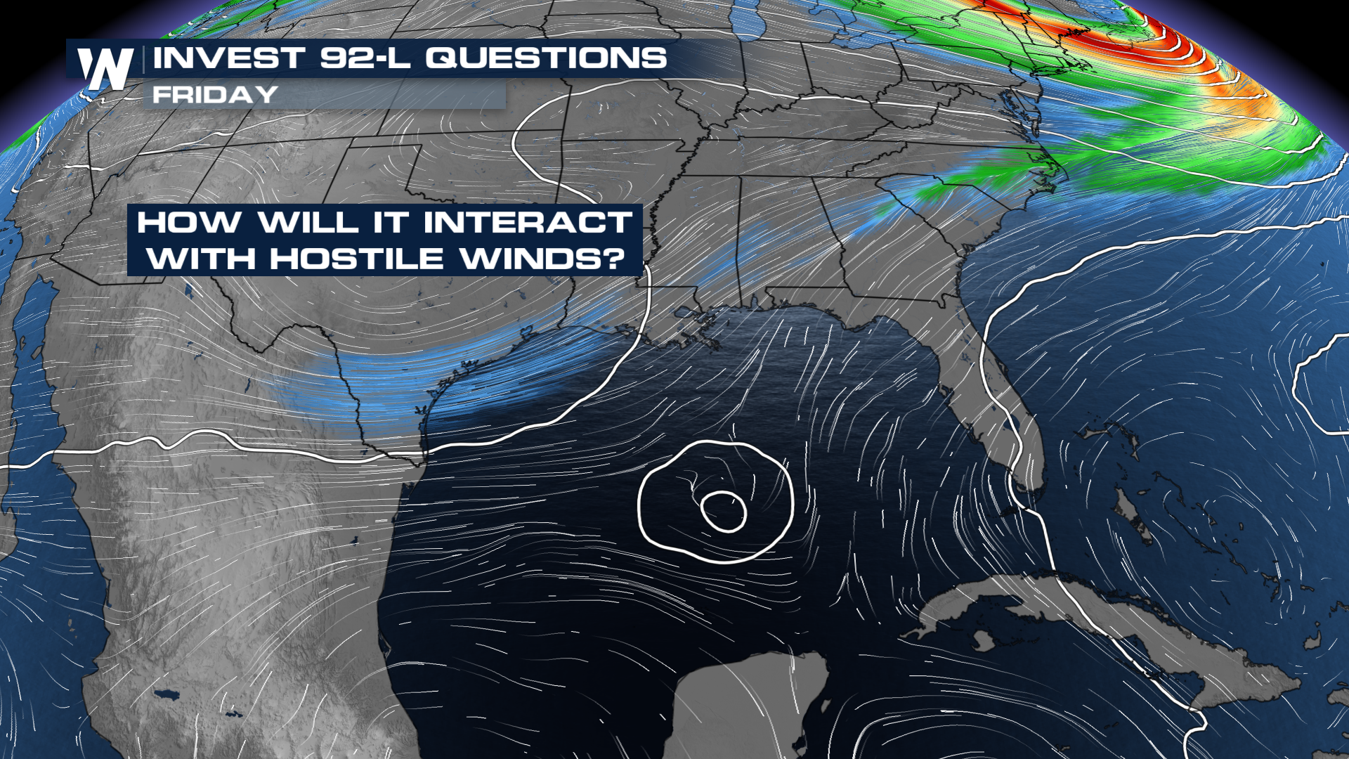
If you're living along the Gulf Coast, now is definitely the time to really start paying attention to the forecast. There is still some uncertainty in the forecast as there is shear and dry air standing in its way as it moves north. That's why the ensemble forecasts below still don't perfectly line up. Anyone form the Louisiana coast to the Big Bend of Florida should be on alert for changes in the forecast.
Our in-house BARON model shows nonstop heavy rain associated with a different system we've been tracking this week. The potential impacts are likely going to arrive this weekend.
Regardless of strength and intensity, we can count on heavy rainfall across a lot of these Gulf Coast states into the weekend. We're seeing potential totals above 6 inches! The flood threat will definitely be there as a result.
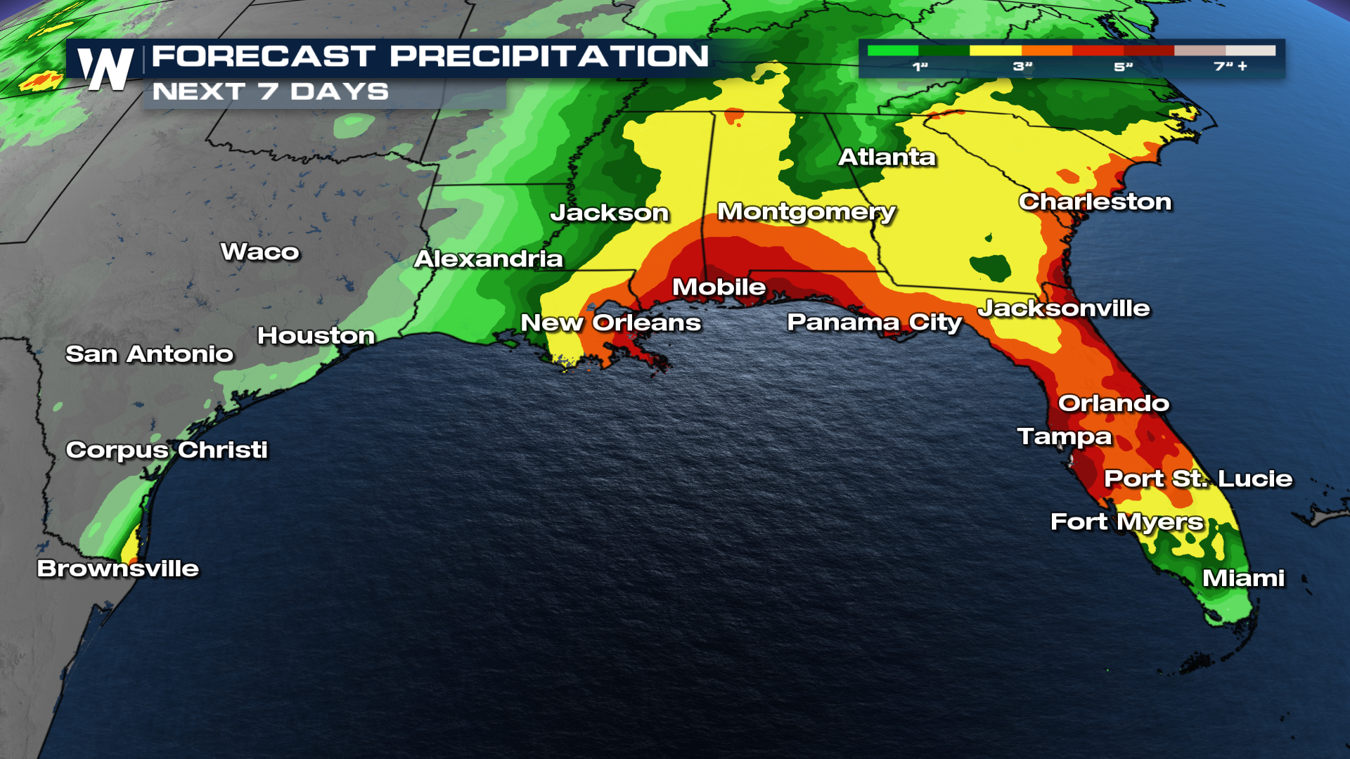
Stay tuned to the forecast here on WeatherNation. We'll bring you the details you need, and cut out all the hype.


