Severe Weather Risk in the Plains, Ohio and Tennessee Valleys
Special Stories
26 Jun 2018 2:11 PM
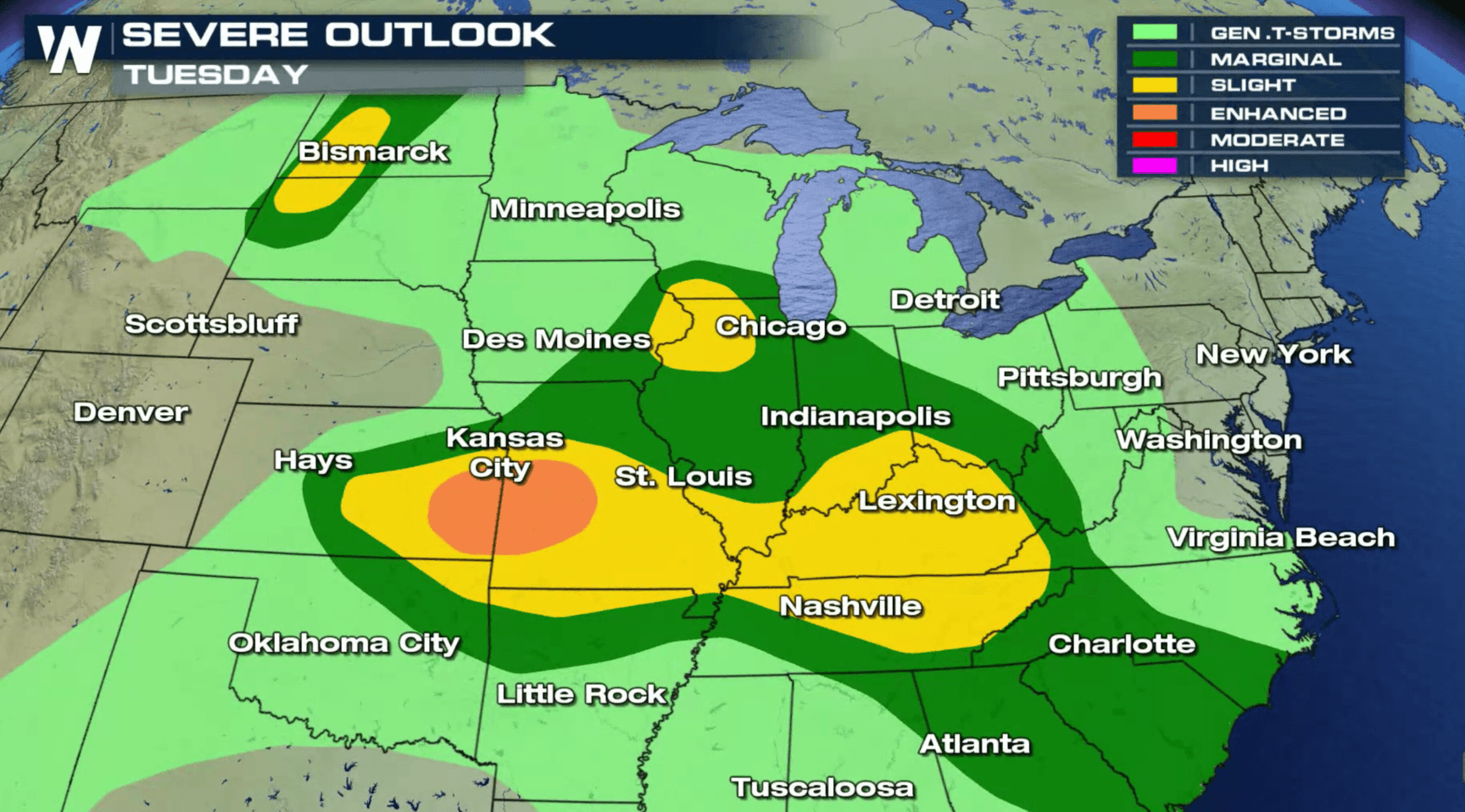
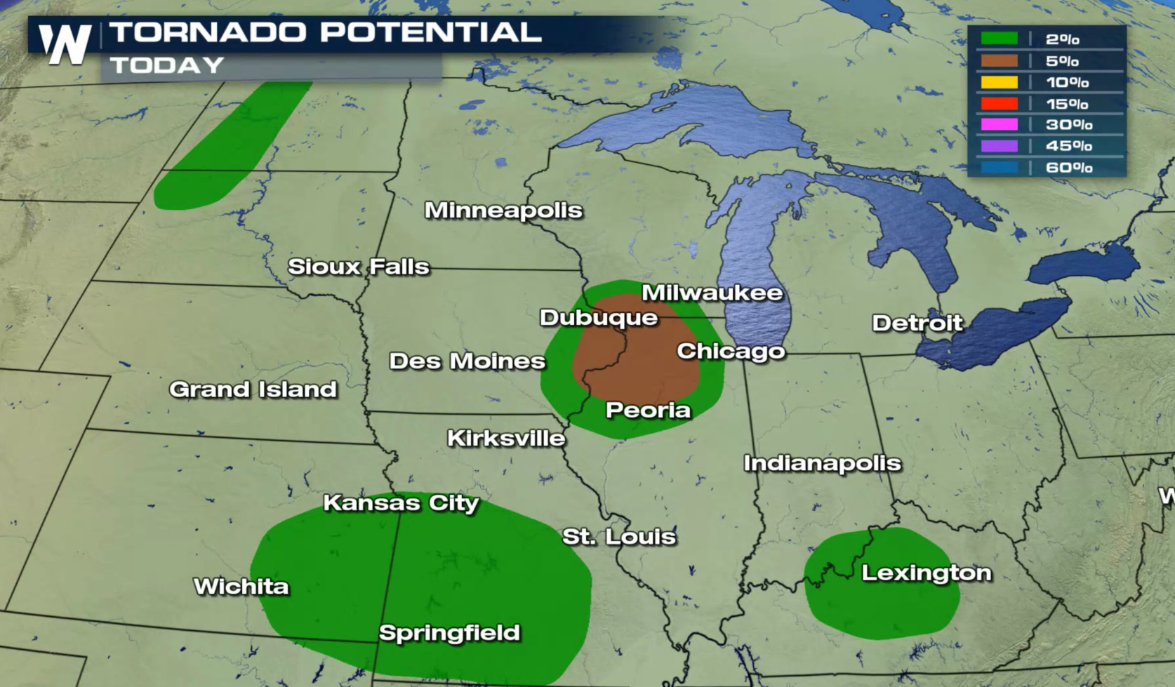
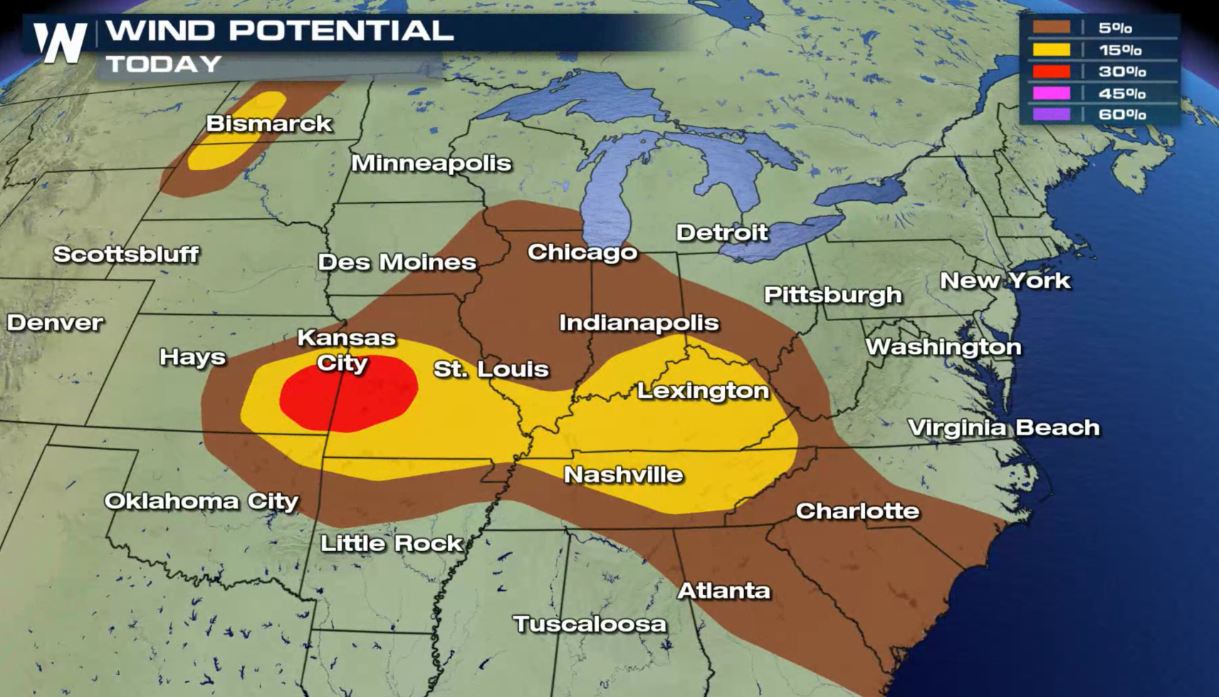
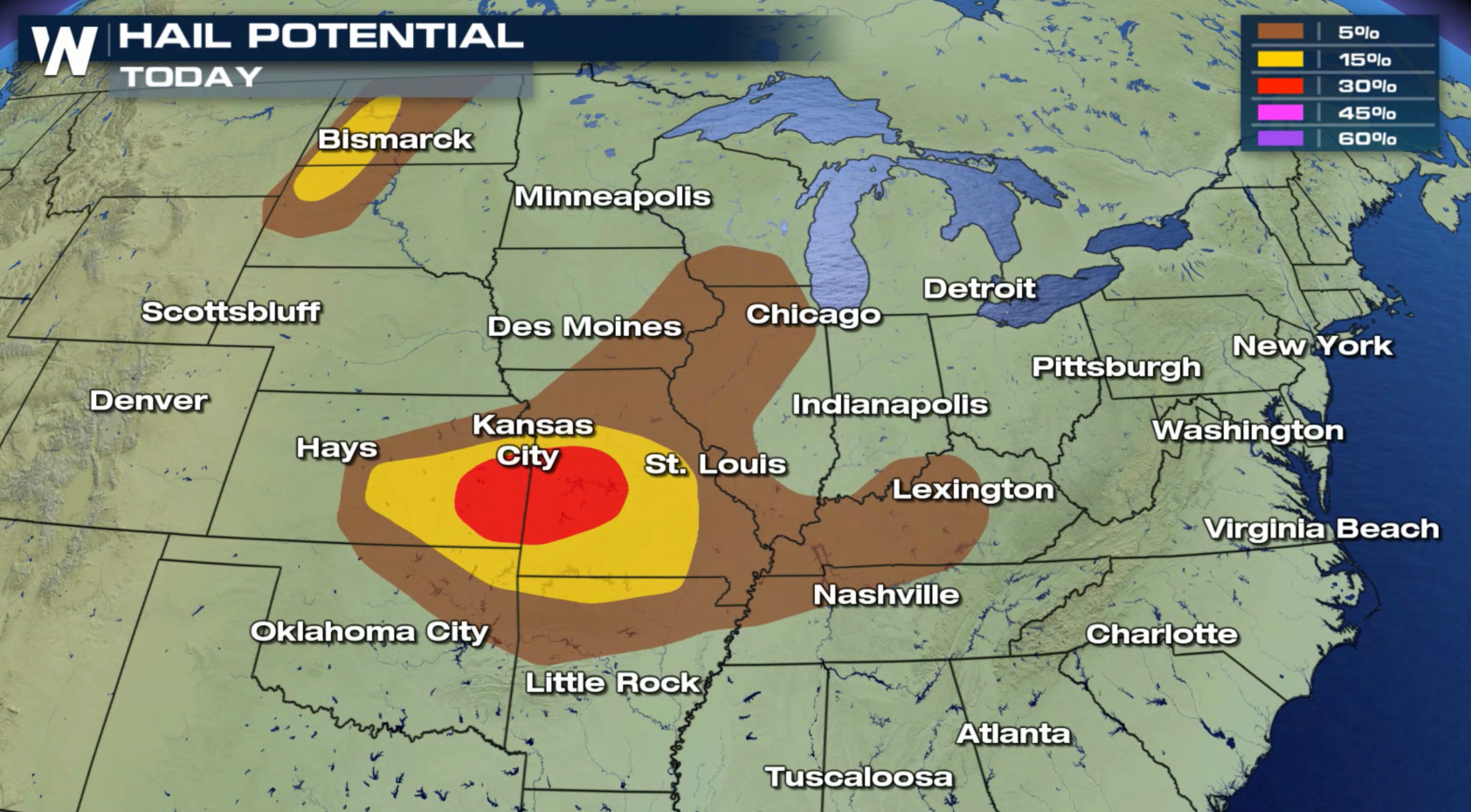
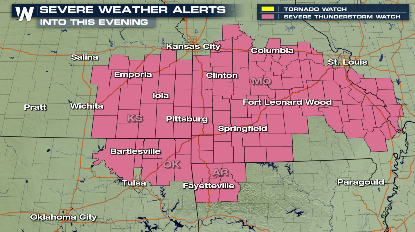
The risk for severe thunderstorms has pushed slightly eastward for the rest of today (Tuesday). The areas of concern include the Central and High Plains, along with the Ohio and Tennessee Valleys. The region around Kansas City is under an enhanced risk for severe thunderstorms, with damaging wind gusts and large hail as the biggest threat. A few tornadoes are possible, especially near the Mississippi River in Iowa and Illinois.
 Several Severe Thunderstorm Watches have been issued in the Central Plains, with additional watches likely throughout the night. Stay tuned to WeatherNation on-air and online for the latest severe weather alerts and updates.
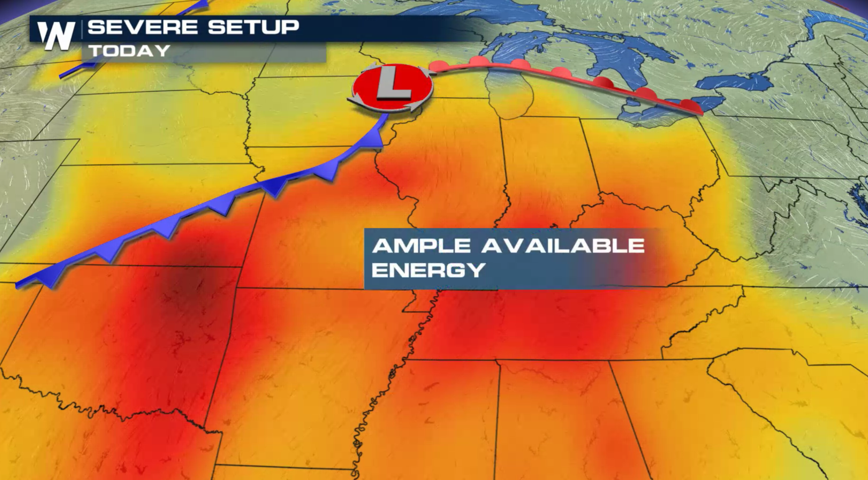
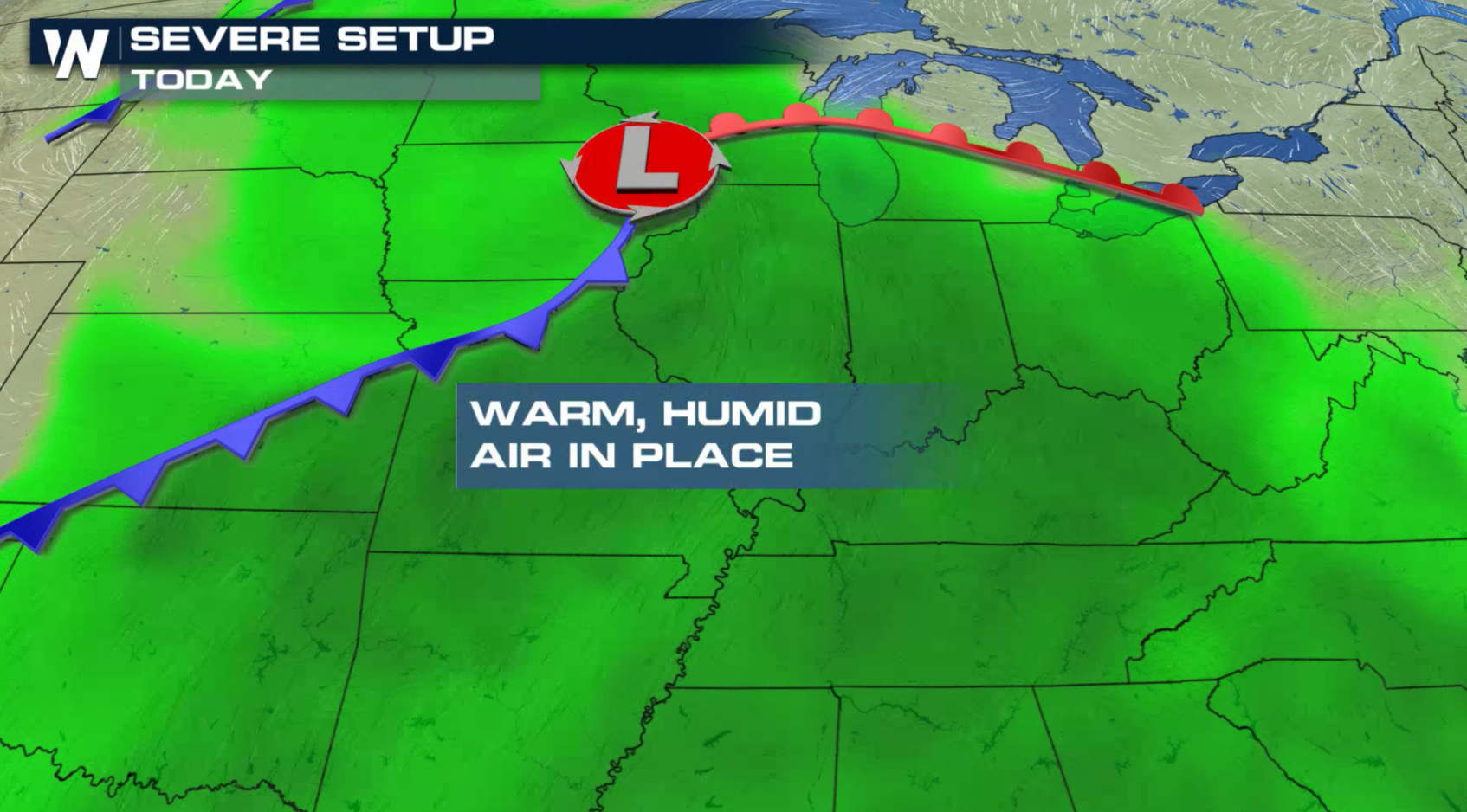
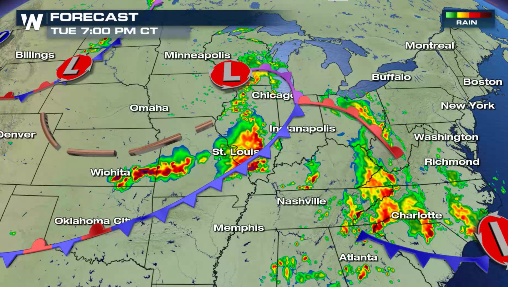
 A slow moving cold front will collide with increasing heat and humidity building ahead of the system. This will help severe thunderstorms to develop and sustain into the evening.
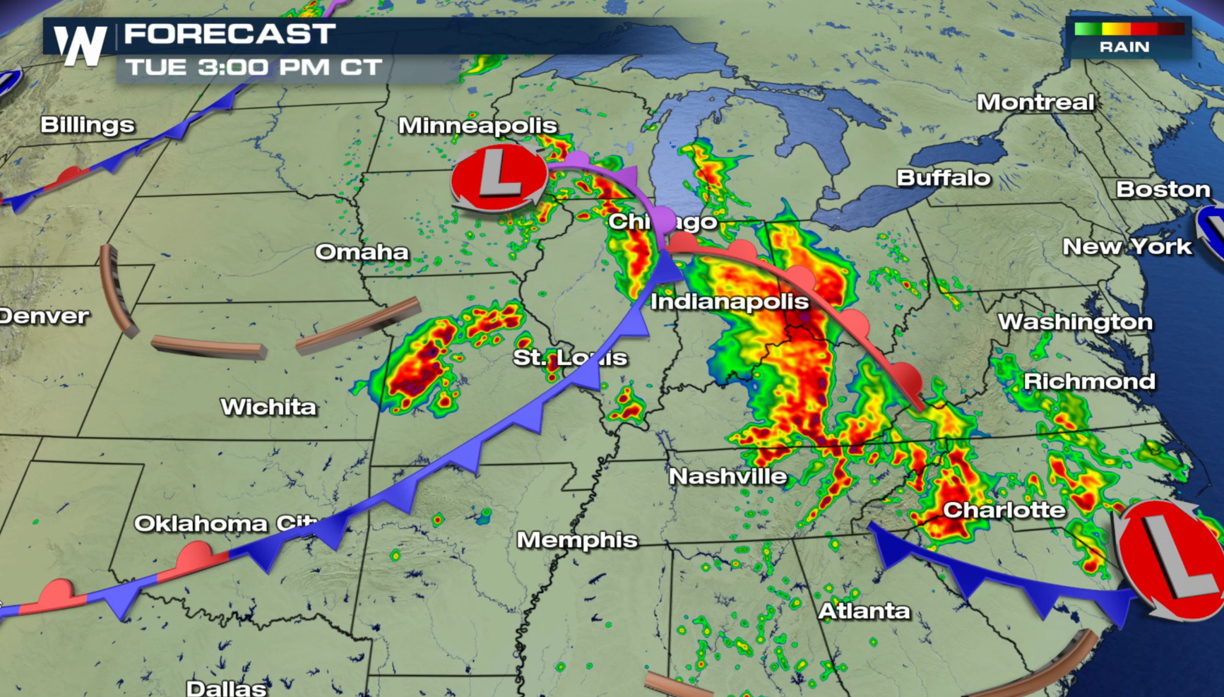
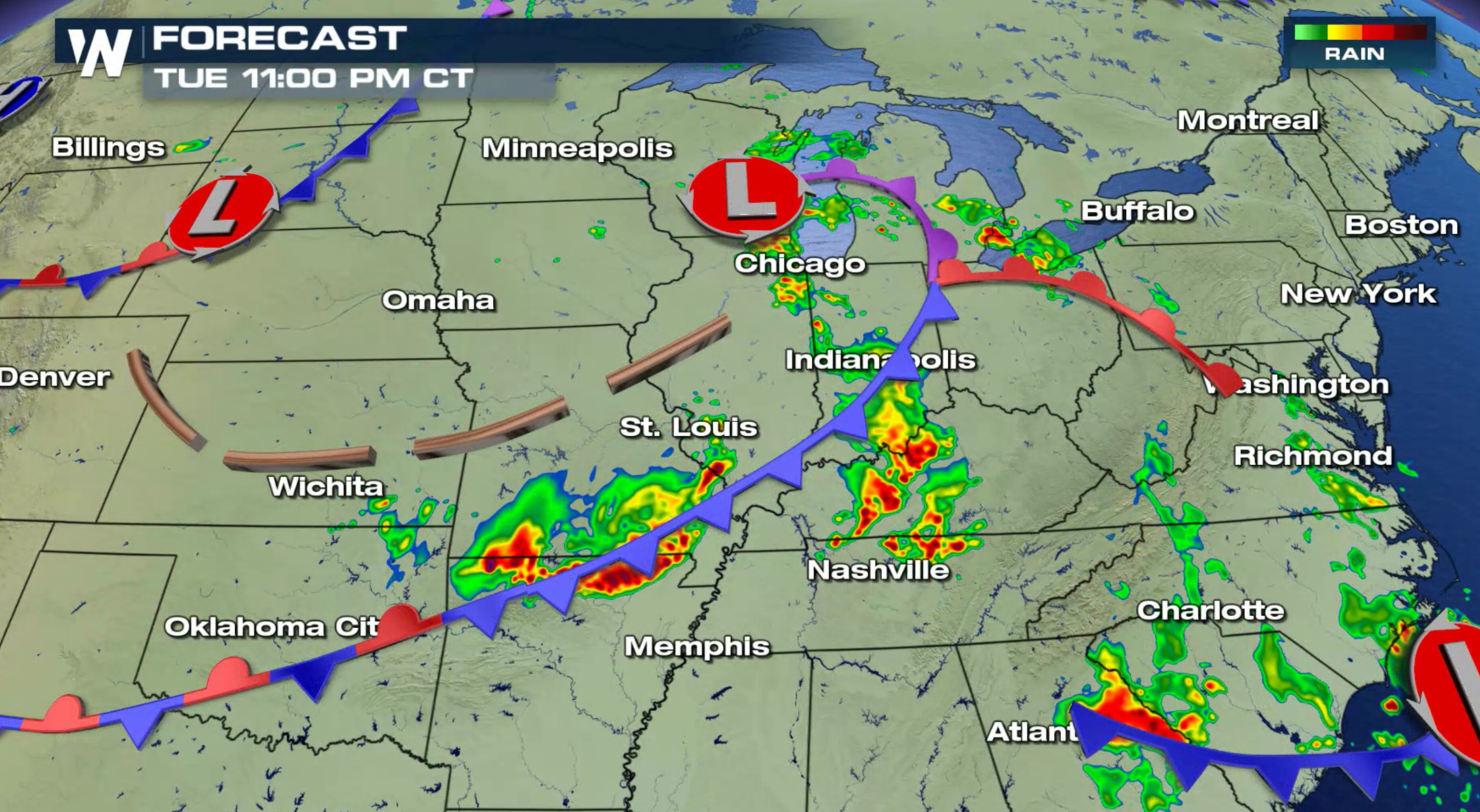
 The storm system that has been slowly marching eastward across the Plains will push into the Ohio and Tennessee Valleys tonight (Tuesday). Severe weather chances will likely continue well into the night.
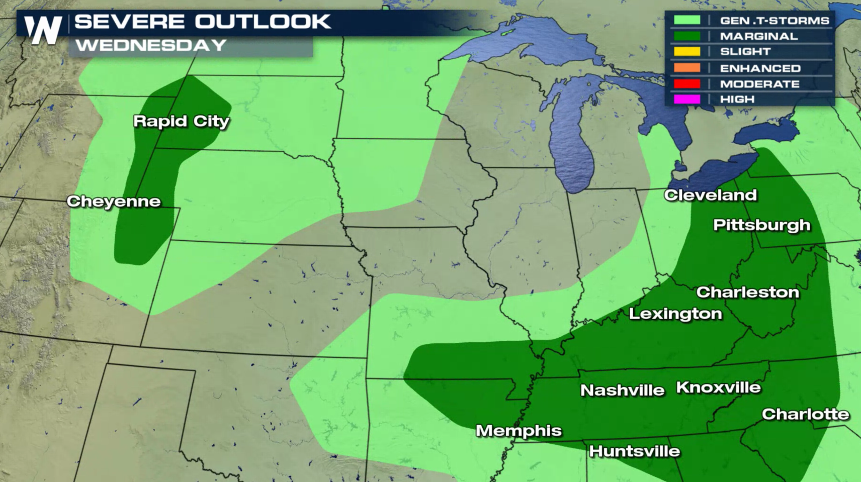
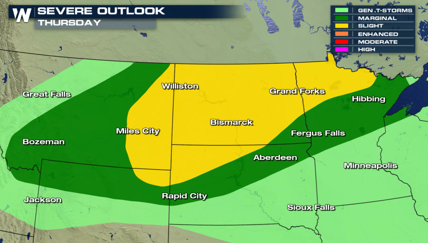
 The severe weather threat lowers on Wednesday, but builds back to a slight risk in the High Plains and Upper Midwest on Thursday.
 For WeatherNation: Meteorologist Mace Michaels
Several Severe Thunderstorm Watches have been issued in the Central Plains, with additional watches likely throughout the night. Stay tuned to WeatherNation on-air and online for the latest severe weather alerts and updates.
A slow moving cold front will collide with increasing heat and humidity building ahead of the system. This will help severe thunderstorms to develop and sustain into the evening.
The storm system that has been slowly marching eastward across the Plains will push into the Ohio and Tennessee Valleys tonight (Tuesday). Severe weather chances will likely continue well into the night.
The severe weather threat lowers on Wednesday, but builds back to a slight risk in the High Plains and Upper Midwest on Thursday.
For WeatherNation: Meteorologist Mace MichaelsAll Weather News
More
Severe Storms Target the Midwest to the Northeast This Week
Extreme heat will be a big story this week ac
26 Jul 2026 2:30 PM

Tropics: Fausto Heads to Hawaii; Genevieve Rapidly Intensifying
Atlantic BasinBertha has dissipated after mov
26 Jul 2026 2:30 PM

Fire Weather Continues This Weekend
Conditions have been really dry out west. We'
26 Jul 2026 10:40 AM

Heat Wave Grips Central, Western U.S.
Are you over the summer heat yet? The heat al
26 Jul 2026 10:35 AM

Southeast Flood Risk Lingers Near Stalled Front
A stalled boundary over the Southeast will ke
25 Jul 2026 10:55 AM

Another Round of Storms Targets the Northeast
Tuesday brought severe weather again across p
23 Jul 2026 1:15 AM

Another Round of Severe Weather for the Upper Midwest and Great Lakes
The upper-level low train continues to keep t
21 Jul 2026 1:45 AM