Snow from the Great Lakes to Cape Cod into Tuesday
Special Stories
29 Jan 2018 1:54 PM
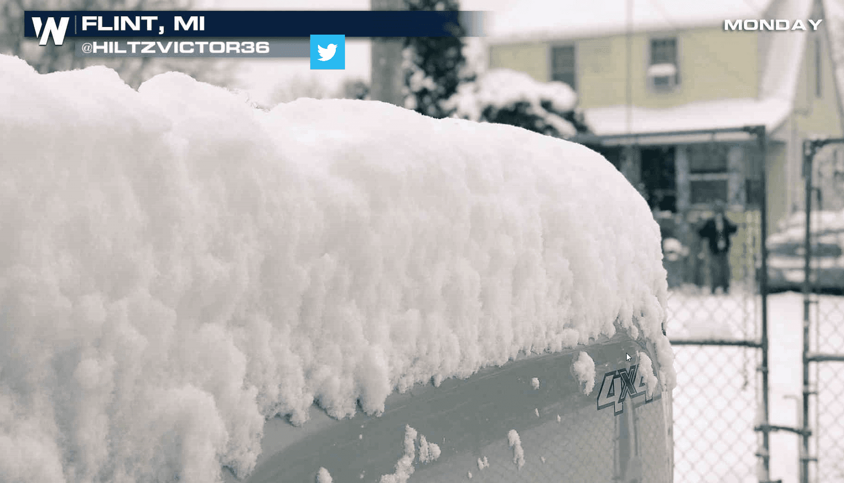
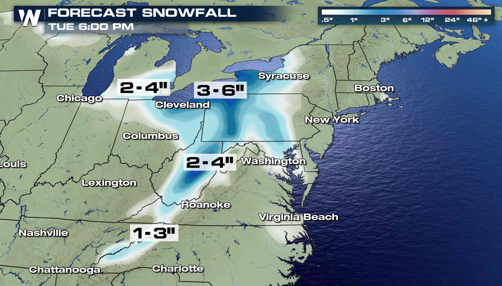
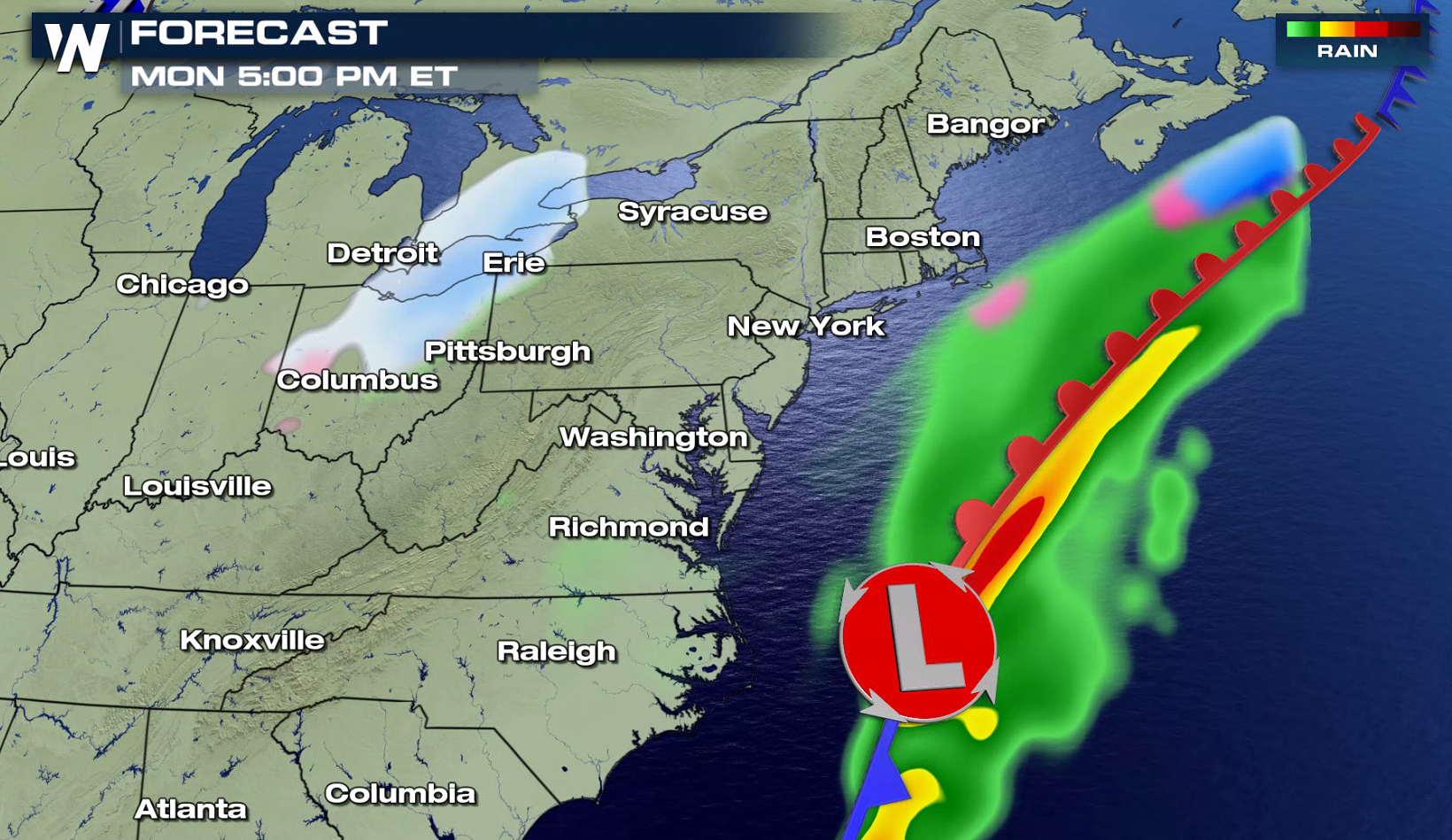
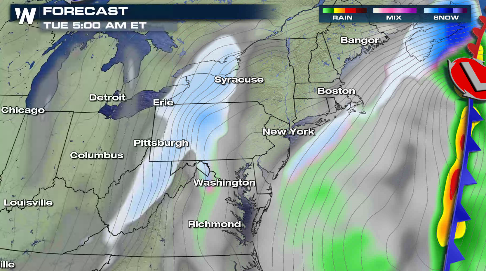
Snow showers and flurries continue to move through the Great Lakes and will expand into the New England tonight and Tuesday. Winter weather alerts extend from Michigan to Massachusetts.
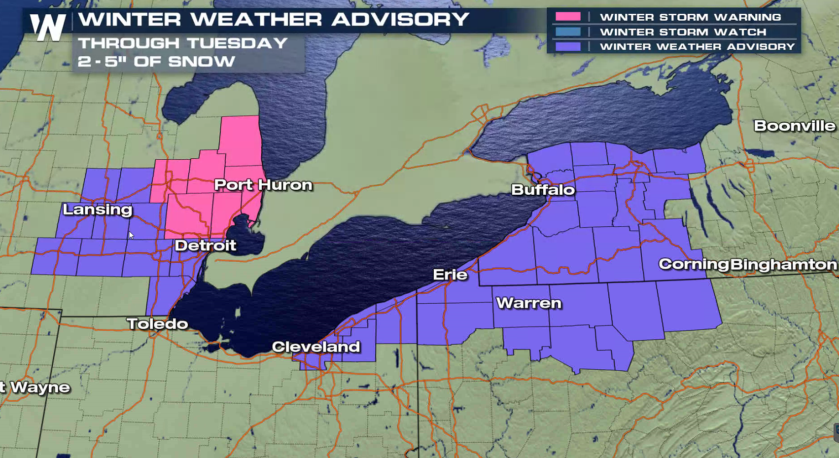
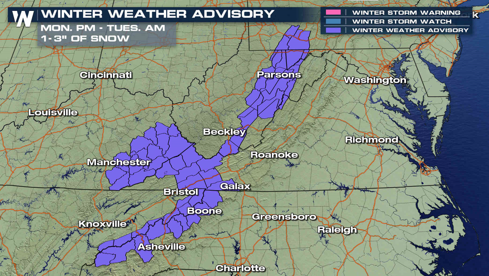
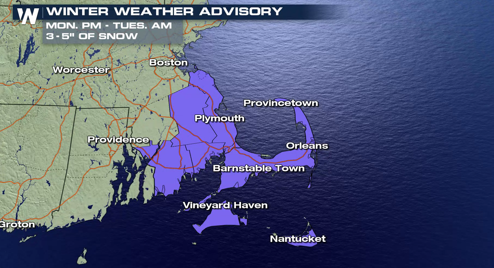 Minor additional accumulations will fall in Michigan, but up to 6" of new snow may fall from near Lake Erie through the Appalachians to Cape Cod. An upper level disturbance moving through the Great Lakes and a low pressure center in the Atlantic Ocean will bring the snowfall. The moisture will move out of the region and diminish Tuesday afternoon.
 For WeatherNation: Meteorologist Mace Michaels
For your local forecast, download our app or click here.
For WeatherNation: Meteorologist Mace Michaels
For your local forecast, download our app or click here.
Minor additional accumulations will fall in Michigan, but up to 6" of new snow may fall from near Lake Erie through the Appalachians to Cape Cod. An upper level disturbance moving through the Great Lakes and a low pressure center in the Atlantic Ocean will bring the snowfall. The moisture will move out of the region and diminish Tuesday afternoon.
For WeatherNation: Meteorologist Mace Michaels
For your local forecast, download our app or click here.All Weather News
More
East Gears Up for Stormy, Wet Weekend
A low pressure system crashing through the Mi
1 Aug 2026 11:35 AM


Flooding, Severe Storms Target the Midwest Again
After an active week of storms across the nor
1 Aug 2026 1:40 AM


After Reaching Category 5, Genevieve Weakens in the Pacific
PacificFausto is now a post-tropical cyclone.
31 Jul 2026 1:30 AM

Flooding Risk Increases as Heavy Rain Targets the Tri-State Area
Tuesday, heavy rainfall moved across the Nort
30 Jul 2026 12:25 AM

Severe Weather: Energy From the Midwest Now in the Southeast
UPPER MIDWEST - Through Monday, dangerous tor
29 Jul 2026 10:30 PM