High Flood Risk - Remnants of Tropical Storm Arthur Head East

The National Hurricane Center has been tracking Tropical Storm Arthur and has issued their last advisory as it degenerated to a low pressure area along the Upper Texas Coast. It may reform in the Atlantic but won't likely be a direct threat to the United States.
Despite the storm degenerating, it's still bringing intense, tropical downpours to parts of the South. A rare HIGH RISK for flash flooding has been issued from eastern Louisiana through western Florida, including southern Alabama and Mississippi.
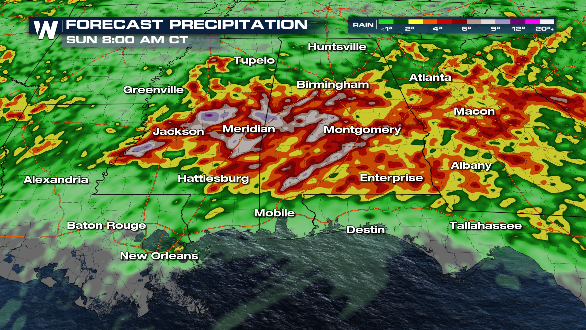
High risk days are a big deal - accounting for 80% of flood damages in the United States each year. About a THIRD of flooding deaths in the US each year occur on high risk days.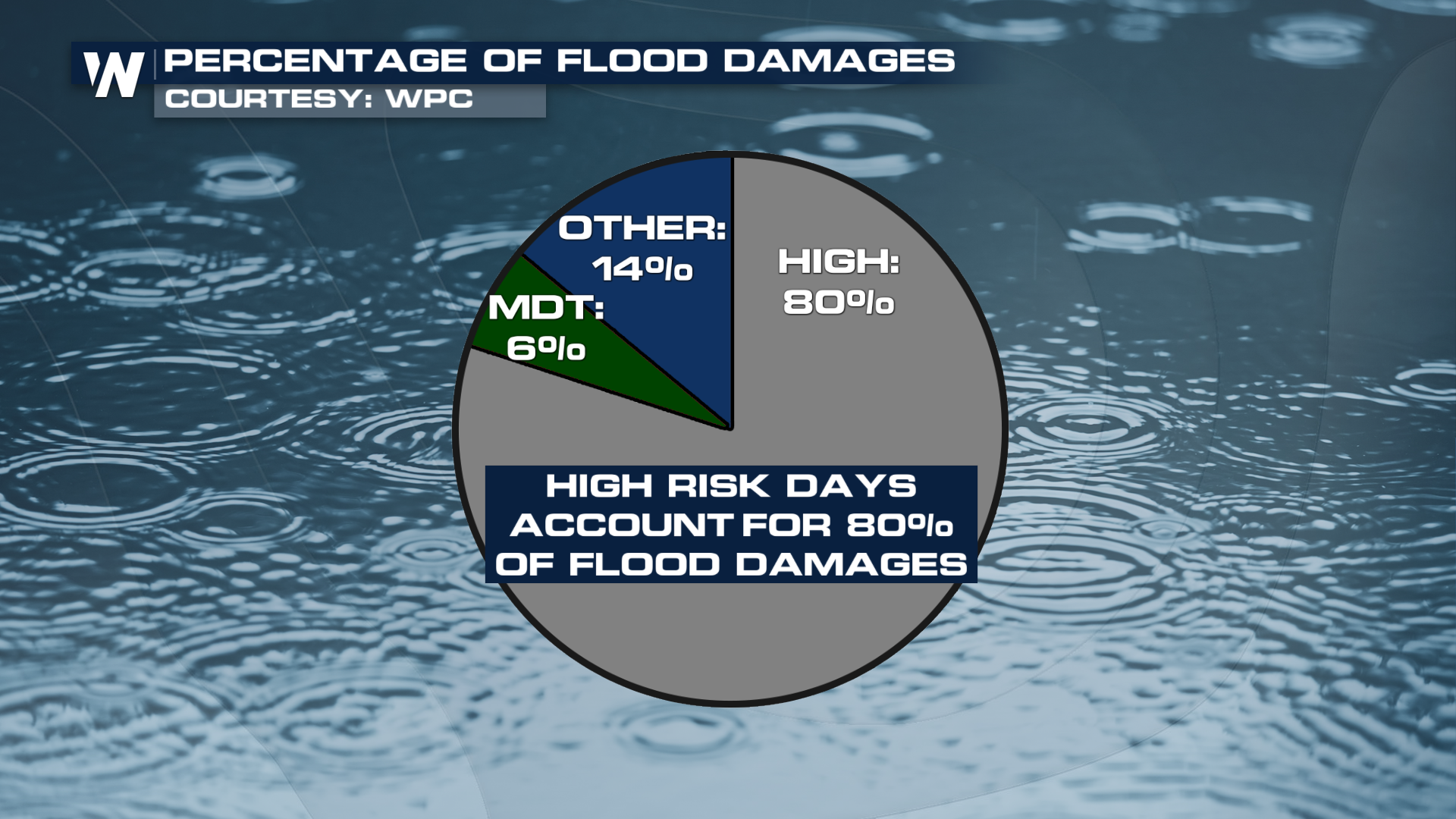 Rainfall totals may reach up to 5-10 inches with isolated higher totals around 20 inches from Louisiana through Mississippi and Alabama.
 Forecast
Storm timing will be anytime of day - though the afternoon will add extra energy for severe storms. Flash flooding and tornadoes will be possible any time, including the overnight hours. Please have multiple ways to get weather alerts, including with noises loud enough to wake you if you're sleeping.
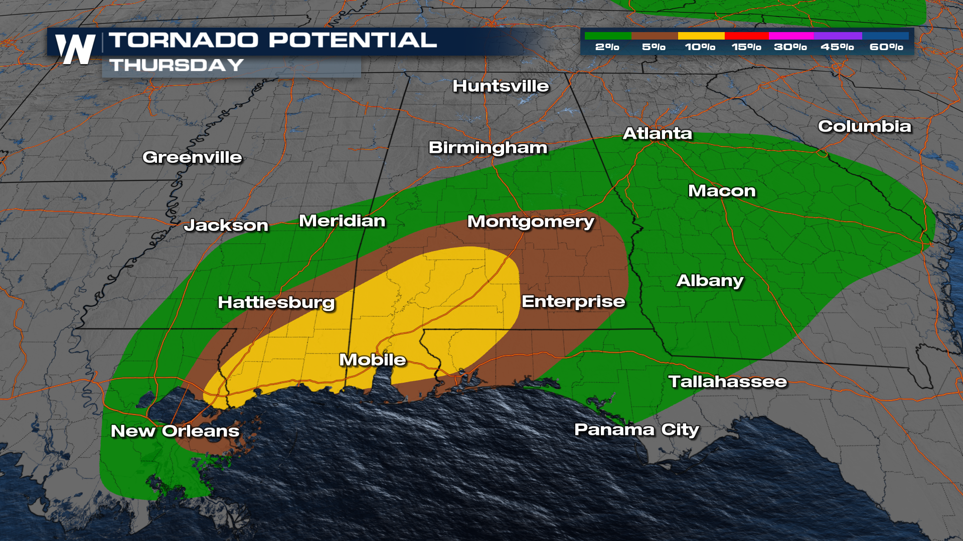
Severe Storms
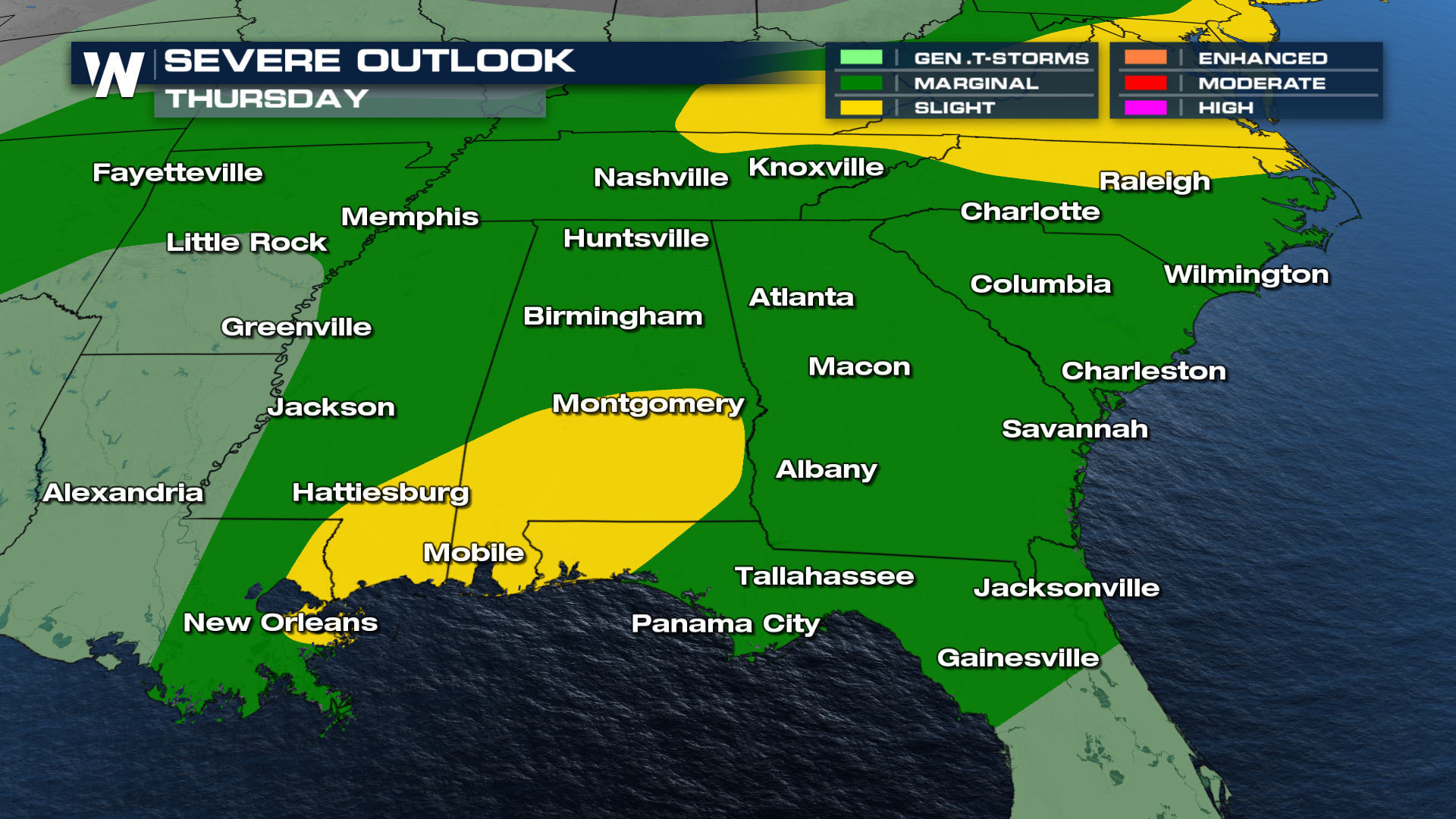
Arthur's spin, or shear, will aid in producing severe storms, in addition to the flash flooding. Much of the SE will be at risk for strong thunderstorm winds on Thursday, but elevated tornado potential will continue due to the shear added by Arthur's remnant circulation.
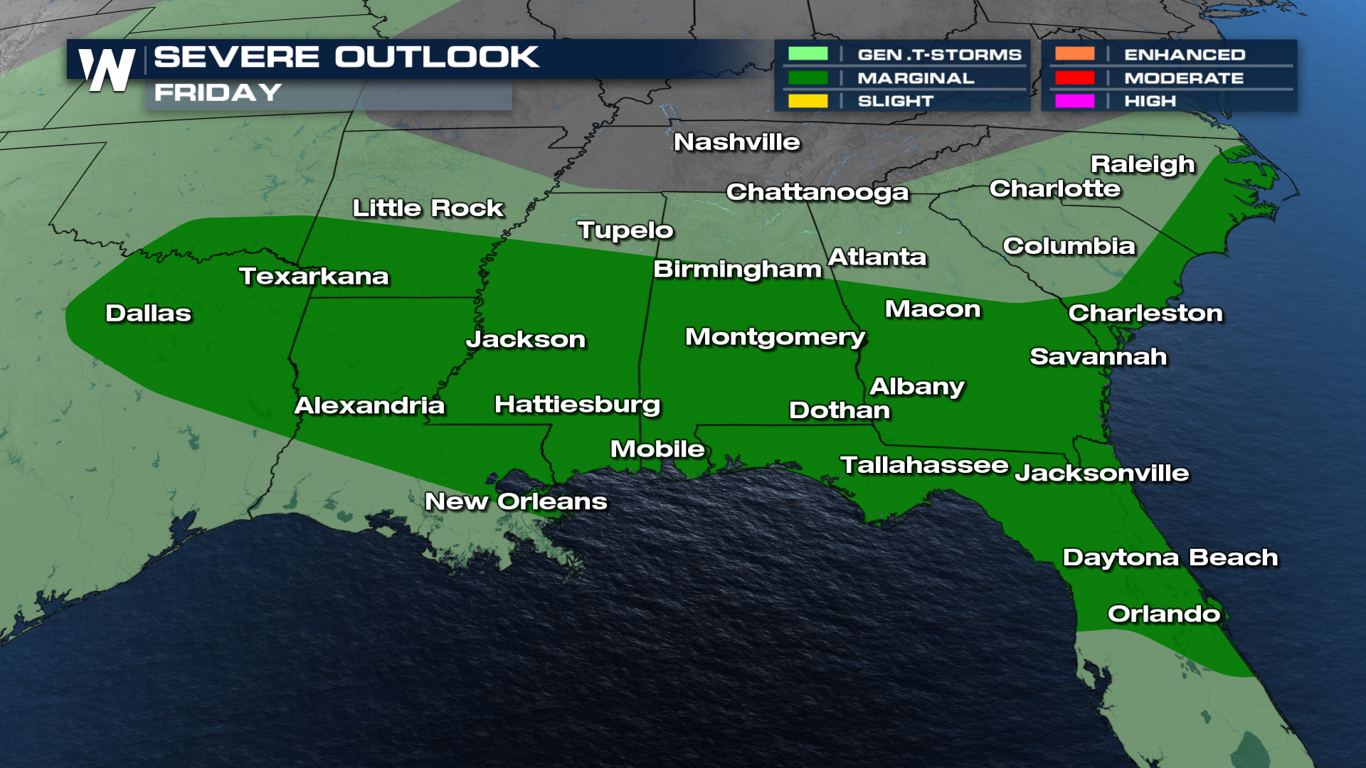
 The risk for severe weather continues Friday as a frontal boundary stalls in the area, producing storms that could lead to additional flash flooding.