Flood Threat Slowing Down for California

Monsoon season can be enhanced by tropical systems from the Eastern Pacific, in fact, this usually occurs 1-2 times per season on average! For the second time this year, parts of the SW are seeing enhanced precipitation from the tropics, this time from what was Tropical Storm Mario.
Mario's moisture led to some intense rainfall from California to New Mexico, producing several significant flash flood events and debris flows, including in Oak Glen. 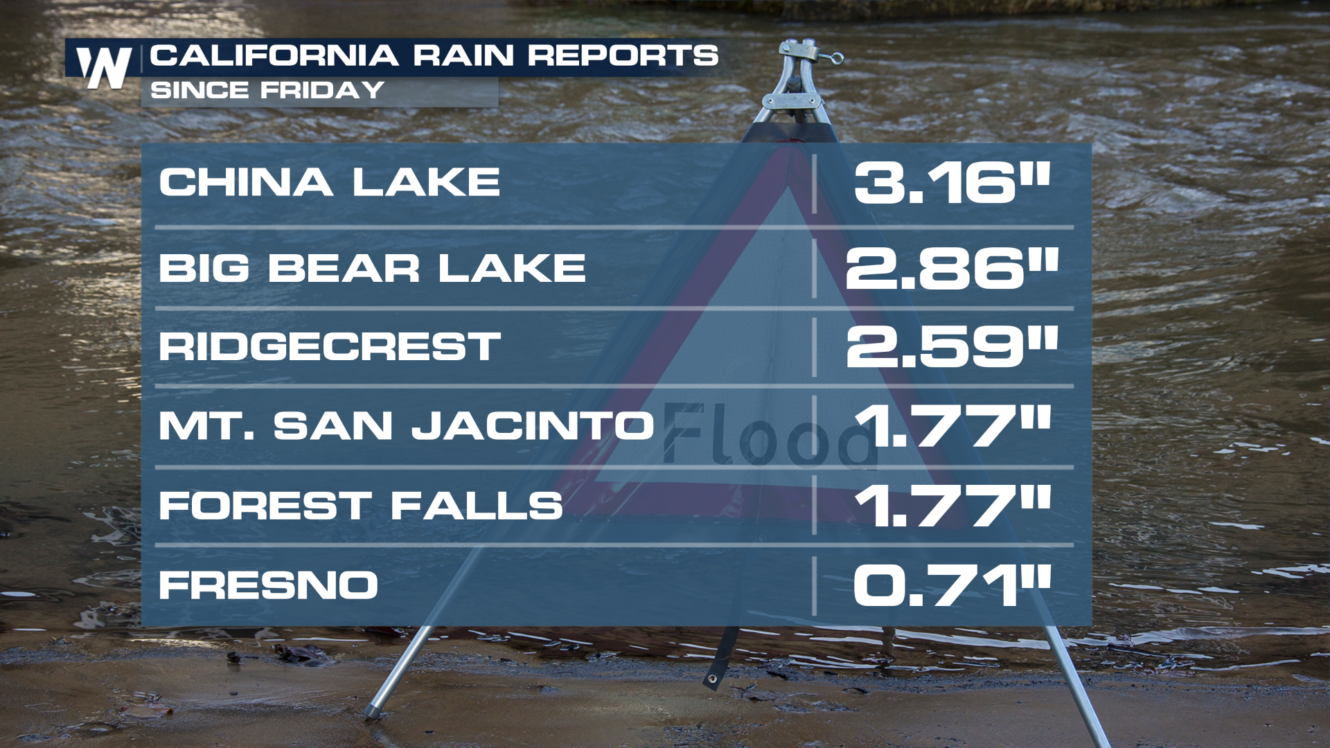 The heaviest of the rain is behind Southern California, but more scattered storms are possible with monsoon moisture across the Lower Four Corners Saturday.
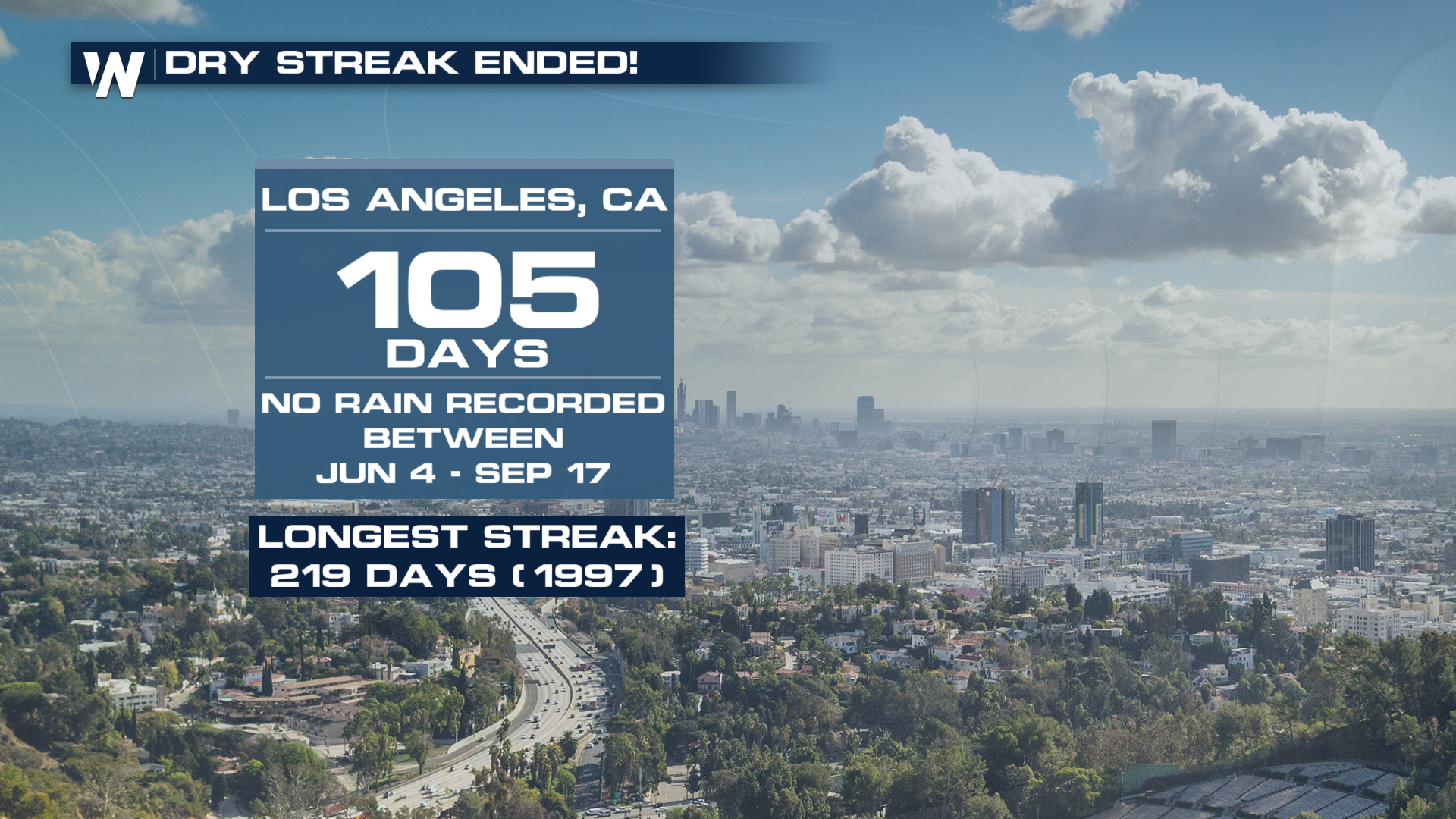
The rain was a welcome sight for many in California. Downtown LA hadn't seen rain since the beginning of JUNE! The final count of 105 days isn't close to their longest streak ever, but that's not a bad thing.
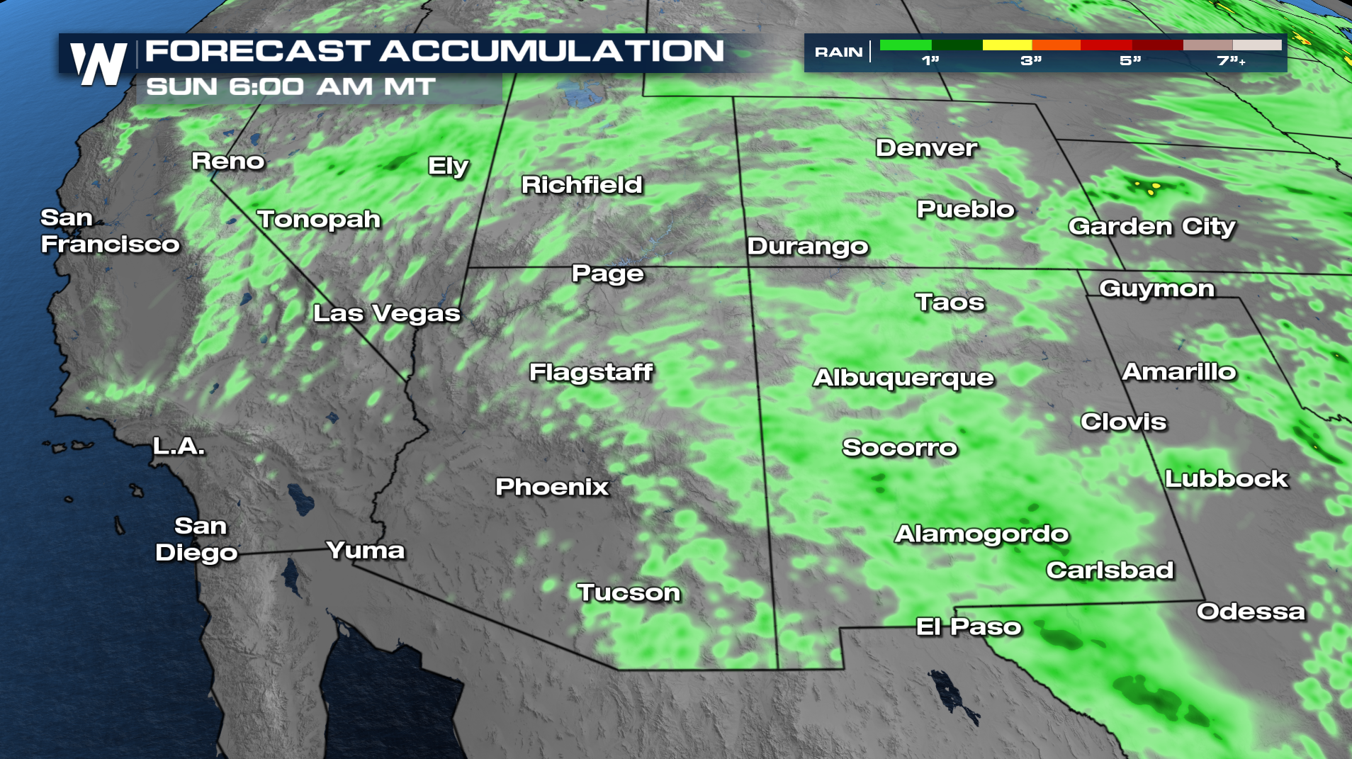
 Through Sunday morning, an additional half an inch to an inch of rain will be possible across the Southwest!