Monster Hail & Tornadoes Hit the Plains Monday

Our multi-day severe threat started on Sunday but continues through the middle and end of this week in the northern and southern Plains. What looks like a landspout tornado touched down in Hayfield, MN on Monday afternoon. The storms we dealt with throughout the day on Monday was not responsible for a lot of tornado reports. What more people and places had to deal with was the giant hail and hurricane-force winds!
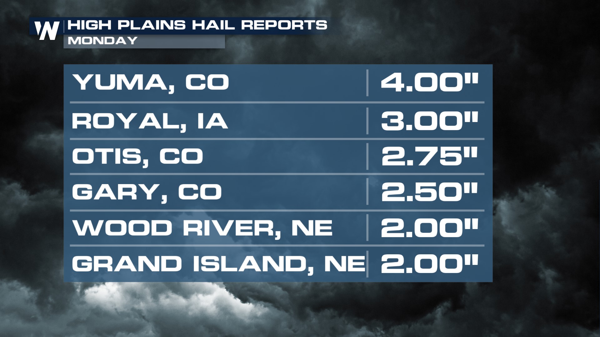
Softball-sized hail fell in Yuma, CO, in northeastern Colorado, Sunday night. And even northwestern Iowa got in on some of the action with apple-sized hail, marking 3" in diameter.
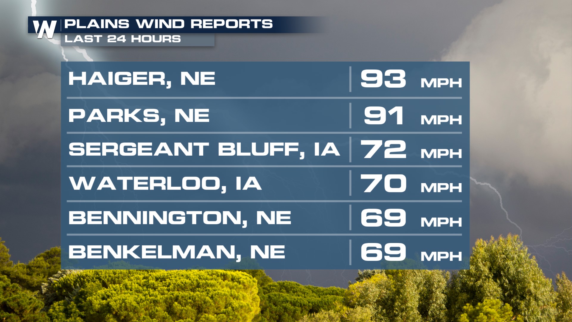
 Hurricane-force winds tore through much of the central and northern Plains. A 93 mph wind gust was recorded in Haiger, NE.
 As the severe weather threat is still ongoing, we can't stress to you enough just how important it is to stay weather-aware in the days ahead.


