Deadly Tornadoes, Hurricane Force Winds Slam Iowa

Multiple tornadoes ripped through Iowa Tuesday afternoon and evening. Preliminary reports have 23 tornadoes touching down across the Midwest in Iowa, Illinois, Nebraska and Wisconsin. Sadly four people were killed in the storms, three in the violent tornado that hit Greenfield, IA south of Des Moines. Our field crews captured the moments after the storm of first responders and neighbors descending on a destroyed home to look for survivors. A debris ball was visible on radar for over 45 minutes as this monster tornado moved through.
Tornadoes toppled giant wind turbines south of I-80. Our field correspondents captured two distinct scenes of damage in Prescott, IA, and about 75 miles east in Williamson, IA. At the height, 60k customers were without power across the state. Even outside of the tornadoes winds were reported over 70 mph in Iowa and Illinois - that's hurricane force.
This is the likely tornado that moved into Greenfield. Tornado warnings started west of Omaha, NE and continued through Iowa with multiple spin-ups in and around Des Moines. There were over 330 reports of severe weather on Tuesday with 100+ buildings destroyed. A PDS watch or "potentially dangerous situation" was issued in Iowa, southern Minnesota and western Illinois for the threat of EF-2 tornadoes and extremely damaging winds.
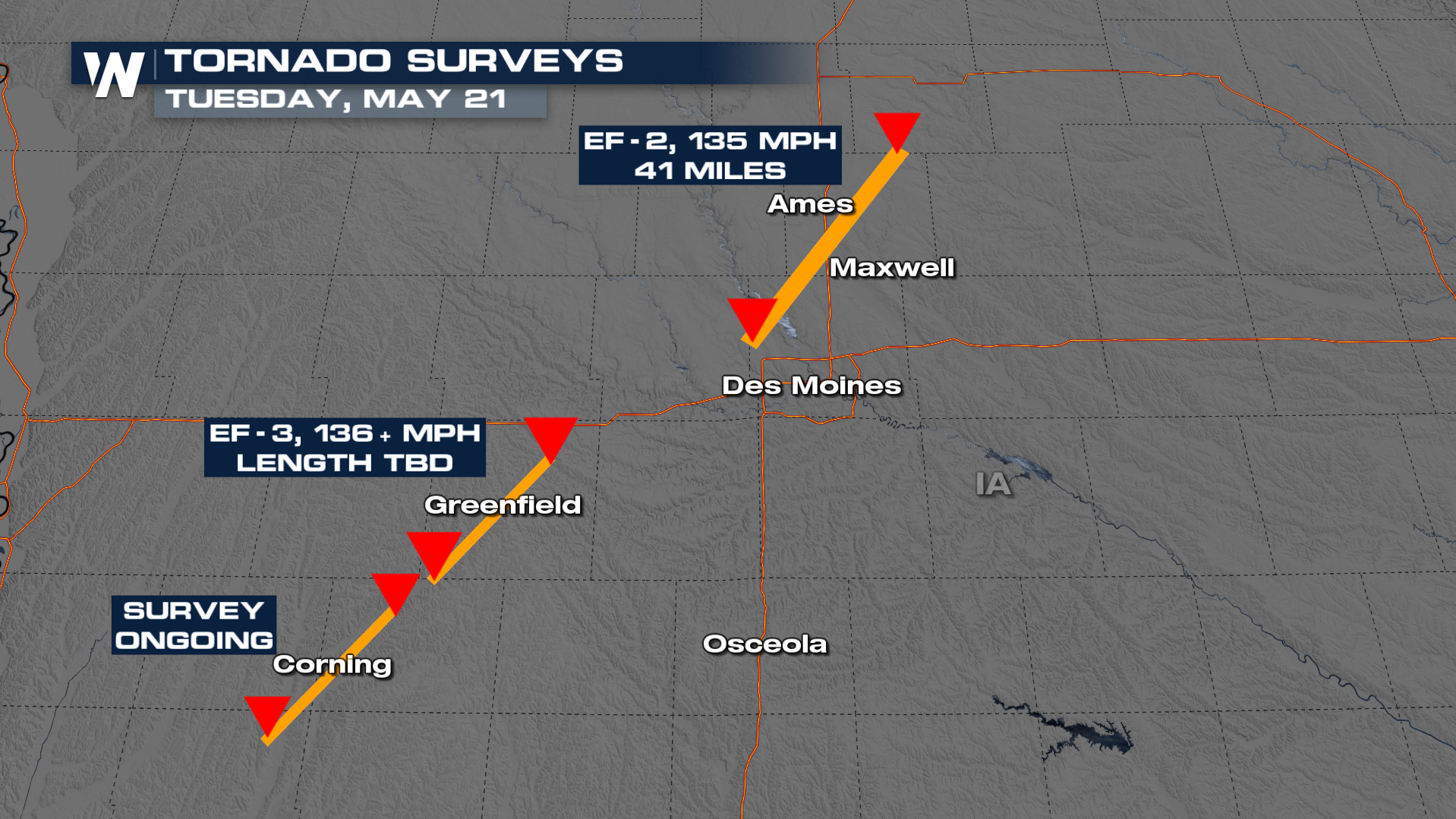
Storm surveys have found preliminary damage comparable to EF-2 and an EF-3 intensities, meaning that these were significant tornadoes. The National Weather Service in Des Moines, Iowa says the tornado that moved through Story County, north of Des Moines, was traveling about 70 miles per hour! NWS Des Moines also says the Greenfield, Iowa tornado was at least an EF-3. Storm surveys are still ongoing.
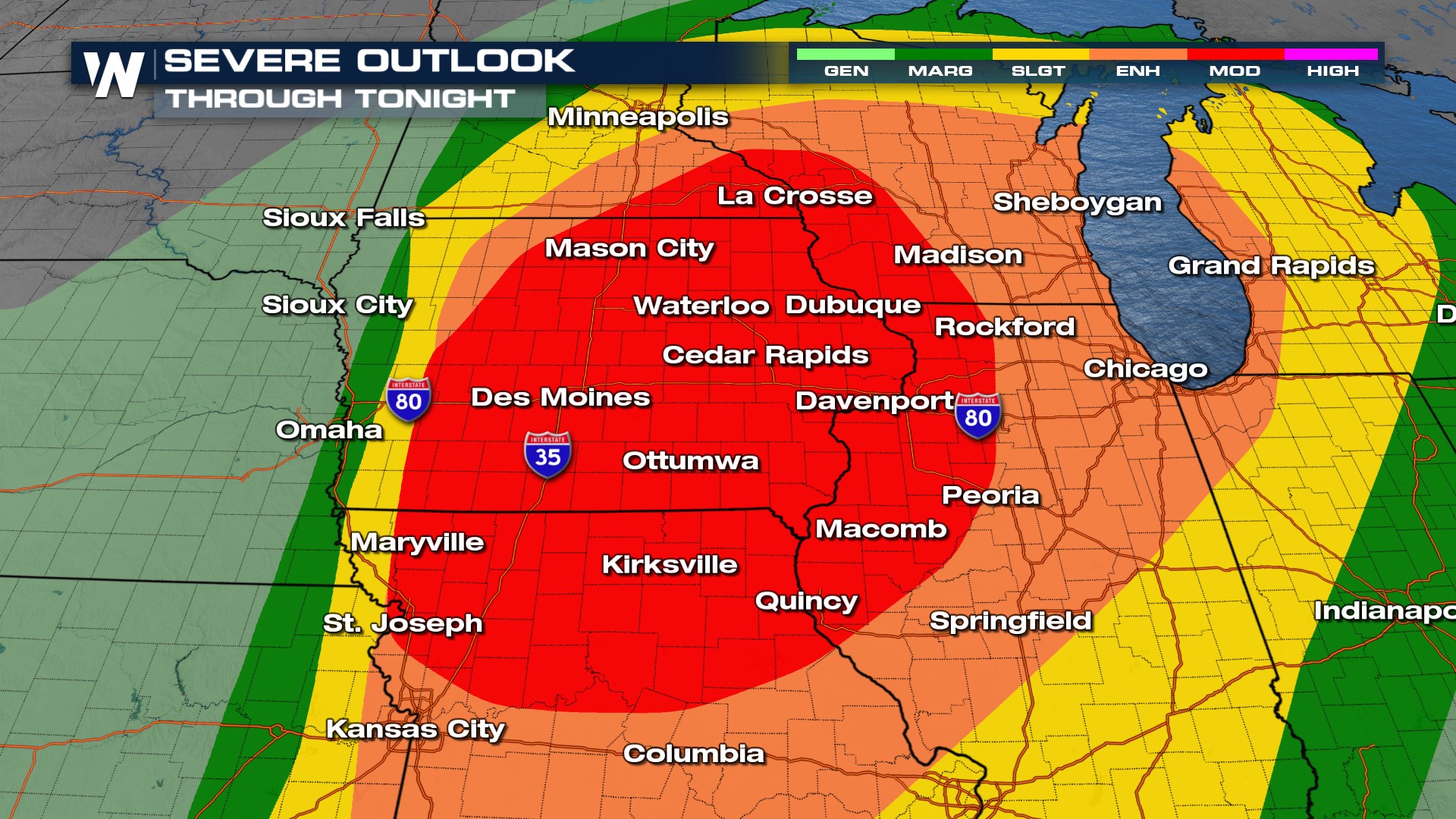
 There was a widespread ENHANCED risk in the Upper Midwest with a MODERATE risk in Wisconsin and Illinois. This is our third moderate in the month of May.
 This comes after torrential rainfall and flash flooding in Omaha, with over 6" of rainfall in less than 12 hours in the city. These regions have been particularly wet over the last couple of months so additional rainfall could quickly flood fields and make for high-running rivers, creeks, and streams. For more on the flood threat, check out this article.


