Snow Returns to Ski Country

It's been a slow start to the ski season for a lot of our resorts out west, so any snow in the forecast should bring a little hope to the skiers and boarders out there. Winter weather alerts have been issued across the Four Corners through Friday. Totals will vary based on elevation.
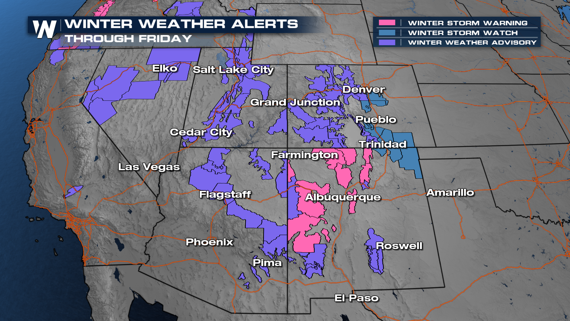
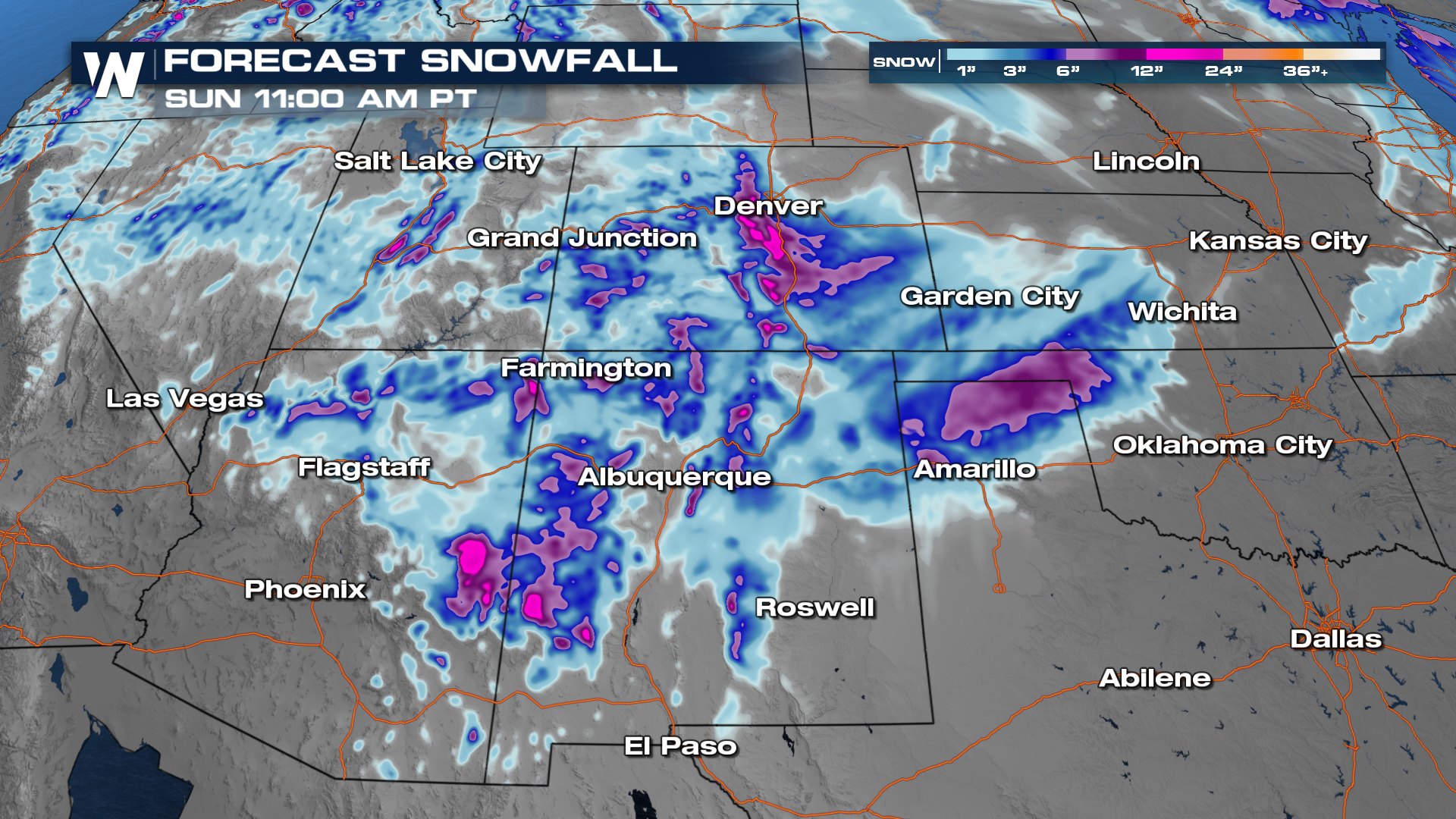
Across Arizona and New Mexico, we've been getting rainfall, and that will continue overnight. In the meantime, snow will start to pile up in Colorado, Utah, and the higher elevations of the southern Four Corners.
Through Friday, some of our ski resorts could max out around a foot. For the Colorado Rockies and resorts of Utah, we'll be fortunate enough if we see around 9" to one foot for resorts like Vail and Steamboat Springs.
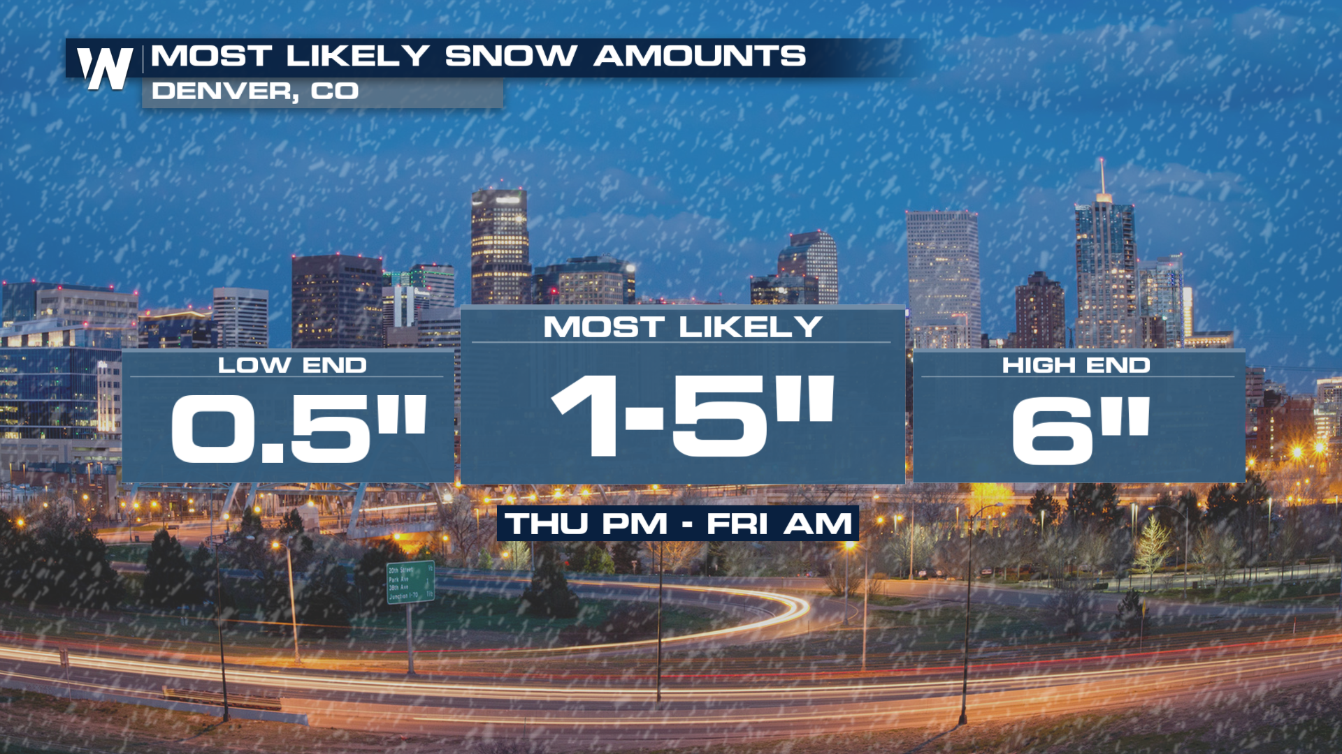
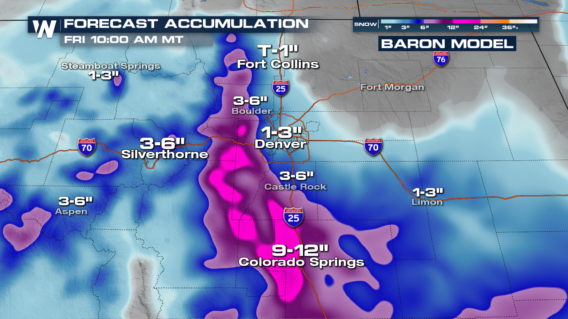
Denver Area
Models are starting to get better correlated on what the outcome for Thursday's snowfall is. Temperatures look to be a bit cooler, cool enough to support upwards of 1-5" of snow in the Denver area.
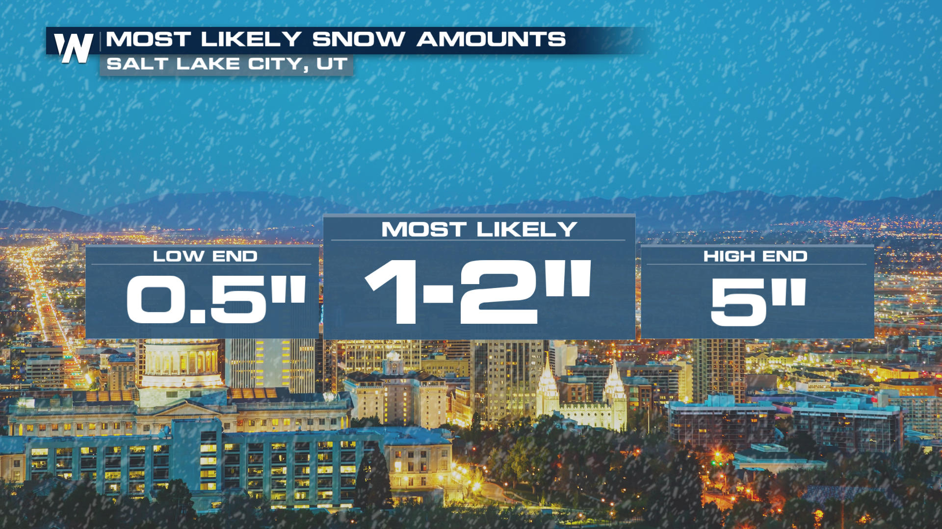
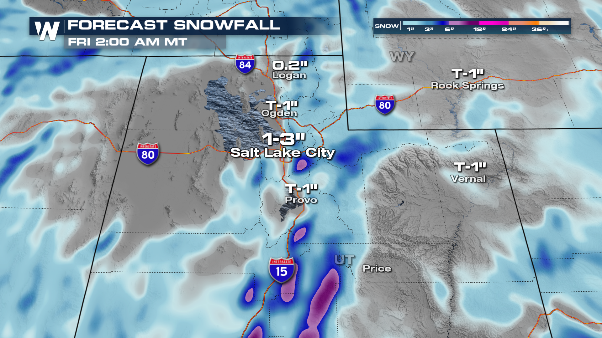
Salt Lake City
SLC has seen barely any snow this season. So far, we've only had 0.1" of snow downtown. The forecast from the National Weather Service has a forecast of 1-2" in the city.
Whether you're hopeful or skeptical of this forecast, be sure to join us on WeatherNation live for the latest breakdown of these forecasts!


