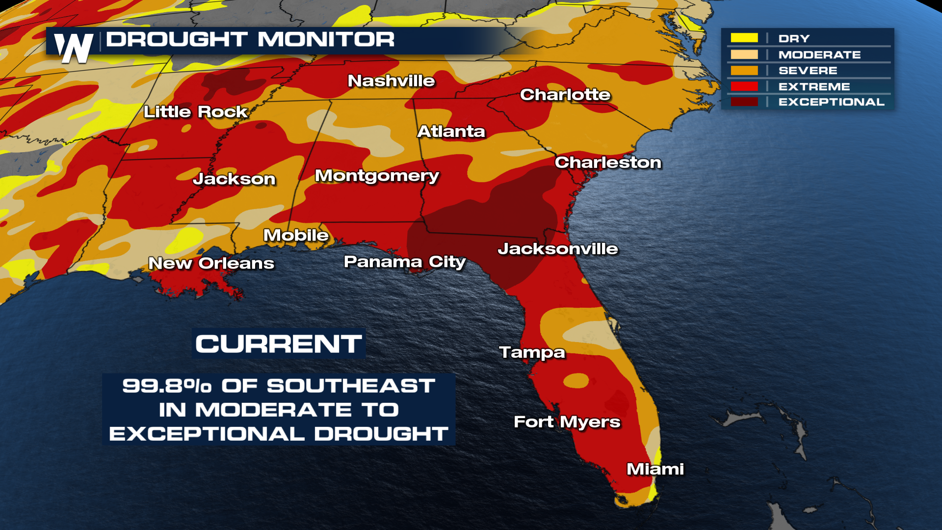
Southeast Rain Brings Relief, But Drought and Wildfire Threats Persist

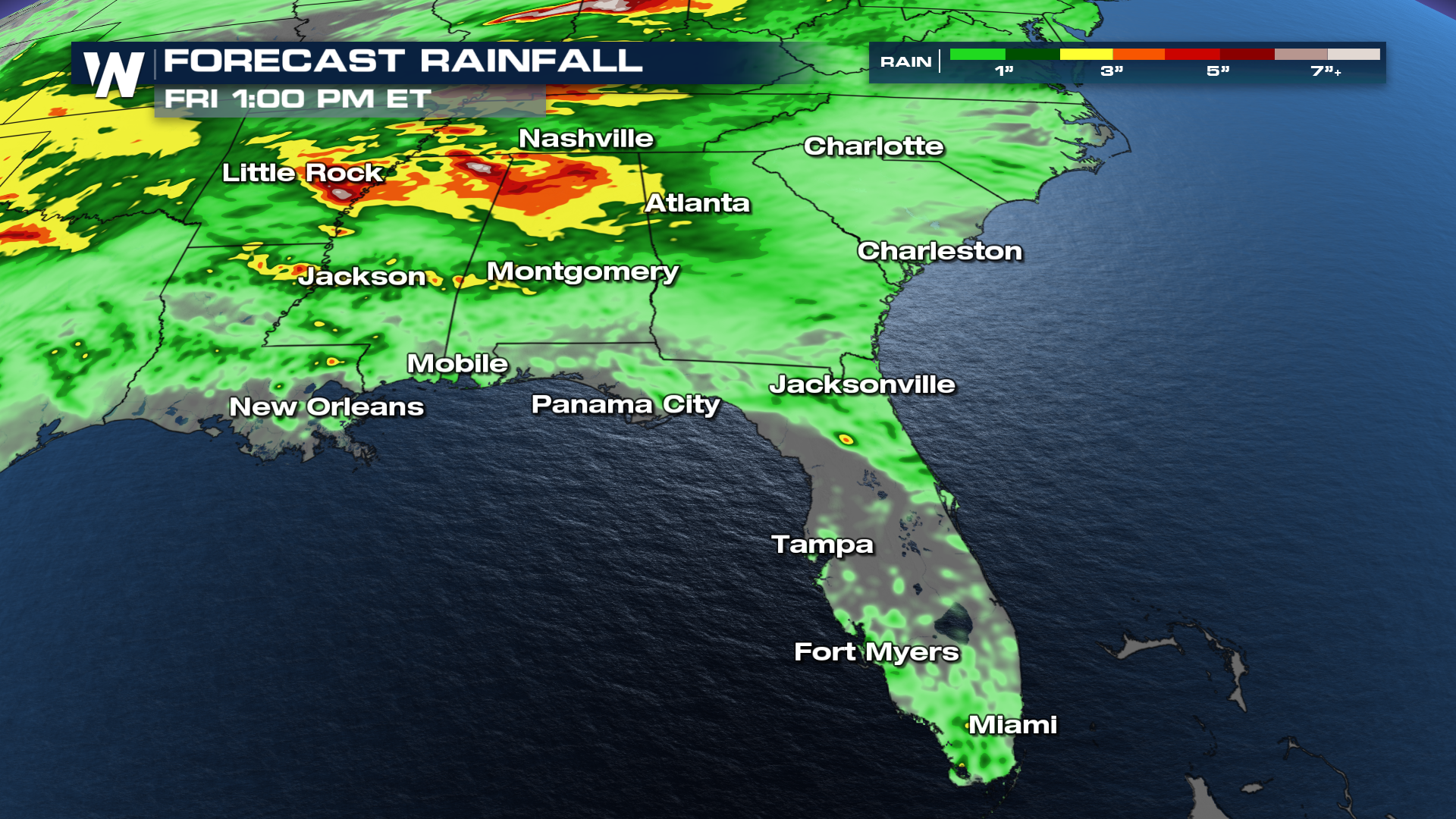
Rounds of rain are set to return to the Southeast through the end of April, offering some much-needed moisture to a region that has been dealing with unusually dry conditions. While several systems are expected to bring periods of steady rain and thunderstorms, the rainfall will likely fall short of fully reversing the ongoing drought. Many areas across the region have recorded well below-average precipitation in recent weeks, leaving soils parched and waterways running low.
 Even with pockets of heavier rain, totals will be inconsistent, meaning not all drought-stricken locations will benefit equally. Some communities could see meaningful improvement, but others may miss out on the heaviest downpours altogether. This uneven distribution limits the overall impact and slows any long-term recovery.
The heaviest of the rainfall over the next few days looks to be across Mississippi and Alabama. However, it might not get all of us - the latest models are avoiding northern Florida/southern Georgia, where we desperately need it.
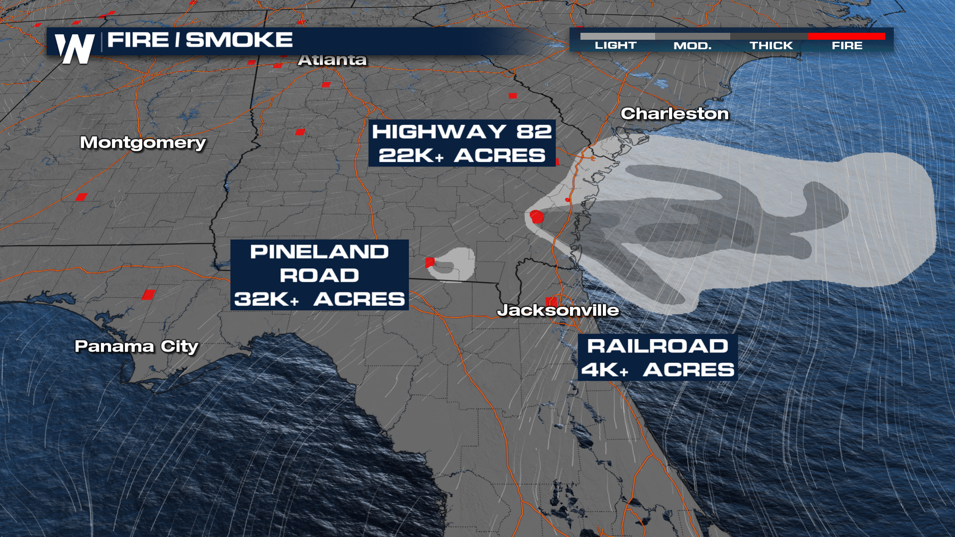
 The continued dryness has also heightened wildfire concerns across parts of the Southeast. There are still several fires burning between Georgia and Florida that are spreading smoke across the Southeast. If you have upper respiratory issues, limit the time spent outdoors. The air quality near these fires could be significantly impacted.
More details on your Eastern Regional Forecast can be found :10 past the hour on WeatherNation.


