Looking Back at Last Week's Severe Storms

Top Image: Brett Adair
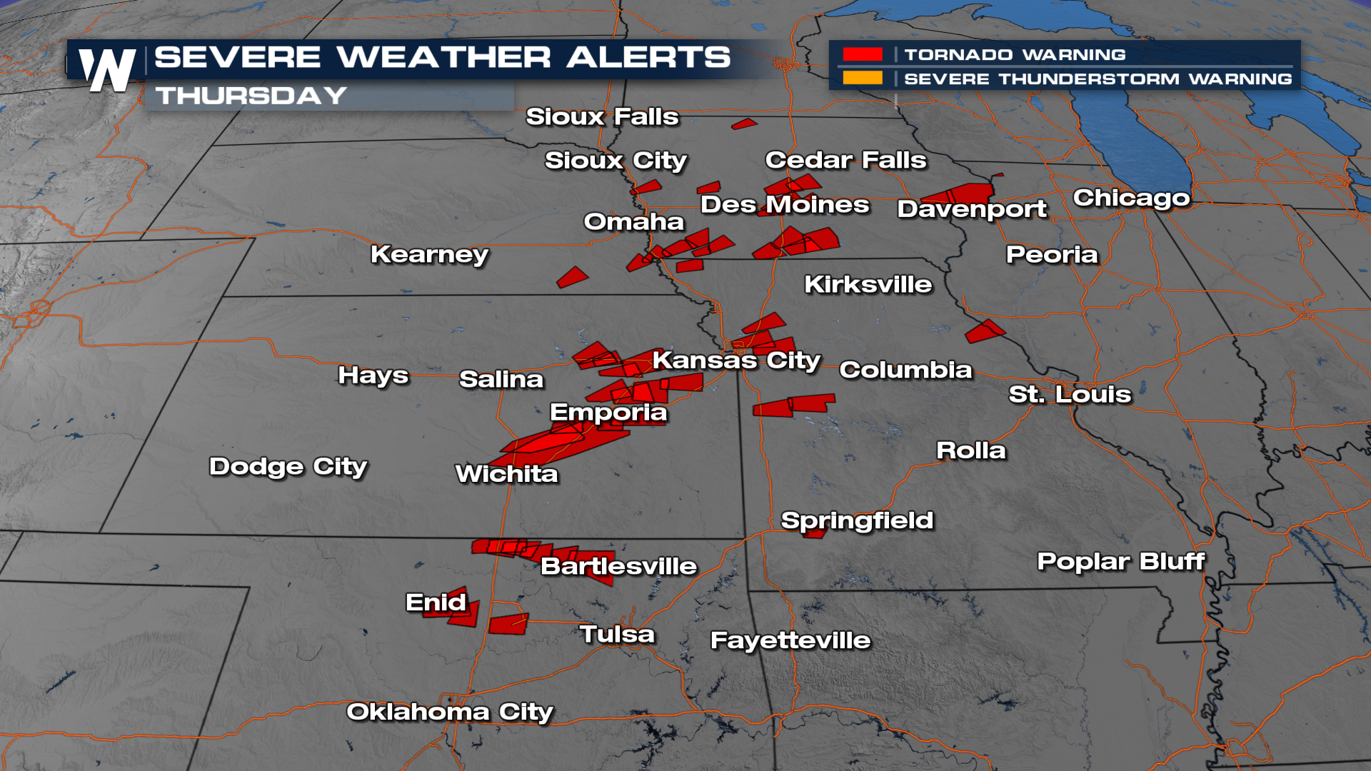
Several strong tornadoes tore across portions of the Great Plains and Midwest on Thursday, causing damage, notably in the town of Enid, Oklahoma. WeatherNation field correspondent Brett Adair captured a different tornado near Braman, Oklahoma (below). In contrast, correspondents Brandon Clement and Jonathan Petramala caught the Enid tornado during and after its tear through town.
Jonathan provided an update late Thursday as emergency crews were combing through collapsed buildings in Enid. Thankfully, the Sheriff's office has reported only minor injuries so far.
Tornado warnings were issued across six different states on Thursday, with about 21 reports of tornadoes coming in. Some of those reports will be from the same tornado, so we'll have to wait for damage surveys to confirm numbers and intensity (EF) ratings.
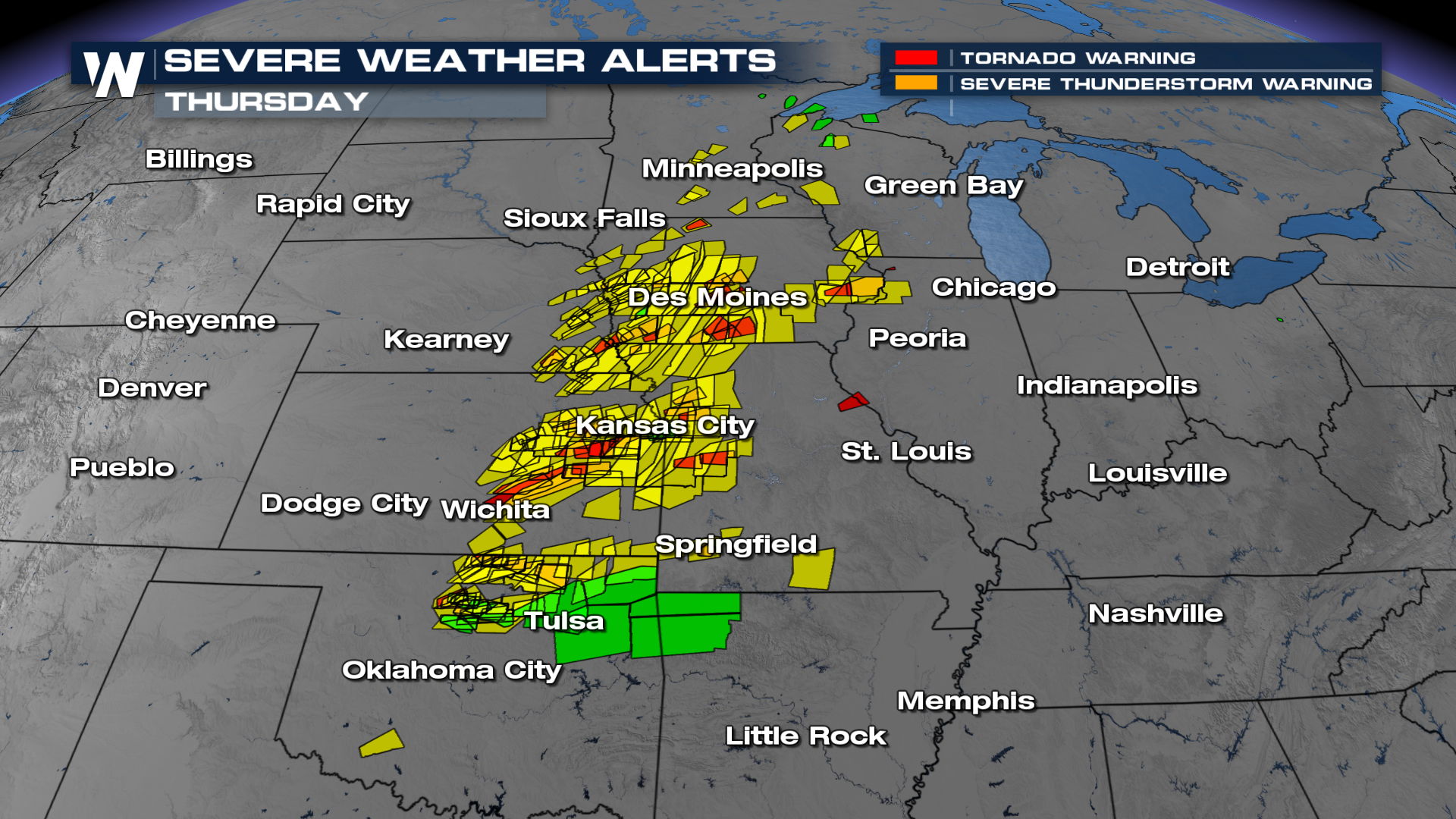
 Aside from the tornado warnings, severe thunderstorms were numerous on Friday! Storms produced hurricane-force wind gusts and hail up to the size of softballs!
 Radar Review
The Braman and Enid tornadoes formed from supercell thunderstorms, each producing a classic "hook echo" while the tornadoes were mature. The storms eventually congealed into a line that produced additional severe weather and heavy rain, leading to flash flood warnings.
Farther north, tornado warnings started earlier in the day for areas around the I-29 corridor, with a picturesque tornado captured near Little Sioux, IA (video below the radar loop). Additional severe storms, including confirmed tornadoes, formed through the afternoon and into the evening. You can see the squall line with a tornado-warned storm move through the Kansas City area in the evening. This occurred while the Chiefs were making their selection in the NFL draft, forcing some personnel around the building to huddle near the draft room, which is in the middle of the building (a safer location to shelter from a tornado).
This story will be updated with tornado damage surveys as they come in. Check back for updates!


