Southeast Flood Risk Lingers Near Stalled Front

A stalled boundary over the Southeast will keep storms in the forecast into the weekend, leading to an increased risk for flash flooding.
Flooding
Flash flooding was an issue Friday across parts of North Georgia and Northern Alabama with the slow-moving showers and storms. Another batch of storms will keep the flooding threat on the table as we move into this weekend. Make sure you have a plan of action if high water becomes an issue in your neighborhood.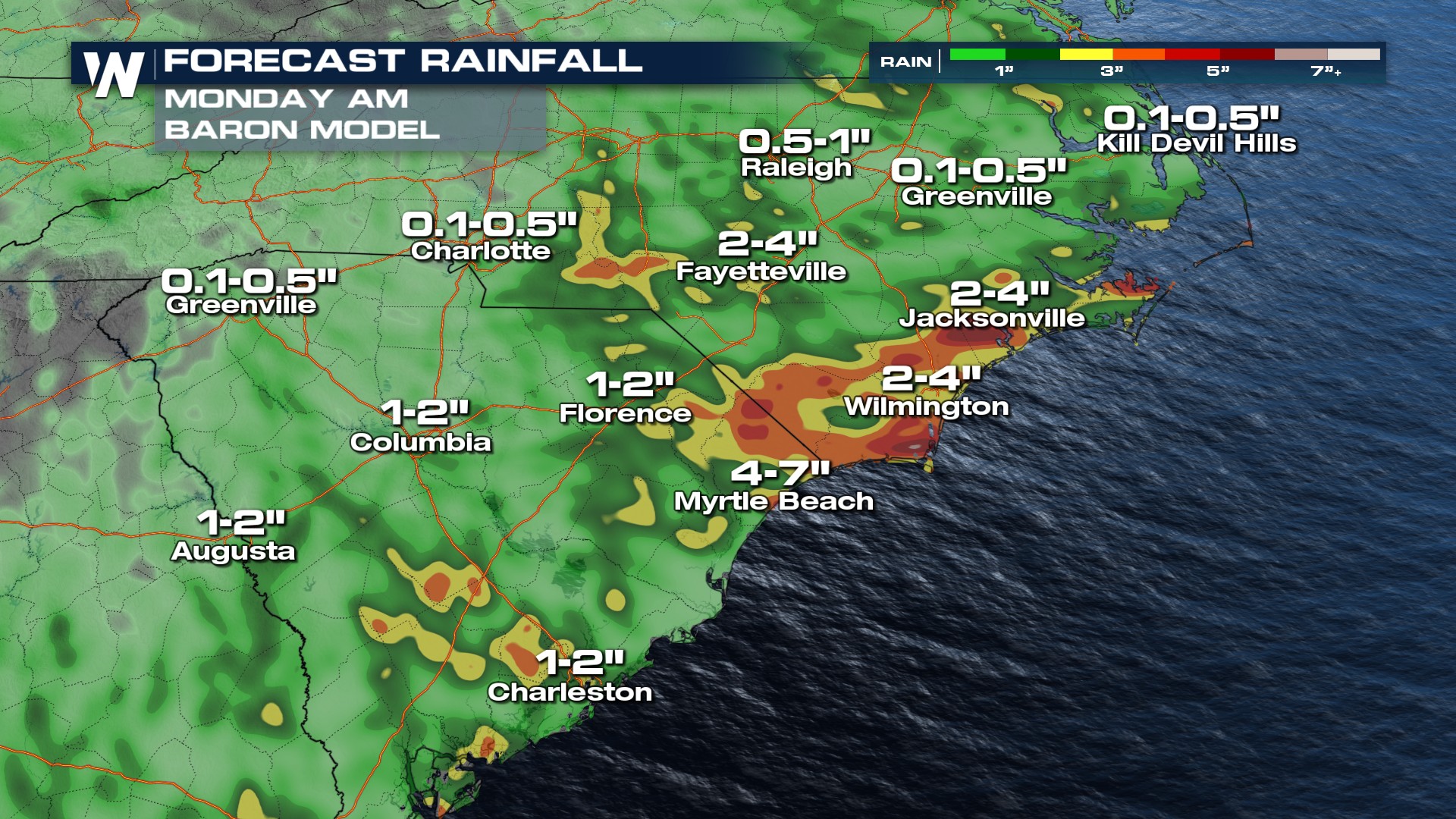
All the rain that has fallen in the last month will keep the flood risk ongoing for many spots in the Mid-Atlantic.
Timing
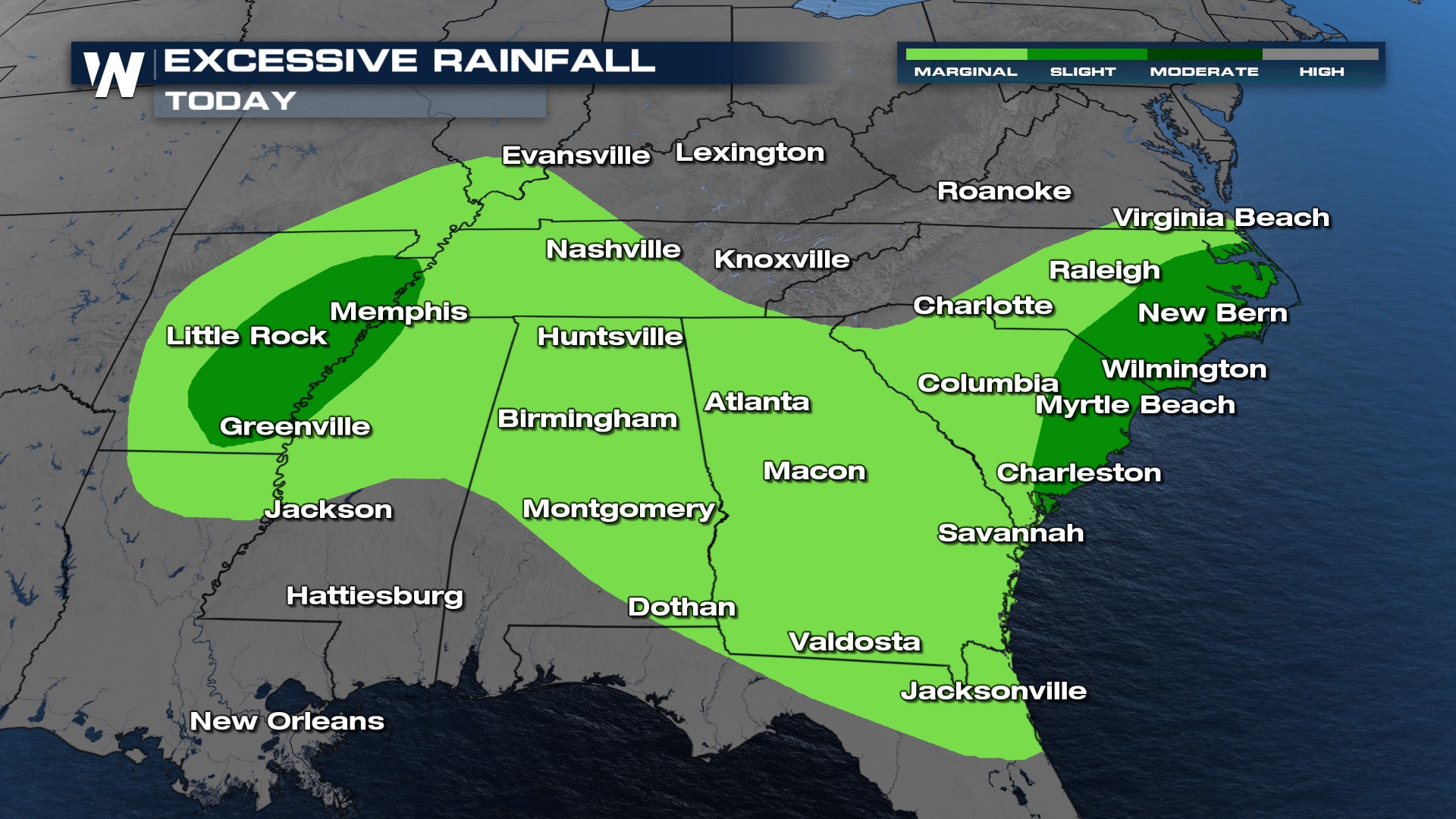
Showers and storms will continue Saturday across the Southeast. Flash flooding and even a few isolated strong storms will be possible this weekend. As the front drops south, more concentrated storm chances will move into the Sunshine State. Storms capable of producing damaging winds will be possible.
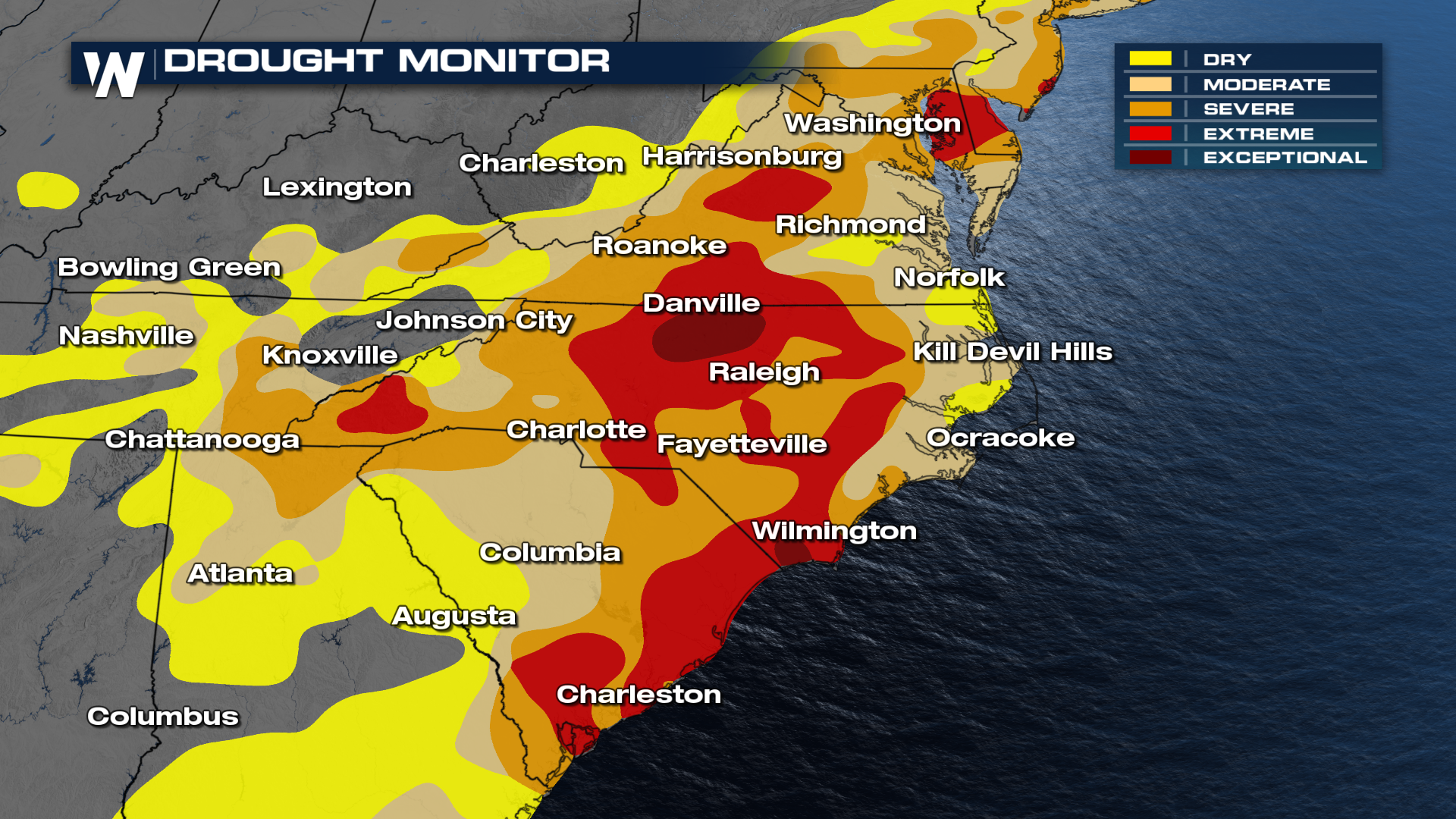
Despite this last week, it's been pretty dry for the Carolinas. Recent updates from the drought monitor show an extreme to even exceptional drought across the Carolinas. Hopefully, all this rain can offset some of those concerns.
Make sure to tune into WeatherNation for the full east breakdown at :10 past the hour! Always remember, turn around and don't drown!


