Florida Storms Bring Isolated Flooding

Top Stories
4 May 2026 12:55 AM
Rainfall & Forecast
Afternoon thunderstorms are in the forecast for South Florida for the next couple of afternoons, bringing some isolated downpours to the region. The threat for severe thunderstorms is not in the forecast.
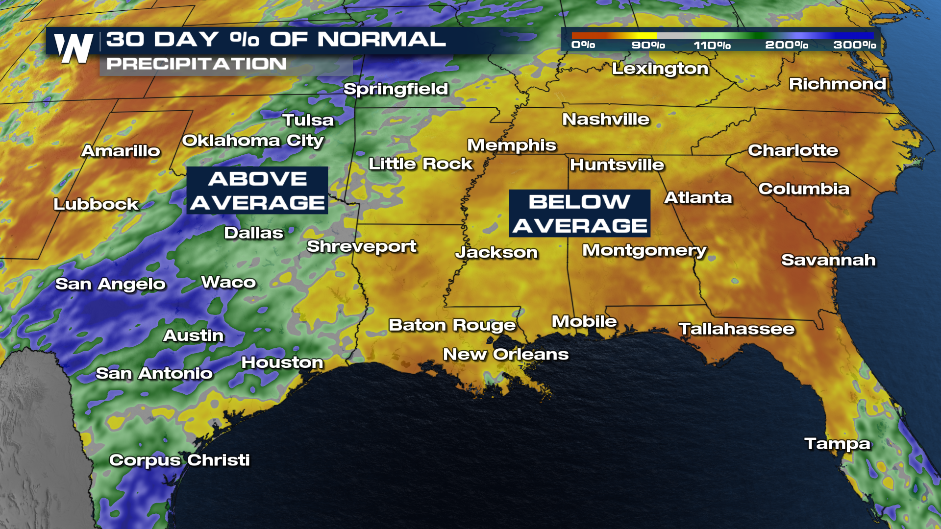
There are many areas, especially across the southeast, that desperately need more rainfall.
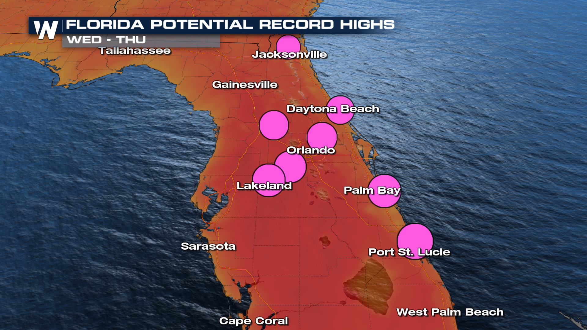
 As we head into Tuesday and Wednesday a ridge of high pressure is expected to shift into Florida to bring in the potential for record high temperatures.
Cities like Jacksonville and Orlando are expected to break those records on Wednesday with highs in the low 90s.
 For more on this, be sure to join us live at :10 pas the hour.
All Weather News
More

Severe Storms, Flash Flooding Overnight In Midwest
WHAT TO EXPECTIt was a very active day across
22 Jun 2026 1:50 AM


Summer Solstice Kicks Off Father's Day Sunday
Fathers across the country will have to share
21 Jun 2026 5:20 PM

Flood Risk Continues This Weekend for the Gulf Coast States
Numerous flash flood warnings were issued as
21 Jun 2026 1:15 PM

Dry T-Storms & Fire Danger in the West
A weak low-pressure system moving through the
20 Jun 2026 1:40 PM

Tornadoes Tear Through The Midwest, Isolated Severe Storms in the South
EARLIER THIS WEEKMONTROSE, IL - A dangerous t
20 Jun 2026 1:30 AM