Front Range Overnight Storms, More Thursday and Friday

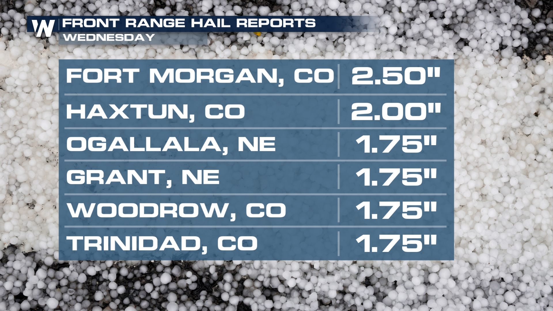
FRONT RANGE - Large hail and strong winds pushed through portions of Colorado, Wyoming, and into the Plains on Wednesday. The severe storm threat continues for these areas through the overnight hours. Hail during the day topped out at 2.5" near Fort Morgan, Colorado.
Severe Outlooks
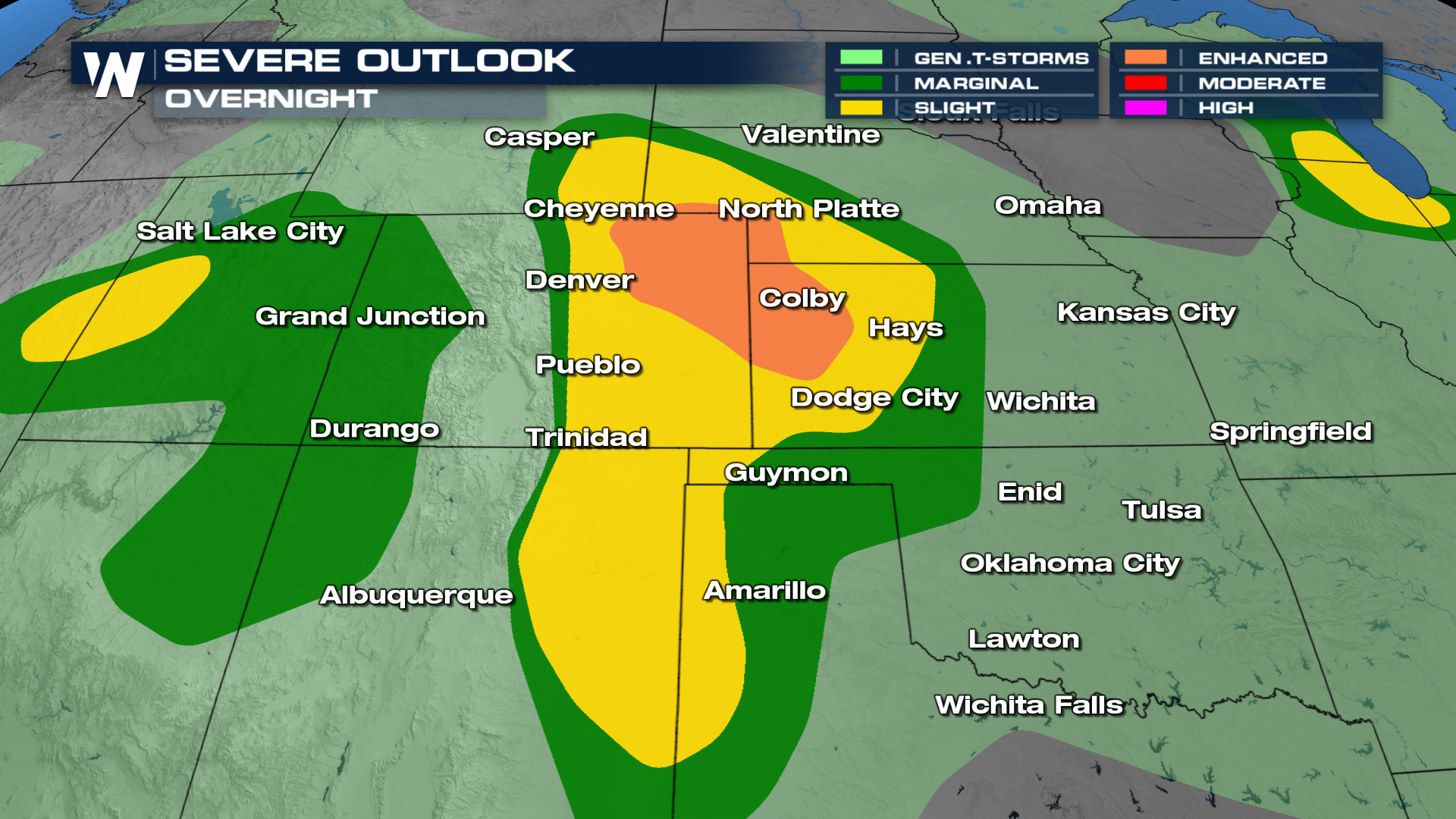
The SPC has maintained an ENHANCED risk (level 3 out of 5) for severe weather across portions of Colorado, Nebraska, and Wyoming through Thursday morning. Destructive winds and very large hail remain possible with severe storms that form off the Rockies. Be sure to protect your property before the storms arrive.
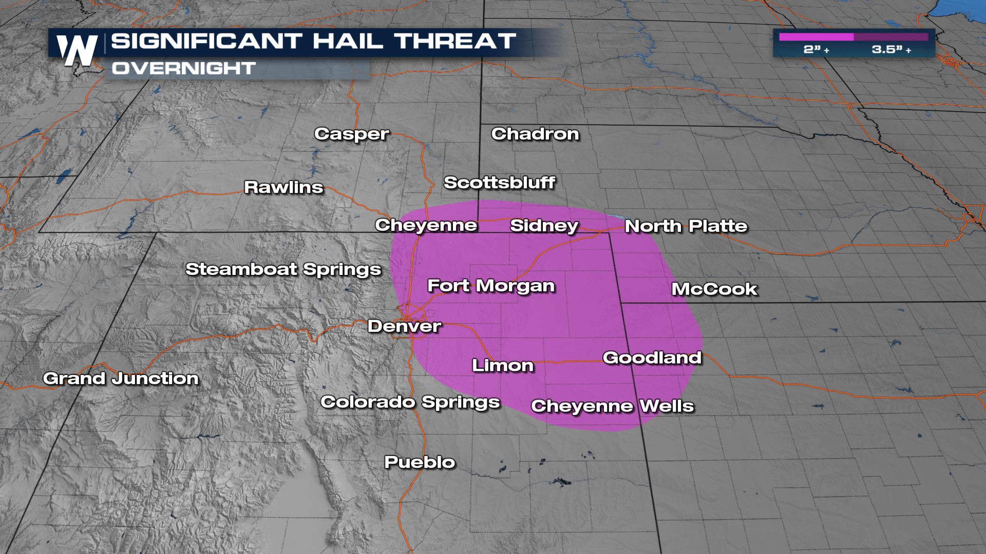
For Thursday, we'll see a similar setup persisting. A SLIGHT (level 2 out of 5) risk has been issued for relatively the same areas. This outlook, however, extents into the Southern Plains as well.
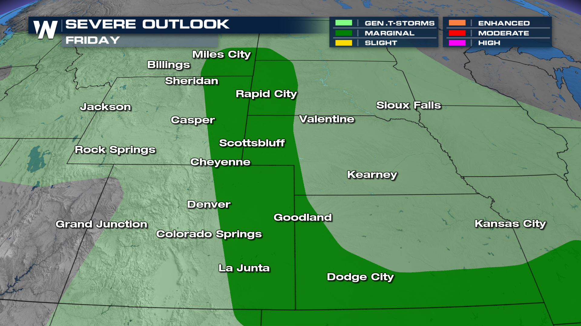
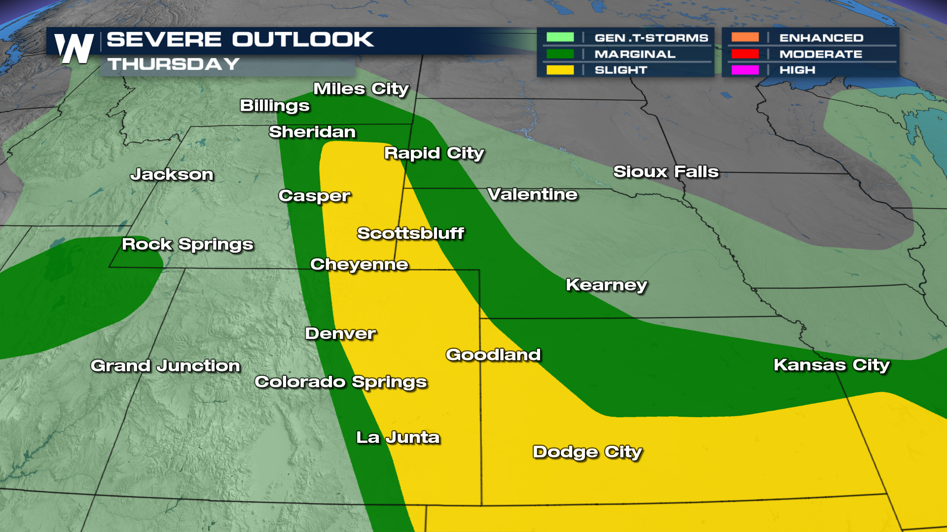 On Friday, a level 1 out of 5, MARGINAL, risk is in place for the same spots as thunderstorms fire off the same region and into the High Plains.
FORECAST
Strong to severe storms will continue through the night across the front range with all modes of severe weather possible from Colorado, Eastern Wyoming, and Western Nebraska. The Urban Corridor could see some strong storms too and the same process will pretty much repeat itself Thursday.
Stay tuned to WeatherNation for the latest. We've got you covered through everything severe weather!


