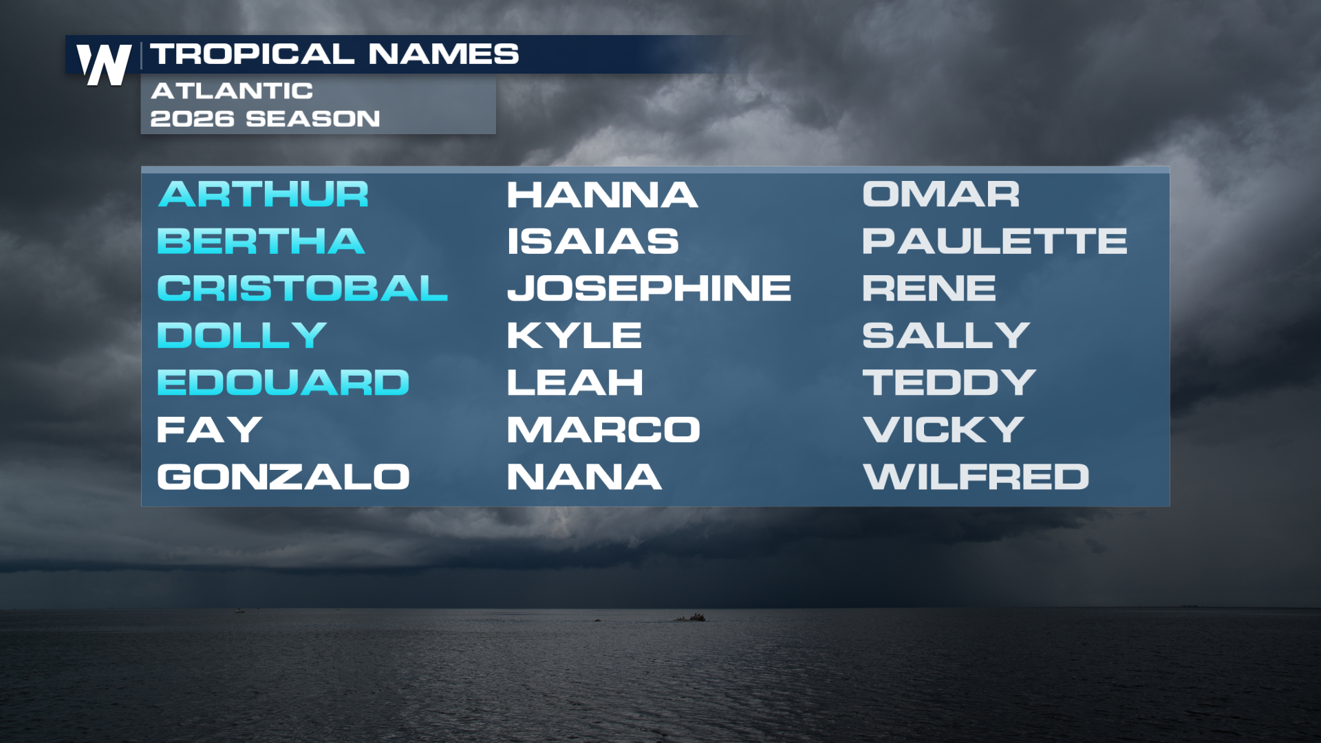
Eduoard Strengthens Near Landfall

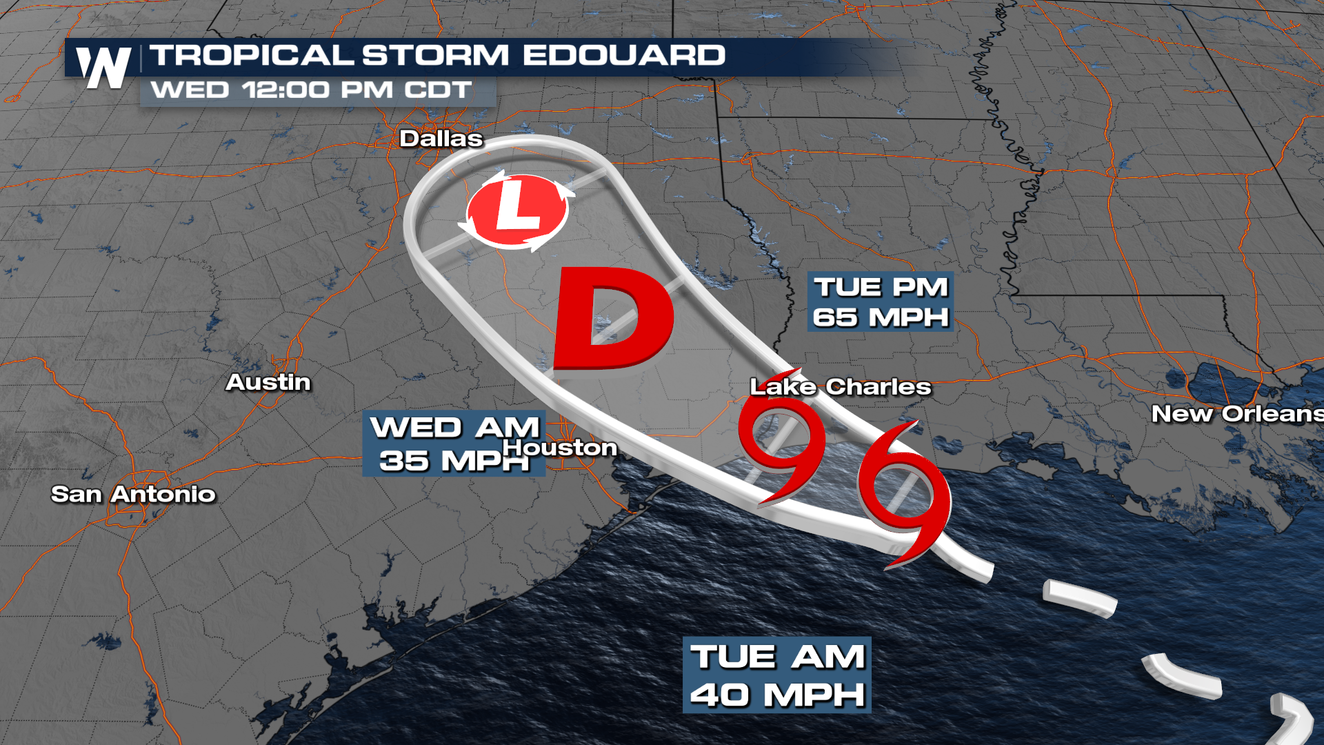
Tropical Storm Edouard has formed over the Northern Gulf. Strengthening to near Category 1 strength is expected before it makes landfall around midday. Areas along the Gulf can see 3-6 inches of rain (isolated 9"+) and a storm surge up to 4 feet. The biggest concerns will be along the coast, with flooding being the primary threat.
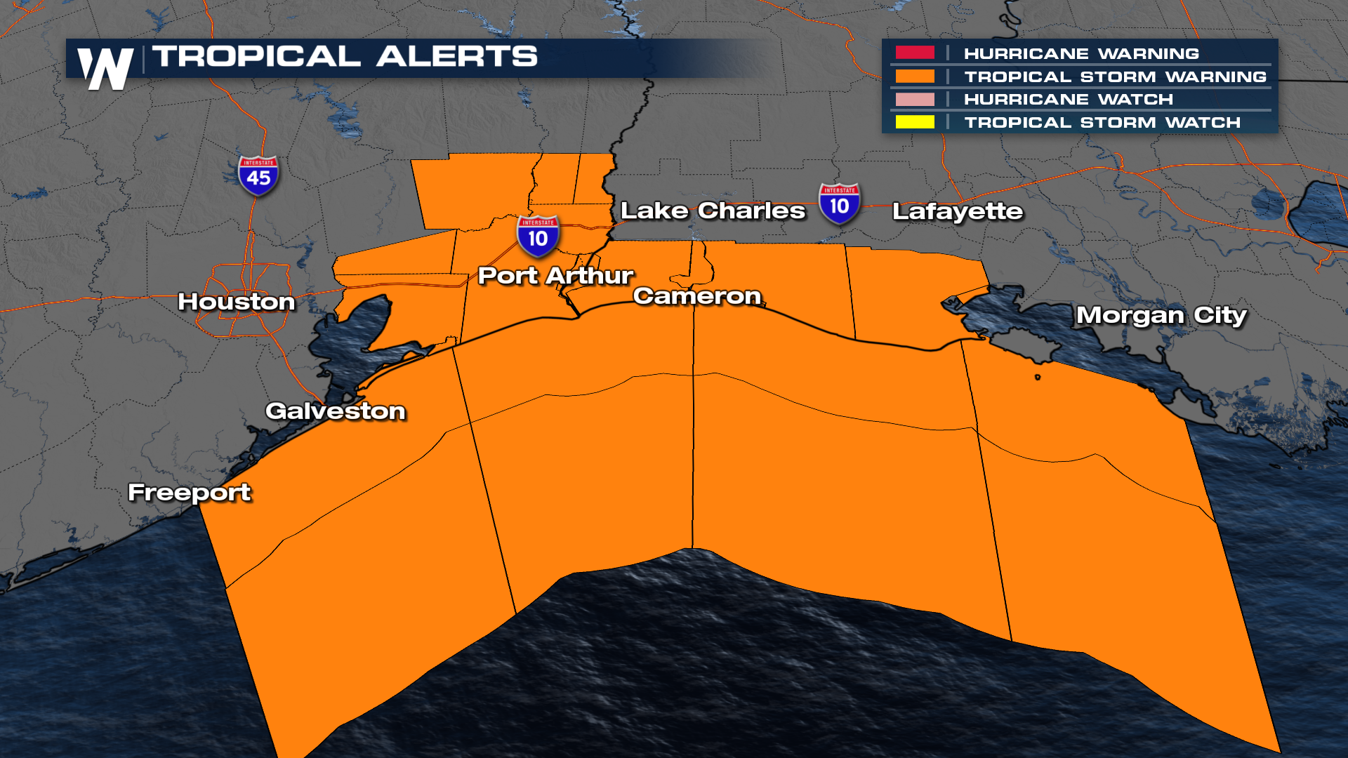
Tropical Storm Warnings are in effect for portions of the Upper Texas and Southwestern Louisiana Coast. These conditions are expected Tuesday morning. A Hurricane Watch is also in effect from High Island, TX to Cameron, LA, as gusts will likely approach Cat. 1 hurricane strength.
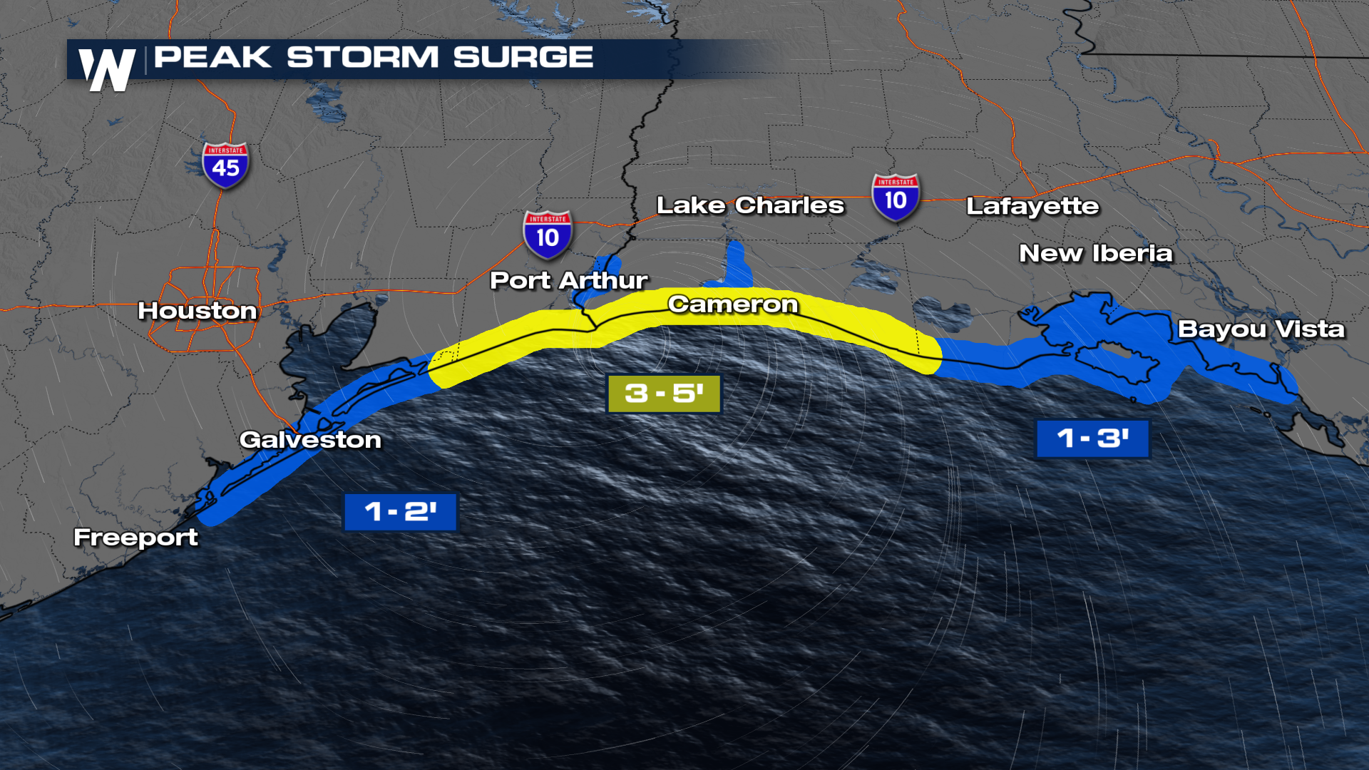
Storm Surge Warnings are in effect for a very similar area, from High Island, TX to the Vermilion/Cameron Parish Line in Louisiana. Peak storm surge of 3-5 feet will be possible in these areas. Inundation of 1-3 feet will stretch from Freeport, TX to the central coastline of Louisiana.
Eduoard will be a compact system, with the strongest winds and heaviest rain close to its center. As this tropical system moves inland around midday, it will bring heavy rain and gusty winds through the Houston and Lake Charles metro areas. This moisture then pushes through Texas and up the I-45 corridor towards Dallas by Wednesday.
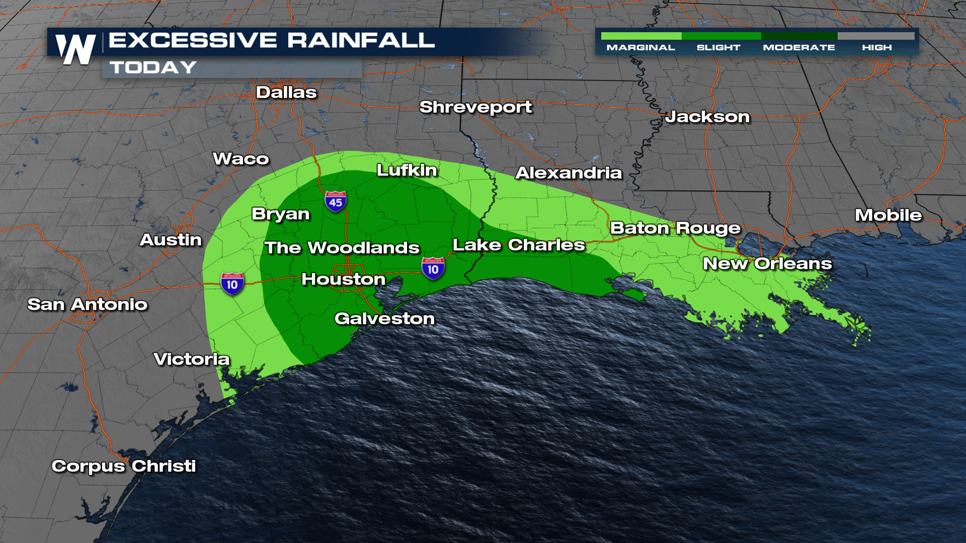
Threats for heavy rain and flooding have been issued from the Weather Prediction Center. There is a SLIGHT risk on Tuesday.
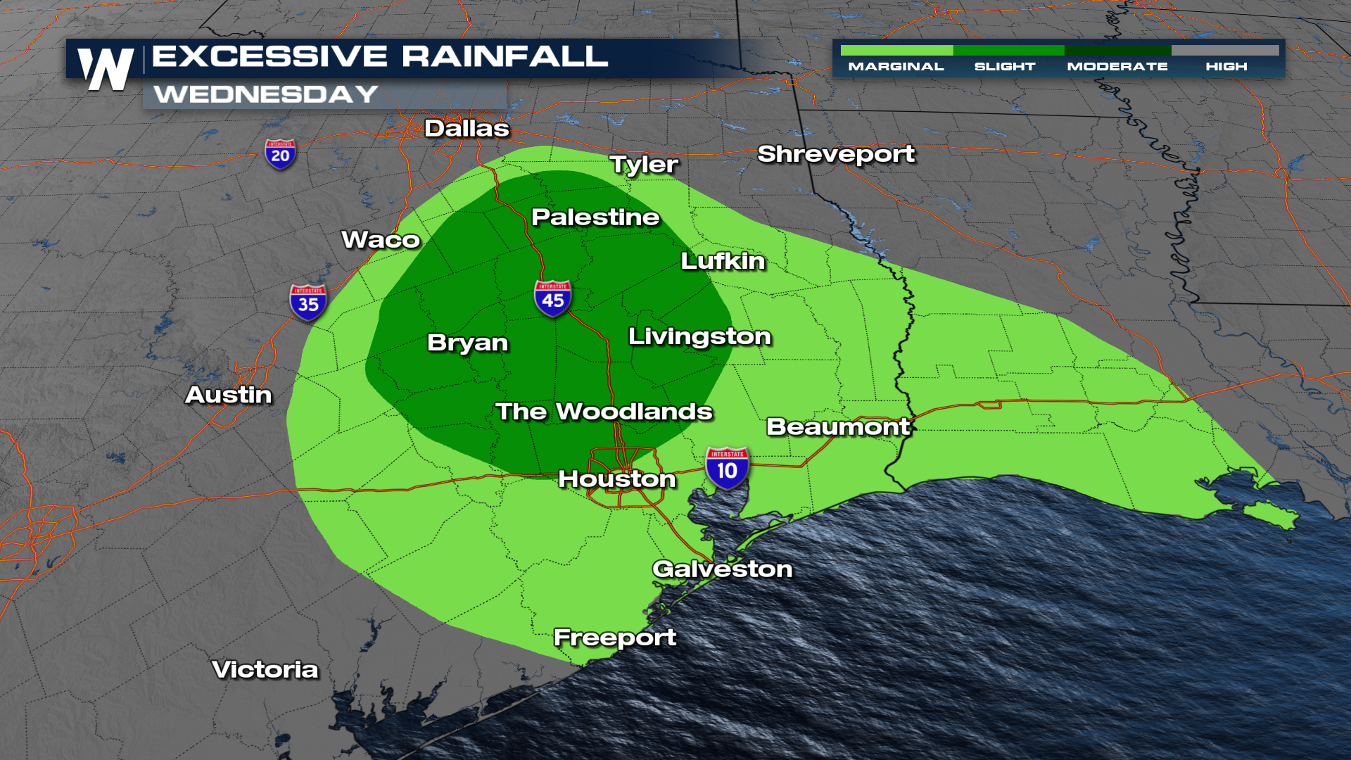
As this system pushes farther inland, the level 2, SLIGHT, risk for excessive rainfall expands up the I-45 corridor into more of east Texas.
El Niño has been smothering tropical waves in the Atlantic this summer, with four named storms to date but only 11% of average cyclone energy!
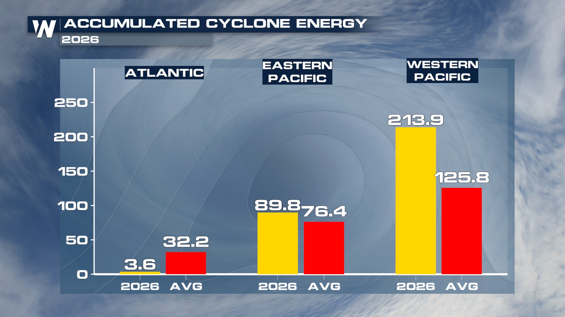 This doesn't mean the rest of the season will be just as quiet, however, as 66% of all hurricane activity in the Atlantic occurs between August 20th and October 10th. The climatological peak of Atlantic Hurricane Season is September 10.