Dry T-Storms & Fire Danger in the West

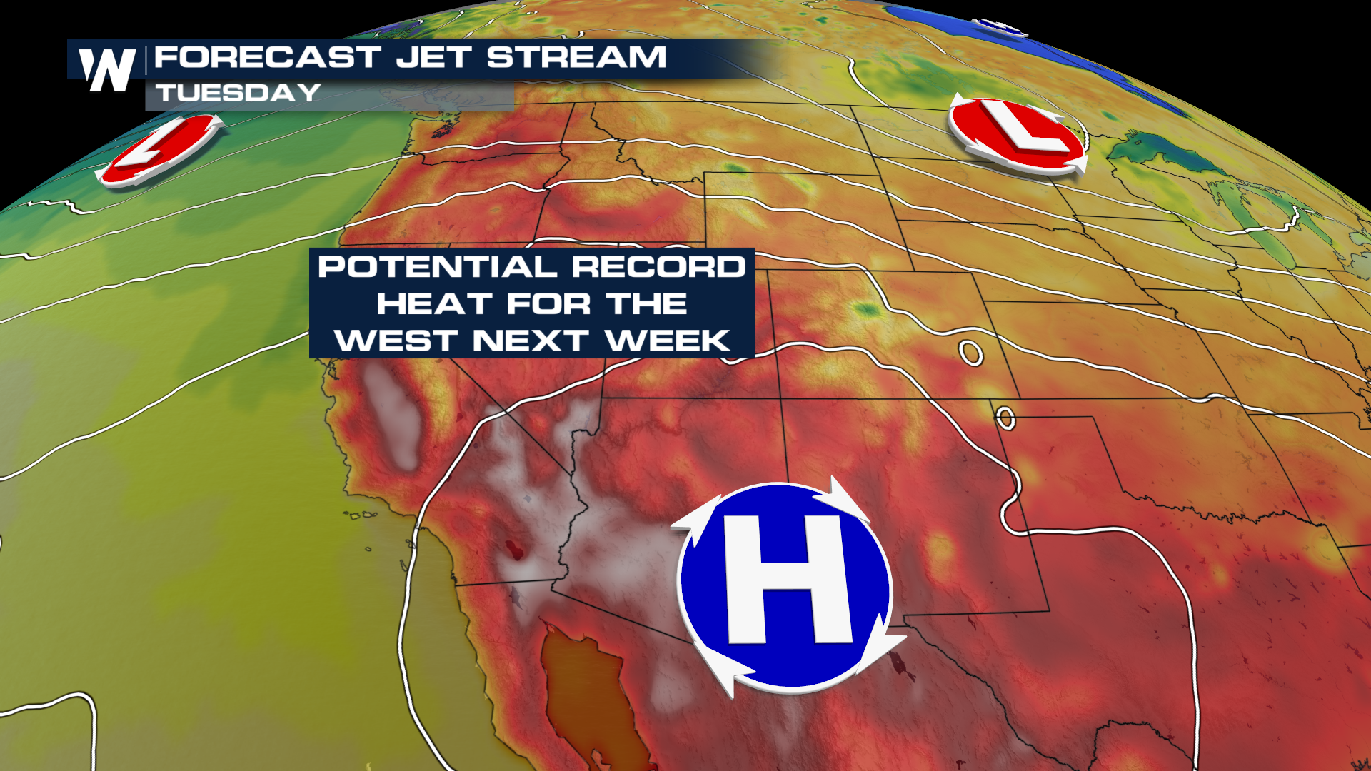
A weak low-pressure system moving through the Great Basin will help to increase fire danger Saturday for parts of the west, increasing gusty winds in the region and spurring thunderstorm activity. As the low moves into the Plains states, high pressure will build with record heat possible into next week.
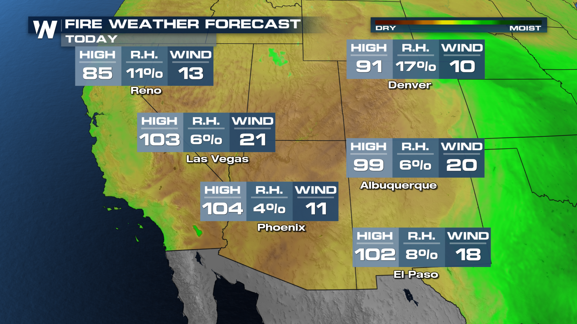
Warm and dry conditions will lead to drier fuels, while the low also provides higher winds. Humidity will be less than 10%in some areas with temperatures over 100 degrees. Combined with gusty winds, that's a recipe for high fire danger.
 In addition to dry and gusty conditions, the low will spur thunderstorms, with the potential for rain to evaporate before reaching the ground. Known as "dry thunderstorms," these storms can create new fires quickly, sometimes many at once.
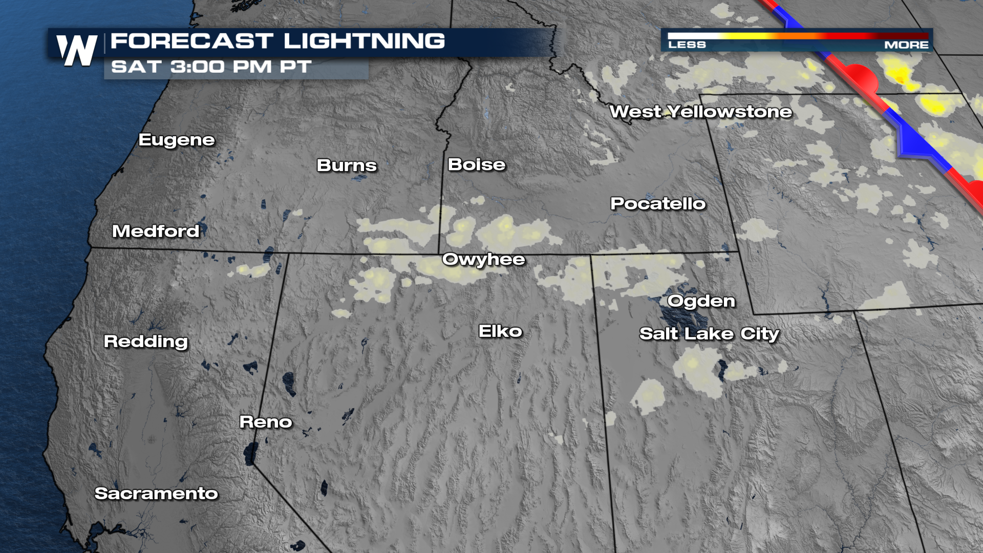 When dry thunderstorms are present, downdraft winds can be intense. As the rain evaporates, it cools rapidly and accelerates toward the ground. Gusts over 58 mph are possible Saturday in parts of Utah through SE Idaho and Wyoming.
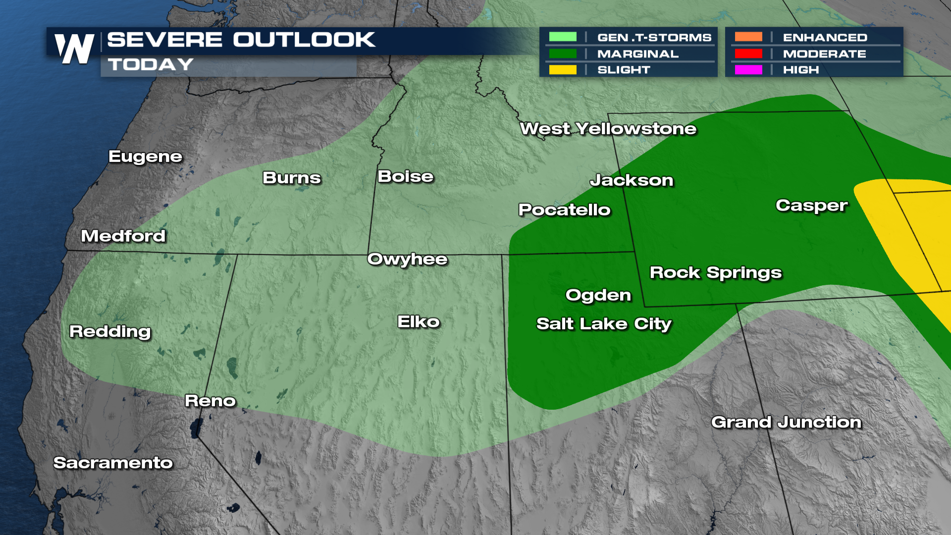 Storms should wrap up into the late evening hours. Storms should be less widespread on Saturday as the low shifts east.
Record heat will continue to contribute to fire danger next week across parts of the West. Oregon, Washington, Nevada, and California have the potential for record highs starting on Tuesday.