Severe Storms Target I-95 Saturday, D.C. to NYC

A series of frontal systems will keep the Northeast active with storms and heavy rainfall chances into the weekend. As a front approaches the coast on Saturday, scattered severe storms are expected with damaging winds possible. Flash flooding will also be a concern, especially in urban areas.
HEAT ALERTS
Warm southerly flow around the Bermuda high in the Western Atlantic is keeping the coast hot and humid on Saturday. Heat alerts have been issued where heat index values will range between 95 - 105° F. Take breaks from the sun in shade or air conditioning and be sure to drink lots of water.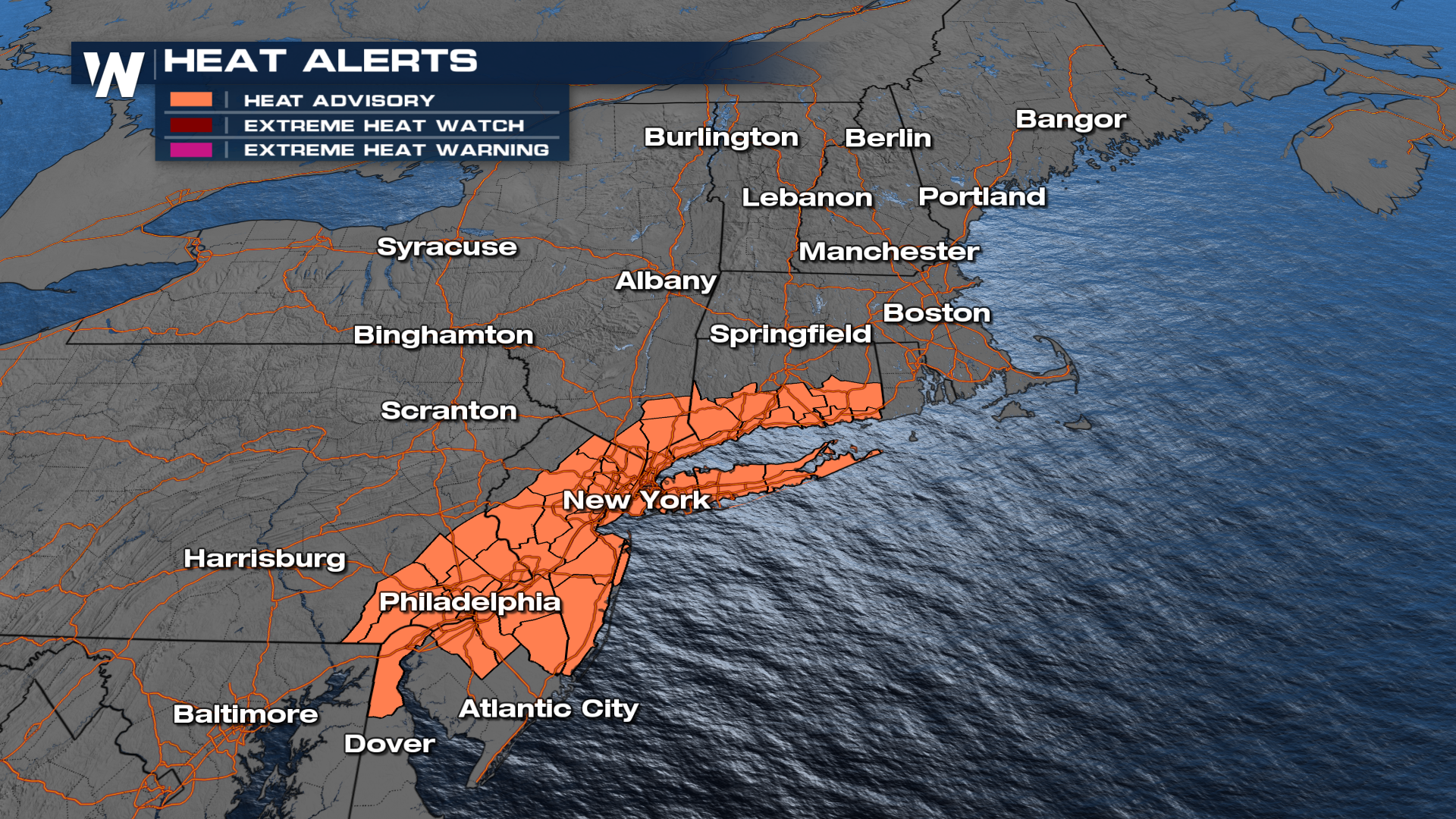
FORECAST
Friday's storms did produce several areas of damaging winds and flooding across parts of the Mid-Atlantic and Northeast. In the Northeast, wind gusts topped out at 58 mph in Pennsylvania. Saturday, more scattered storms are possible ahead of the cold front, which could lead to gusty winds and heavy rainfall. The best timing for the severe storms will occur during the afternoon and evening hours. The front should clear most of the Northeast on Sunday.
RAINFALL
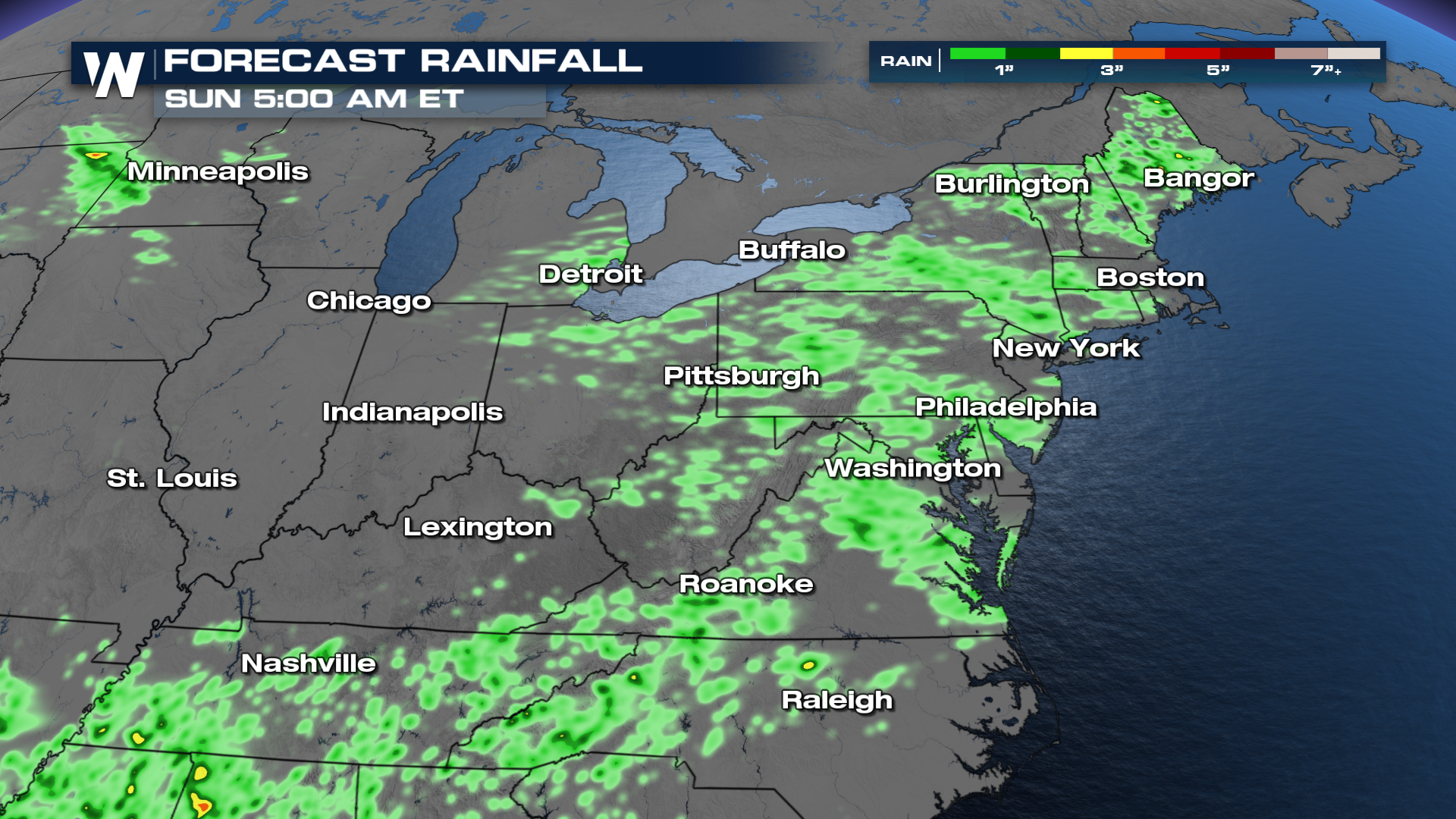 Rainfall totals don't appear off the charts, but with already saturated grounds, the flooding risk is certainly here.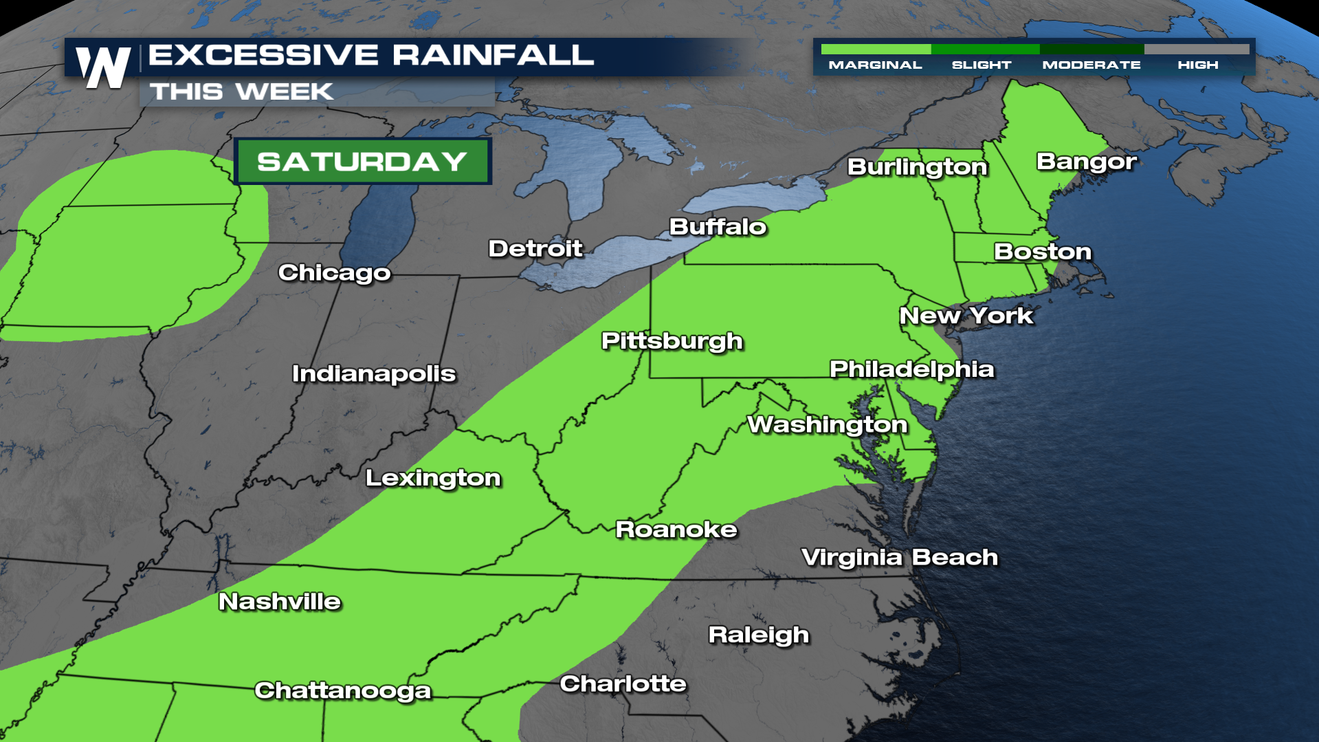
For more on this and any flood or severe alerts in your area, be sure to join us on WeatherNation for the latest.


