Severe Storms and Heavy Rain Across the East Coast

A stormy end to the week is taking shape for parts of the eastern U.S., where rounds of thunderstorms will bring torrential rain, localized flash flooding, damaging winds, and tornadoes. Thursday, storms produced significant damage across parts of Delaware and Pennsylvania. In Dover, a tornado hit, causing damage throughout the city. A high school near Lancaster, PA had its roof ripped off. Friday, storm surveys will be performed to assess some of the damage.
Showers and storms will linger into early Friday morning over areas of the Mid-Atlantic. The severe risk will diminish for the morning, and then the risk picks up during the afternoon and evening.
Urban communities will be particularly vulnerable. Heavy downpours can quickly overwhelm storm drains, leaving streets, underpasses, and other low-lying areas flooded. Areas that experience multiple storms could see the flooding risk increase as the ground becomes increasingly saturated.
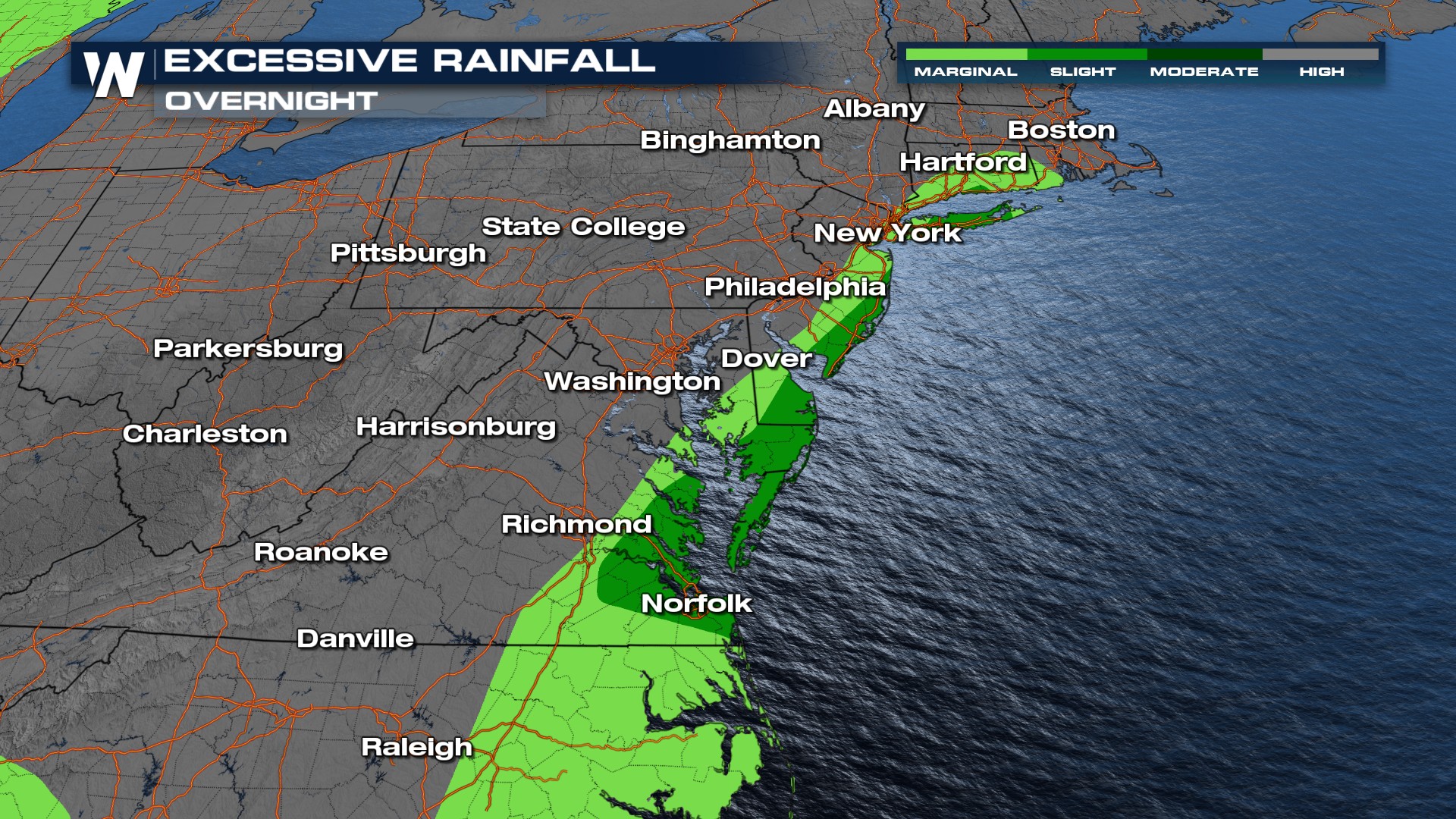
A cold front moving east will provide the trigger for showers and thunderstorms throughout the day. With plenty of moisture available, some storms will be capable of producing a large amount of rain in a short period of time.
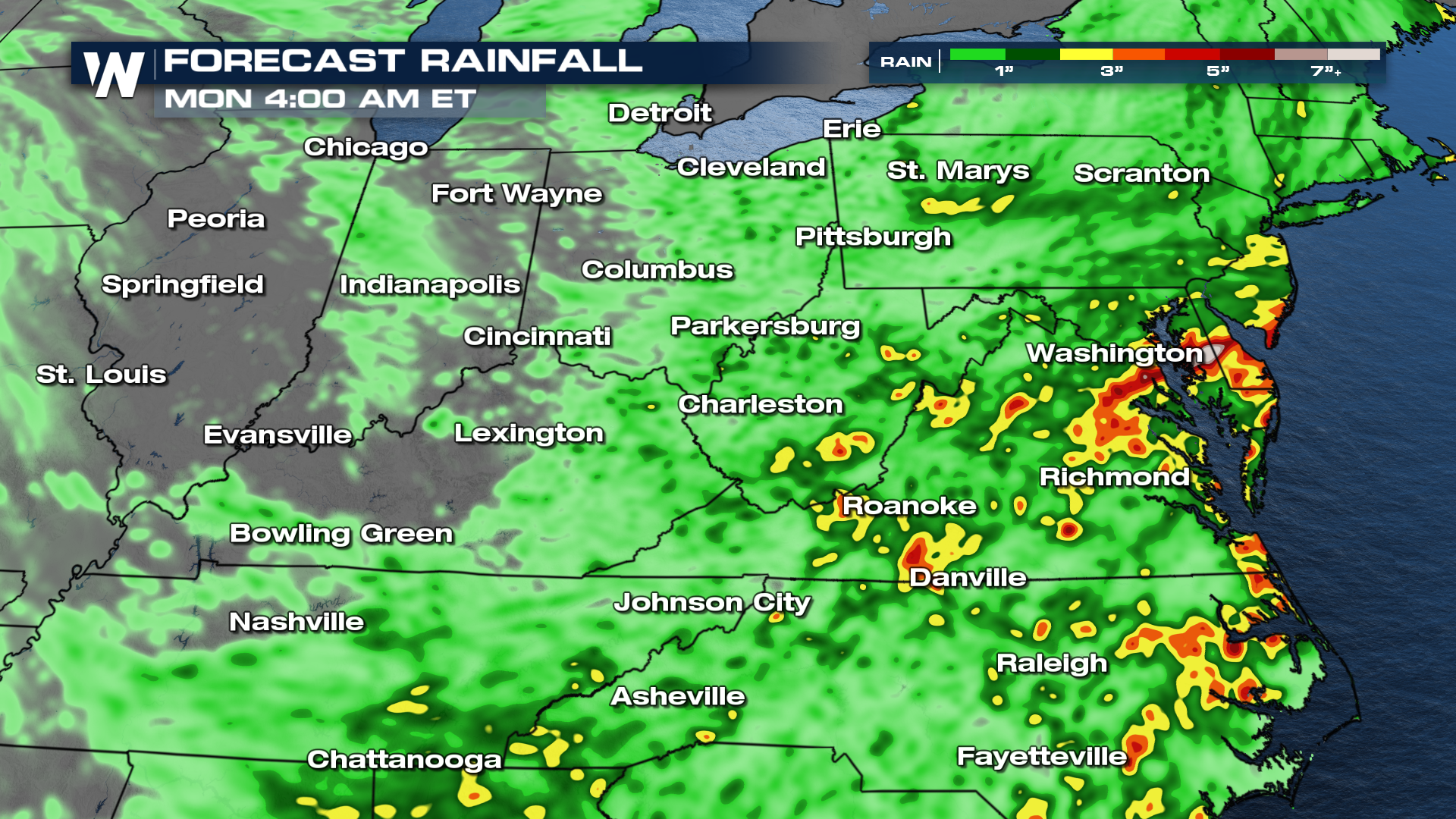 Friday, the focus for heavier rainfall and thunderstorms is expected to extend from parts of Virginia and North Carolina toward the Delmarva Peninsula and portions of South Carolina. Severe storms could extend all the way down to the Gulf Coast for Friday afternoon and evening.
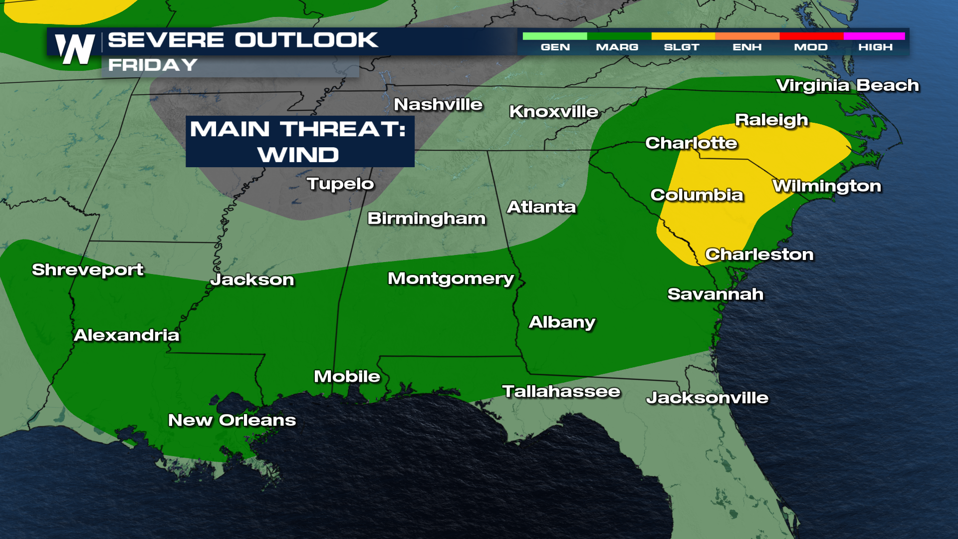
The front could linger near the East Coast rather than quickly clearing the region, allowing additional showers and storms to develop into the start of the weekend. Several inches of rain could accumulate in some locations, especially where thunderstorms repeatedly track over the same areas. If a roadway is covered by water, drivers should turn around and find another route. The depth of floodwater can be difficult to determine, and even relatively shallow moving water can create hazardous conditions for vehicles. Tune into WeatherNation TV for more details.


