Tornadoes Tear Through The Midwest, Isolated Severe Storms in the South

EARLIER THIS WEEK
MONTROSE, IL - A dangerous tornado tore through the town of Montrose, Illinois on Wednesday evening along the I-70 corridor, just miles after passing through Effingham. WeatherNation field meteorologist Brett Adair captured this tornado on camera and confirmed that homes were damaged, injuries and search and rescues were happening, and power lines were taken down as a result of this tornado.
The tornadoes that hit Effingham caused significant damage. Field correspondent Brian Emfinger spoke to residents after the tornado moved out of the area.
Tornado Ratings
The reports are coming in slowly across parts of Indiana and Illinois, but a few preliminary reports of EF-1s and EF-2s were found. Further information was released on Friday, with the Effingham, IL, tornado found to have caused EF-3 damage.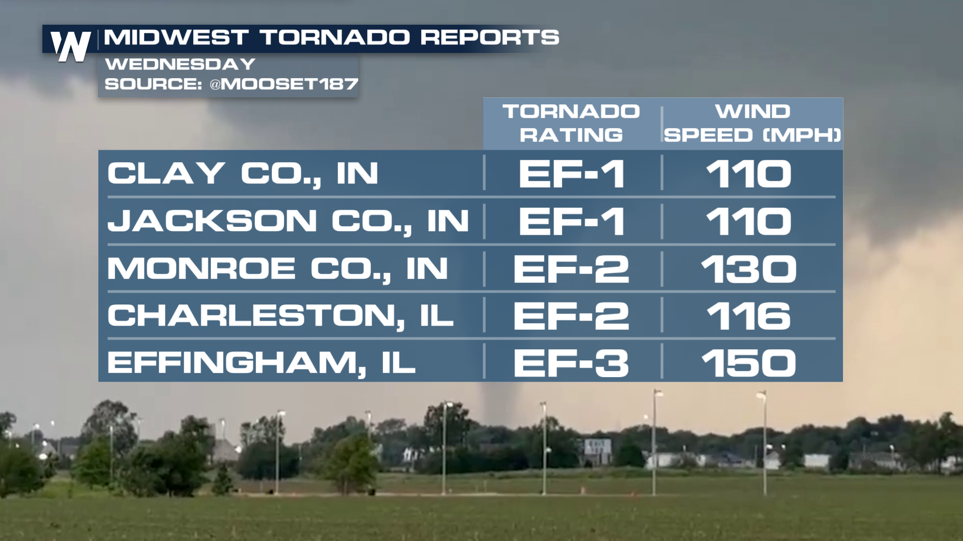
For more info on this forecast, tune into WeatherNation :10 and :30 past the hour for your eastern and central regional forecasts.


