Severe Weather: Energy From the Midwest Now in the Southeast

UPPER MIDWEST - Through Monday, dangerous tornadoes were confirmed across the state of Wisconsin. The threat for severe storms will follow a frontal boundary across the Great Lakes and Midwest through tonight due to strong upper-level winds and a very moist and unstable low-level air mass moving through. The tornado out of Menasha, WI has been labeled as a preliminary EF-3 by the National Weather Service. Peak winds were estimated to be 140 mph.
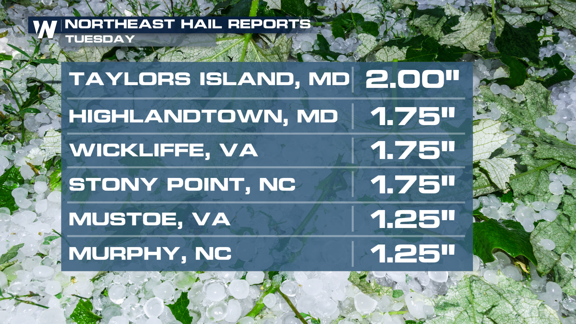
This same front pushed storms east on Tuesday, leading to heavy rain and severe weather across the Eastern U.S. Some hail reports out of MD, VA, and NC reached 2" in diameter.
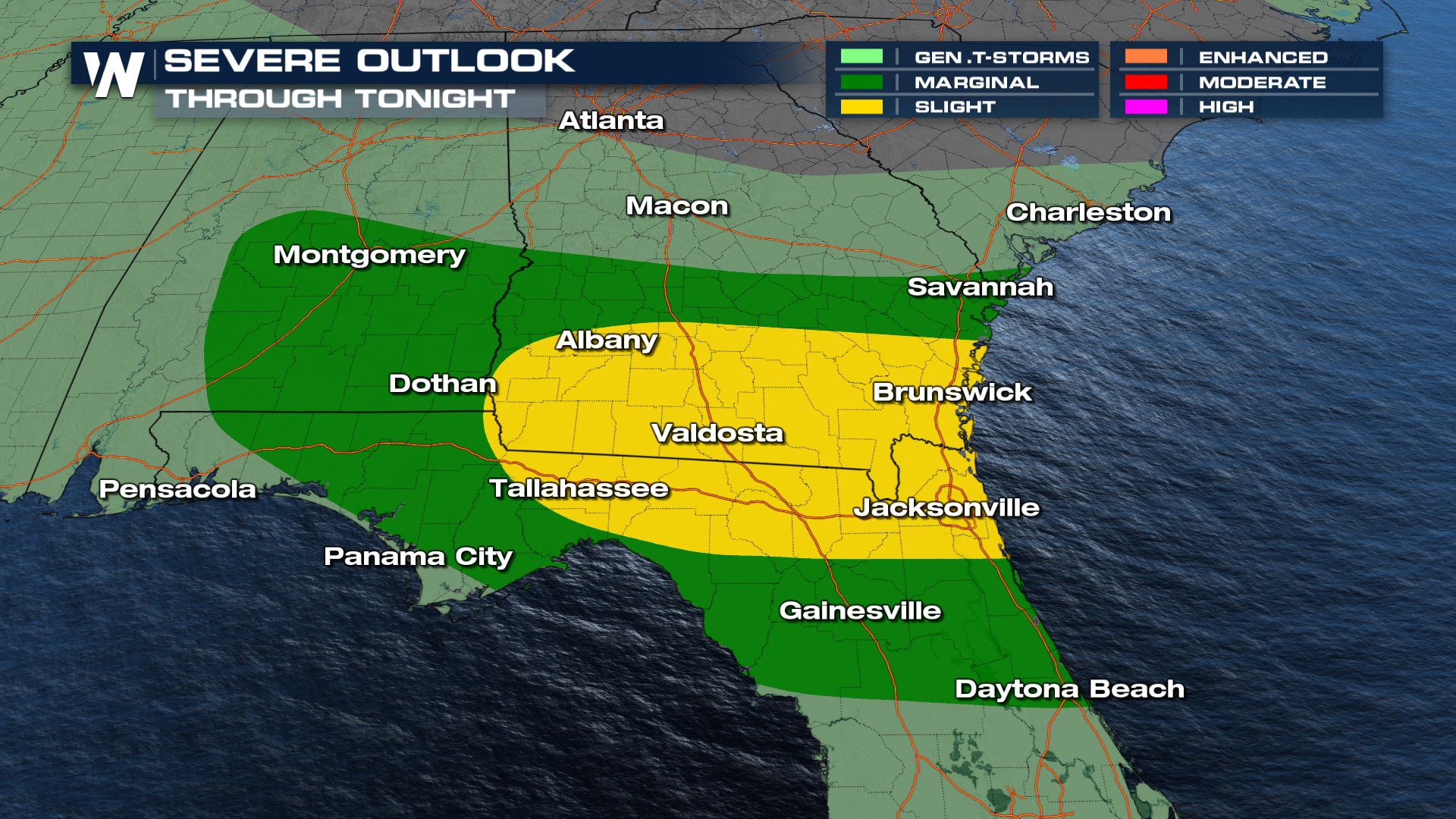
 For Wednesday, the southern U.S. will see the risk for severe weather. The same front has prompted a SLIGHT (level 2 out of 5) risk for severe weather around the Deep South. This is predominantly going to be a wind threat.
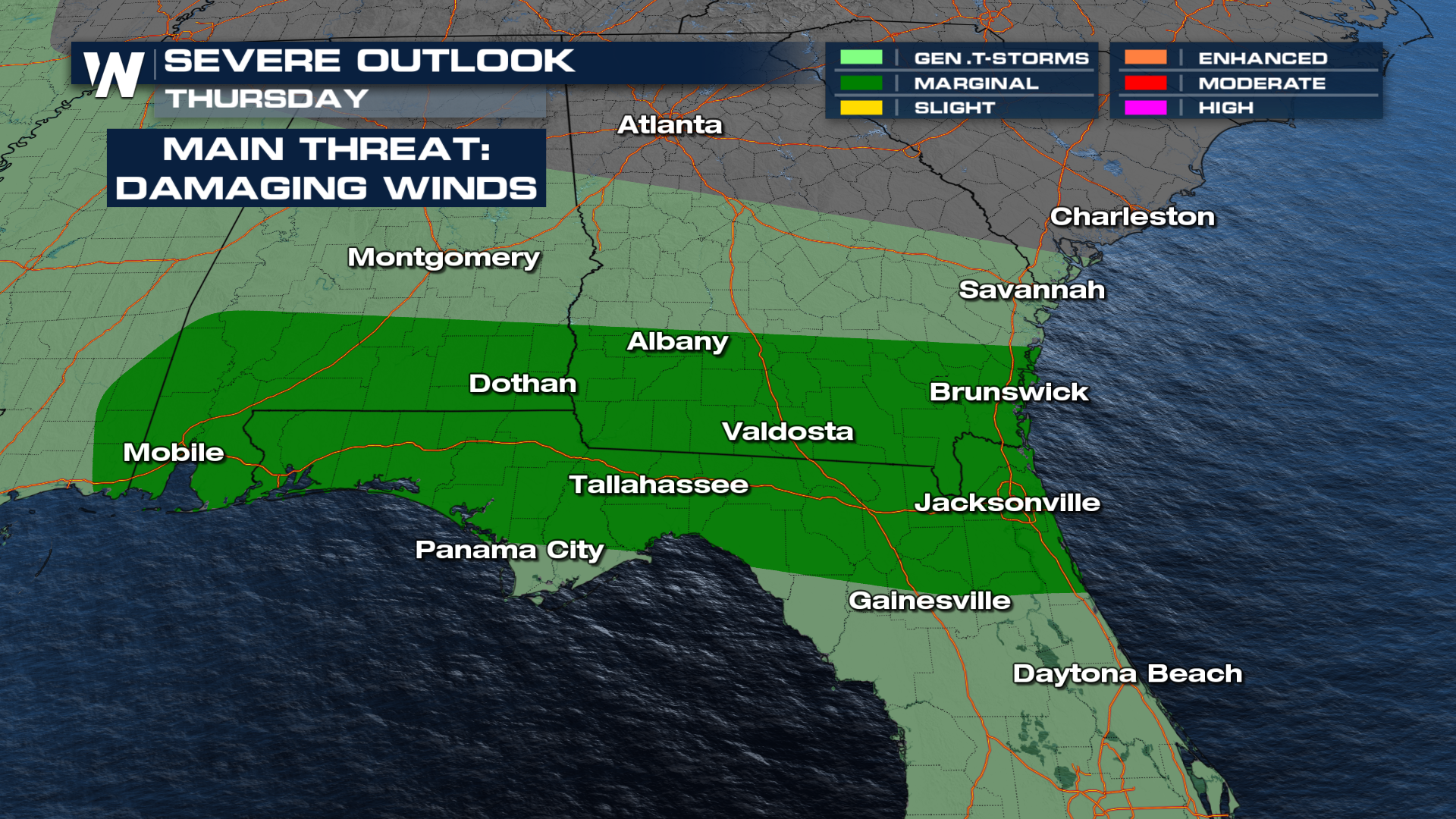
 The front is expected to stall out across the region. This will give us multiple days of storms that could potentially become severe. Another MARGINAL (level 1 out of 5) risk remains in the same region come Thursday.
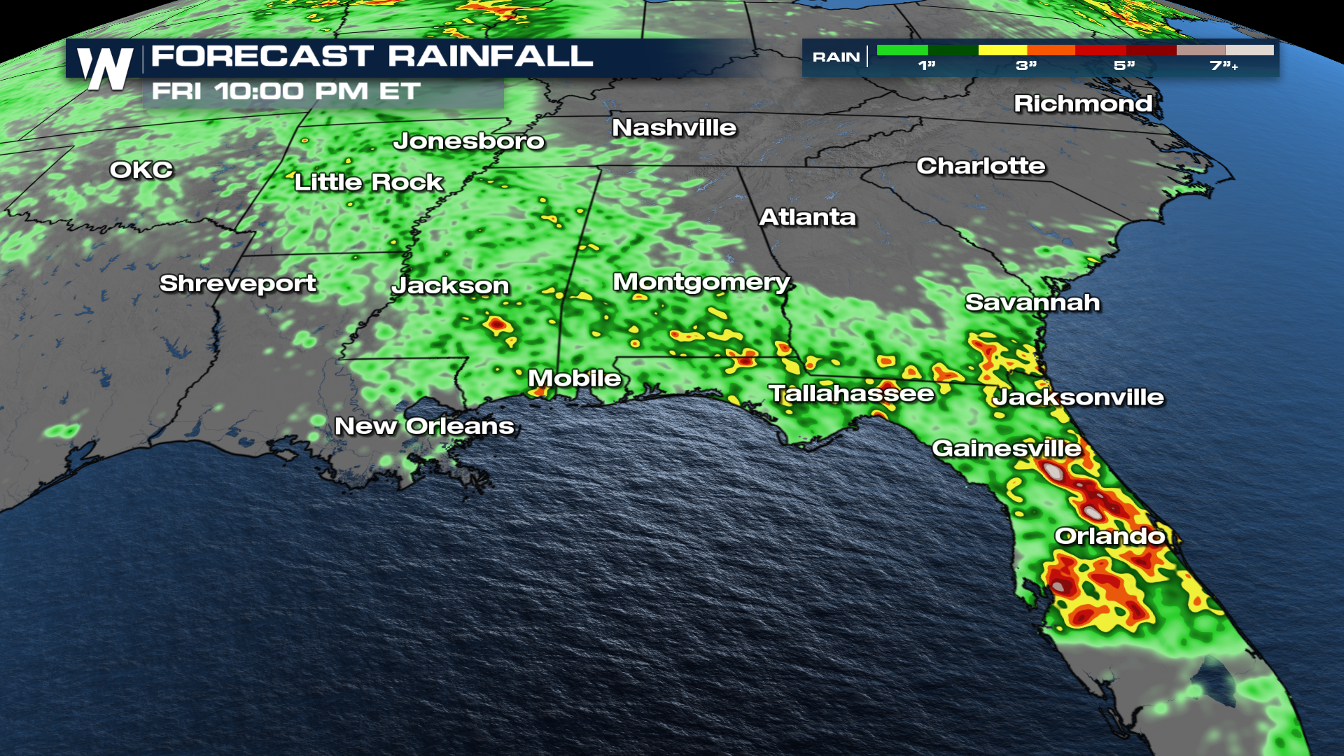
There will be isolated pockets of heavy rain and potential for flooding. Some isolated rainfall totals could reach close to 4-5".
 For a more detailed breakdown, tune in to WeatherNation at :10 past the hour for your full eastern U.S. forecast!


