Flood Threat Persists This Week

New rounds of rainfall are expected to continue to move in from the High Plains and down to the South over the next few days. With additional rain across saturated soils, the WPC has issued Excessive Rainfall Outlooks.
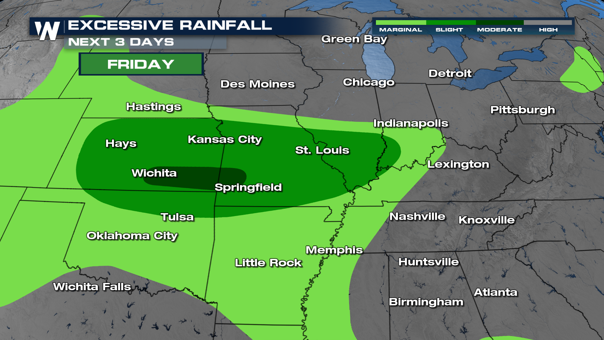
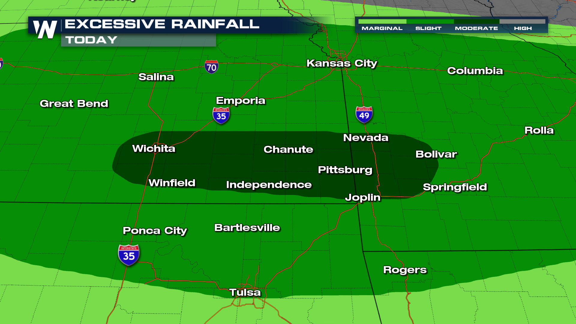
While severe weather will be a concern, heavy rainfall may become the more widespread threat. Abundant atmospheric moisture will allow storms to produce intense downpours, and some areas could see rainfall rates of more than an inch per hour. Repeated rounds of thunderstorms moving over the same locations may quickly overwhelm drainage systems and lead to flash flooding.
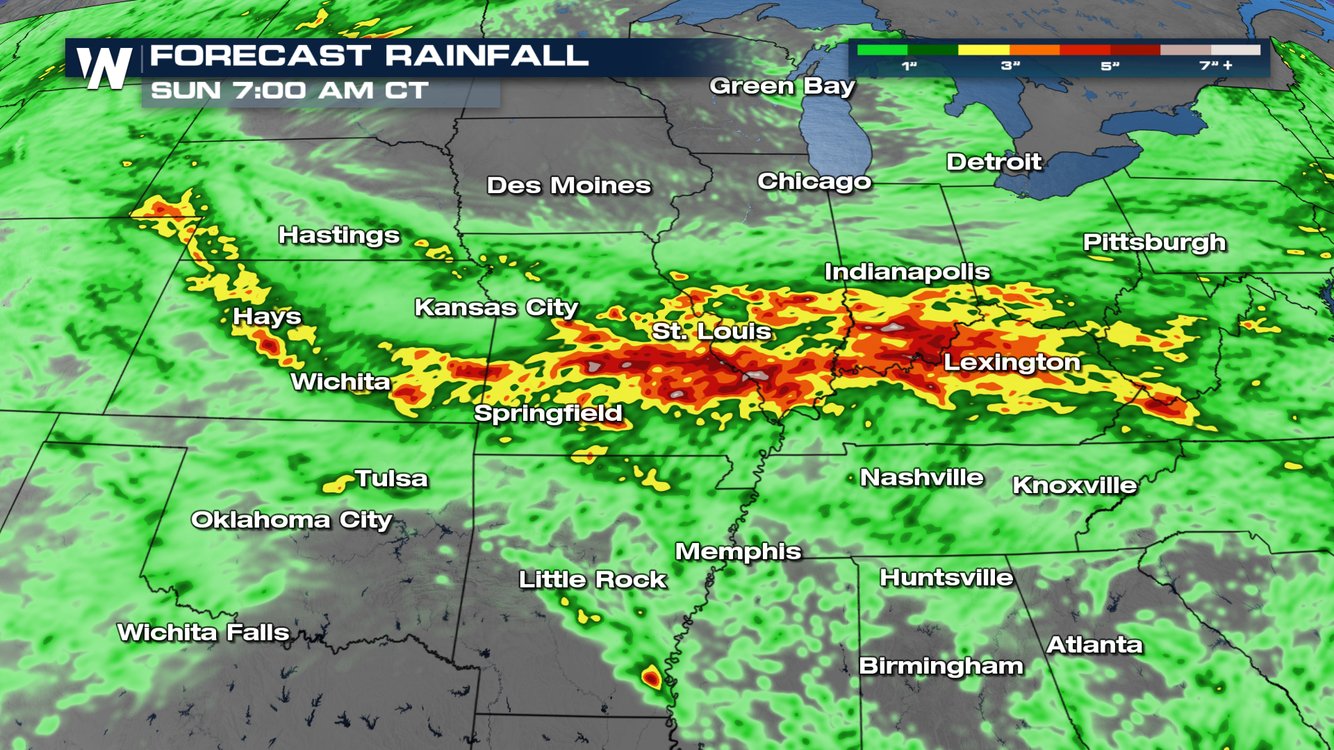
We will continue to monitor the progression of the system as it moves across the region. Residents in areas prone to flooding or severe weather are encouraged to stay informed of the latest forecasts and have multiple ways to receive weather alerts throughout the weekend.


