East Coast Storm Threat Lingers Friday

Top Stories
28 Aug 2026 12:40 PM
Strong storms and flash flooding hammered the I-95 corridor Thursday afternoon. Numerous flash flood warnings were issued to accompany storms with strong downdraft winds. As the front lingers on Friday, expect more storms during the afternoon and evening with potential for strong wind gusts and flash flooding.
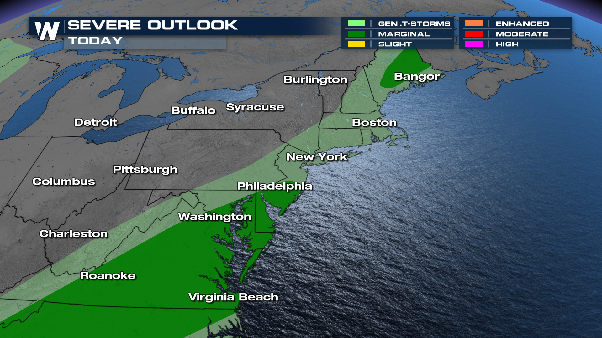 While wind is the primary severe weather hazard, a tornado or waterspout is not of the question.
Some areas received 2-6 inches of rain on Thursday, with more on the way today. That means some areas will be more susceptible for flooding to develop again.
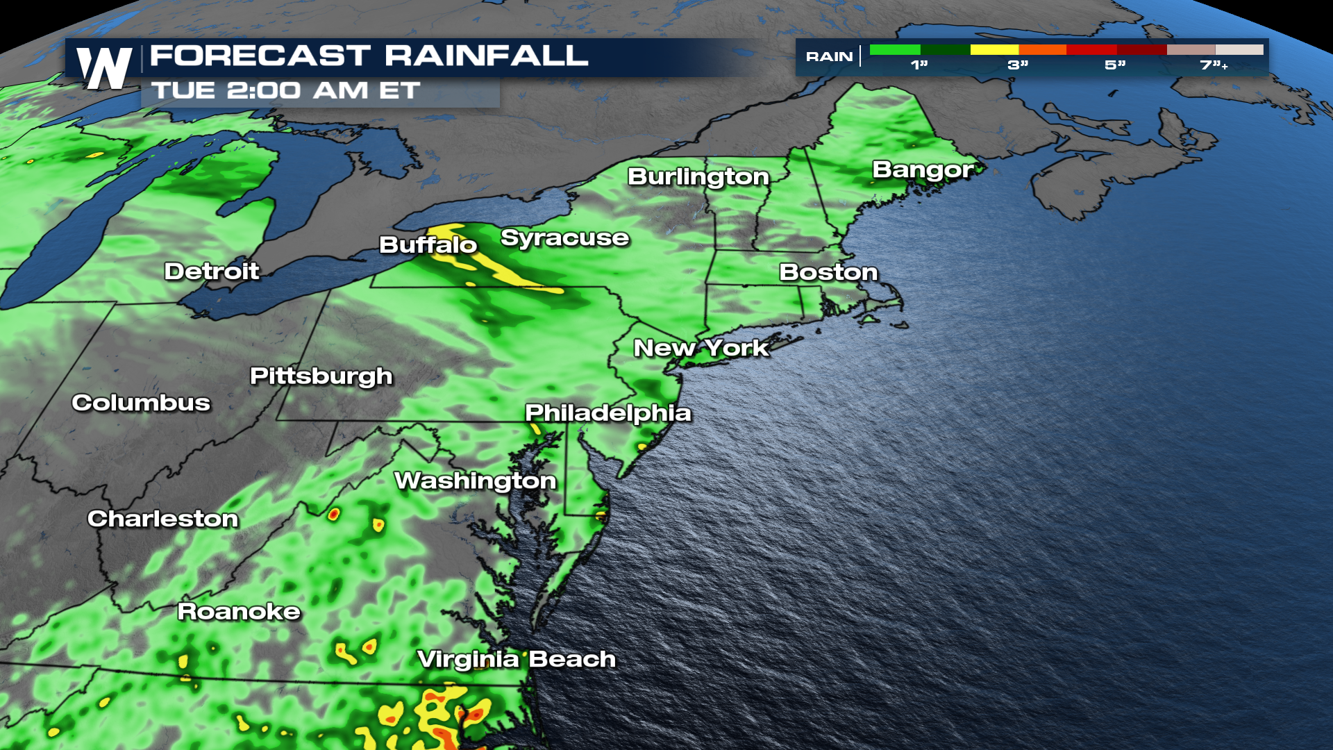 We will have more updates and live coverage on this risk all day on Friday, so make sure to tune in to WeatherNation for the latest .
All Weather News
More
Flooding & Severe Storms Target the Southwest
A low pressure system coming across the Weste
23 Oct 2026 2:05 AM

Tropical Storm Vance Forms In The Pacific
Isaias ended the late-season streak of no hur
23 Oct 2026 2:00 AM

Warmer Than Average: Above-Normal Temperatures Across the Central U.S. This Week
WHAT TO EXPECTA ridge of high pressure will b
23 Oct 2026 1:45 AM


Several Fires Break Out in SoCal Last Week Amid Santa Ana Wind Event
Santa Ana winds helped several fires grow qui
19 Oct 2026 1:25 PM

Another Cold Morning Before Things Warm Back Up
Across portions of the Ohio Valley through th
19 Oct 2026 10:15 AM

Severe Risk Diminishing Saturday Morning for the Northeast
Severe Storm PotentialSevere risk is decreasi
16 Oct 2026 10:20 AM