A Look Back at Moderate Risks This Week

MONDAY
Severe storms erupted across the Midwest on Monday, causing damage to homes and other structures. Reports of damaging winds, large hail, and even a few tornadoes came in throughout Monday. Some of those tornadoes touched down after dark, creating truly nightmare-like scenes captured on video in Illinois.
Storms started to spark up by the early evening hours on Monday. Severe thunderstorm and tornado warnings were firing off into the nighttime hours across Missouri, Illinois, and Indiana.
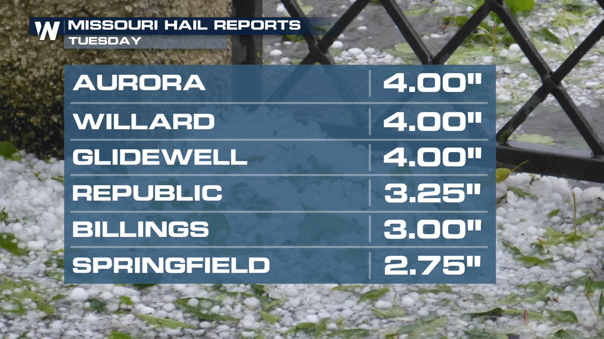
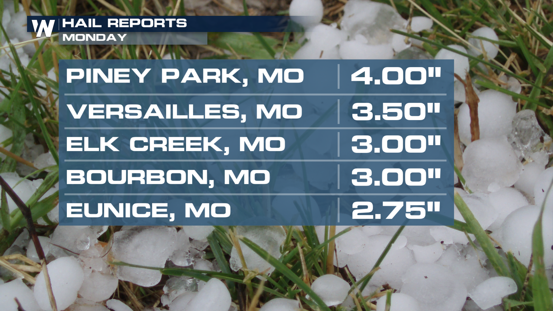
We picked up some pretty large hailstones out of Missouri after this system pulled through. Some reports showed hailstones reaching the size of softballs!
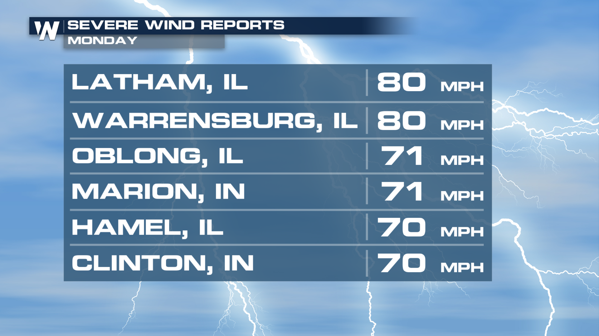
The gustiest winds reported were actually out of Illinois and Indiana. Looking back at the radar from Monday night, it's no surprise, being that we got that defined bow echo.
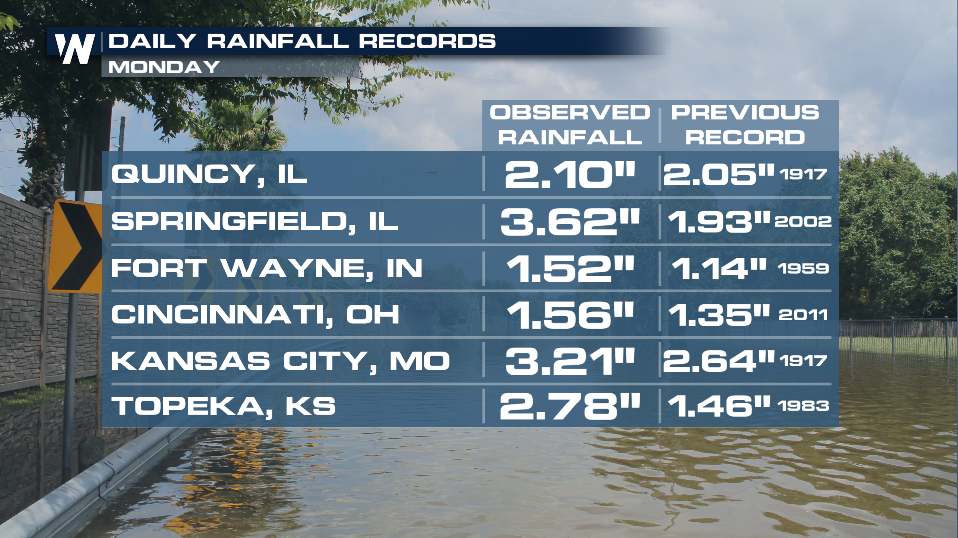
Flooding was also a major issue across places like Kansas City. With multiple heavy rounds of rainfall, we even broke several records across major cities in the Midwest. We always tell folks to never sleep on that flooding threat!
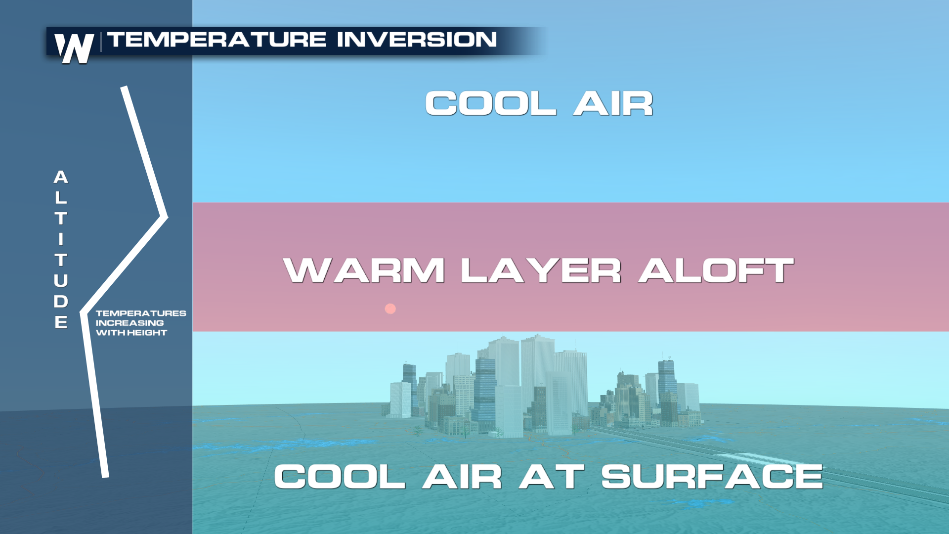
 Why weren't there more high-end tornadoes? A lot of research will go into the exact whys, but one thing that jumped out at us was the cap. Temperatures above the area where storms were attempting to form were slightly warmer than expected. That snuffed out many storms before they could achieve strong to violent status on Monday evening.
 TUESDAY
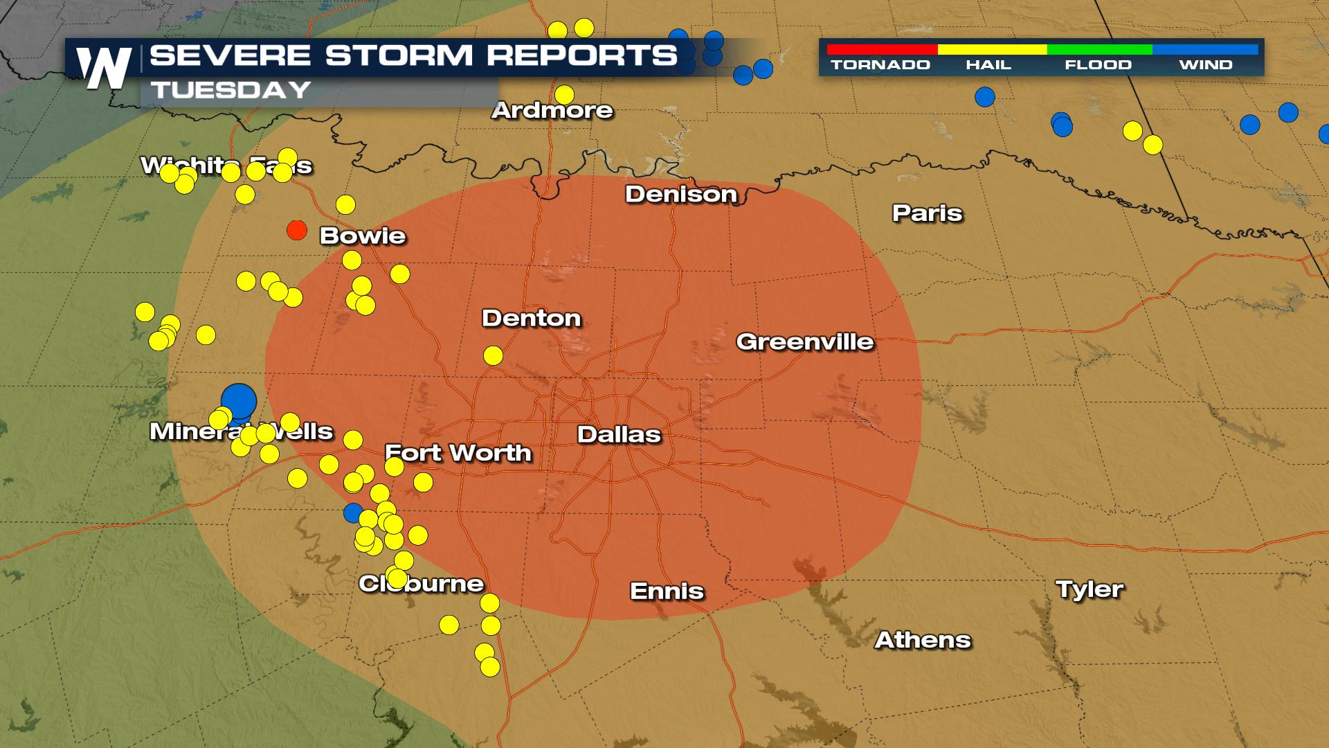
On Tuesday, our front dropped into the southern plains, providing a focus for more thunderstorms. Supercells approached the Dallas-Fort Worth metro, nearing rush hour. Large hail fell with the most intense storms, and a few tornadoes were reported.
Earlier in the day, storms north of the boundary produced more massive hail in southwest Missouri, smashing multiple windows!