Late Week Storm System Brings a Different Pattern

By Thursday morning, some parts of the country are gearing up for heavy rain, snow, and even severe storms. This will be a big change-up in the pattern compared to what we have seen over the last several weeks.
SETUP
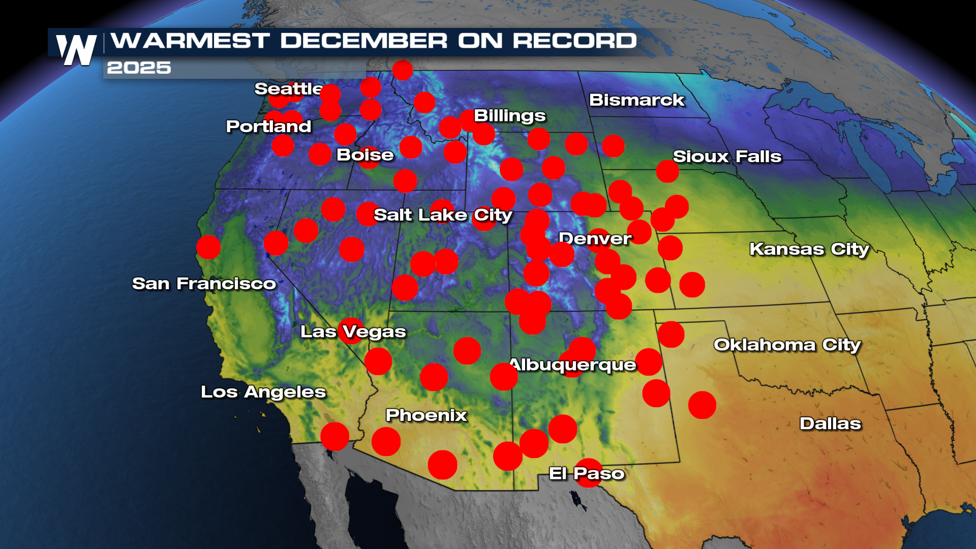
With persistent high pressure being hard to move, the warm weather hasn't been hard to find over the past few months. In fact, many saw their warmest December on record.
 A strong trough will bite into our friendly neighborhood ridge, bringing back a stormy pattern to places that haven't seen much of it in recent weeks.
SEVERE
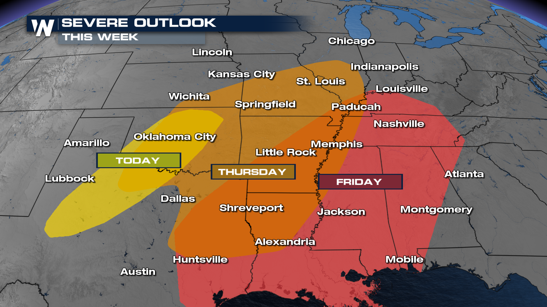
This strong trough will have more than enough wind energy and turning of the winds with height to organize any storm that forms in the right location.
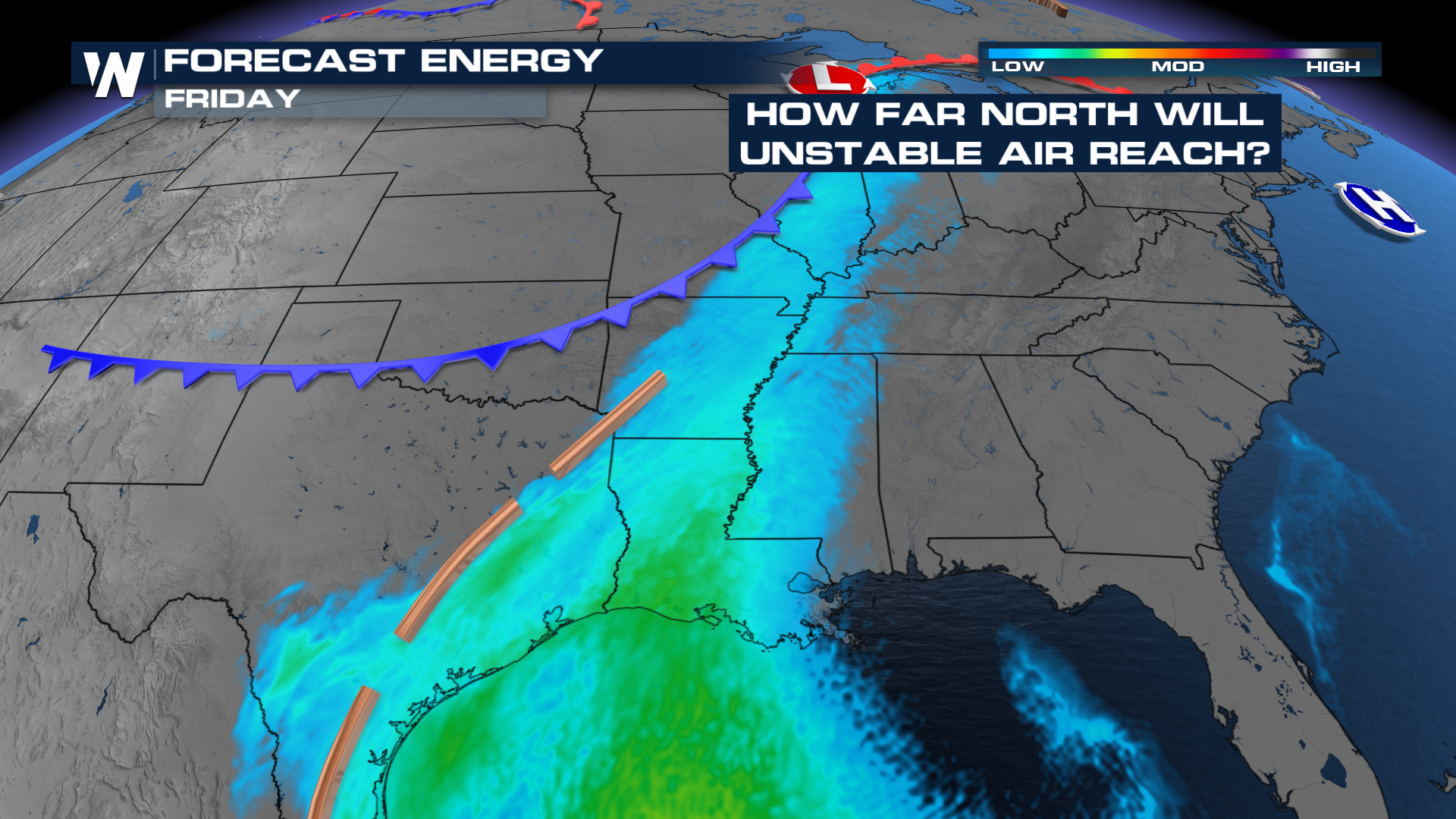
The question is, just how much energy can these storms tap into? This is pretty normal for a wintertime setup, and there seems to be a higher likelihood for severe weather by Thursday morning. The Storm Prediction Center (SPC) issued multiple outlooks for the latter-half of this work week.
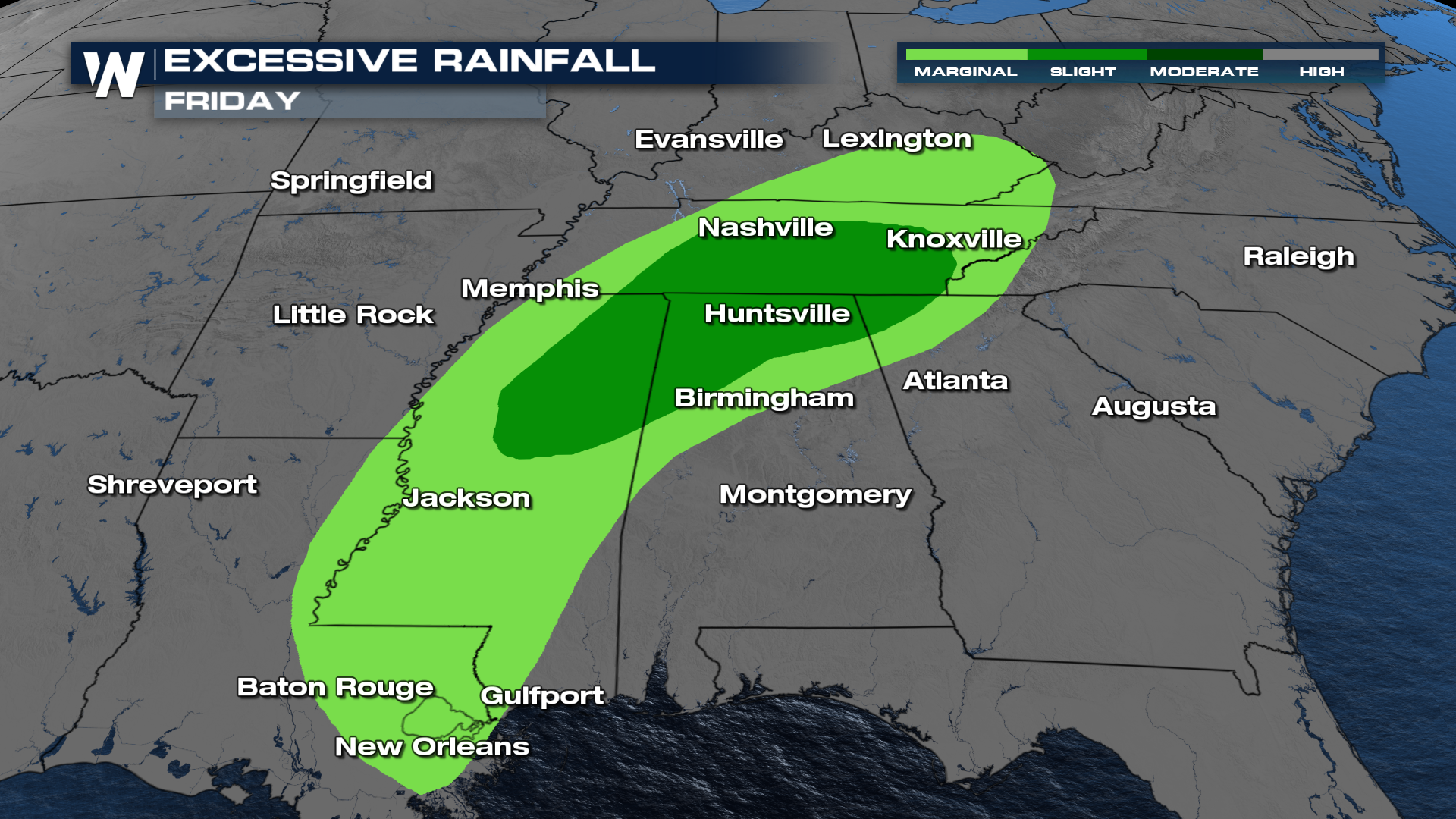
With a few rounds of storms likely, areas from the southeast, all throughout most of Tennessee have a higher risk for flooding. The Weather Prediction Center (WPC), has even issued a slight (level 2 out of 4) risk for flooding across central and east Tennessee.
SNOW
Hard to believe that temperatures in the middle of the week will be some 15-20 degrees above average, which will lead to POTENTIALLY winter weather. Some models have cold air wrapping around the area of low pressure and catching up to the moisture.
Stay with us as we iron out the details!


