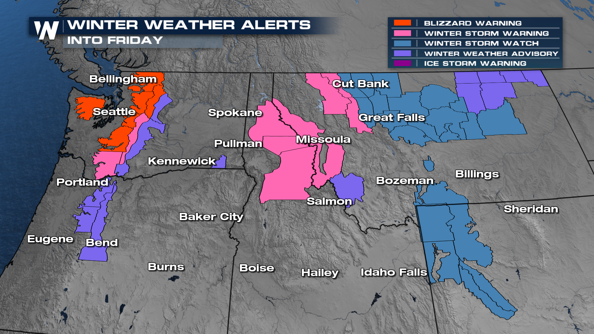
Blizzard Warnings Issued for the Northwest

NORTHWEST - Blizzard warnings have been issued for the mountains of the Pacific Northwest for today and tomorrow. The reason? A ridge of high pressure over the Pacific Ocean is funneling in an atmospheric river of moisture into the Pacific Northwest through tonight and tomorrow. High moisture content will lead to heavy rain and snow for these areas and winds will be very high too.
Blizzard warnings are issued when winds are greater than 35 mph, visibility less than 1/4 of a mile, and lasting for 3 hours. Additional winter weather alerts have been added for the Pacific Northwest and the Rockies.
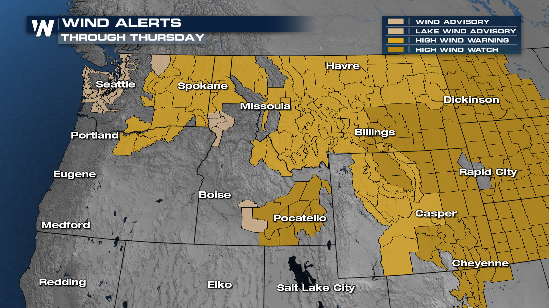
 In addition to these winter weather alerts, wind alerts have been issued for the northwest for gusts up to 50-60 mph with locally higher gusts.
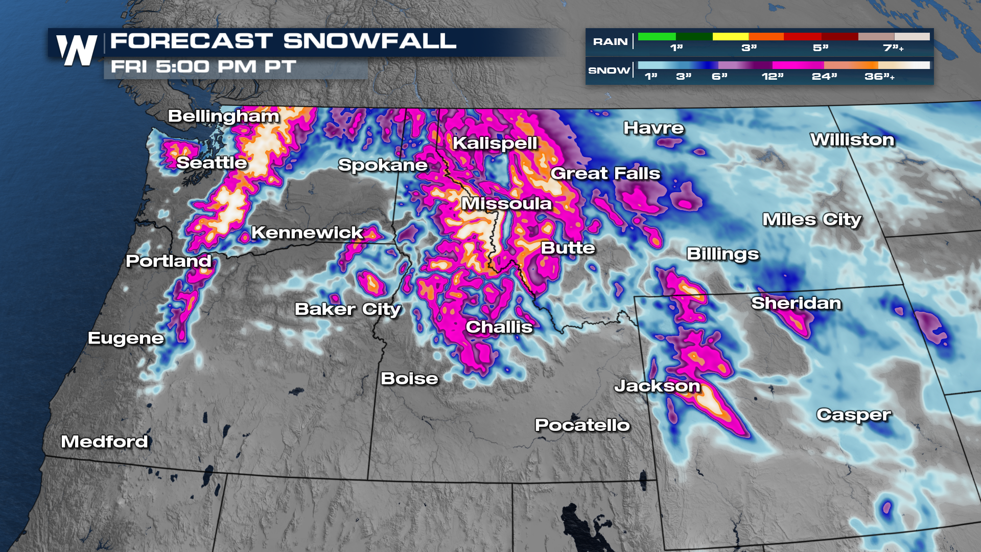
 Let's time this out, as a warm front pushes through, moisture will pick up in the Pacific northwest saturating the soils and lashing with winds. The heaviest of the precipitation picks up on Wednesday before the frontal boundary continues to push inland into Thursday and Friday.
Moisture content with this is extremely high, which will lead to very high snowfall totals.
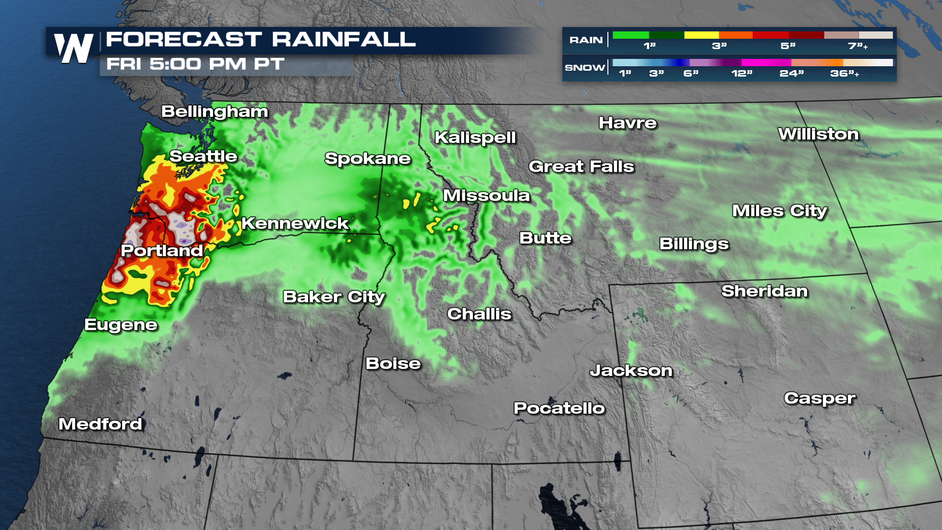
 Some of the heaviest rain is expected across portions of Oregon and southern Washington. Some totals through the end of the week will surpass 6-10 inches of rain.
 For more information about this, be sure to join us at :50 past the hour during your west regional forecast.


