Heavy Rain and Flooding Threat Continues Across South Florida

Top Stories
3 Jun 2026 9:00 PM
What to Expect
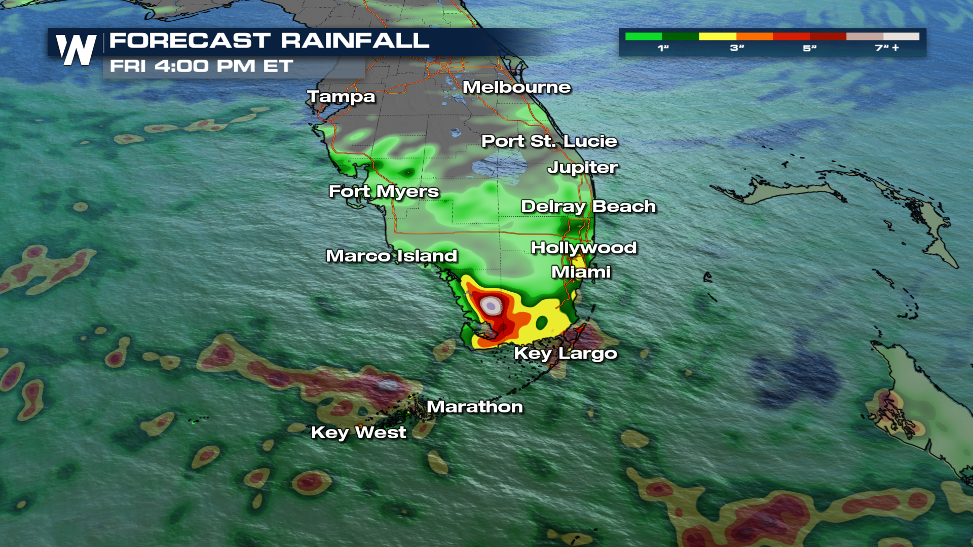
With a frontal boundary draped across the area, more heavy rain is expected across South Florida.
Timing
There's plenty of moisture and instability for this front to tap into. This will keep the afternoon thunderstorm chances in the forecast for the next few days.
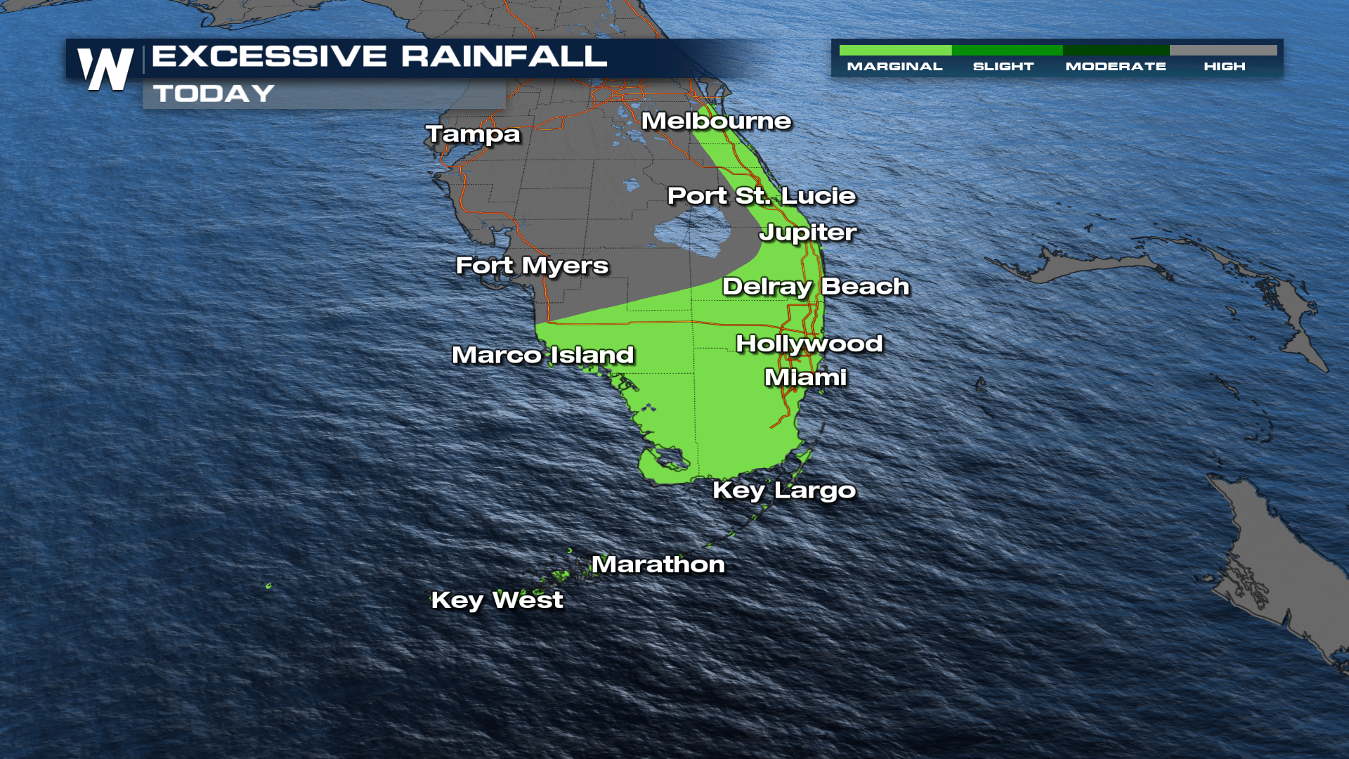
Flood Risk
We'll likely pick up some pretty hefty totals across South Florida. In some cases, this could lead to some localized flooding. Make sure to never drive through flooded roadways if possible!
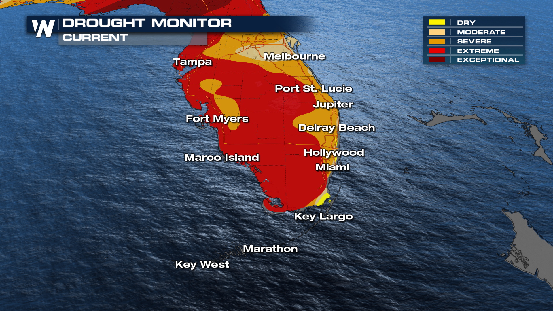
While this rain is causing flash flooding, it is beneficial in many areas, as widespread drought conditions continue in this week's drought update
Stick around at 20 past the hour for your full Eastern U.S. breakdown, right here on WeatherNation!
All Weather News
More
Tropical Storm Bertha Makes Landfall Along Gulf Coast
Wednesday afternoon: Bertha made landfall wit
23 Jul 2026 3:20 AM

Flash Flooding for the Carolinas This Week
Another stalled front in the Carolinas is for
23 Jul 2026 1:20 AM

Another Round of Storms Targets the Northeast
Tuesday brought severe weather again across p
23 Jul 2026 1:15 AM

Pacific Northwest Fires Bringing Down the Air Quality
Conditions have been really dry out west. We'
23 Jul 2026 1:00 AM

Another Round of Severe Weather for the Upper Midwest and Great Lakes
The upper-level low train continues to keep t
21 Jul 2026 1:45 AM

Air Quality Improvements in the Forecast
Wildfires burning in Northwestern Ontario, Ca
20 Jul 2026 7:20 PM

Monsoon Moisture Brings Weekend Flood Threat
The monsoon has returned to the southwestern
19 Jul 2026 1:30 AM