Flood Threat Lingers in Texas After Edouard

Intense rainfall has inundated parts of Texas this week thanks to, what was, Tropical Storm Edouard. Rain totals east of I-45, north of Houston, have come in at over 15 inches for a few areas.
The heavy rain led to flash flood emergencies being issued this past Wednesday, as roads became impassable in some areas. High rainfall totals for East Texas due to the heavy rain.

Additional heavy rain is expected for a few areas on Thursday, leading to a lingering flood threat, primarily due to saturated soils.

The WPC has issued a moderate risk (level 3 out of 4) for parts of eastern Texas, with a level 2 threat that covers portions of the Dallas area. Isolated flooding may linger on Friday before the remnant moisture finally fades.

Landfall
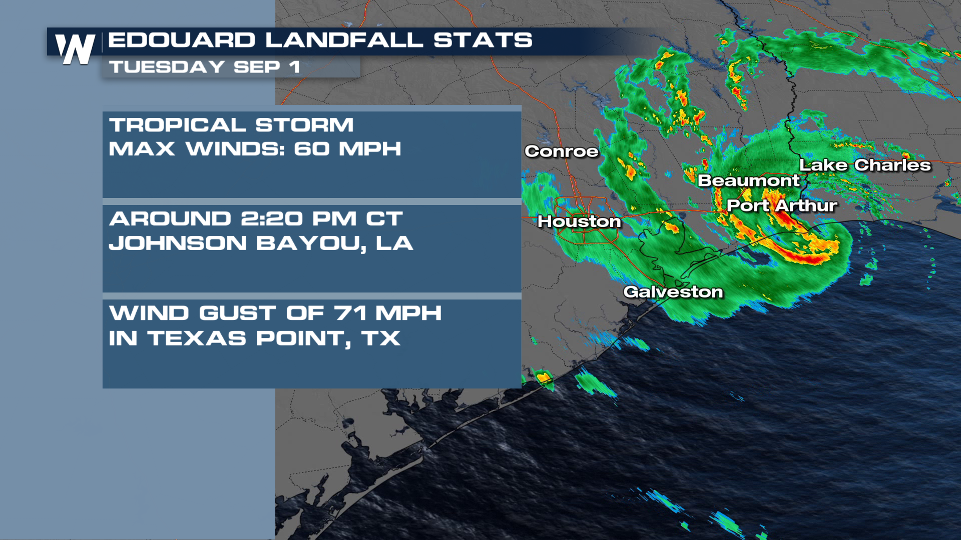
Tropical Storm Edouard made landfall along the northwestern Gulf Coast on Tuesday, September 1st. The National Hurricane Center used radar data from Lake Charles, LA and Houston, TX to determine maximum sustained winds of 60 mph as it moved ashore around 2:20 PM CT near Johnson Bayou, LA.
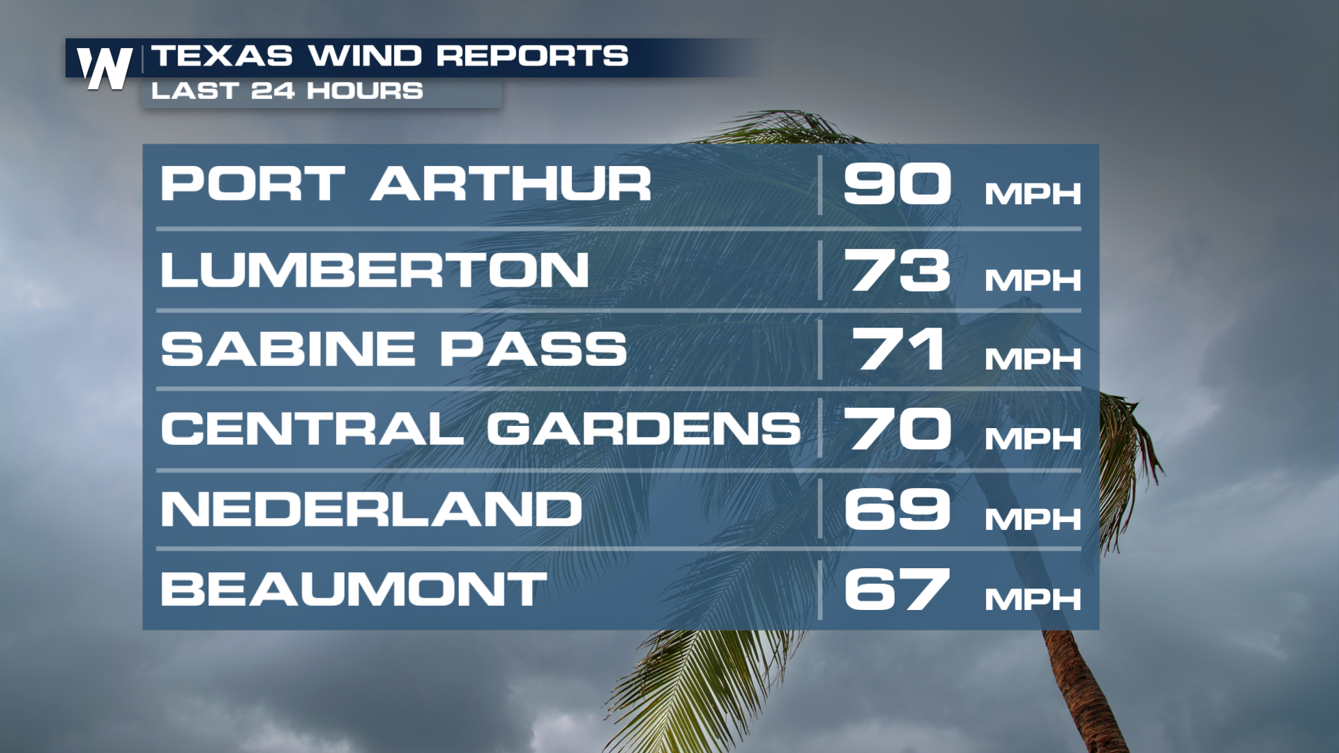
 Wind speeds across portions of Texas peaked to 90 mph. Multiple areas saw wind speeds over 70 mph, leading to power outages for over 75,000 households.