High Heat & Humidity Across the Southwest

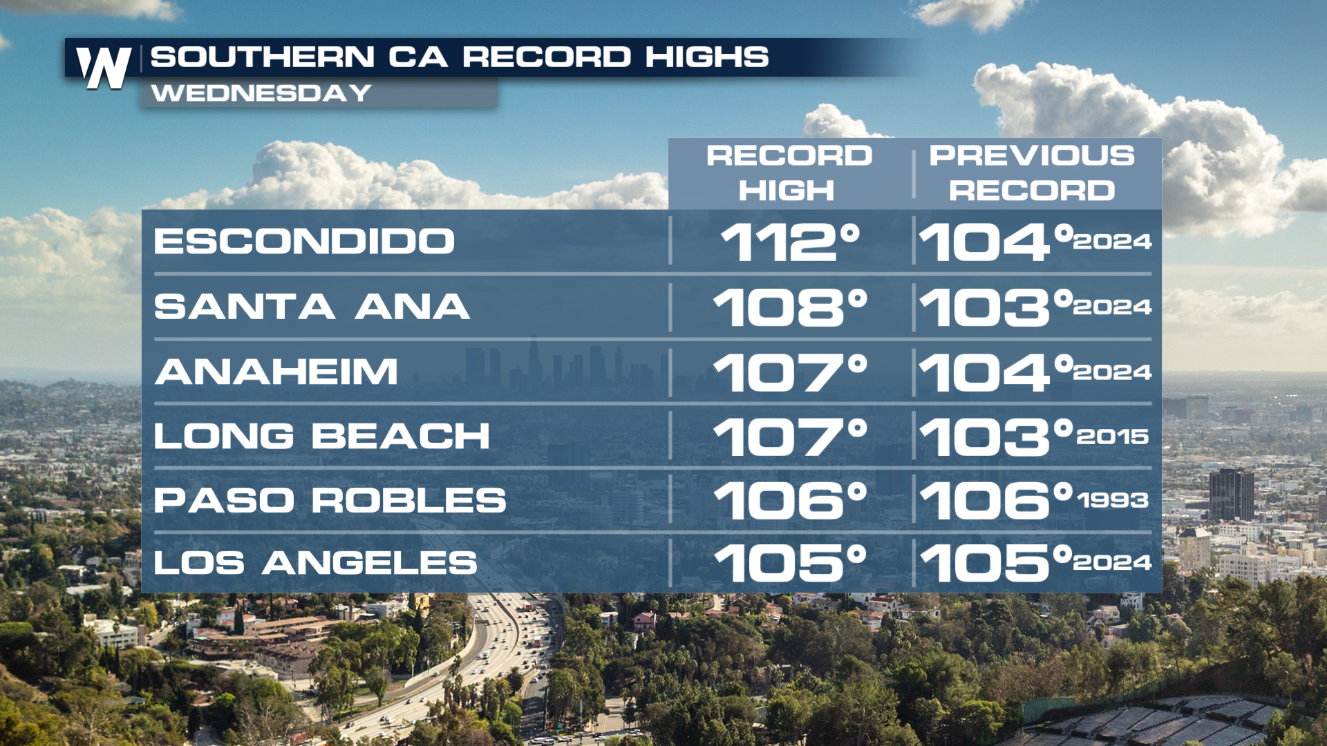
Temperatures not only broke records on Wednesday but the heat index for some Southern California cities hit near 120° (above).
While many do not associate tropical storms and hurricanes with the Desert Southwest, it's not unusual to see remnant moisture from these systems pulled into the region several times a year from decaying systems in the Eastern Pacific. The leftover moisture from Marie that streamed into the area over the holiday weekend is still lingering. Rainfall totals from Marie brought 2" in some locations. This also significantly increased the high surf and rip currents over the weekend holiday. Beach erosion and coastal impacts have been significant!
The higher moisture is also impacting the heat across the region. Dew point temperatures have been in the 60s and 70s. Heat Alerts remain active through Thursday.
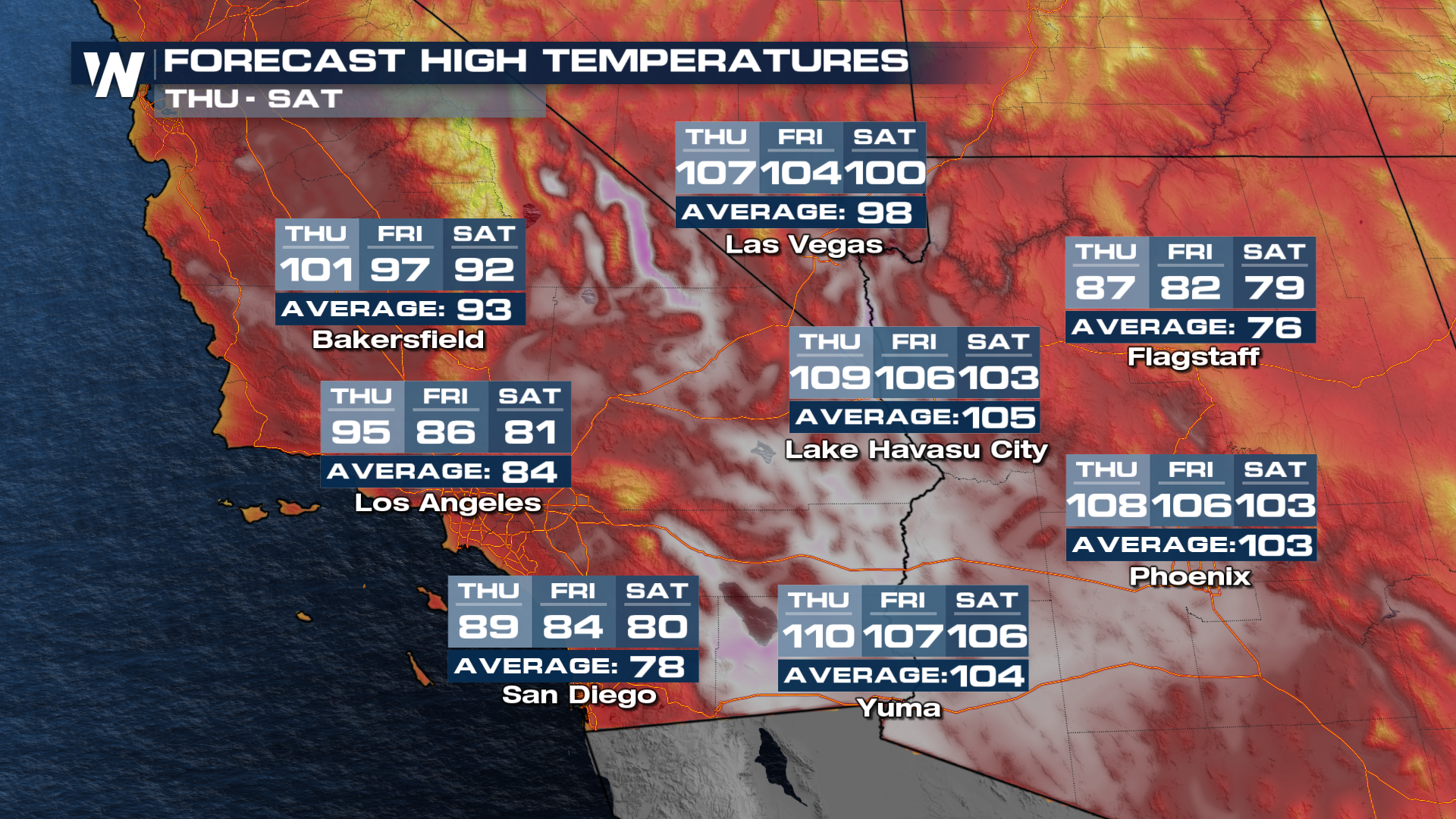
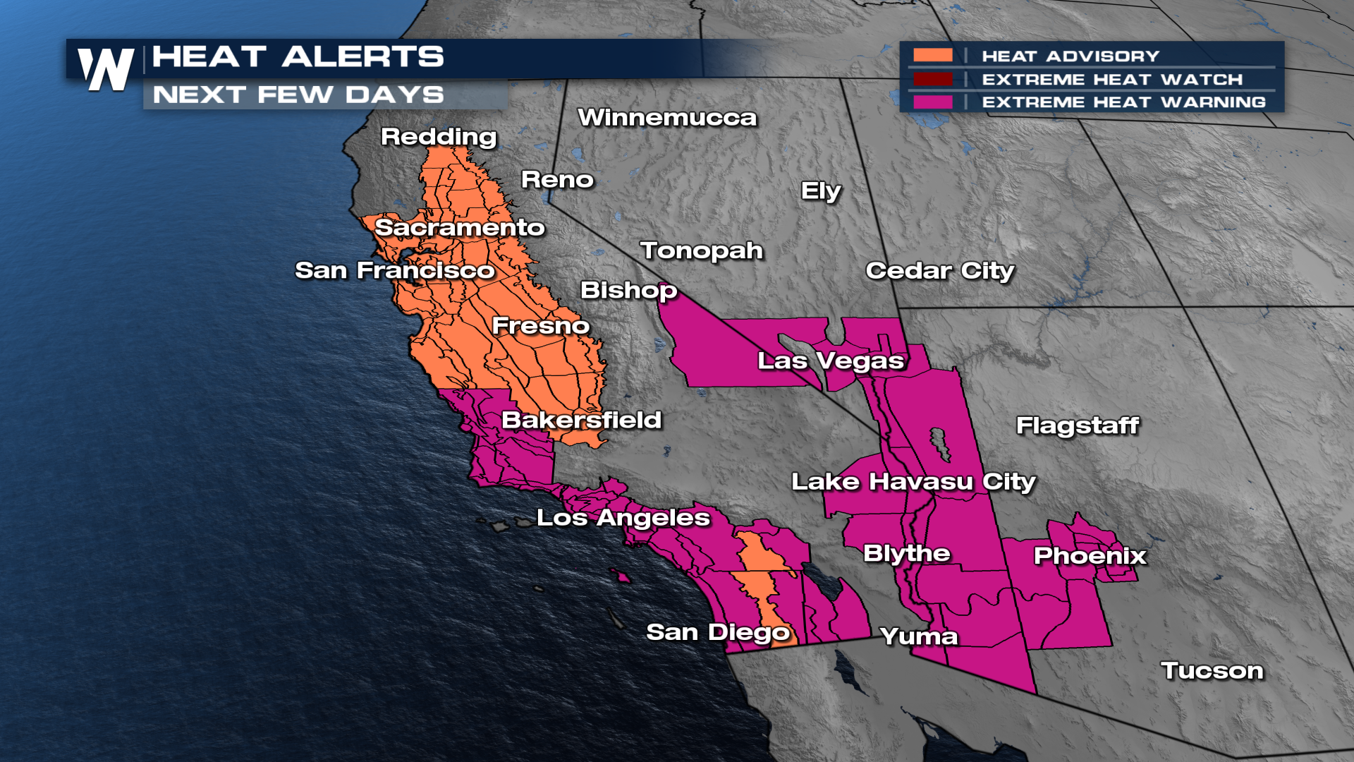 Temperatures across this area are running 10-20° above average for Thursday, before more seasonable temperatures for Friday. Near 90 is expected for San Diego! When the humidity is factored in, temperatures could feel nearly 10 degrees warmer, and today that humidity is lingering.
 Below are just a few of the records that broke in Southern California on Wednesday. Temperatures will start to reach near normal again for many by the weekend.
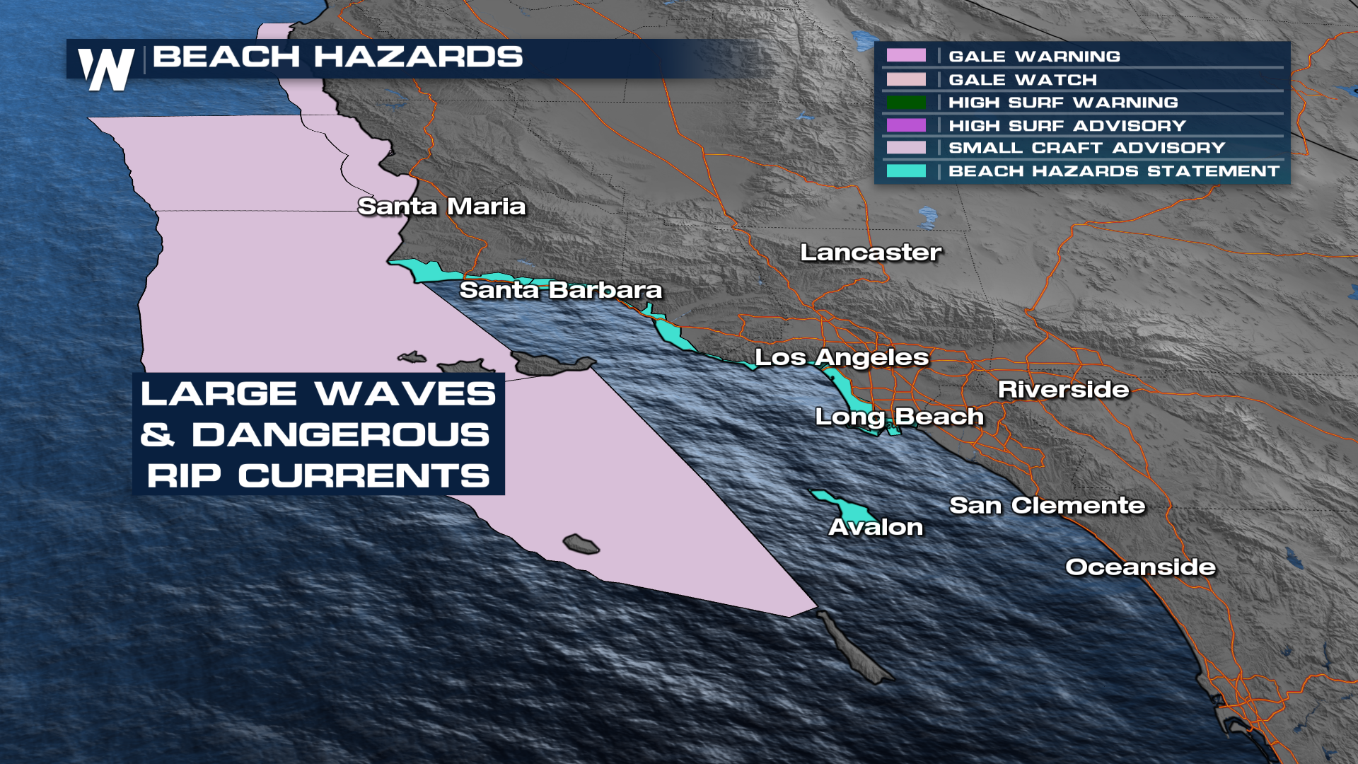
 Had plans to hit the beach and beat the heat? Might not be the best idea to head into the water. Beach hazards statements have been issued for coastal California. Mainly, large waves and dangerous rip currents will be the threats to watch out for. Some of these alerts will last through the rest of the work week.
 If you are going to the beaches, swim near a lifeguard! This is true even for more experienced swimmers.
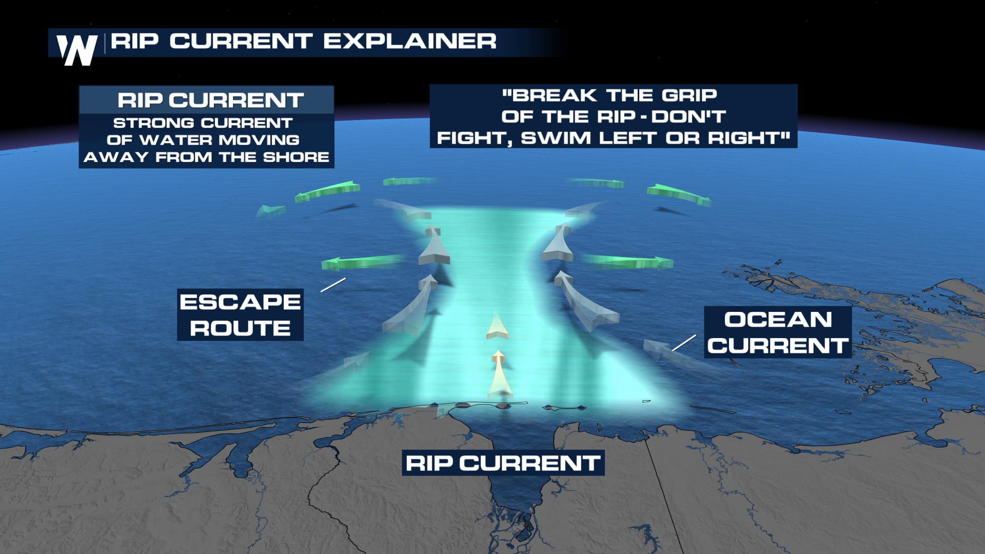
If you ever find yourself caught in a rip current:
Don't panic. If you panic and try to swim back to shore against the current, you will exhaust your energy.
Swim parallel to the coastline. Once you're out of the grip of the rip you'll be able to move towards the shoreline.
If swimming parallel is too difficult. Float on your back and try to signal for help!
Listen to the lifeguards and monitor beach conditions before you go into the water.
 Stay tuned to WeatherNation for the latest in the forecast.


