Rockies Brace for Snow, Severe Storms as Cold Front Moves In

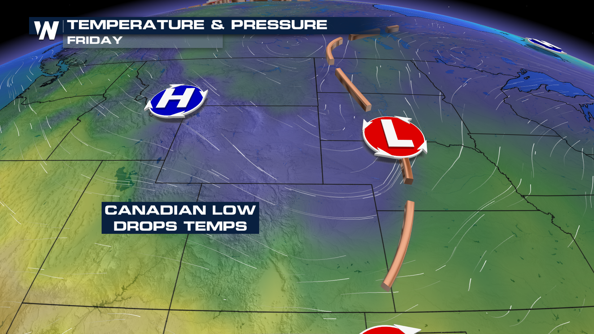
ROCKIES - Through the rest of the week, an upper-level low and a cold front will move into the Rocky Mountains, bringing cooler air, chances for thunderstorms, and even snow across the region!
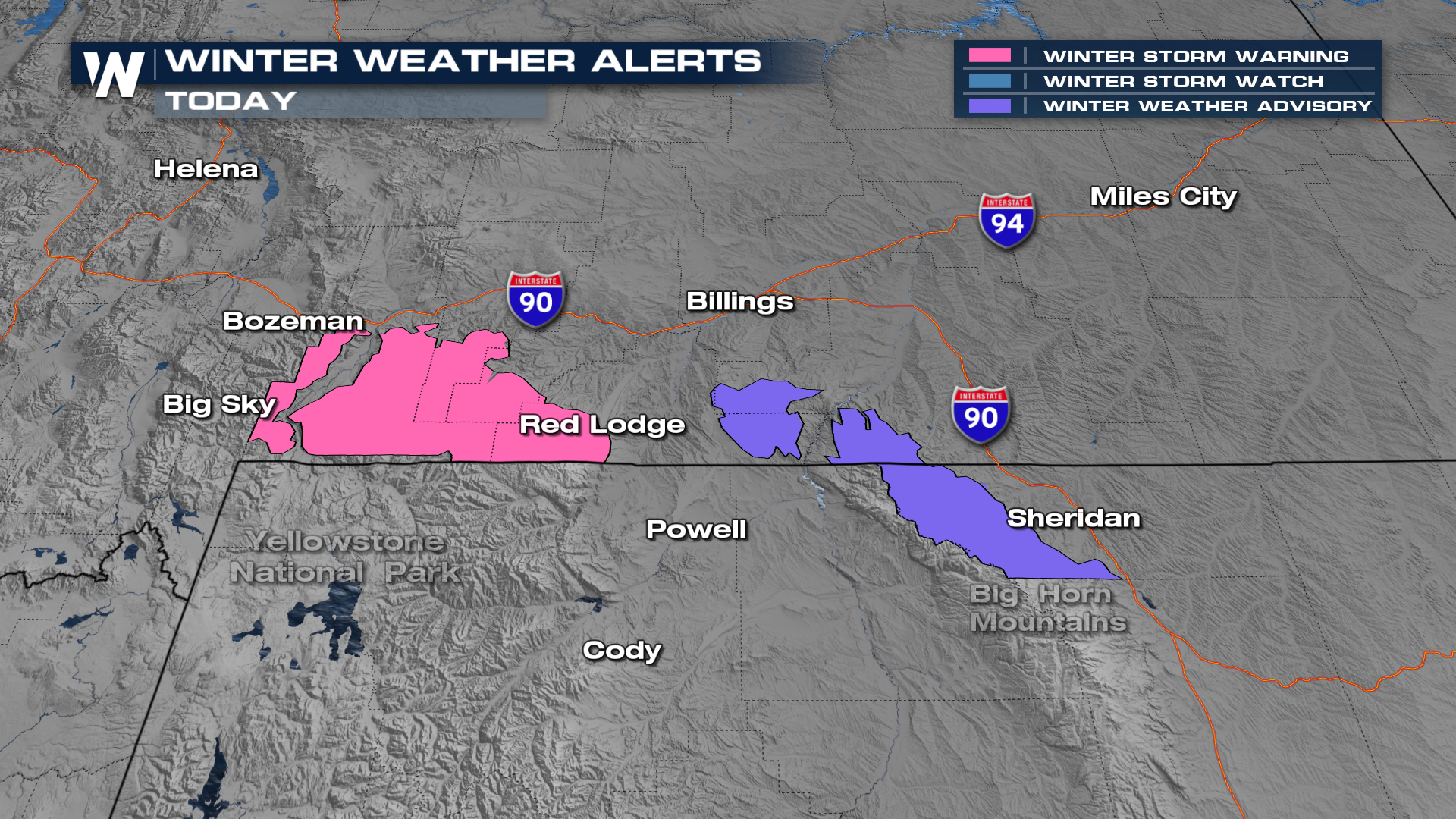
A Winter Weather Advisory and Winter Storm Warning have been issued for portions of Montana and Wyoming in the higher elevations. Heavy snow is expected on north-facing slopes above 7,000 feet, where snowfall totals of 8–13 inches are possible.
In addition to the snowy conditions, temperatures ahead of the system will remain warm enough to support instability and thunderstorms. Portions of the Plains are under a highlighted risk area for severe thunderstorms as this cooler air mass collides with the warmer air ahead of the front. A SLIGHT (Level 2 out of 5) risk for severe thunderstorms is forecast for Colorado and surrounding states today. Wind and hail are expected to be the primary hazards, but a tornado or two will be possible.
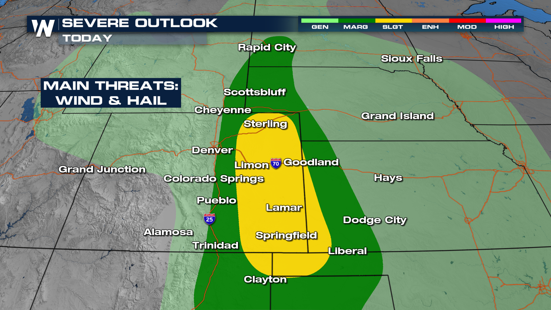
As the front moves in and provides additional forcing, stronger storms will become possible through the afternoon and evening.
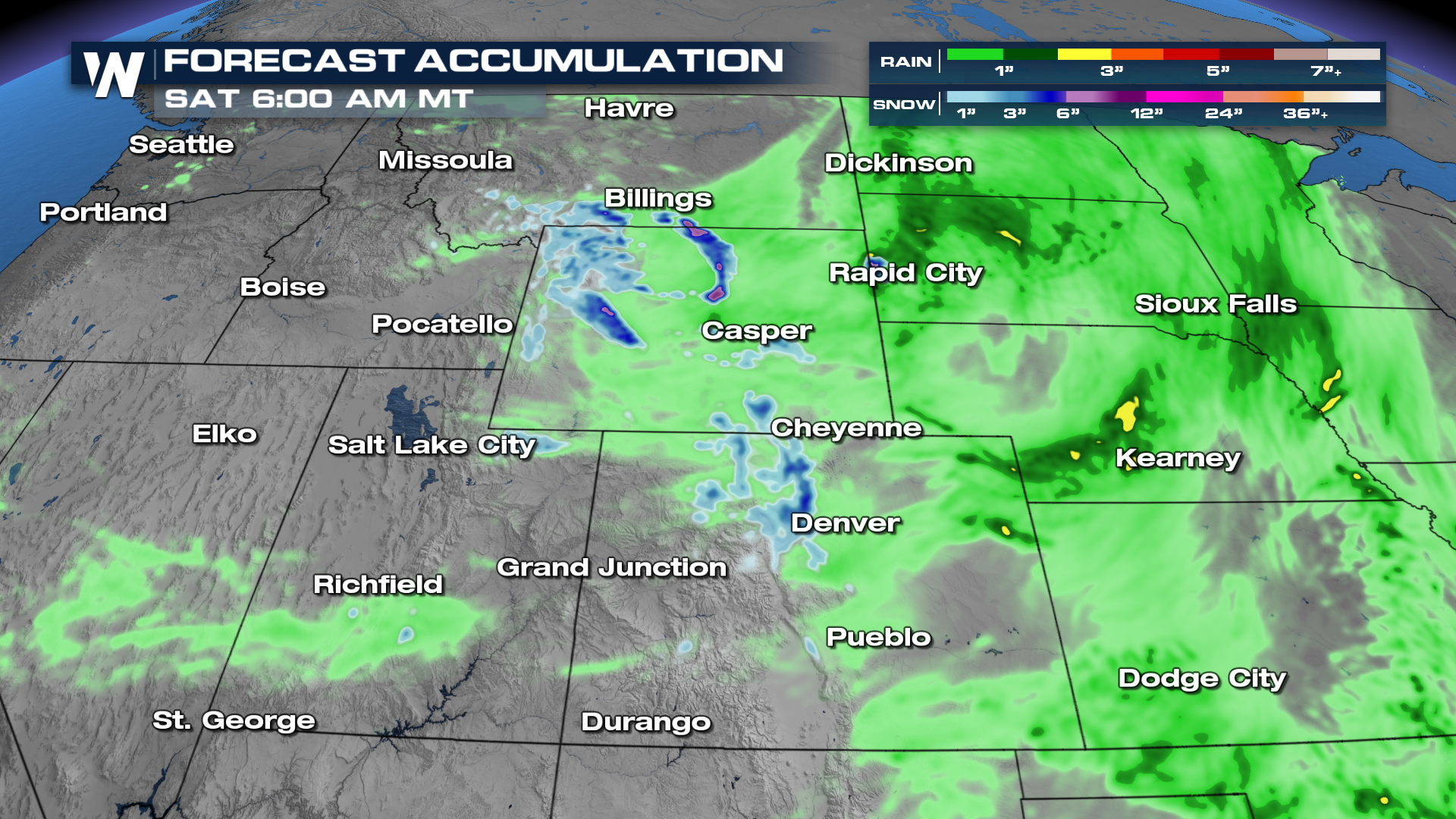
Rainfall totals are not expected to be nearly as high as they were earlier this week, but some minor disruptions to outdoor plans during the holiday long weekend are still possible.
 Be sure to join us on WeatherNation for the latest!


