First Disturbance of the 2026 Atlantic Hurricane Season Identified in the Gulf

Atlantic
The first disturbance out into the Atlantic was identified on Wednesday. In the latest outlook from the National Hurricane Center (NHC), it has a rather low chance of development. A broad low-pressure area is expected to develop over the Bay of Campeche on Friday, associated with a westward-moving tropical wave currently over Mexico’s Yucatan Peninsula. Environmental conditions appear only marginally favorable for development before the system is forecast to move inland across eastern Mexico late Saturday or Sunday.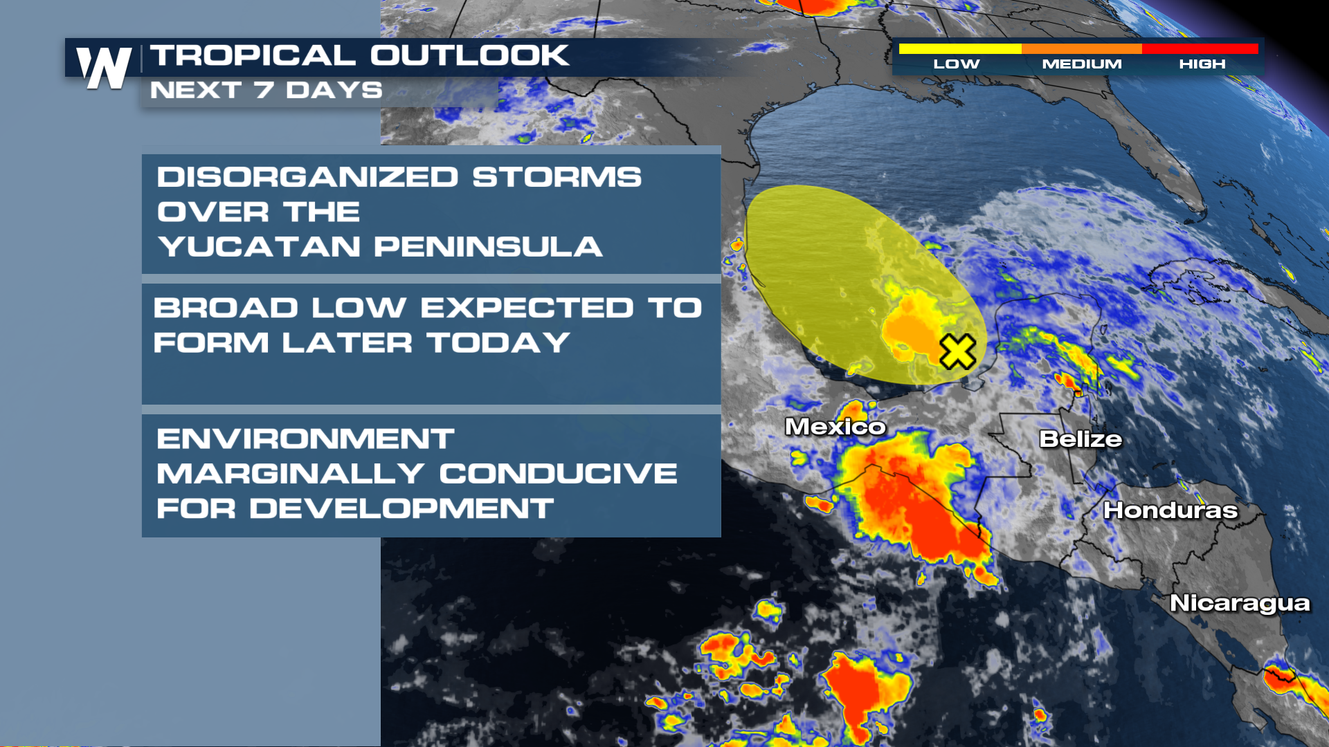
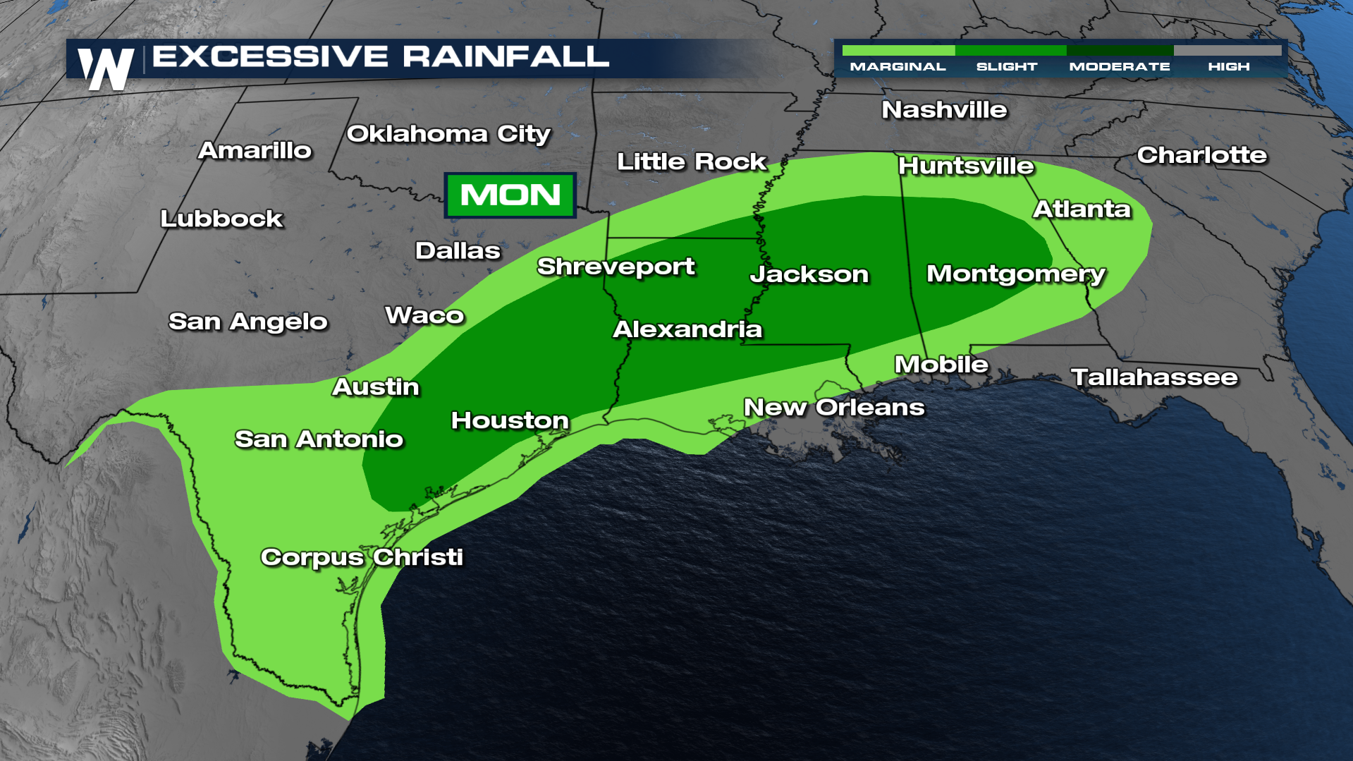
As moisture from the remnants of Cristina slams into a cold front, heavy rain and flooding could be an issue heading into next week for the South. Forecasts are calling for 3-5 inches of rain from Texas into the Deep South. While some of the rain could be beneficial, most of this rainfall will be hazardous and lead to the flooding risk.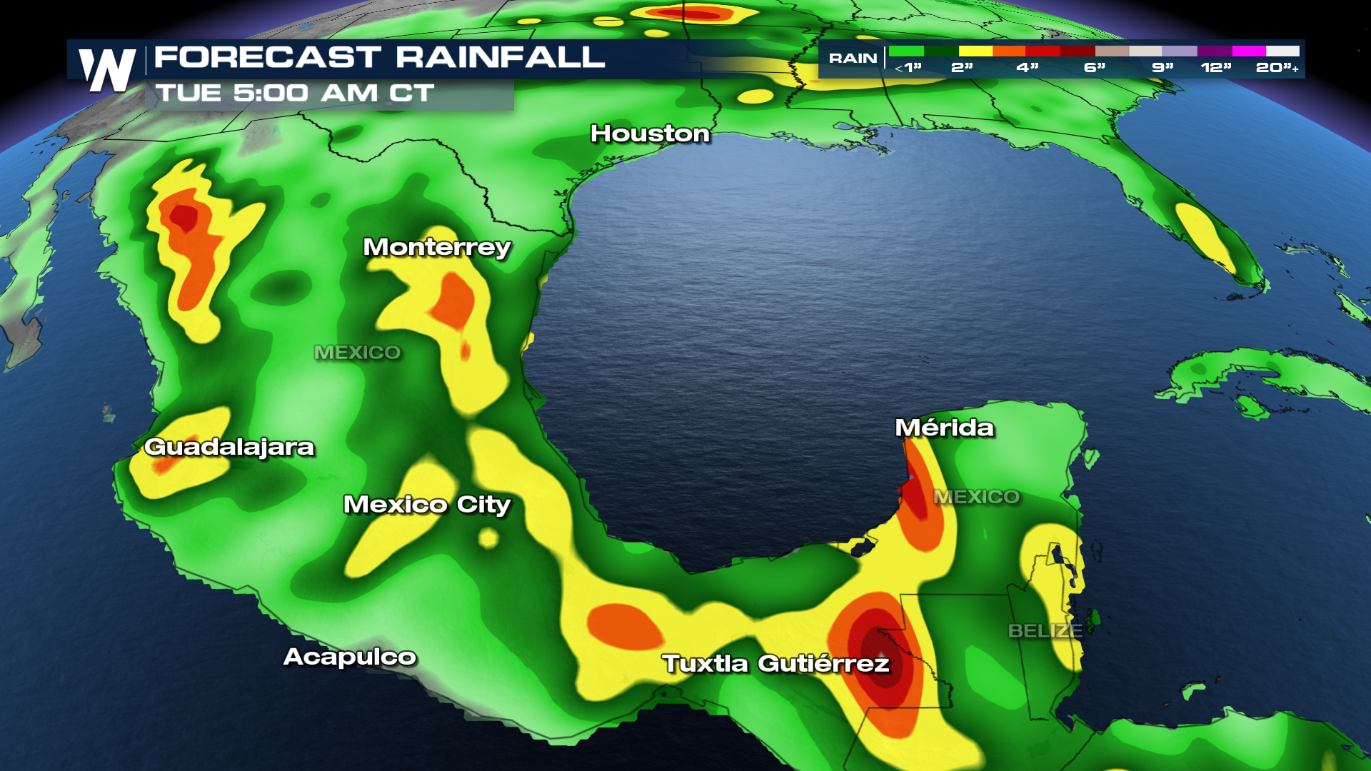
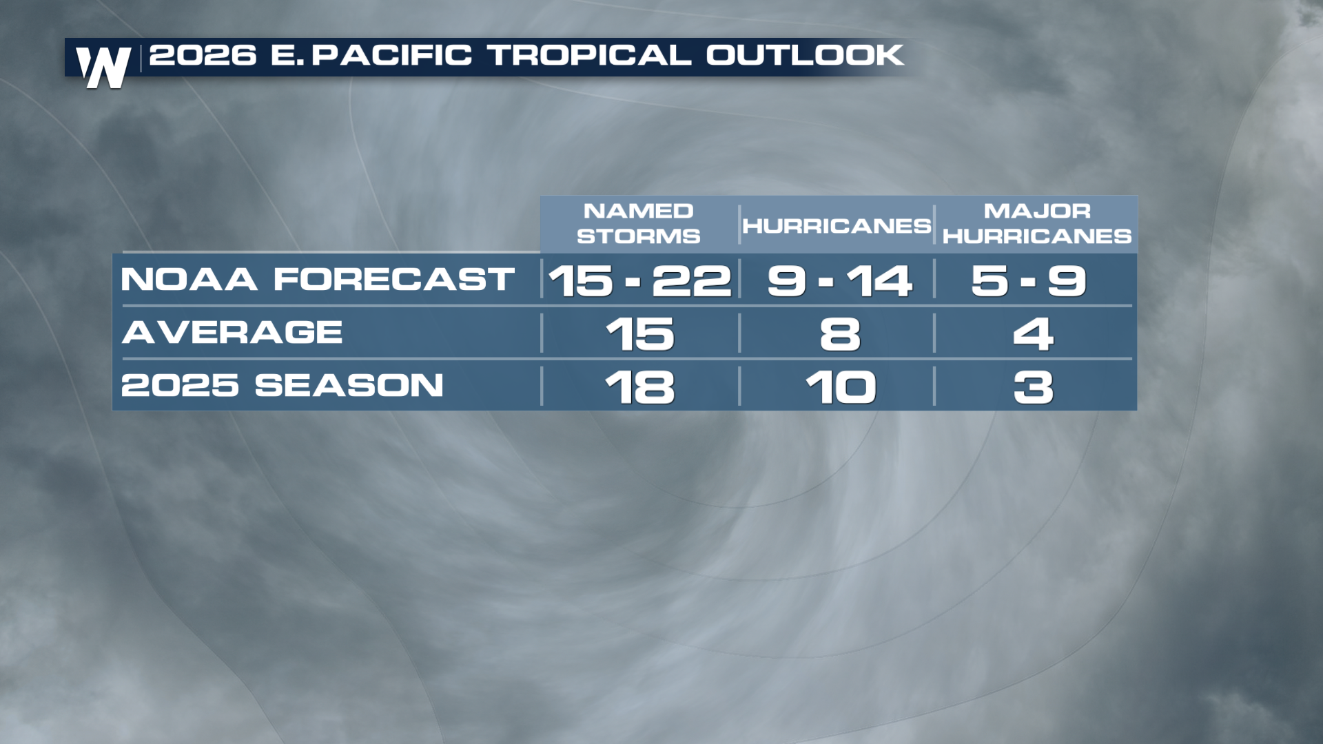
Signs Point to an Active Eastern Pacific Season:
The early burst of activity is occurring as sea surface temperatures across parts of the Eastern Pacific remain warmer than average. Combined with the development of El Niño conditions, forecasters expect the basin to remain favorable for tropical cyclone formation through much of the season. NOAA’s seasonal outlook calls for an above-average Eastern Pacific hurricane season, with between 15 and 22 named storms possible. Several of those storms could reach hurricane strength, including multiple major hurricanes.
Stay With WeatherNation This Hurricane Season:
Whether storms threaten land or remain over open waters, WeatherNation is your destination for around-the-clock tropical coverage. Our meteorologists track every tropical wave, depression, storm, and hurricane with the latest forecast models, expert analysis, and live updates whenever conditions warrant.


