El Niño Forms, Very Strong El Niño Likely Late 2026

El Niño has arrived! It didn't take long for La Niña conditions this spring to quickly be replaced in the equatorial Pacific over the last few months. A big surge of warm water has now reached the surface after traveling in deeper waters for months, taking sea surface temperatures up to the level needed for an El Niño designation.
El Niño is expected to continue for the foreseeable future (below), and will likely to continue to strengthen through the summer into fall and possibly winter (top of page). You've probably heard the term "super" El Niño mentioned - which is the same as a "very strong" El Niño in the graphic above. "Super" El Niño isn't a term officially recognized, but seeing temperatures that warm in the Pacific typically mean bigger impacts to global weather patterns, including hurricane season and the winter forecast in the United States.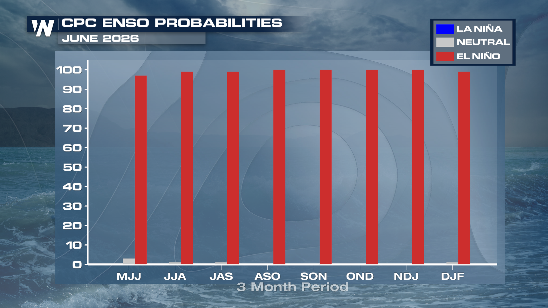
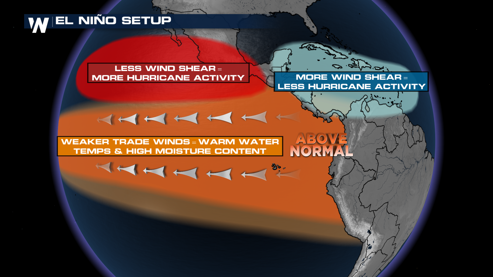
A strong or very strong El Niño is different than a weak or moderate El Niño in terms of impacts. A very strong El Niño typically leads to a tighter and stronger sub-tropical jet, which increases wind shear in the Atlantic. If a moderate El Niño is in place through hurricane season, it's impacts in the Atlantic could be less pronounced. Regardless, WeatherNation will be monitoring the latest in the tropics and will bring you updates all season long.
To read the full release from NOAA about El Niño emerging - click here!


