Rare Enhanced Severe Threat For New England

WHAT TO EXPECT
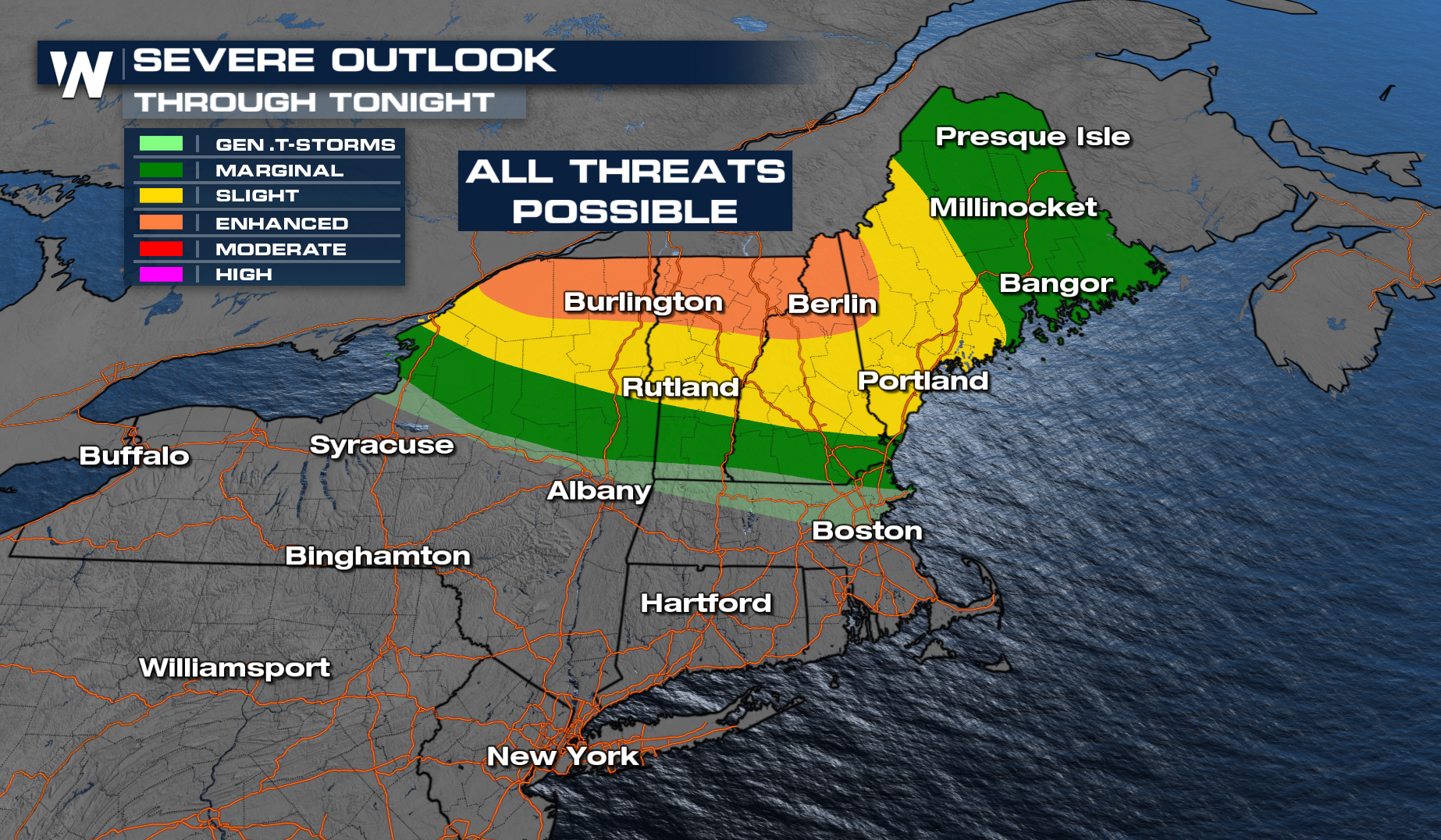
The SPC has issued a severe outlook for the overnight hours across portions of New England. Damaging winds, large hail, and tornadoes will be possible as a cold front moves through.
TIMING
As the frontal boundary moves to the south, storms will develop through the overnight hours. Any storms that do develop will have the potential to be strong to severe. By mid-morning, things look to be calm, but more isolated storms can pop up in the afternoon once again on Wednesday.
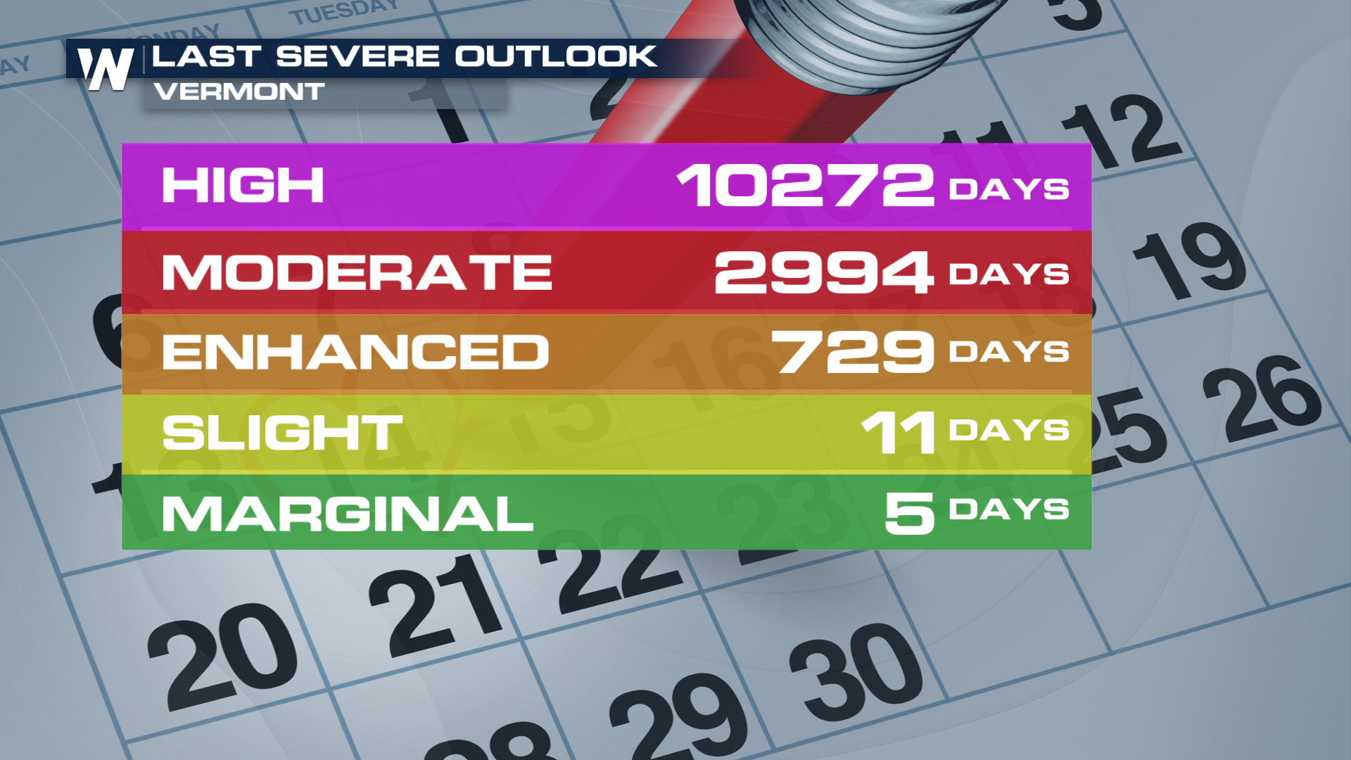
How weird is it to be talking about severe weather this far north in New England? A little odd. The last Enhanced risk for the state of Vermont, for instance, was almost two years ago! The last High risk was back in May of 1998!
 More on your full Eastern Regional Forecast can always be found :10 past the hour on WeatherNation.


